

Between Corbett WMA and the Luckey Tract of Loxahatchee Slough, the Florida Trail immerses in a surprising diversity of habitats.
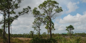
Dense tropical hammocks and pine flatwoods with tall slash pines form a counterpoint to with broad open prairies and cypress domes.
Largely wet, these habitats support an astounding array of wildflowers and are a magnet for wildlife on the edge of urbanized Palm Beach Gardens.
Within two county natural areas flanking the Beeline Highway, this linear hike shows off the outstanding results of restoring natural habitats on lands long used for agriculture.
Our Florida Trail Books & Guides


Disclosure: As authors and affiliates, we receive earnings when you buy through our links. This helps us provide public information on this website.
Overview
Location: Jupiter Farms
Length: 12.1 miles linear
Trailhead: 26.855529,-80.300273
Fees: $3 per person, $6 per vehicle to park in Corbett WMA. No fee applies to Ocean to Lake hikers backpacking through the preserve.
Restroom: None
Land Manager: Palm Beach County
Phone: 561-233-2400
Overnight parking allowed at Corbett WMA. Day use parking only at Hungryland Slough and Loxahatchee Slough.
Do not bring dogs on this hike. They are not allowed in Palm Beach County Natural Lands.
To camp at either site in Loxahatchee Slough, contact Mary Canada at Palm Beach County ERM by phone Mon-Thu 9-4 at 561-233-2503 or 561-233-2400.
Camping permits are free. Campsite space is limited. No ground fires permitted.
Directions
Take Northlake Blvd west from the Beeline (SR 710) in West Palm Beach for 8.7 miles, passing Grassy Waters Preserve en route. The road ends at Seminole Pratt Whitney Rd. Turn right and continue 3.5 miles north to Stumpers Grade Road, the well marked entrance to Corbett WMA. After paying your entrance fee, follow the road west and turn right to continue around the lake towards the Youth Camp. A small sign points out the trailhead up a short road to the left as you draw close to the buildings at the youth camp.
Hike
If you’re starting from the Corbett trailhead, follow the blue blazed connector to the orange-blazed Florida Trail. If you’re starting from Big Marsh campsite, add 1.1 miles to this overall hike.
Either way, at the junction of the orange and blue trails, the orange blazes lead to Stumper Grade, a limestone road.
Walk along it past the big pond fronting Everglades Youth Camp to the hunt check station. Exit Corbett WMA at the front gate. Turn left. The road swings right to follow the canal.
At 1.1 miles, reach Hungryland Slough Natural Area. A small day use trailhead is at its entrance. Follow the blazes to a forest road lined by pines on either side, adjoining a steep-sided canal.
In these wet flatwoods, there are many bog plants, including candyroot, bog buttons, star rush, and stands of needlerush. It’s a comfortable walking surface, although it can get puddles.
After a sharp right, leave the canal and meander through grasslands between the pines. Take the left fork at 2 miles onto a forest road past a large, wet prairie and into the pines.
Keep left at the next fork. The pine flatwoods become dense enough that you can’t see through the understory. There are a lot of tall saw palmetto, and the hum of crickets.
The trail leaves the forest road on the left at a double blaze on a pine tree, becoming a mowed path paralleling the road before it dips into the woods on the left.

Watch for the two next junctions as they come up quickly. At 2.4 miles a double-blaze leads to a curving forest road with pines and very old saw palmettos underneath them.
A large wet prairie adjoins where the trail curves at a double blaze to join a straightaway along a wide forest road.
Continue through a 4-way intersection and follow the long straightway until the blazes lead right into narrow track in the pine woods.
Turn left at the next T intersection onto a two-track with a slight elevation over the soggy landscapes around it.
A big, beautiful wet prairie extends to the right at a 3-way intersection of roads at 3.1 miles. Turning left across from it, continue down a very broad path between the pines.
At the next 4-way intersection, make a sharp left. A long stretch of wet prairie parallels the road, goldenrod and tickseed blooming along its edges.
On the curve away from the prairie, pink blossoms of sabatia catch your attention. Rounding a curve onto the paralleling forest road, a line of cabbage palms is to the left and a wet prairie behind.
Stands of marsh fern grow thickly under young cypresses in the first cypress dome encountered today.
A communications tower comes into view in the distance. Through an opening next to a cypress strand, traffic sounds filter in from the Beeline.
Take the right fork, heading deeper into the pine woods on a grassy track. At the next T intersection, look for a double blaze.
Turn right along the edge of a cypress-lined wet prairie with corkwood and St. John’s wort. Pine flatwoods edge the prairie, eventually offering shade.
At 4.8 miles, emerge onto a road along the C-18 canal. Turn left. Cross the CSX railroad tracks at the railroad crossing sign to reach the Beeline.
This is a busy highway with high-speed traffic. Cross where the blazes and signage direct you. On its east side, follow the blazes into the woods, entering the Sandhill Crane Tract of Loxahatchee Slough Natural Area.
Join the trail system in this preserve, staying with the orange blazes. Leaving the Wah-too-lah (“sandhill crane”) Hiking Trail along the perimeter, turn left to cross a culvert over a canal.
The footpath winds beneath tall slash pines. Grasses and shrubs lean into the trail corridor before it emerges into the open.
 Flag pond next to the trail
Cocoplum thrives near a pond dense with alligator flag on the edge of a vast prairie. Pass one bench on a high spot and another looking over a different prairie.
Cross a boardwalk over a waterway flowing between the prairies. Look for sundews and bog buttons along with other colorful wildflowers that love damp earth: blue-eyed grass, Glades lobelia, and star rush.
Tall, amber-colored chalky bluestem grass forces the trail down a well-defined corridor like a tunnel.
Edge around a large marsh that sometimes spills across the footpath. A small pond within it is dotted with water lilies.
 The trail squeezes right up to marshes
At 7.3 miles, take a sharp left as the trail narrows among the pines. Another wetland sometimes overflows into the footpath.
Reach a palm hammock with a bench on a slight rise, overlooking an open prairie. Across it is a tall observation tower.
Follow the worn path across this sometimes-wet expanse where sandhill cranes gather. Aquatic plants, including pennywort and dollarweed, rise from the prairie.
 The tower ahead
On slightly higher ground, the intersection with the Echoche Trail, a forest road, is at 7.8 miles. Take a detour to the observation tower for a panorama from the top.
The Echoche Trail provides a connector to the trailhead for Loxhatchee Slough Natural Area, which lies 1.5 miles beyond the tower. It is also part of the Sandhill Crane Loop.
The orange blazes continue across it along a berm above a wetland. The palm-lined berm reaches a T intersection and a confusion of roads.
 After crossing the Echoche Trail, follow this route
Blazes guide you into a silver-blue thicket of saw palmetto near the pines, passing a slash pine with an interesting curve to its trunk.
Continue down the mowed path between the saw palmetto and cabbage palms. There is a vast wet prairie off to the right.
By 8.2 miles, reach a limestone berm paralleling a wet prairie off to the left and a rough looking swamp buggy road off to the right. This corridor is lined with cabbage palms and slash pine.
The footpath drops off the berm into a pretty tropical hammock, its oaks covered in bromeliads and ferns.

Leaving the dense hammock, pass a wet prairie. Enter wet flatwoods, which may have mud holes created by wild hogs. Wildflowers grow profusely in open spots.
Pass a pond on the right at 9 miles before another tropical hammock with a dense understory of cocoplum.
Crossing a small waterway, climb over a berm and into a cypress strand before re-entering the wet flatwoods. Be cautious of sawgrass and cypress knees.
At 9.4 miles a boardwalk leads through a cypress dome and around the edge of a wet prairie with sundew and bladderwort along its edges, and soggy boggy places to squish through.
Cross a narrow dike between two prairie ponds and enter a palm hammock, the trail weaving its way through the trees.
The next boardwalk edges a wet prairie. Climbing out of a cypress stand at 9.9 miles, ascend into a small hammock.
The boardwalk beyond is over a substantial swampy waterway. It ends in a palm hammock with a thick wild coffee understory. A palm arches over the trail low enough a tall person might hit their head.
Leaving this hammock, reach the C-18 canal at 10.6 miles. Cross the large pedestrian bridge and look for the blazes.
This is the Luckey Tract of Loxahatchee Slough Natural Area. Within it, the trail meanders beneath tall pines and cabbage palms in an easterly direction.
Crossing a cypress strand, enter a hammock with dense wild coffee, American beautyberry, thick clumps of sword fern, and royal ferns.
Leaving the hammock, the trail keeps to the edge of a large wet prairie under sparse pines, where St. John’s wort and corkwood are the dominant low plants.
Passing some ancient “hat rack” bald cypress like you’d see in Big Cypress or the Everglades, reach an open area around 11.6 miles.

The trail crosses a broad forest road inundated with water and heads around a dense circle of pine flatwoods with a ring of diminutive cypress around it.
The pine woods ring a tropical hammock. This is Luckey Hammock. If you’re lucky, you’ll recognize the poison ivy that grows throughout it and avoid it.
Heading down a short but showy avenue of palms, come to a sign for the campsite at 12 miles. Turn left.
Follow the side trail to the small clearing in the hammock that makes up the campsite. It has no water, so make sure you haul some in.
Westbound / Eastbound
 Florida Trail, Ocean to Lake: Corbett An 11.7 mile linear hike through a vast watery wilderness comparable to Big Cypress and the Everglades, it's hard to believe this woolly adventure is in Palm Beach County.
 Florida Trail, Ocean to Lake: Luckey Tract to Kitching Creek 10.7 miles. A hike of extreme contrasts, this segment of the Florida Trail crossing Riverbend Park and Cypress Creek connects Loxahatchee Slough with Jonathan Dickinson State Park.
Explore More
Learn more about the Ocean to Lake Hiking Trail and Loxahatchee Slough
 Ocean to Lake Hiking Trail A 61-mile spur of the Florida Trail from Port Mayaca on the east side of Lake Okeechobee through forested landscapes to Hobe Sound Beach on the Atlantic Ocean.
 Loxahatchee Slough Natural Area Escape to a vast watery wilderness where you can hike, bike, or paddle through Northern Everglades habitats on the outskirts of residential Palm Beach County
Slideshow
Our photos from hiking this section
Nearby Adventures
 Sweetbay Natural Area A quick visit to Sweetbay Natural Area, which has a trailhead along the Beeline north of PGA Boulevard. Wildflowers put on a grand show in the summer months.
 Sandhill Crane Loop Discover the wild beauty of the Sandhill Crane Tract of Loxahatchee Slough on this soggy loop hike through swamps, prairies, and to a tall observation tower with panoramic views.
 Apoxee Wilderness Trail In the wet prairies and tropical hammocks of Apoxee Wilderness, an urban wilderness area, tackle a 4.7-mile day hike through the southernmost part of Grassy Waters Preserve.
 Grassy Waters Hog Hammock Trail At the north end of Grassy Waters Preserve, traverse an Ice Age ridge protruding above the sheet flow of Loxahatchee Slough on a series of islands topped with tropical hammock.
Thanks to Bryce Layman at Litepacker for his assistance in transcribing our field notes for this hike.

- Baseline Trails - November 7, 2026
- Hal Scott Yellow Trail - November 3, 2026
- Hal Scott Preserve - October 28, 2026