
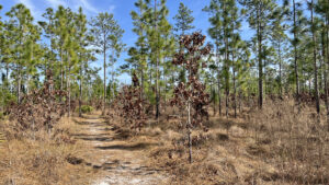
A spectacular reboot of the first long trail built at Jennings State Forest more than two decades ago, the Sandridge Trail Complex radiates from Old Jennings Recreation Area.
Clearly separated from the equestrian trail now called the Evans Horse Trail, it replaces the original North Fork Black Creek Trail with dedicated footpaths.
 Trail junctions are well marked
Exploring rolling hills on the east side of North Fork Black Creek, it traverses healthy pine savanna, sandhills, and hardwood forests in the deep folds between the hills.
Its 7-mile outer loop has many cross trails to tailor the length of your hike, and a spur trail to the interpretive Fire and Water Trail.
 Junction with outer loop to campground
A primitive campground is at the far northeast corner of the outer loop; it also has vehicular access via forest roads.
Using the Dome Swamp Crossover south of the wetter portion of the forest, this 4.1 mile route covers a scenic central loop largely on high ground.
 Rolling sandhills
Resources





Disclosure: As authors and affiliates, we receive earnings when you buy through our links. This helps us provide public information on this website.
Overview
Location: Middleburg
Length: 4.1 miles
Trailhead: 30.122308, -81.882527
Address: 2 Live Oak Ln, Middleburg
Fees: $2 per person
Restroom: At the trailhead
Land Manager: Florida State Forests
Phone: 904-406-6390
Open sunrise to sunset. Leashed dogs welcome. No bicycles allowed. There are picnic tables at the trailhead. Reserve campsite online.
Hunting is permitted in the forest; review hunt dates in advance and wear bright orange if you plan to hike during hunting season.
Directions
From SR 21 in Middleburg, follow Long Bay Rd north 2.5 miles. Turn left on Old Jennings Rd and continue a mile. Turn right on unpaved Live Oak Ln. Drive 0.6 mile and turn in at Old Jennings Recreation Area on the left.
Hike
Pick up a map at the big kiosk in the picnic area. Start your hike at the pink-blazed signpost for the Sandridge Trail to the right of the restrooms.
A sign lists distances to trail connectors and the primitive campground near the north end of the loop. Sprinkled with pine needles, a sandy path starts into scrubby flatwoods.
 Starting point
At a Y junction at treeline, arrows point left. A signpost points out the Bird Blind Connector, a side trail to a viewing blind.
It’s a short walk into relict sandhill, ending at a wooden platform under the oaks and pines with a cutout in it to peer into the forest beyond.
 Viewing blind at clearing
Return to the signposted trail junction and continue straight ahead. Resume the pink-blazed footpath along the edge of the scrubby flatwoods.
Turkey oaks and a more open understory beneath the oaks and longleaf pines mark a transition into sandhills.
 In the sandhills
At a junction with a worn path at 0.7 miles, a hiker symbol points forward. Views throughout the surrounding open understory confirm an ascent to a ridge.
In this beautiful sandhill habitat, the landscape drops off in all directions from the ribbon of footpath through the wiregrass on the crest.
 Climbing to the crest
A signpost marks a four-way junction on the ridge at 0.9 mile. Straight ahead, the path is blazed yellow, as it is to the left.
That’s the Wiregrass Connector, part of the return route. Turn right to continue along the east perimeter of the loop along the Sandridge Trail.
 Descent from the trail junction
The immersive longleaf pine savanna yields to denser stands of pines and then a ribbon of oaks on the descent. Cross the Evans Horse Trail, marked with yellow and blue bands.
Make a sharp turn and steeper descent into a deep basin with a plank bridge over a clear sand-bottomed stream. Gravel adds traction underfoot for the uphill climb.
 Bridge crossing
Soft young slash pines and saw palmetto edge the trail corridor. Double pink blazes and an arrow guide the trail around a curve, paralleling the creek basin upstream.
A signposted sharp right turn starts a gradual uphill through a nursery of small slash pines, the sandhills denser with turkey oak as the footpath becomes white sand.
 Sand pine nursery
Clumps of saw palmetto break up an otherwise open understory. Stick with the pink blazes at a yellow-blazed junction at 1.4 miles, walking deeper into the expanse of sandhills.
Meet a broad sand road and join it through a curve, resuming the footpath on its left.
 Bear left at this split
Cross signposted Wheeler Branch Rd at 1.6 miles, which leads east into a rural subdivision slightly visible through the forest.
From the crest of this ridge, the hillside drops off towards a dense line of trees, a large cypress dome within a low basin in the sandhills.
 Cypress dome at base of hill
The gap between the Sandridge Trail and the cypresses lessens to where water may be visible in the swamp.
At a green bench 1.8 miles into the hike, the signposted trail junction is where our route veers off the Sandridge Trail for a shorter loop. Should you choose to do the longer loop, stay with the pink blazes.
There are no more crossover trails north of this junction, but there is a spur to the Fire and Water Trail and four more water crossings.
 Approaching the Dome Swamp Connector
Making a left at the bench, begin the red blazes of the Dome Swamp Connector.
A ribbon of white sand through the open landscape, it provides a pleasant panorama of pine savanna from the ridge above the cypress swamp.
It ends at the west side of the Sandridge Trail at a signposted junction with a green bench.
 West junction of Dome Swamp and Sandridge Trails
At 2.3 miles, turn left on the pink blazes to start the return route towards Old Jennings trailhead.
With the trail surrounded by an undulating landscape of pine savanna, savor this stretch for its outstanding scenery.
 Expansive forest
Within the next quarter mile, cross both Wheeler Branch Rd and the Evans Horse Trail. Along this part of the loop, the forest feels huge.
If no planes are overhead, it is whisper-quiet except for birdsong and the sound of the wind in the pines.
 Trail junction
Curving southeast, descend to a lower plateau in the pines where a depression cradles a sometimes-dry marsh.
Chinquepin oaks, which never grow tall, mass in dense patches a few inches high, like pincushions across the forest floor.
 Chinquepin oaks on depression marsh slope
On the approach to the Black Creek basin, the habitat shifts from sandhills to tall loblolly pines before a descent into the hardwood forest.
A bench at 2.8 miles provides a rest stop before a steep drop past ancient pines into a swampy thicket. Tannic water collects in leafy basins under bay trees.
 Rest stop
Fed by many rivulets, a creek pours beneath a plank bridge. Follow it upstream briefly before a very steep climb out of the basin to the sandhills above.
Cross a leaf-strewn firebreak to resume the pink blazes at an arrow. Rising into pine savanna, meet a signposted trail junction at 3 miles.
 Plank bridge over creek
Leave pink blazes for yellow to follow the Wiregrass Connector into a beautiful expanse of pine savanna at the top of a ridge.
Young longleaf pines give themselves away in bursts of green amid the surrounding brownish-orange hues of wiregrass in winter.
 On the Wiregrass Connector
Within two tenths of a mile, a hiker symbol marks an equestrian trail crossing by pointing towards the next yellow blaze.
Continue an ascent along the ridge, reaching a scrubby spot with tall sand pines.
 Trail junctionhr/>
Returning to the initial junction of the Sandridge and Wiregrass Trails, seal an upper loop at 3.3 miles.
Make a right at this four-way junction to join the Longleaf Pine Connector heading to the west side of the Sandridge Trail.
 Along the Longleaf Pine Connector
Descending through the sandhills along pale blue blazes, round a marsh behind a rim of saw palmetto.
With pines more dense in this part of the forest, the pine duff footpath makes for a pleasant walk.
 Among young pines
Ascend into more relaxed sandhills, the path becoming sandy on the approach to another crossing of the Evans Horse Trail at 3.7 miles.
Along the blue blazes, the open understory and tufts of wiregrass once again surround the descent.
 Past the Evans Horse Trail junction
This old remnant of the former North Fork Black Creek Trail ends at a sandy T intersection with the Sandridge Trail.
Make a left under the tall pines to resume the pink-blazed route. Cross a service road and a slight depression through a drainage area.
At the double-pink blazes on a blue-ringed pine, turn right to exit to the Old Jennings Trailhead, completing this 4.1 mile loop.
 Exit to the trailhead with a right
Trail Map

Explore More!
Learn more about Jennings State Forest
 Jennings State Forest Protecting the headwaters of Black Creek, one of the northernmost freshwater tributaries of the St. Johns River, Jennings State Forest spans almost 24,000 acres west of Jacksonville.
Video
Hiking the Sandridge Trails
Slideshow
See our photos from the Sandridge Trails
Nearby Adventures
 Jennings Pioneer Trail With elevation changes, streams, and cascades, the Pioneer Trail is as close as you can get to the Appalachian Trail experience without leaving the Florida peninsula.
 Black Creek Ravines Conservation Area Perched on high ground above Black Creek downstream from Middleburg, this 6.5 mile hike showcases upland forests, seepage slopes, bluffs and the transitional habitats between them.
 Jennings Dunns Farm Trail A highlight of Jennings State Forest, this 3.5 mile loop traverses healthy longleaf pine habitat and showcases a series of cascades above the North Fork of Black Creek.
 Sal Taylor Creek Preserve Along a pine forested greenway, this preserve offers hikers numerous easy-to-hike trails, including a main trail that leads to a blackwater creek.

- Michael Crotty Bicentennial Park - November 3, 2026
- A.J. Henry Park - November 1, 2026
- Okeeheelee Nature Center Trails - October 22, 2026