
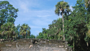
At the corner of Mission and Old Mission Roads in New Smryna Beach, a narrow dirt road leads west under ancient live oaks to an archaeological site that was long mistaken for an early Spanish mission.
But the coquina walls belong to the Cruger-dePeyster Sugar Mill, established in 1830 and abandoned in 1835 after a Seminole raid, and this park tells its story.
Resources





Disclosure: As authors and affiliates, we receive earnings when you buy through our links. This helps us provide public information on this website.
Overview
Location: New Smyrna Beach
Length: 0.3 mile
Trailhead: 29.009093, -80.940358
Address: 600 Mission Drive, New Smyrna Beach
Fees: Free
Restroom: At the west end of the park
Land manager: Volusia County
Phone: 386-736-5953
Open sunrise to sunset. Leashed pets welcome. Prepare for voracious mosquitoes. Picnic tables available. Removal of artifacts is punishable by law.
Directions
From SR 44, take Mission Road south for 0.3 mile to its intersection with Old Mission Road. Turn right into a one-lane dirt road with a “No Trespassing” sign posted so close to it you’d assume that you weren’t supposed to drive back here. The dirt road leads back to the park.
Hike
An interpretive trail loops around the impressive coquina ruins, with detailed interpretive signs explaining the history of the speculative sugar plantation and its downfall at the hands of the Seminole and the actual process of making sugar.
One of the more intriguing panels shows a reproduction of a painting from 1843 of the ruins by a soldier and artist who visited the site.
As you loop around the structure, note how well the walls have withstood the ages, the weather, the heat and humidity. Coquina is a stone found along the Atlantic Coast Ridge.
It’s a sedimentary deposit made of tightly crushed seashells cemented together over time. Used to build the Castillo de San Marcos in St. Augustine, it can be cut into blocks thick enough to repel cannonballs.

Behind the mill, a nature trail snakes through a dense hardwood hammock with a high canopy of ancient live oaks. The deep shade invites both mosquitoes and lush growth.
Shoelace fern and goldfoot fern dangle from the cabbage palms that make up the lower canopy, and a riot of palm fronds create a path to tunnel through.
Sword ferns edge portions of the partly-graveled path, which stays mostly dry even when the surrounding terrain is soggy. Hickory trees appear on the higher ground.
After this short trail zigzags through the forest, it emerges behind the mill only a few feet from where it began.

Continue your walk around the mill. On its west side are several large kettles in which the sugar cane juice would be boiled down to crystallized sugar.
There is also a well that once sat behind the engine house. Follow the pathway around to the front of the building to complete the loop.
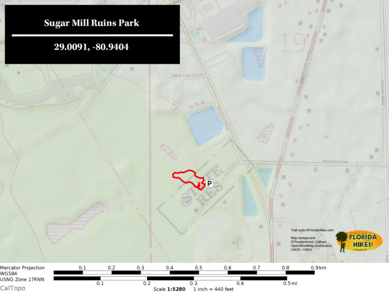
Trail Map
Explore More!
Slideshow
See our photos from Sugar Mill Park
Nearby Adventures
 East Central Regional Rail Trail Spanning 36.2 linear miles across southern Volusia County, the East Central Regional Rail Trail offers a long ride that also makes up a portion of several major Florida bike trails.
 Doris Leeper Spruce Creek Preserve Protecting miles of frontage along the sinuous path of Spruce Creek, Doris Leeper Spruce Creek Preserve offers a diverse collection of trails to explore.
 Smyrna Dunes Park At Smyrna Dunes Park, this 2.4-mile hike scenic coastal hike is largely along an accessible boardwalk, with side trips off to the sea and inlet via more rugged approaches.
 Canaveral National Seashore Canaveral National Seashore protects 58,000 acres of maritime hammocks, dunes, and coastline north of Cape Canaveral, a natural sandy cape that formed where ocean currents meet.

- Michael Crotty Bicentennial Park - November 3, 2026
- A.J. Henry Park - November 1, 2026
- Okeeheelee Nature Center Trails - October 22, 2026