
Encompassing the historic right-of-way of the Live Oak, Tampa, and Charlotte Harbor Railroad through Branford, the Suwannee River Greenway centers on the town of Branford.
The original railway line was extended south to High Springs and Gainesville by railroad tycoon Henry Plant during the Gilded Age, becoming the Seaboard Coast Line.
Once an important port on the Suwannee River, Branford was known as Rowland’s Bluff in its heyday. Steamboats coming upriver from the Gulf docked here.
 Historic Branford Depot
Established by the Office of Greenways and Trails in a joint effort with Suwannee County, the Greenway connects to three rivers via 14.5 linear miles of paved trail.
Southeast of Branford, the paved pathway parallels US 129 to the Santa Fe River, with an alternate branch east along US 27 to the Ichetucknee River.
As side paths along highways, both routes are largely in the sun. Distance-wise they work well for cyclists but not for hikers.
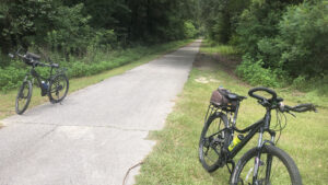
 Shady corridor north of Branford
On foot, you’ll want to stick to the most scenic portion of the greenway, centered on Branford. Hike or bike up to 9.7 miles along this route.
Our route starts at the primary trailhead downtown, with an extension south crossing busy US 27 to visit Branford Spring at Ivey Memorial Park.
 Downtown trailhead
Typically busy with boaters, Ivey Memorial Park offers an outstanding view of the Suwannee River and paddler access to the Suwannee River Wilderness Trail.
Along with its showy spring basin, the park provides an alternate trailhead for exploring the southern end of the greenway.
 Branford Spring
Resources





Disclosure: As authors and affiliates, we receive earnings when you buy through our links. This helps us provide public information on this website.
Overview
Location: Branford
Length: Up to 9.7 miles round-trip
Trailhead: 29.956563, -82.928934
Address: Trail St, Branford (behind 304 SW Suwannee Ave)
Fees: None
Restroom: At Ivey Memorial Park
Land manager: Suwannee County
Phone: 386-362-3004
Open sunrise to sunset. Leashed dogs welcome; pick up after your pet. No camping along route. The surface is accessible. Sporadic benches provided.
Directions
Branford sits at the crossroads of US 27 and US 129 on the east bank of the Suwannee River. From Interstate 10 at Live Oak, follow US 129 south 27 miles into Branford. Turn right onto Trail St and follow the curve to the left to enter the large trailhead parking area. Alternatively, from Interstate 75 at Alachua, follow US 27 north 28.5 miles into Branford, turning north on US 129 before the Suwannee River Bridge. Make the first left onto Trail St to access the trailhead.
Hike or Bike
Join the paved path under the oaks and start northbound, crossing over a sandy access road leading to the historic Branford Depot.
Established in 1882 as the terminus of the Live Oak and Rowland’s Bluff Railroad, it remained in service for many decades.
It was moved to this spot by the Branford Shrine Club in 1982. Behind it is a view of the Suwannee River through the trees.
 Branford Depot
North of its entrance road, continue beneath a shaded avenue of planted live oak trees behind commercial buildings.
Low fences on either side of greenway define the trail through downtown Branford before it slips into a pleasant tree-edged corridor.
 Just north of downtown
At 0.6 miles, emerge into a grassy clearing and cross NW 2nd Avenue. Continue into a forested corridor northbound, leaving downtown behind.
The next two tenths of a mile parallel a residental street but is nicely buffered by tall trees and a grassy expanse on the right.
 Corridor in residential area
A trailside bench and gravel road with a gate signals access to the Branford Bend Tract at 0.8 miles.
Part of Suwannee River Water Management District lands, it was the location of a pioneer homstead along a river bend.
 Entry to the Branford Bend Tract
A lengthy canopied corridor commences, signaling the best part of the greenway. It’s a pleasant tunnel through the woods.
At 1.3 miles, a sheltered bench adjoins the trail. Cross a dirt road leading to privately managed timberlands to the west.
 Trailside bench
The canopy thins somewhat as the trail approaches the road crossing for unpaved 254th Terrace at 2 miles, which leads west to residences bordering a farm.
Lush grapevines fill in the understory for the next stretch, growing up amid the trees to create a lower canopy.
 Riding under the grapevines
At 2.4 miles, leave the forested corridor as the paved path swings out towards US 129 to become a sidepath. Cross 250th Terrace within a tenth of a mile.
This side-of-the-road stretch is the least compelling portion of the northbound route, mirroring the nature of the trail south of Branford.
 Riding next to US 129
At 3.1 miles, reach CR 248 where the pavement of the Suwannee River Greenway ends. Little River Springs lies 1.8 miles west.
A county park, this popular swimming hole is a second magnitude spring along the Suwannee River with a showy mingling of waters at its outflow.
 Little River Springs
Turn around at pavement’s end and retrace the trail corridor back towards Branford.
Re-enter the forested right-of-way at 3.8 miles. On the return route, the benches are located at 4.9 miles and 5.4 miles.
 Long straight stretch towards the bench at 4.9 miles
By 5.5 miles, return to the north edge of residential Branford. Cross the entrance road to the historic train station. Reach the trailhead parking area at 6.1 miles.
To continue southbound, you have two options. There is a crosswalk at US 27 but not a single driver stopped for us despite state law and signage.
If you cross, do so carefully. We suggest families move their vehicle to Ivey Memorial Park.
 US 27 crosswalk
Beyond the road crossing, the greenway right-of-way stays on a high embankment above the park, outlined by fences.
Not until the fence ends and the trail drops to road level can you double-back into the park to visit Branford Spring.
 Road leading back into the park
A steep set of wooden stairs leads to a boardwalk half-circling this second magnitude spring.
Chalky aqua-green waters bubble up and flow through a short, curving spring run to pour into the Suwannee.
 Descent to Branford Spring
The park itself is a former roadside park along US 27 with vintage picnic pavilions and restrooms on a higher bluff.
A post near the boat ramp ominously marks the height of floodwaters during major floods over the years.
 Waterfront at Ivey Memorial Park
Beyond the park, the Suwannee River Greenway is largely shaded as it parallels Old US 27 past homesteads to the edge of Branford.
Meeting the shared route of US 27 and US 129 due east, it becomes a sidepath. Turn around at this point to complete a 9.7 mile round-trip.
 Paralleling old US 27 in Branford
Cyclists have the option of extending their mileage by riding to the Ichetucknee River and/or the Santa Fe River, as shown in blue on the map below.
It’s 2.4 miles east to where the trail (and US highways) split at a traffic light. Continue another 2.8 miles south to William Guy Lemmon Memorial Park on the Santa Fe River.
Or cross US 129 to parallel US 27 to the Ichetucknee River, another 4.6 miles east. In all, you can ride up to 29.3 miles round-trip along it.
In adjacent Gilchrist County, the sidepath continues east of the Ichetucknee River into Fort White towards High Springs as the O’Leno to Ichetucknee Trail.
 Ichetucknee River bridge
Trail Map

Explore More!
Learn more about the Suwannee River Wilderness Trail
 Suwannee River Wilderness Trail Showcasing springs, sandy beaches, waterfalls, and haunting swamp forests where manatees gather, the 170-mile Suwannee River Wilderness Trail is a paddling trip of a lifetime
Video
Biking the Suwannee River Greenway at Branford
Slideshow
See our photos from the Suwannee River Greenway
Nearby Adventures
 Royal Springs Staring into Royal Springs, it feels like looking into a bottomless pit. Steep and broad, it drops 42 feet into shimmering waters of turquoise and royal blue.
 Ichetucknee Springs State Park A swimming hole as a work of natural art, the deep gash in the earth that is Ichetucknee Spring glows an unearthly robin's-egg blue, cradled in a limestone bowl within a leafy glen.
 Troy Spring State Park A first-magnitude spring along the Suwannee River, Troy Spring State Park has the remains of a Civil War steamboat cradled in its rocky waters.
 Wes Skiles Peacock Springs State Park A top international destination for cave divers, Peacock Springs also offers a unique interpretive hike for non-divers to trace the watery passages beneath the surface.

- Hal Scott Yellow Trail - November 3, 2026
- Hal Scott Preserve - October 28, 2026
- Tradewinds Park - October 27, 2026