
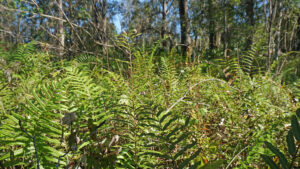
Acquired in 1992, Brooker Creek Preserve is one of the oldest and by far the largest property set aside as natural lands by Pinellas County.
Managed in conjunction with Southwest Florida Water Management District, this sprawling and largely soggy landscape protects 9,800 acres of the Brooker Creek watershed.
 Bottomland forest in the watershed
Two separate trailheads provide access to two very different sets of trails. The original trail system, the Friends Trail, is an easy ramble through pine flatwoods.
 Brooker Creek Friends Trail Let the sounds of suburbia melt away just a few miles east of downtown Tarpon Springs on a 1.9 mile hiking-only loop through pine flatwoods in the Brooker Creek watershed.
The trail system accessed via the main gate of the gated Environmental Education Center complex has a gradient of trails from mild to wild.
Start the Education Center Trail along an accessible boardwalk to reach the center, where there is also a picnic shelter and restrooms.
 Inside the Environmental Education Center
Along this boardwalk are tags on the trees giving details about the monetary value of not cutting them down.
Past the restrooms, a signboard lists which trails are open today. Some close due to prescribed burns, wildfires, or because they are too wet.
 Signboard
The 0.9 mile Education Center Trail continues along a boardwalk through the swampy and over Brooker Creek, becoming a footpath.
Along it, clever interpretive panels and stations illustrate the habitats and their inhabitants while asking challenging questions.
 Interpretive station
The Bird Blind Trail is a 0.2 mile spur off it to a cabin with windows overlooking a wetland under power transmission lines
An easy 0.4 mile round-trip from the southern trailhead makes it ideal for birders, with a crossing of Brooker Creek itself somewhere to spot more.
 Anhinga preening along the creek
The Wilderness Trail is where things get wild. Only the Flatwoods Trail portion might be largely dry on an amble through pine flatwoods for a 1.8 mile loop.
Going deeper on the South Wilderness Trail means going even deeper into the floodplain for either a 2.8 or 4.3 mile walk in bottomland forest.
 Rainbow swamp reflections from cypress oils on the water
No matter the time of year we’ve tried it, it’s always been under water. If you decide to tackle it, expect soggy shoes and socks and mosquitoes. Bring a hiking stick for balance.
All but the most hardcore hikers stick with the Education Center / Flatwoods Trail combo, which with adding the Bird Blind Trail, works out to 2 miles.
 Trail junctions are well marked
Resources





Disclosure: As authors and affiliates, we receive earnings when you buy through our links. This helps us provide public information on this website.
Overview
Location: Tarpon Springs
Length: Up to 6.2 miles
Trailhead: 28.1319,-82.6566
Address: 3940 Keystone Rd, Tarpon Springs
Fees: Free
Restroom: At the environmental education complex
Land manager: Pinellas County
Phone: 727-453-6800
No pets or bicycles permitted. Open 7-sunset except Christmas and the day after Thanksgiving.
Closing time is posted at the trailhead. Insect repellent strongly recommended, as well as dry shoes and socks for after the hike.
Environmental Education Center open Thu-Sat 9-4 and Sun 11-4, closed holidays. Hands-on activities and interpretation of habitats are its main focus.
Directions
Main entrance with access to environmental center
From US 19 in Tarpon Springs, turn onto E Tarpon Ave. It becomes Keystone Rd in less than a mile. Five miles later, past a Great Florida Birding Trail sign, the preserve entrance is on the right. If the main gate is closed, you can still hike at the Friends Trail off nearby Lora Ln.
Hike
Walk to the shelter that shades the Environmental Education Center entrance. It has trail maps and posts today’s closing time for the preserve.
This shelter marks the beginning of the Education Center Trail, which starts as a boardwalk through a swamp
 Entry point
Cinnamon ferns cluster along the water’s edge. Red maples show off crimson leaves in winter.
Interpretive markers are cleverly hidden under hinged boards, the better to protect them from fading in the sun.
 Tag on tree
The large tags noting the dollar value for certain tree species over the life of a tree are a bit jarring to anyone who loves the woods for what they are.
However, we don’t doubt this educational feature is here for a purpose, since Pinellas is Florida’s most built-out county.
 Sculptured archway
Artful sculptures mimicking vines arch overhead before the boardwalk leaves the swamp for an island of oak hammock.
Meet a junction at a bench. Buildings are tucked into the forest, signage pointing to various features.
 Environmental Education Center
If it’s open, visit the Environmental Education Center, down the boardwalk straight ahead. It contains exhibits and hands-on displays as well as a gift shop.
Otherwise, turn towards the restrooms. Beyond them is the sign stating which trails are open today and another reminder of the closing time.
 Interpretive marker
The broad boardwalk gently winds through the shade of overhanging oaks. Clever interpretive signs call attention to the change in habitat.
Reaching the floodplain of Brooker Creek, the boardwalk adds railings. The forested swamp extends in all directions.
 A meander through the floodplain
Cypress trees dominate one section of the swamp, and ferns keep the dry spots on the forest floor well-hidden.
After a quarter mile, the boardwalk ends. The Education Center Trail continues as a footpath, passing a bench.
 Nearing the end of the boardwalk
Cinnamon fern and saw palmetto mingle beneath the shade of the oaks. As it gains a little elevation, the trail becomes sandy underfoot.
Pass a white-tipped marker amid a dense understory of young oaks, including scrub species like myrtle oak. Reach a four-way junction at a half mile.
 Junction with the Wilderness Trail
Bear right to join the Flatwoods / Wilderness Trail, blazed with green and orange-tipped posts and markers.
Sweeping past dense stands of saw palmetto punctuated by fluffy longleaf pines, a shift occurs when sweetbay starts poking out of the palmetto.
 Pine flatwoods with sweetbay (aka loblolly bay)
It’s a tree that loves water, a hint that the habitat is going to change for the wetter. Mosses form a carpet across the footpath on the drop into wet pine flatwoods.
Puddles pool in the trail, the low spot. Some are very large but can be walked around. A descent into bottomland forest soon follows.
 Side path along a low spot
After 0.8 mile, you come to the junction with the Flatwoods Trail, and another reminder of when the park closes. It’s a warning: Wilderness Trail South is not for the timid.
It will take a lot longer than your normal hiking pace due to all the wading. It’s a swamp walk that can get knee-deep a quarter mile south of this junction.
 What’s ahead on Wilderness Trail South
Make a left to stay on the Flatwoods Trail, following green blazes. True to its name, the Flatwoods Trail immerses in a healthy pine flatwoods.
The broad footpath is essentially a forest road covered in pine needles from the slash pines, making for easy walking.
 Flatwoods Trail
Some pines are young and skinny, others mature and stately. Sweetbay and dahoon holly signal this path can also have puddles and soggy spots certain times of year.
Slowly gaining elevation, approach and pass the junction with Black Water Cutoff at 1.1 miles, the incoming end of Wilderness Trail South.
 Approaching the junction
As the elevation increases, clumps of sphagnum strictum, a moss that looks like it would enjoy water, appear. It prefers drier habitats.
Oaks dominate the lower canopy. At a T intersection, turn left a a green arrow to walk beneath towering pines.
 Sphagnum strictum
In fall, the purple paintbrush-shaped blooms of deer’s tongue are eye-catching. Also known as wild vanilla, it’s a favorite for butterflies to feed on.
Beneath a canopy opening to reveal more tall pines, the footpath is a corridor through the saw palmetto.
 Pine flatwoods
At 1.5 miles, meet a Y junction with the Education Center Trail, marked by a lightning bolt sculpture that holds an interpretive marker.
Nearby is the Flatwoods Shelter, a platform for ducking out of the rain. The trail straight ahead returns to the boardwalk to the center.
 Trail junction
To stay on the outer loop, bear right. Live oaks provide a high canopy over a broad open area in the forest, where the Live Oak Shelter sits.
An interpretive sign near it speaks to changes in biodiversity due to human impacts on the land.
 Live Oak Shelter
Continue straight ahead at the next signposted trail junction, a shortcut back to the center, following the Parking Lot sign.
Past an interpretive panel on gopher tortoises, we saw a very large one sharing the trail, nibbling at grasses near a bench.
 Hungry gopher tortoise
Meet a T intersection with the Bird Path at 1.7 miles. Turn right and walk down this short trail through the edge of the oak hammock.
The cabin has windows overlooking a marsh under a power transmission line for you to quietly spy on birds feeding.
 Bird Blind marsh
Return past the trail junction and come to the edge of Brooker Creek. It was very surprising to see a large alligator nestled into a perfect spot for sunning.
Cross a bridge and boardwalk over the creek basin. It ends at a second access point to the trail system from the parking area.
Continue past the entrance shelter to complete a 2 mile hike.
 Alligator along Brooker Creek
Trail Map

Red: Route described. Brown: Wilderness Trail South. Blue: Cross trails. Green: Friends Trail.
Explore More!
Slideshow
See our photos from Brooker Creek Preserve
Nearby Adventures
 Brooker Creek Headwaters With nearly 4 miles of footpaths adjoining the paved Upper Tampa Bay Trail, Brooker Creek Headwaters explores the rise of a waterway that nourishes Lake Tarpon.
 John Chesnut Sr. Park Weaving through floodplain forests and cypress swamps, the boardwalks and trails of John Chesnut Sr. Park add a place to pause for wildlife along a wild shoreline on Lake Tarpon.

- Hal Scott Yellow Trail - November 3, 2026
- Hal Scott Preserve - October 28, 2026
- Tradewinds Park - October 27, 2026