
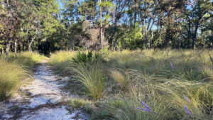
An oasis of green space in the Orlando area, Wekiwa Springs State Park anchors the south end of a wildlife corridor extending to the Ocala National Forest and beyond.
Its proximity to the third largest metropolitan area in the state is reflected by high visitation rates throughout the year.
The main draw is the park’s namesake, a second magnitude spring that empties into the Wekiva River, a federally designated Wild and Scenic River.
 Spring pool
The spring and its popular swimming area are tucked into a small corner of this massive park with over 20 miles of trails for hiking, biking, and equestrian use.
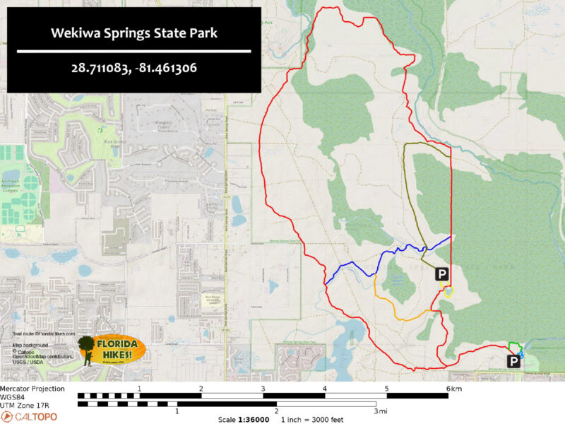
Built and maintained by the Florida Trail Association, the main hiking trail forms a large loop traversing a variety of scenic natural habitats.
Hiking the whole route involves an out and back trip on a 0.9 mile approach trail starting at the springs for a total distance of 12.2 miles.
Beginning at the Sand Lake Trailhead cuts off nearly two miles on a true loop trail. It’s also a more likely place to find parking, as parking by the spring fills up.
 Sand Lake trailhead
Although it can be difficult to book a spot due to its popularity, the park offers a 60-site family campground with electric, water, and bathhouses. The trail passes right by the campground, providing easy access for campers.
For a more remote overnight experience, two primitive campsites are along the loop, immersed in the wilderness surrounding Rock Springs Run. A third primitive site is along the East-West Connector Trail.
 Camp Cozy
Resources



Disclosure: As authors and affiliates, we receive earnings when you buy through our links. This helps us provide public information on this website.
Overview
Location: Apopka
Length: Up to 12.2 miles
Trailhead: 28.711083, -81.461306
Address: 1800 Wekiwa Cir, Apopka
Fees: $6 per vehicle
Restrooms: At the concession area
Land manager: Florida State Parks
Phone: 407-533-4348
Open 8 AM to sunset. Leashed dogs welcome, but not near the springs area or on boardwalks. To enter the park, day use reservations must be made in advance on the state park website.
The primitive campsites are $5 per person, per night, and must be reserved in advance. For more information on the primitive sites, call the park at 407-553-4383.
Directions
From the intersection of SR 436 and Interstate 4 in Longwood, head west on SR 436 for 0.8 mile before turning right onto Wekiva Springs Rd. The park entrance will be on the right side of the road in 4.1 miles. Follow the park road for 0.2 mile, passing the ranger station before turning right at a fork to enter the day use parking area. Accessible parking is available at the northwest end of the lot, alongside a boardwalk leading down to the spring.
Hike
Starting at the day use parking lot, use the closest boardwalk to descend towards the spring area and turn left onto a sidewalk circling the basin.
Where a set of steps drop further towards the water, look to the left for a large map kiosk next to trail marker number 1.
 Beginning of the hiking trail
Orange and white blazes lead the way as a sandy pathway enters the woods, passing the western end of the Wet to Dry Trail in a tenth of a mile.
Initially shaded under an overstory of southern magnolia, sweetgum, and cabbage palms, the canopy progressively thins.
Transition into a sandhill habitat dotted with pines and twisted sand live oaks.
 Sand live oaks
Reaching an intersection at 1.3 miles, turn left to cross the main park road and begin the loop portion of the main hiking trail in a clockwise direction.
In less than a quarter mile, a small amphitheater comes into view shortly before crossing a road to the campground.
In another tenth of a mile, notice a stark change in environment as the trail enters and weaves through a dense scrub habitat.
 Scrub island
Cross a paved road to the youth camp at marker number 6, then delve into heavier tree cover surrounding an arm of Prevatt Lake.
Common elements of sandhill habitat are present on the forest floor here, where blazing stars bloom in autumn among a carpet of tall wiregrass.
Glimpses of the water appear though thick vegetation as the path sweeps around an edge of the lake before curving northward.
 Blazing stars and wiregrass in bloom
Several paths diverge at marker number 10. From here, the blue-blazed East-West Connector heads eastward along with the orange-blazed Volksmarch Trail.
Continue following white blazes northward as the red-blazed Bicycle Trail joins the route.
Over the next 2.3 miles, traverse rolling sandhills pocked with sinkholes and a patch of successional forest.
Reach a junction with the green-blazed Equestrian Trail at marker 17.
 Marker 10 junction
A descent begins on sloped terrain towards a tree line in the distance, a transition to seasonal wetlands.
Across a dirt road at marker 18, the path quickly dips into the corner of a swamp filled with air plants, cypress trees, and their knees.
If the trail is underwater, the next 2.5 miles of the White Trail will likely be inundated as well.
An option to avoid this soggy section is to turn right at marker 19 and follow red and green blazes eastward on a slightly drier route.
 Wet trail in swamp
Following white blazes northward, venture deeper into the hammock, crossing over and tracing alongside tannic creeks flowing towards Rock Springs Run.
Pay close attention to the blazes, as navigation can be tricky in this primordial forest.
A set of markers labeled 19A through 19C confirm your whereabouts before emerging from the subtropical jungle into open pine flatwoods near 19D.
 Palm hammock
Camp Cozy is a welcome sight at 8.7 miles, especially if it is unoccupied. In a small clearing, a handful of benches sit alongside fire rings and a picnic table.
The site has a bear box and spigot with water that needs to be treated before drinking.
Past the campsite, drop into another swampy environment. Pass through a stand of tall tulip poplars, evidenced by their distinctive leaves on the muddy earth.
 Tulip poplar leaves
In a half mile, Rock Springs Run appears on the left where a path from the river leads to Big Buck Camp, a primitive campsite also accessible to paddlers.
At 9.5 miles, take a sharp turn to the south, towards an intersection of two white blazed loops.
 Rock Springs Run
Stay straight through this junction as the trail climbs slightly onto an old logging tramway flanked by soggy ditches.
Cabbage palms dominate this landscape, with huge fronds drooping over the grassy corridor.
Reaching the eastern side of the East-West Connector Trail at 10.3 miles, keep following white blazes southward for a half mile to the Sand Lake Loop.
 Bridge on the tramway
The Sand Lake parking area and restrooms are a short distance to the right. Stay to the left for a scenic stroll around the pond.
Several picnic tables sit on a raised shoreline, overlooking the water in this tranquil spot.
Keep left at the next junction in a quarter mile and make another left in 200 feet to continue south along the main hiking trail.
 Benches alongside Sand Lake
A white blazed pathway traces alongside the main park road for a quarter mile before it meets the Volksmarch Trail, adding orange blazes once again.
Curve eastward through a blend of pine flatwood and mixed palm and hardwood hammocks.
Approaching the 11 mile mark, climb onto high ground to cut across a dry, sunny stretch of sandhill habitat.
In another quarter mile, close the main loop. Turn left to follow the approach trail another 0.9 miles back to the spring.
 Open sandhills
Trail Map
Explore More!
Learn more about Wekiwa Springs State Park
 Wekiwa Springs State Park A massive wilderness area on the edge of the Orlando metro, Wekiwa Springs State Park is centered on a first-magnitude spring that pours forth a river lined with jungle-like vegetation.
Looking for a much shorter hike? Try this one at the spring.
 Wekiwa Springs Wet to Dry Trail Starting at the outflow of Wekiwa Springs, the Wet to Dry Trail at Wekiwa Springs State Park offers an easy walk showcasing habitat changes by the waterway.
Video
Hiking the Wekiwa Springs Hiking Trail
Slideshow
See our photos from the Wekiwa Springs Hiking Trail
Nearby Adventures
 Wekiva River Paddling Trail A leisurely float downriver from Wekiwa Springs provides paddlers an immersion in the beauty of a Wild and Scenic River teeming with wildlife.
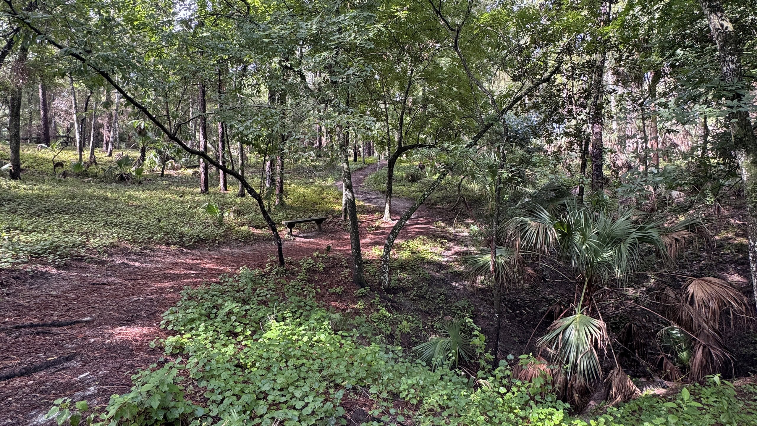 Kelly Park Renowned for its crystal clear lazy river and unique rock spring, Kelly Park is home to a scenic hike amid a surprising variety of natural landscapes along a 2 mile loop.
 Charles Lee Sabal Point Sanctuary Threading through a wilderness floodplain where the Little Wekiva and Wekiva Rivers meet, this 3.4 mile round-trip hike hidden in a subdivision offers excellent birding near Orlando.
 Lake Apopka Wildlife Drive A dedicated driving route through vast wetlands along the Lake Apopka North Shore, Lake Apopka Wildlife Drive is one of Florida's best birding locations.

- Kelly Park - November 18, 2026
- Wekiwa Springs Hiking Trail - November 17, 2026
- Black Lake Preserve - November 15, 2026