
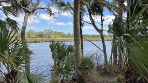
Established in 1821, Bulow Plantation was a powerful economic force in the region, with 2,200 acres of sugar cane, cotton, rice, and indigo.
More than 200 enslaved workers maintained the plantation. A small town, Bulowville, grew up around it.
 It fronted Bulow Creek for ease of transporting goods by boat
While it prospered, John James Audubon visited Bulowville, arriving Christmas of 1831.
The famed naturalist painted his Greater Yellowlegs here, clearly showing a row of slave cabins in the background.
 Location of one of the cabins along Bulow Creek
Burned to the ground by a Seminole war party in 1836, Bulow Plantation fell into ruins.
The towering remains of its sugar mill remain the primary focus of Bulow Plantation Ruins Historic State Park.
 Tall chimneys still stand
Interpretation of additional structures along Bulow Creek provide a more complete picture of the community once called Bulowville.
From the breezy waterfront picnic area and launch, connect five distinct interpretive sites along footpaths beneath the stunning canopy of Bulow Hammock.
 Hiking the Nature Trail
Resources



Disclosure: As authors and affiliates, we receive earnings when you buy through our links. This helps us provide public information on this website.
Overview
Location: Flagler Beach
Length: 1.4 miles
Trailhead: 29.43469, -81.13767
Address: 3501 Old Kings Rd, Flagler Beach
Fees: $4 per vehicle
Restroom: At the picnic pavilion
Land manager: Florida State Parks
Phone: 386-517-2084
Open 9-5 Thu-Mon. Closed Tue-Wed. Leashed dogs welcome; pick up after your pet.
Mosquitoes can be plentiful in the warmer months. With the exception of the loop around the sugar mill ruins, trails are not accessible.
A boat ramp and paddlesports launch adjoin the picnic area. Canoe rentals are available for you to paddle Bulow Creek or bring your own.
Directions
From Interstate 95 exit 278, follow Old Dixie Hwy east for 0.9 mile to Old Kings Rd. Drive north 1.9 miles to the entrance for Bulow Plantation Ruins State Park. Watch for the sign to turn right. The natural surface entrance road, about a half mile long, is one lane with pulloffs, showing off the beauty of Bulow Hammock. Passing the trailhead for the Bulow Woods Trail on the right, enter the park gates and pay your entrance fee. Signs mark the one way driving loop. Park by the picnic pavilion.
Hike
From the parking area, circle around the picnic pavilion for a view of Bulow Creek.
Start this interpretive walk by heading towards the fenced location with white posts within it marking where John Bulow’s home stood.
 Location of Bulow’s home
The anchor of Bulowville, it rose within sight of boat slips used for flatboats to transport both visitors and goods to and from the plantation.
A stroll out on the boardwalk adjoining the modern-day boat ramp provides the park’s best view of the breadth of Bulow Creek.
 Bulow Creek
A tributary of the Halifax River, it meets it several miles south in a puzzle of estuary that can be seen from the Fairchild Oak Trail in adjoining Bulow Creek State Park.
Follow the worn path south of the boat ramp close to the shoreline to see the boat slips themselves.
These distinguishable cuts in the creek bank are filled with grasses.
 One of the boat slips
The sandy trail continues past each one in the riverfront hammock, with views out across the water from each embankment.
Proceeding past the final one, ascend into a denser forest with a saw palmetto understory. The path ends on a low bluff with a panorama framed by trees.
 Trail’s end
Return along the waterfront, crossing the boat ramp back to the picnic lawn behind the pavilion by 0.2 miles.
A replica of drying racks for indigo production are displayed along with an explanation of dye-making.
 Indigo processing display
Continue towards the kiosk under the palms at the start of a path leading to where portions of the slave cabins have been excavated.
Nearly 200 enslaved Africans purchased by Charles Bulow and his son John, who inherited the plantation, constructed their homes here.
 Pathway to the cabin clearing
They grew and harvested sugar cane and indigo, and built and operated the sugar mill. They lived within 40 cabins.
This short walk through the lush hammock ends at the recognizable remains of a foundation of one of the cabins. Posts outline the size of the structure.
 This trail ends in a small clearing with interpretation
Return the same way to the picnic pavilion. Walk around it and cross the parking area to the Nature Trail sign, starting this linear footpath at 0.4 miles.
Just a few inches of elevation higher than the palm-dominated riverfront hammock, these woods are heavier on oaks and pines.
 Start the walk to the sugar mill here
Passing tall southern magnolias and towering loblolly pine, savor a comfortable bed of pine needles underfoot.
Some pines show long-healed gashes from where they were split open to tap turpentine in past centuries.
 Along the Sugar Mill Nature Trail
Curve right at a junction with a path coming in from the park gate, a connector to the Bulow Woods Trail.
Cross a small drainage area in a grassy spot. There are many more palms in the forest to the west.
 Drainage area
Reach an unusual natural sculpture created by an ancient oak with its base largely hollowed out.
Tall, skinny cabbage palms filter in through the pines as the path proceeds north.
 Palms and catfaced pines
Emerge from under the showy limbs of a large live oak within sight of the sugar mill ruins at 0.8 miles.
Cross the road and a small parking area to begin the accessible walkway through this 1831 industrial complex.
 Nearing the sugar mill
Exploring the complex loop takes a quarter mile. Among these the towering coquina walls, it’s hard to imagine how busy this place was in the 1830s.
Cane crushing. Syrup boiling. Packing molasses and cane sugar for shipment.
 The sugar mill ruins
A side path marked “Nature Trail” leads to a spring in a dense palm hammock not far from Bulow Creek. The pathway may be soggy.
A building used to top the basin built around the spring. Now only a low foundation remains.
 Sulfuric spring within the spring house foundation
Return up the Nature Trail. Continue around the interpretive loop to see the remainder of the operation. Interpretive stops explain the stations.
Hauled from here to the boat slips, products would be shipped down Bulow Creek to the Halifax River and on to Mosquito Inlet in New Smyrna to reach the Atlantic Ocean.
 Details on processing sugar
The next side path leads to an interpretive display that discusses the rise and fall of Bulow Plantation.
Burned to the ground during the Second Seminole War, it was never rebuilt. These ruins have stood here since.
 Interpretive display
Complete the loop 1.1 miles into this hike. Cross the parking area and park road to return along the nature trail the way you came.
Finish your hike at 1.4 miles at the parking area in front of the picnic pavilion.
 Returning to the trailhead
If you wish to put on more substantial miles, tackle the Bulow Woods Loop, which starts at the trailhead kiosk outside the nearby entrance gate.
It’s a delightful immersion in the ancient coastal forest, but requires careful attention to your surroundings and may include some wading.
 Bulow Woods Loop In a primordial forest of sluggish, fern-lined waterways amid a dense forest of massive, ancient trees, the 5.2 mile Bulow Woods Loop is one of North Florida's most scenic hikes.
 Hiking among the giants on the Bulow Woods Loop
Trail Map

Explore More!
Video
Hiking Bulow Plantation Ruins Historic State Park
Slideshow
See our photos from Bulow Plantation Ruins Historic State Park
Nearby Adventures
 Bulow Creek State Park At Bulow Creek State Park, walk among the ancients in Bulow Hammock, starting with the imposing Fairchild Oak, one of Florida's largest live oak trees.
 Fairchild Oak Trail Beginning at one of Florida's largest live oak trees, the Fairchild Oak Trail explores a gradient of habitats above Bulow Creek for two linear miles.
 Betty Steflik Preserve Betty Steflik Memorial Preserve protects 320 acres of mangrove marsh, mud flats, and coastal uplands fronting downtown Flagler Beach.
 North Peninsula State Park Neatly accessed via a scenic drive extending north from Ormond Beach, North Peninsula State Park has two tantalizing miles of oceanfront along a palm-rimmed line of dunes.

- Fort Matanzas National Monument - November 21, 2026
- Carney Island Conservation Area - November 19, 2026
- Hal Scott Red Trail - November 13, 2026