
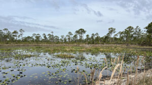
A mile of graded road between US 41 and the south trailhead of Deer Creek Prairie Preserve sets the stage for the sheer expanse of this preserve south of Interstate 75.
Protecting the north shore of the Myakka River, the preserve flanks its namesake creek, accessible for paddling at the south trailhead recreation area.
 Deer Creek
Three entrances provide access. At its northwest corner in Venice, the North Entrance has direct access for cyclists to the paved Legacy Trail North Port Extension.
Ample unpaved parking enables equestrians to park horse trailers to ride into the trail system.
 Trailhead in Venice
On its eastern flank, a tiny trailhead in residential North Port is at the west end of the Legacy Trail Extension.
For hikers, the ideal entrance is off US 41. At the south trailhead, a day use area along Deer Creek encompasses a launch, a picnic area with pavilions, and an observation/fishing pier.
 Waterfront day use area
An equestrian-scaled trail system—some 60 miles—is laid out with markers at junctions of broad ranch roads through immersive pine flatwoods and wet prairies.
With numerous possible routes, it’s a puzzle to tackle hiker-sized bites of the preserve. A primary destination is well-marked Alphabet Trail.
 Letter marker along the Alphabet Trail
From the south trailhead, it’s a 5.3 mile round-trip on a largely graded backbone to the ranch roads and firebreaks that make up the trail system.
Most importantly, it’s easy to follow as it passes alphabet markers through the scrubby flatwoods and scrub that dominate the preserve.
 The Alphabet Trail ends at the North Port Legacy Trail Extension
Our 3 mile route blends the south end of the Alphabet Trail with a loop to the west to explore a variety of wide open landscapes, including one favored by Florida scrub-jays.
Expand this to 5.2 miles or contract it to 1.8 miles at two decision points along the route.
 A Florida scrub-jay along the Alphabet Trail
Resources





Disclosure: As authors and affiliates, we receive earnings when you buy through our links. This helps us provide public information on this website.
Overview
Location: North Port
Length: 1.8 to 5.3 miles
Trailhead: 27.06369, -82.28671
Address: 10201 S Tamiami Trl, North Port
Fees: Free
Restroom: At the trailhead
Land Manager: Sarasota County
Phone: 941-861-5000
Open 6 AM to sunset. No camping. Leashed dogs welcome; pick up after your pet. Expect wet feet seasonally and prepare for mosquitos and ticks.
Directions
From Interstate 75 exit 191, River Rd, drive south 5.5 miles to meet US 41 at a traffic light. Turn left and drive 1.1 miles, crossing the bridge over the Myakka River. Pass the preserve entrance on the left and make the first u-turn to return to it. The graded limestone road inside the gate ends in a mile at the trailhead.
Hike
Leaving the trailhead, cross Deer Creek on a broad bridge marking the start of the Alphabet Trail. Wax myrtle and cabbage palms edge the creek.
The broad basin at the day use area exists because its waters are held back by a weir.
Downstream from the weir, it relaxes into a more natural narrows as it flows towards the Myakka River.
 Deer Creek flowing towards the Myakka River
The first marker along the Alphabet Trail is E. Behind it, a grassy path vanishes into a collection of cabbage palms.
Skip past it, but pause at the opening on the right for a clear view of the impounded portion of Deer Creek at a hand launch.
 Hand launch
Curving away from the creek, the two-track straightens out briefly. Around the next bend, Marker F sits at a junction with a grassy trail beneath a stand of slash pines.
At 0.2 miles, bear left off the Alphabet Trail. Quickly leave the stand of pines behind.
 Marker F turnoff
The broad path opens into a vast scrubby flatwoods. A sea of saw palmetto dominates the south side, with grasses to the north.
As the terrain becomes scrubbier, more oaks appear, as do swaths of sand across the trail.
 Grassy spot
At a half mile, vegetation crowds in more closely along a northward bend. Young pines sprout among tall grasses.
The habitat shifts to well-established scrubby flatwoods with a saw palmetto understory.
 Scrubby flatwoods
The first clue things are about to get damp are the constellations of white button blooms of hatpins poking up from the path.
From the patterns of open sand intermingled with leaf matter and the appearance of marsh ferns, a low swale obviously holds water seasonally.
 Hatpins
Pass a pine with an extraordinarily crooked trunk before a flowway out of a thicket of wax myrtle.
St. Johns-wort clusters in this seasonal wetland. Rising away from it, the pine canopy thins.
 Crooked pine
Reach Marker 80 at 0.8 miles. Turn right on this extremely broad corridor. A muddle of sand and grass, it often sports a firebreak somewhere within it.
The dampness of these pine flatwoods continues, with candyroot bearing lemon-yellow blossoms among the hatpins.
 Marker 80
Beneath the scattered skinny pines is an impenetrable wall of lyonia crowding the saw palmetto.
At 1.1 miles, Marker 79 is within view of an expanse of low palmetto scrub up ahead.
 Approaching Marker 79
It’s ideal Florida scrub-jay habitat and thus a popular destination for birders coming to this preserve.
Continuing straight along this corridor leads to Marker G on the Alphabet Trail; a return south to the trailhead from it results in a 1.8 mile hike.
 A scrub-jay family near Marker G
To stay with the longer loop, which also reaches Marker G later on, turn left at Marker 79.
This corridor heads due north through drier pine flatwoods, with expansive views across an open landscape to the west.
 Flatwoods north of Marker 79
Meeting somewhat of a T intersection at 1.4 miles at Marker 76, bear slightly left to continue straight north.
The landscape remains very open, with scattered skinny pines above the saw palmetto. Grassy openings host wildflowers.
 Landscape north of Marker 76
The appearance of wax myrtle and occasional cabbage palms means a wetter landscape is ahead.
Although it is out of sight to the east, a large wet prairie along the Alphabet Trail has an impact on its surrounding habitats. This route skirts west of it.
 Marker 75
Pass Marker 75 about halfway along the arc around the wet prairie. The understory becomes a dense thicket of gallberry and lyonia.
Continuing the curve, emerge at Marker J at 1.9 miles, another key decision point.
 Meet the Alphabet Trail at Marker J
A round-trip north along the Alphabet Trail to its terminus at the Legacy Trail North Port Extension adds another 2.2 miles to this hike.
For the 3 mile loop, turn right, paralleling a lily-dotted slough leading to the wet prairie.
 Lily-dotted slough
The walk along the wet prairie is worth lingering to watch for wildlife. Its grassy edge holds concentric circles of slightly deeper marsh and a pond in the middle.
It’s always busy with birds. You might spy roseate spoonbills scooping through the mud, or tri-color herons feeding amid the lilies.
 Wet prairie
Anhinga perch wherever they can to dry their wings before diving into the pond again.
Use caution approaching the sandy shoreline adjoining the trail, as its favored by alligators for sunning.
 Sandy shoreline
Clearing the wetland, continue south along a line of tall pines, passing Marker H at 2.1 miles.
Surprisingly, we spotted scrub-jays among these pines before reaching the more typical place to see them
 Marker H
Pines yield to scrubby flatwoods and then a palmetto prairie at Marker G at 2.5 miles. This is where to expect to encounter families of scrub-jays in the morning and evening,.
It may take a little searching to the right to find them. If that excursion west for birding reaches Marker 79, turn back.
 Scrub-jays on the Alphabet Trail near Marker G
Continue south along the Alphabet Trail, scrubby flatwoods on one side and mesic hammock on the other along a length straightaway.
The pathway curves past Marker F at 2.8 miles, sealing the loop. Curving to the next straightaway, pass the launch.
Cross the bridge over Deer Creek to return to the trailhead, completing a 3 mile hike.
 Meeting incoming cyclists on the way out
Trail Map

Explore More!
Video
Hiking Deer Creek Prairie Preserve
Slideshow
See our photos from Deer Creek Prairie Preserve
Nearby Adventures
 Carlton Reserve Less than a dozen miles from downtown Venice, the vast expanse of T. Mabry Carlton Reserve provides regional drinking water and a massive refuge for wildlife.
 Sleeping Turtles Preserve South Where subdivisions now occupy a formerly sleepy rural corner of Venice, Sleeping Turtles Preserve South provides a haven for wildlife along the Myakka River floodplain.
 Myakkahatchee Creek Environmental Park Along a 2.1 mile loop largely under a lush canopy of live oaks and cabbage palms, circle a deeply eroded basin holding sinuous Myakkahatchee Creek, also known as Big Slough.
 Big Slough Preserve Adjoining Carlton Reserve, Myakka River State Park, and Walton Reserve, Big Slough Preserve provides a vast space for wildlife to roam north of North Port.

- Hal Scott Red Trail - November 13, 2026
- Baseline Trails - November 7, 2026
- Hal Scott Yellow Trail - November 3, 2026