
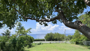
The Calusa Heritage Trail is set of marked pathways on the grounds of the Randall Research Center, an extension of the Florida Museum of Natural History.
The Center serves to educate the public about the Calusa people, an indigenous culture that existed in southwest Florida for over 1,500 years.
 Interpretive panel
This mound complex is thought to have been one of the Calusa’s largest cities.
On some early maps it is labeled Tanpa, which may have been an origin of the name used for a city to the north.
A set of loops lead to prominent archaeological sites. Showcasing the closest mound to the visitor center, the shortest trail has a hard-packed surface.
 Short Loop Trail
Resources



Disclosure: As authors and affiliates, we receive earnings when you buy through our links. This helps us provide public information on this website.
Overview
Location: Pineland
Length: 1.3 miles
Trailhead: 26.661389, -82.153056
Address: 13810 Waterfront Dr, Pineland
Requested donation: $7 adults / $4 children
Restrooms: At the visitor center
Land manager: University of Florida
Phone: 239-283-2157
Open sunrise to sunset. Leashed dogs welcome.
Directions
From the intersection of Pine Island Rd and US 41 in North Fort Myers, head west on Pine Island Rd for 14.7 miles before turning right onto Stringfellow Rd. In 3.3 miles, make a left onto Pineland Rd, and continue for 0.2 miles before turning right at the entrance to the Randell Research Center.
Hike
Begin your tour on a sidewalk leading to the visitor center, where the most up-to-date version of the trail map is posted on the front of the building.
Continue across the front porch and down a wooden ramp on the other end and turn left onto a wide crushed shell pathway.
 Visitor center
To the right, a grassy lawn stretches towards the steep slope of Brown’s Mound, where an observation deck peeks through a stand of trees at the top.
Stay to the left at the first junction, following the shell path as it leads out into an open clearing between a group of small ponds.
At the end of a short side spur, an interpretive sign provides information about the fate of the Calusa.
 Side trail to the pond
Keep left at the next intersection, walking across an often-muddy road alongside remnants of the Pine Island Canal.
Constructed more than 500 years ago, this waterway once cut across the island and is thought to have been used for transportation.
Pay attention to the signs as they lead towards a boardwalk crossing over a marshy area and to the foot of Smith Mound.
 Boardwalk
This large earthwork is composed of sand rather than shell and was used as a burial mound.
A sign at the base tells the story of Pine Island settler John Smith and his efforts to protect this piece of history from being demolished in 1926.
Take a left here to circumnavigate the mound on a mulched pathway.
 Bench along the Smith Mound Loop
The trail is well marked at every junction as it winds through a shady oak and palm hammock, passing a short side trail to Low Mound.
This older and smaller midden is composed of shells and thought to have been created at a time when the shoreline was much further inland.
 Low Mound interpretive panel
When the loop trail returns to the Smith Mound sign, keep straight as the path rounds a bend before opening to a meadow.
It’s edged by a coastal habitat covered in sea purslane and dotted with windswept buttonwood trees.
In a little over a tenth of a mile, look for a side path to the left where a staircase ascends to a view that shouldn’t be missed.
 Randell Mound staircase
A pair of benches sit in the shade of gumbo limbo trees at the top of Randell Mound, offering a spectacular view of Pine Island Sound.
It’s easy to imagine the Calusa using this elevated location to scan the horizon and surrounding waters.
 View of Pine Island Sound
Head back down the stairs and turn left, following a detour around a spot where a bridge used to cross the canal.
Use directional signs to find a set of stairs ascending Brown’s Mound. At the summit, a wooden platform with benches offers a spot to rest in the shade and take in the view.
Returning to the base of this tall mound, stay to the left, where the hike ends at the visitor center in a tenth of a mile.
 Platform on Brown’s Mound /
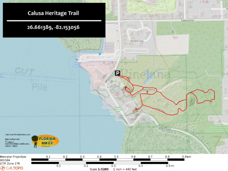
Trail Map
Explore More!
Video
Hiking the Calusa Heritage Trail
Nearby Adventures
 Cayo Costa State Park To spend a day or a weekend on your own deserted island? Heaven. This is one of the tougher and costlier state parks to get to, but well worth it.
 St. Jude Trail A ramble to the mangrove-lined shores of St. Jude Harbor, the St. Jude Trail is a birder's delight, tucked away in a residential neighborhood on the edge of St. James City on Pine Island and protected by the Calusa Land Trust.
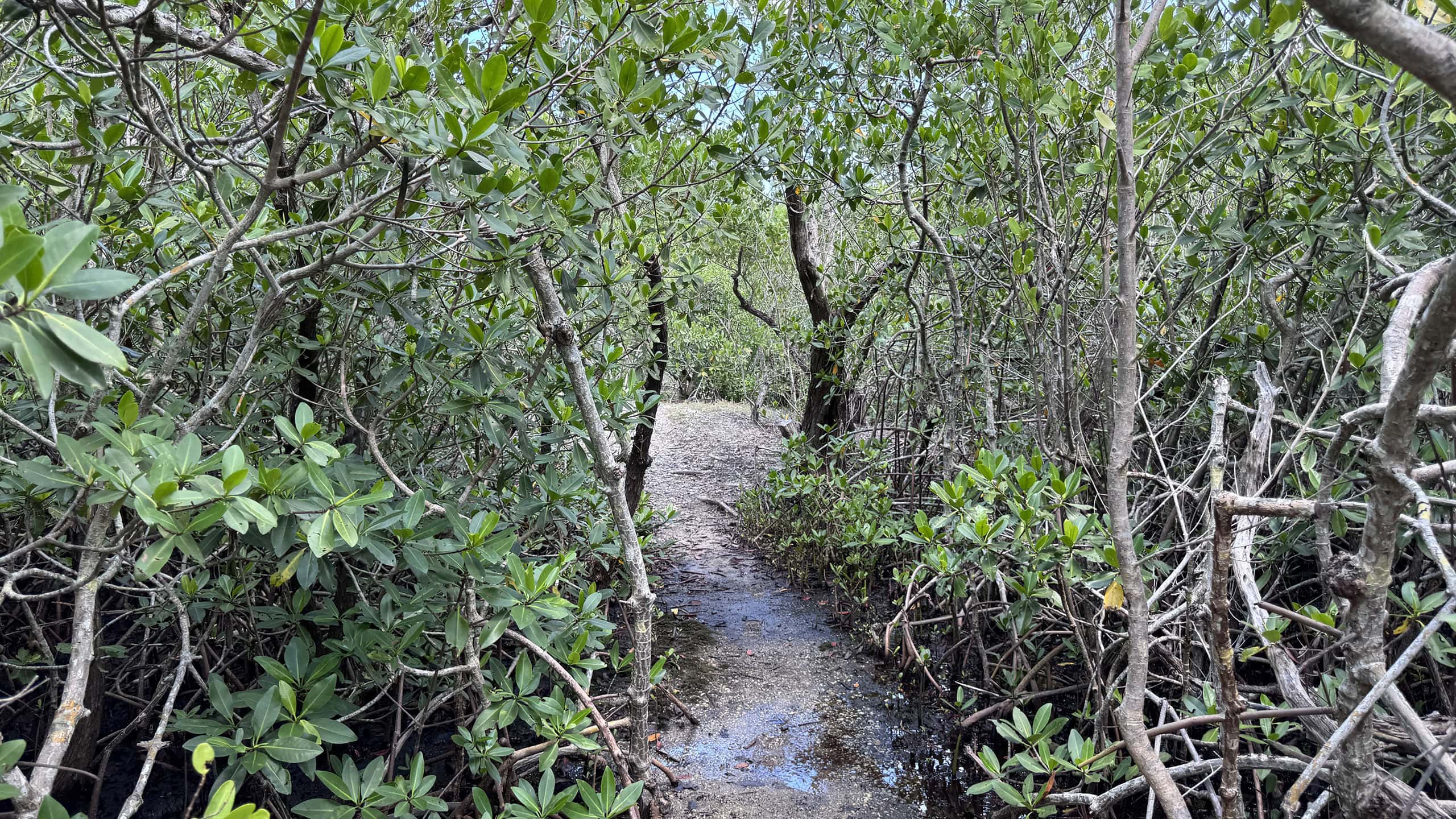 Nancy Weir Mangrove Preserve At the southern end of Pine Island, a hidden trail winds through mangrove habitat, crossing numerous bridges and navigating surprisingly uneven terrain.

- Calusa Heritage Trail - November 5, 2026
- Scherer Thaxton Preserve - October 21, 2026
- Little Awesome Preserve - October 19, 2026