• Skip to main content
  • Skip to header right navigation
  • Skip to after header navigation
  • Skip to site footer
Florida Hikes logo

Florida Hikes

Hike Bike Paddle Camp Florida with authors Sandra Friend and John Keatley as your guides

  • Trails
  • Maps
  • Guidebooks
  • Hike
    • Scenic Hikes
    • Loop Trails
    • Dog-friendly Hikes
    • Hikes for Kids
    • National Parks in Florida
    • Florida State Parks
  • Bike
    • Major Bike Trails
    • Paved Bike Trails
    • Off Road Biking
    • Biking Articles
  • Paddle
    • Canoe & Kayak Rentals
    • Paddling Destinations
    • Paddling Articles
  • Camp
    • Cabin Rentals
    • Car Camping
    • Primitive Camping
  • Florida Trail
    • Plan your Hike
    • Best Scenic Hikes
    • Best Backpacking
    • Section Hiking
    • Thru-Hiking
    • Trail Updates
  • Travel
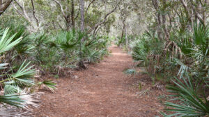
Broad path under a canopy of coastal hammock

Doris Leeper Kaye Access to Bluffs

Explore a truly scenic corner of massive Doris Leeper Spruce Creek Preserve on a trio of loops extending 3.6 miles from ancient oak hammocks to high bluffs above the creek.

New Smyrna Beach (29.069077, -80.985288)   3.6 miles   Doris Leeper Spruce Creek Preserve

One of many possible hikes at Doris Leeper Spruce Creek Preserve, this triple loop uses scenic singletrack to tie two of the showiest trails together.

The immersive Ford Loop delights on its own with tunnel-like passages under a sand live oak canopy and enormous oaks and pines on its perimeter.

Pair it with the stunning panoramas of Spruce Creek from its high bluffs on this sometimes rugged hike.

View of creek from high bluffs Spruce Creek from the Bluffs Trail


Kaye Access makes an excellent starting point as it’s easily accessed by paved roads in New Smyrna Beach, unlike the more remote Martins Dairy trailhead on the west side of the preserve.

The often-steep terrain makes this a major destination for singletrack as well as equestrians, so expect to share the trails, especially on weekends.

Trail kiosk and fence Kiosk for the start of this hike at Kaye Access


Resources

Resources for exploring the area
50 Hikes in Central Florida Central Florida Orlando Explorers Guide book cover Hikers Guide to the Sunshine State book cover Paddlers Guide Florida The Hiking Trails of Floridas National Forests Parks Preserves book cover
 
Disclosure: As authors and affiliates, we receive earnings when you buy through our links. This helps us provide public information on this website.

Overview

Location: New Smyrna Beach
Length: 3.6 miles
Trailhead: 29.069077, -80.985288
Address: 2317 Creek Shore Trail, New Smyrna Beach
Fees: Free
Restroom: Portable toilets nearby
Land manager: Volusia County
Phone: 386-736-5953

Open sunrise to sunset. Leashed dogs welcome. Insect repellent strongly encouraged.

All trails are open to hiking, off-road biking, and equestrian use except where posted. Some bike trails are one-way only.


Directions


From Interstate 95 exit 249 at New Smyrna Beach, follow SR 44 east a half mile and turn left on Sugar Mill Dr. After 1.3 miles make a right on Turnbull Bay Rd. Passing Martins Dairy Rd, continue 2 miles to Creek Shore Trail, just before the railroad tracks. Turn left and continue 1.1 miles to the preserve entrance on the left. Continue straight ahead where the road curves, and park somewhere between the big trail kiosk near the fence and the trail opening in the woods.

Hike

From the kiosk in front of a fenced grassy expanse, walk towards the wooded edge of the parking area.

A trail marker beckons down a broad path into the oak hammock, with a sign for the Ford Loop at a T intersection.

Footpath into woods and trail marker Entrance to the Ford Loop


Turn right, quickly entering deep shade under an archway of sand live oaks lined with saw palmetto.

This picturesque corridor meets a T intersection with a path coming in from the grassy area. Turn left. Oak leaves pop and crackle along the broad path.

Archway of oaks Picturesque corridor


Descending slowly around curves, the trail meets a triangle intersection at a tall southern magnolia at a half mile.

Bear right, leaving the Ford Loop for a wide, shaded connector between crisscrossing singletrack loops, passing a junction marked SC4-E.

Broad path in forest Broad connector


Watch for an opening on the left that reveals an orange sign topped with a bell and head for it.

The admonition to ring the bell is for cyclists and equestrians; hikers take far longer to cross the ravine.

Bell and sign saying to ring it The bell before the descent


Descend sharply to a causeway over a waterway flowing into a marshy cove of Spruce Creek, edged by Virginia willow, cattails, and giant leather fern.

The narrow bridge is the pinch point for fast-moving trail users. Climbing up the bluff on the opposite side, reach a sign pointing to the West Trailhead.

Zigzag bridge over marsh Causeway bridge


Skip the trail to the left and the singletrack on the right, staying with what feels like the main trail through the bluff forest.

Largely shaded by magnolias, oaks, and cabbage palms, it rapidly narrows and makes curves through the woods, doubling back on itself at one point as singletrack tends to do.

Curving singletrack past a magnolia Curving singletrack climb


Ascending all the while, finally emerge at a four-way trail intersection after 1.1 miles. Across the way is marker SC-22W. Turn right.

Following a well-worn sandy strip under power lines, pass what will be your return trail on the right, directly across from a singletrack on the left.

Four way junction Four way junction under power lines


The path you are on descends, curving along the edge of another marshy cove on Spruce Creek.

Start the climb to the bluffs as the trail swings away from the cove, brushing through palmetto fronds under the oaks. The thinned canopy speaks to the ravages of past hurricanes.

Glimpse of waterway through vegetation Low spot along the cove


Glimpses of the creek basin begin on the right during the ascent. Sand pine scrub tops the bluffs, with a thicket of scrubby understory beneath the lower canopy of oaks.

Ambling beneath draperies of Spanish moss, come to an incredible overlook on a horseshoe curve in Spruce Creek at 1.3 miles. A bench sits in the shade not far past it.

Horseshoe curve in creek Horseshoe curve in Spruce Creek


The slow, curving ascent of the bluffs continues. Archaeological surveys in 1885 confirmed a 52-acre mound complex topped these heights, part of an indigenous village dating to 800 AD.

While what remains of those middens is beyond this loop, examining maps at the kiosks will give you an idea of the extensive array of trails to plot loops along in this preserve.

Creek view from bluffs Glimpses of the creek continue


The sinuous curves and blue waters of the creek are frequently visible beyond a thin screen of vegetation as the curves of the Bluff Trail continue.

The next overlook provides a broader overview of the horseshoe curve and residences on the far shore of Spruce Creek in Port Orange.

Woman taking a photo Pausing for a photo


Young sand pines pepper the sandy path with short needles. Narrowing, the path draws close to a creek basin panorama visible through the trees.

Past a blaze post, tall grasses edge the trail, which tunnels through the scrub understory before emerging at the final overlook at 1.6 miles.

The view down the steep bluffs is as impressive as the panorama across the waterway. Another bench adjoins in a small clearing.

Overlook with descent funnel Final overlook


Past this overlook, the fence along the bluff ends. The Bluffs Trail turns towards the West Trailhead to tie into the greater system of more than ten miles of mazy loops.

Unless you’ve plotted out a route to take you farther, turn around and walk back along the bluffs, savoring a second look at the views through the trees and from the overlooks.

Fence along dropoff Turn around where the trail leaves the bluffs


At 1.8 miles, just shy of the easternmost overlook, a trail sign on the right calls your attention to a parallel singletrack. Step over to it and turn left.

Its descent is far more gentle than the one on the Bluffs Trail. Pass junctions with other singletrack trails before reaching the sand road under the power line at 2 miles. Cross the road to continue.

Signage at trail junction Junction at power line


While narrow, this particular loop of singletrack is one of the showiest in the preserve. It curves and descends under a high canopy of forest.

Reaching a palm hammock above Spruce Creek, new views across the creek open up along gentle descents. There is a spot to walk out to the water’s edge.

Waterway in blue at end of peninsula Spruce Creek


Turn to parallel the cove in the creek, passing under towering southern magnolias. Then it’s time to ascend through this lush habitat, with glimpses of the marsh in the cove.

Reach the top of the causeway crossing past the SC21-W sign at 2.5 miles. Turn left, walking downhill past the sign with the bell.

Descent towards a footpath causeway Descent to the causeway


Once across the causeway, go straight ahead to meet the doubletrack trail you took to the causeway and make a right. Meet the Ford Loop again at 2.6 miles.

Continue straight past a sheltered bench, ambling by an interpretive sign about gopher tortoises.

Ford Loop marker and bench beyond Rejoining the Ford Loop


Cabbage palms grow profusely through this hammock. Both they and slash pines tower to incredible heights.

Turning to parallel a fence, walk beneath these giants and past massive live oaks. Ferns and lichens smother their fallen brethern.

Tall trees Under the tall trees


Curving away from the property fence at 3 miles, enter a corridor defined by saw palmetto under lyonia and a variety of oaks preferring drier ground.

Interlocking their limbs, the oaks form a tunnel effect. Pines hidden by this canopy of shade carpet the footpath with their fallen needles.

Path under oak canopy Canopied path


At a T intersection with a bench at 3.4 miles, turn left. Longleaf pines grace this last stretch of the scrub-edged corridor up to the end of the Ford Loop.

At the sign, turn right to exit to the parking area, completing this 3.6 mile hike with a return to the trailhead kiosk.

Line of pines along fence Nearing the end of the loop


Trail Map

Doris Leeper Spruce Creek Preserve Trail Map.
Red: hike described. Blue: Kaye Waterfront. Orange: Bluff Trail to Sunset Point and Mounds Loop. Brown: bike path. Garnet: bike path. Green: Stanaki Trail.

Explore More!

Learn more about Doris Leeper Spruce Creek Preserve

View of creek from tall bluff Doris Leeper Spruce Creek Preserve Protecting miles of frontage along the sinuous path of Spruce Creek, Doris Leeper Spruce Creek Preserve offers a diverse collection of trails to explore.

Video

Hiking the Ford Loop


Slideshow

See our photos from this hike


Nearby Adventures

Oceanfront ramp and saw palmetto Canaveral National Seashore Canaveral National Seashore protects 58,000 acres of maritime hammocks, dunes, and coastline north of Cape Canaveral, a natural sandy cape that formed where ocean currents meet.
East Central Regional Rail Trail East Central Regional Rail Trail Spanning 36.2 linear miles across southern Volusia County, the East Central Regional Rail Trail offers a long ride that also makes up a portion of several major Florida bike trails.
Rolling oceanfront dunes with palms Smyrna Dunes Park At Smyrna Dunes Park, this 2.4-mile hike scenic coastal hike is largely along an accessible boardwalk, with side trips off to the sea and inlet via more rugged approaches.
Coquina wall with forest beyond Sugar Mill Ruins Park At Sugar Mill Ruins Park in New Smyrna Beach, an interpretive trail tells the story of the Cruger-dePeyster Sugar Mill, established in 1830 and abandoned in 1835 after a Seminole raid.

Trail Map (PDF) Official Website

  • Author
  • Recent Posts
Sandra Friend
Sandra Friend
Author of 45 books, Sandra Friend established FloridaHikes.com in 2006 to expand on the field research she'd completed for her first six hiking guides. She has been honored with lifetime achievement awards from the Florida Trail Association and the Florida Outdoor Writers Association.
Sandra Friend
Latest posts by Sandra Friend (see all)
  • Michael Crotty Bicentennial Park - November 3, 2026
  • A.J. Henry Park - November 1, 2026
  • Okeeheelee Nature Center Trails - October 22, 2026
Category: Central Florida, County Parks, Day Hikes, Hikes, Loop Hikes, Natural Lands, Off Road Biking, TrailsTag: Archaeological Sites, Big Trees, Birding, Dog-friendly, Hilly Trails, New Smyrna Beach, Port Orange, Scenic Hikes

Sidebar

FarOut Guides

Our comprehensive trail logistics presented on offline maps:

Florida National Scenic Trail (1,500 miles)
Florida Keys Overseas Heritage Trail (108 miles)
Eastern Continental Trail in Florida (92 miles)


We earn a small commission on sales through these links. Thanks for your support!


Our Florida Guidebooks

We’ve written Florida guidebooks for over 25 years. These include Central Florida destinations.

Book cover with woman hiking through palms with baby carrier
Book cover of Florida Trail Hikes
The Florida Trail Guide fifth edition
50 Hikes in Central Florida 3rd edition

Explore More

Newest Articles for Central Florida

Two-track through pine savanna Hal Scott Yellow Trail
Footpath through coastal hammock Michael Crotty Bicentennial Park
Young longleaf pines at Hal Scott Hal Scott Preserve
FT sign under blue blaze next to trail corridor Land Bridge Loop

  • Facebook
  • Flickr
  • Instagram
  • Pinterest
  • Substack
  • Vimeo

FIND A TRAIL OR PARK

METROS: Bradenton. Clearwater. Crestview. Daytona Beach. Destin. Fort Lauderdale. Fort Myers. Fort Walton Beach. Gainesville. Jacksonville. Kissimmee. Lakeland. Melbourne. Miami. Naples. Ocala. Orlando. Panama City Beach. Pensacola. Port St. Lucie. Punta Gorda. St. Petersburg. Sanford. Sarasota. Sebring. Stuart. Tallahassee. Tampa. Vero Beach. West Palm Beach.

MULTI-REGION: Atlantic Coastal Ridge. Atlantic Coast. Bartram Trail. Big Bend. East Coast Greenway. Everglades National Park. Florida National Scenic Trail. Gulf Coast. Lake Wales Ridge. WATERWAYS: Indian River Lagoon. Intracoastal Waterway. Kissimmee River. St. Johns River. Withlacoochee River.

NORTHWEST FLORIDA: Altha. Apalachicola. Apalachicola National Forest. Big Bend Scenic Byway. Blackwater River State Forest. Blountstown. Bonifay. Bristol. Bruce. Cantonment. Cape San Blas. Carrabelle. Chattahoochee. Chipley. Crawfordville. DeFuniak Springs. Eastpoint. Ebro. Eglin Air Force Base. Freeport. Fountain. Gulf Breeze. Gulf Islands National Seashore. Holt. Madison. Marianna. Milton. Monticello. Mossy Head. Munson. Navarre. Navarre Beach. Newport. Niceville. Panacea. Panama City . Perdido Key. Ponce De Leon. Port St. Joe. Quincy. Santa Rosa Beach. Sopchoppy. South Walton. St. George Island. St. Marks. St. Marks NWR. Sumatra. Vernon. Wakulla. Wewahitchka. Woodville. WATERWAYS: Apalachicola River. Blackwater Bay. Blackwater River. Chipola River. Choctawhatchee Bay. Choctawhatchee River. Coastal Dune Lakes. Ochlockonee Bay. Perdido River. St. Marks River. Wacissa River. Wakulla River. Yellow River.

NORTH FLORIDA: Alachua. Amelia Island. Archer. Baldwin. Branford. Bronson. Bunnell. Callahan. Cedar Key. Chiefland. Crescent City. Cross City. Cross Creek. Dowling Park. Ellaville. Fanning Springs. Fernandina Beach. Flagler Beach. Fort White. Glen St. Mary. Green Cove Springs. Hawthorne. High Springs. Inglis. Jacksonville Beaches. Jacksonville Northshore. Jasper. Jennings. Keystone Heights. Lake Butler. Lake City. Live Oak.Macclenny. Mandarin. Mayo. Mayport. Micanopy. Middleburg. Old Town. Olustee. Orange Park. Osceola National Forest. Palatka. Palatka-Lake Butler Trail. Palm Coast. Palm Valley. Perry. Ponte Vedra. Rodman. Salt Springs. St. Augustine. Starke. Steinhatchee. Suwannee. Suwannee River Wilderness Trail. Suwannee Springs. Talbot Islands. Timucuan Preserve. Trenton. Waldo. Welaka. White Springs. Williston. Worthington Springs. Yankeetown. WATERWAYS: Santa Fe River. St. Marys River. Suwannee River. Tolomato River. Upper Withlacoochee River.

CENTRAL FLORIDA: Altamonte Springs. Apollo Beach. Apopka. Astatula. Astor. Auburndale. Bartow. Babson Park. Bayport. Belleview. Bithlo. Brandon. Brooksville. Bushnell. Canaveral National Seashore. Cassadaga. Christmas. Chuluota. Citrus Springs. Clearwater Beach. Clermont. Coast to Coast Trail. Cocoa. Cocoa Beach. Cross Florida Greenway. Crystal River. Dade City. De Leon Springs. DeBary. Deland. Deltona. Dunedin. Dunnellon. Edgewater. Enterprise. Eustis. Ferndale. Fort Meade. Frostproof. Geneva. Gibsonton. Haines City. Hernando. Hernando Beach. Holopaw. Homosassa. Inverness. Kenansville. Kissimmee. Lake Mary. Lake Wales. Largo. Leesburg. Lithia. Longwood. Lutz. Maitland. Malabar. McIntosh. Melbourne Beach. Merritt Island. Merritt Island NWR. Mims. Mount Dora. Narcoossee/Lake Nona. New Port Richey. New Smyrna Beach. Nobleton. Oak Hill. Oakland. Ocala National Forest. Ocklawaha. Ocoee. Oldsmar. Orange City. Ormond Beach. Osteen. Oviedo. Paisley. Palm Bay. Plant City. Poinciana. Polk City. Ponce Inlet. Port Orange. Ridge Manor. Riverview. Ruskin. Safety Harbor. Silver Springs. Sorrento. Spring Hill. St. Cloud. Tarpon Springs. Thonotosassa. Titusville . Umatilla. Viera. Walt Disney World. Weeki Wachee. Weirsdale. Wimauma. Windermere. Winter Garden. Winter Haven. Winter Park. Winter Springs. Withlacoochee State Forest. Withlacoochee State Trail. Yeehaw Junction. Zephyrhills. WATERWAYS: Alafia River. Halifax River. Hillsborough River. Lake Apopka. Little Manatee River. Ochlawaha River. Rainbow River. Tampa Bay. Wekiva River. Wekiva River Basin.

SOUTHWEST FLORIDA: Alva. Boca Grande. Cape Coral. Charlotte Harbor. Ding Darling NWR. Ellenton. Englewood. Estero. Immokalee. Marco Island. North Port. Osprey. Palma Sola. Palmetto. Pine Island. Port Charlotte. Sanibel Island. Venice. WATERWAYS: Caloosahatchee River. Manatee River. Myakka River. Pine Island Sound.

SOUTH FLORIDA: Arcadia. Basinger. Big Cypress National Preserve. Big Cypress Seminole Reservation. Big Cypress Swamp. Bowling Green. Clewiston. Everglades City. Indiantown. LaBelle. Lake Okeechobee Scenic Trail. Lake Placid. Lakeport. Moore Haven. Okeechobee. Ortona. Pahokee. Palmdale. Port Mayaca. South Bay. Wauchula. Zolfo Springs. WATERWAYS: Fisheating Creek. Lake Okeechobee. Peace River.

SOUTHEAST FLORIDA: Biscayne Bay. Biscayne National Park. Boca Raton. Boynton Beach. Coconut Creek. Coral Gables. Coral Springs. Davie. Delray Beach. Fellsmere. Flamingo. Fort Pierce. Hobe Sound. Hollywood. Homestead. Indrio. Jensen Beach. Juno Beach. Jupiter. Jupiter Farms. Key Biscayne. North Hutchison Island. Ocean to Lake Greenway. Palm Beach. Palm Beach Gardens. Pompano Beach. Redland. Sebastian. South Hutchinson Island. WATERWAYS: Florida Bay. St. Lucie River.

FLORIDA KEYS: Big Pine Key. Islamorada. Key Largo. Key West. Marathon. Overseas Heritage Trail.


©2006-2026, Sandra Friend & John Keatley | Disclosure | Site Index | Work with Us | Advertise with Us | Terms of Service and Privacy Policy

Florida Hikes PO Box 93 Mims FL 32754 | Contact
