

Nestled in a remote area of the state between Crescent Lake and the St. Johns River, Dunns Creek State Park protects over 6,000 acres of land adjacent to its namesake waterway.
Acquired by the state in 2001, only a small portion of the park was easily accessed by the public for almost two decades.
Then an entrance road was was paved to the Piney Bluff day use area, featuring a launch and fishing pier alongside the creek and a picnic grove.
 Dunns Creek at Piney Bluff
The road ends at the Piney Bluff trailhead, the access point for the trail system at Piney Bluff.
With options ranging from under two miles to over twelve miles on a round trip, the Piney Bluff Trails include three separate multi-use trails and one that is designated hiking only.
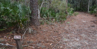
 The hiking-only Yellow Trail
Resources




Disclosure: As authors and affiliates, we receive earnings when you buy through our links. This helps us provide public information on this website.
Overview
Location: Pomona Park
Length: 11 miles
Trailhead: 29.552083, -81.573806
Address: 320 Sisco Rd, Pomona Park
Fees: $5 per vehicle
Restrooms: At day use area next to kayak launch
Land manager: Florida State Parks
Phone: 386-329-3721
Open 8 AM to sunset. Leashed dogs welcome. Mosquito repellent advised.
Directions
Following US 17 south from Palatka or north from Crescent City, turn east onto E Main St. Follow it for 1.3 miles, continuing straight as the road becomes Sisco Rd. In 1.5 miles, turn right at the park entrance. Pay your fee at the entrance gate and continue for 2.1 miles to the parking area at the end of the road.
Hike
Beginning the hike under a shady cover of live oaks, follow a leaf strewn pathway as it leads past the trailhead sign and into the woods.
Songbirds and woodpeckers gather in the treetops, their pleasant calls blending with distant chirps of ospreys and bald eagles soaring high above.
 Trailhead sign
Turn left at a junction in 0.2 miles. Trees painted with green, yellow, red, and blue blazes lead toward the western side of the park.
Scenery rapidly transitions to a mesic flatwoods community of pine savanna covered with lyonia and saw palmettos bathed in abundant sunlight.
Reaching a four-way intersection at 0.7 mile, continue straight to follow red blazes where the Green Trail leads northward and yellow blazes steer to the south.
 Multiple blazes
Markers clearly indicate the route as you navigate a series of forest roads to a trail junction alongside a sign for the Boneyard Campground.
This signage is misleading, referring to an area historically used as a campsite for hunters before the state bought the property rather than a place for visitors to spend the night.
 Boneyard Campground sign
From this point, the Red Trail stretches out across scrubby flatwoods flanked by baygall habitats for an out and back trip of 2.6 miles.
After completing that spur, turn left to start the Blue Trail. It circles around an ancient island with very limited shade.
 Along the Red Trail
Follow the blue blazes across low-lying hydric hammocks to a sign for North Scrub Road, where the loop starts.
A road carved out of deep sugar sand circumnavigates the northernmost edge of the Crescent City ridge.
 Beginning of the scrub
Traverse an impenetrable forest of shrubby scrub and myrtle oaks for 0.6 mile before turning at an arrow pointing southward.
Continue alongside a wooded seepage stream winding along for 0.7 mile to a sign for the shortcut trail.
For the best views, turn left here to ascend the bluff, climbing nearly a hundred feet above the surrounding terrain.
 Rolling ancient dunes
Descending to the other side of the ridge, turn left at the loop trail. Continue another 0.7 mile before making a right to cross the hydric hammock.
Return to the Boneyard Campground sign after a 4.4 mile round trip. Retracing your footsteps east along the multi-use pathway, turn right at the four-way intersection to follow the Yellow Trail.
 Yellow Trail
Designated hiking only, the Yellow Trail leads south through pine flatwoods for 0.7 mile before crossing the main park road and delving into a deeply shaded hammock.
Lush vegetation borders the path on the descent towards a floodplain. The trail sweeps north and winds alongside wetlands for a quarter mile to a small clearing at the end.
 Epiphyte covered oaks in the hammock
Emerge from the forest. Several picnic benches sit on a grassy lawn next to an accessible concrete sidewalk leading to an observation deck and pier overlooking Dunns Creek.
From this scenic day use area, follow the dirt road to the north for a tenth of a mile to return to the trailhead parking area, completing 2 miles on the Yellow Trail and an 11 mile hike.
 Dunns Creek pier
Trail Map

Explore More!
Learn more about Dunns Creek State Park
 Dunns Creek State Park Notable for its habitat diversity, Dunns Creek State Park protects a vast landscape along the south shore of its namesake, a major tributary of the St. Johns River.
Video
A walk through the Piney Bluff Trails
Slideshow
See our photos from Dunns Creek State Park
Nearby Adventures
 Dunns Creek Blue Pond Trail A well-marked system of loop trails extends across sandhill habitats to scenic views of a secluded sinkhole lake at Dunns Creek State Park.
 Welaka State Forest Protecting over four miles of forested waterfront on the St. Johns, Welaka State Forest offers a glimpse of what botanists John and William Bartram saw in the 1700s.
 Beecher Run Nature Trail A stop along the Bartram Trail, the Beecher Run Nature Trail at Welaka National Fish Hatchery provides a walk beneath ancient pines along the edge of the hatchery ponds, which are fed by historic Beecher Spring.
 Murphy Creek Conservation Area With hiking in scrubby flatwoods and sandhills above forested slopes draining to Murphy Creek, as well as on Murphy Island in the St. Johns River, this water management preserve provides two places to explore.

- Calusa Heritage Trail - November 5, 2026
- Scherer Thaxton Preserve - October 21, 2026
- Little Awesome Preserve - October 19, 2026