
Located on the western side of Anastasia Island alongside the Matanzas River, Fish Island Preserve is a refuge for endangered species and a protected historic site.
Added to the National Register of Historic Places in 1972, the island has evidence of habitation spanning thousands of years.
Much of the uplands on the island sit atop an ancient shell midden that was later used to plant orange groves. In the mid-18th century, Jesse Fish ran a plantation known as El Vergel.
 Oaks growing on the midden
Over time, the buildings fell into ruin and nature retook the cleared land, resulting in a shady coastal hammock surrounded by grassy salt marshes.
The property was purchased for preservation in 2019 and is currently managed by the City of St. Augustine.
Open to hiking and biking, the preserve offers a pair of designated trails with several scenic spurs overlooking coastal landscapes.
 Coastal habitats
Resources





Disclosure: As authors and affiliates, we receive earnings when you buy through our links. This helps us provide public information on this website.
Overview
Location: St. Augustine
Length: 1.9 miles
Trailhead: 29.864278, -81.298611
Address: Plantation Island Dr S, St. Augustine
Fees: Free
Restrooms: None
Land manager: City of St. Augustine
Phone: 904-209-4270
Open sunrise to sunset. Leashed dogs welcome.
Directions
From US 1 south of St. Augustine at the intersection of SR 312, head east on SR 312 E for 1.5 miles before turning right onto Plantation Island Dr S. In less than a tenth of a mile, the parking area for the preserve will be on the right.
Hike
Starting at the western end of the parking area, follow a sandy access road as the trail passes a detailed map kiosk before curving southward into the preserve.
Tall pines rise in the distance as a shady forest of oaks, junipers, and cabbage palms begin to enclose the pathway.
 Maritime hammock
In less than a quarter mile, the Blue Trail branches off to the north. This side path leads out to a scenic point alongside tidally flooded salt flats on a 0.3 mile round trip.
Continuing westward on the White Trail, the corridor opens to a small clearing in a few hundred feet.
 Tidal flats
Several signs in the clearing provide information about historic and natural features of the preserve.
From this spot, a short spur winds out to a mangrove covered shoreline where minuscule crabs skitter underfoot.
 Interpretive panels
Follow white blazes southward along the shaded trail as it leads down the island’s center for 0.2 mile to the beginning of a small loop.
Saw palmetto, beautyberry, and Florida coastal bluecurls line the path while it follows a circuit past three side spurs with an inviting bench at the end of each.
 Trail signage
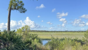
Each of the spurs offer differing panoramic views of verdant salt marshes that surround the island.
Returning to the beginning of the loop in 0.4 mile, turn northward to follow white trail markers for a half mile back to the trailhead.
 Salt marsh view
Trail Map

Explore More!
Video
Hiking Fish Island Preserve
Nearby Adventures
 Anastasia State Park Anastasia State Park is windswept and sandy, with an arc of beach that stretches four miles to Matanzas Inlet, curving in on itself to face the ancient city of St. Augustine.
 Fort Mose Historic State Park Interpreting the first free African settlement in what would become the United States, Fort Mose educates through storytelling along 1.1 miles of trails and within its museum.
 Matanzas State Forest A system of linear and loop trails connected to a primitive campground offers scenic views of flatwoods, hammocks, and marshes alongside the Matanzas River.
 Moses Creek Conservation Area Follow a system of wide trails across pine forests, hammocks, scrub, and sandhill habitats to a scenic overlook and campsite along tidally-influenced Moses Creek.

- Oscar Scherer Green Trail - November 11, 2026
- Sandhill Preserve - November 9, 2026
- Calusa Heritage Trail - November 5, 2026