• Skip to main content
  • Skip to header right navigation
  • Skip to after header navigation
  • Skip to site footer
Florida Hikes logo

Florida Hikes

Hike Bike Paddle Camp Florida with authors Sandra Friend and John Keatley as your guides

  • Trails
  • Maps
  • Guidebooks
  • Hike
    • Scenic Hikes
    • Loop Trails
    • Dog-friendly Hikes
    • Hikes for Kids
    • National Parks in Florida
    • Florida State Parks
  • Bike
    • Major Bike Trails
    • Paved Bike Trails
    • Off Road Biking
    • Biking Articles
  • Paddle
    • Canoe & Kayak Rentals
    • Paddling Destinations
    • Paddling Articles
  • Camp
    • Cabin Rentals
    • Car Camping
    • Primitive Camping
  • Florida Trail
    • Plan your Hike
    • Best Scenic Hikes
    • Best Backpacking
    • Section Hiking
    • Thru-Hiking
    • Trail Updates
  • Travel
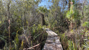
Broad boardwalk in marsh

Fox Lake Yellow Trail

Through habitats ranging from desert-like scrub to marshy boardwalks and and squishy footpaths, the Yellow Trail circles the tip of a peninsula into Fox Lake.

Titusville (28.588660, -80.874806)   4.0 miles   Fox Lake Sanctuary

Abandoned for years due to rising waters, the Yellow Trail at Fox Lake Sanctuary has been relocated slightly and reopened.

Circling a marsh-edged peninsula along Fox Lake, it balances on boardwalks through lakefront wetlands to reach forested high points with lakefront views.

Lakefront view under live oak View along Fox Lake


Following it clockwise off the Red Trail, we discovered its rerouting into drier landscapes at both ends.

Add it to your traverse of the entire trail system for a 5 mile circuit, or walk the route described below for a fascinating 4 mile hike.

Boardwalk in forested wetlands One of the wetland boardwalks


Resources

Resources for exploring the area
50 Hikes in Central Florida Florida Trail Hikes book cover The Florida Trail Guide book cover Central Florida Orlando Explorers Guide book cover Hikers Guide to the Sunshine State book cover Paddlers Guide Florida
 
Disclosure: As authors and affiliates, we receive earnings when you buy through our links. This helps us provide public information on this website.

Overview

Location: Titusville
Length: 4 mile balloon loop
Trailhead: 28.588660, -80.874806
Address: 4400 Fox Lake Rd, Titusville
Fees: Free
Restroom: Near Pavilion I in Fox Lake Park
Land manager: Brevard County
Phone: 321-264-5185

Open 7 AM to dusk. Pets are not permitted. Insect repellent is a must. Trails may be soggy or under water after a rain.

Maps are being replaced at key trail junctions. We hope the mileage signs will be too, as changes to the trail system have rendered some of them inaccurate.
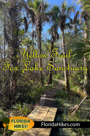
Boardwalk between palms


Directions


From Interstate 95 exit 215 in Titusville, take SR 50 east to the major traffic light at SR 405. Turn left. Drive north on SR 405 for 2.2 miles. Turn left at the traffic light for Fox Lake Rd. Follow it to where it ends at Fox Lake Park. Turn right and follow the one-way road through the park. When it turns away from the boat ramp, look for the trailhead kiosk against the trees near Pavilion I.

Hike

Start this hike as you would a full traverse of the hiking trail system, beginning at the Fox Lake Sanctuary kiosk within Fox Lake Park.

Perched on high ground along the lake’s marshy edge, the Blue Trail forms a shared entrance for all users. At the trail junction with a map, turn right.

Blue marker and tall grasses Follow the blue marker beyond the trail junction


Sometimes soggy, the footpath keeps close to the rim of a bayhead swamp along the lake before emerging onto a white sand slope.

Descend towards the lake and make a hard left into the woods. Loblolly bay trees tower overhead and the footpath is rooty, with saw palmetto leaning in close.

Blue blaze in tangle of trees and shade Blue trail through bayhead


Pass a gap to an abandoned trail before crossing a cut through the woods dense with golden-hued grasses, entering deep shade beyond it.

Reach the junction with the Red Trail beneath a trio of triple-trunked trees at 0.7 mile. Turn right to follow the red blazes, walking on soft ground.

Red blaze in floodplain forest Start of the Red Trail


Past a massive rootball, come to a bench and observation deck. Walk out for a look at a cove where herons gather and otters chase fish through the shallows.

The footpath tracks close to the water’s edge, squishy and rooty, before ascending into the trees to higher ground.

Marsh view with open water View from the observation deck


Meet a signposted Yellow Trail junction at 1.1 miles. Orange flagging tape had been broken off the sign when we scouted this route.

Finding a gloppy bog a few paces beyond the sign, we suspect this kiosk will be moved. Our return route along the yellow blazes did not come through this bog.

Red blaze on tree and sign beyond Approaching the old Yellow Trail junction


Continue along the red blazes, climbing through a bayhead drainage to emerge at a crossing with the multi-use trail on a sand road.

Walk across it to immerse in scrub habitat. A bald eagle soared overhead; lizards skittered into leaf litter.

Woman hiker looking at blue sky Watching an eagle far above


Winding between rusty and shiny lyonia and a variety of scrub oaks, reach a puddle of shade under a cluster of sand live oaks, the trail curving right.

Cross the multi-use again trail, the next red blaze directing you onto a different broad sandy road through the scrub.

Sand roads in scrub habitat Intersection of sand roads


Meet the second junction with the Yellow Trail at 1.4 miles. Pass the sign and continue along the sandy road, now following yellow blazes.

As it descends, the trail narrows, the two-track filling with water in deep ruts at a bayhead drainage.

Yellow blaze on post in scrub Yellow blaze just past the trail junction sign


Round a scrubby curve and pay heed to the yellow-tipped post guiding you into the oak scrub. Cross a short bridge over a bayhead outflow.

A bench tempts under lichen-dotted sand live oaks. Pause for a break before winding between the saw palmetto under the oaks to a boardwalk.

Bench under archway of oaks Shady spot with bench


Surprisingly long, the broad boardwalk sits low as it weaves through in its marshy surroundings.

It narrows to a single plank across dark, fern-dotted waters to reach a ridge topped with oaks, palms, and incredibly tall loblolly pines.

Narrow boardwalk in swamp Walking the planks


Skirting the marsh’s edge, climb to higher ground briefly before the next boardwalk, this one through a stand of sawgrass. Avoid brushing bare skin against its sharp blades.

Once it gains a little elevation, the boardwalk is flanked by ferns and saw palmetto under loblolly bay and wax myrtle.

Boardwalk in herbacious marsh with sawgrass Boardwalk through sawgrass


It ends at another ridge in the marsh topped with tall pines, providing a view of Fox Lake framed by moss-draped oaks and saw palmetto.

Along a scrim of scrub, walk the narrow ridge, emerging at a bench overlooking the open waters of the lake at 1.7 miles.

Park bench under tree overlooking lake Bench along Fox Lake


Beyond it, the footpath tracks close to the shoreline, coming to a rough marked landing for the kayak trail carved between the saw palmetto.

Ascending, pass a double-trunked pine before dropping to a brief rough crossing in a bayhead.

Cut in waterfront to accomodate a kayak The kayak landing


From the wooded ridge, enjoy more lake views whenever the corridor isn’t compressed by walls of saw palmetto. Streamers of Spanish moss sway in the oaks.

At the tip of this peninsula in Fox Lake, one last view of the open sky over the lake is edged by cabbage palms.

Sunlight gleaming on willows along a lake beyond a forest Palms and willows along the lakeshore


The the footpath turns away from the marsh to follow a freshly cut corridor into scrubby flatwoods.

Yellow-tipped posts mark where the trail crosses a sandy forest road at 1.9 miles, joining a worn path through clusters of tall chalky bluestem.

trail marker in scrub Curving through the scrub


As the grasses thin, a well-defined corridor cuts through the dense understory of the scrubby flatwoods. At 2.1 miles, meet a T intersection where blaze posts indicate a left turn.

Now on a wider two-track road, continue through the sweep of flatwoods, scattered pines rising above the thicket of lyonia and saw palmetto.

Yellow blazes on posts along forest road Confirmation blazes


A dampening footpath nourishes clusters of tiny carnivorous sundews, their sticky leaves bright as globs of strawberry jam.

Pass a blaze post just before a drainage where gravel has been added to the forest road to stablize it against the water flowing through.

Blaze post next to forest road Graveled drainage


Much more water drains over the path from an upland wetland soon after, the muddy hump between tire tracks the only dry spot.

Climbing through the flatwoods, meet a junction with a sand road. A sign for the multi-use trail points right. Turn left.

Back side of signpost at a sand road Sand road junction


Flanked by dense scrub, the sand road ascends quickly and meets the Red Trail crossing at 2.7 miles, sealing your loop. Turn left.

Walk through the low bayhead and pass the original junction marker for the Yellow Trail. Return along the Red Trail for a half mile, passing the observation deck and bench.

Triple trunked trees Shady junction of Red and Blue Trails


Meeting the Blue Trail at 3.3 miles, turn left. Follow it back along its rooty route through the saw palmetto and loblolly above the edge of Fox Lake.

Climb the white sand hill and curve through the squishy stretch. Make a left at the map to walk the pretty corridor out to the trailhead kiosk, ending this hike after 4 miles.

Signpost and map with archway of palms beyond Exit along the path through the palmetto


Trail Map
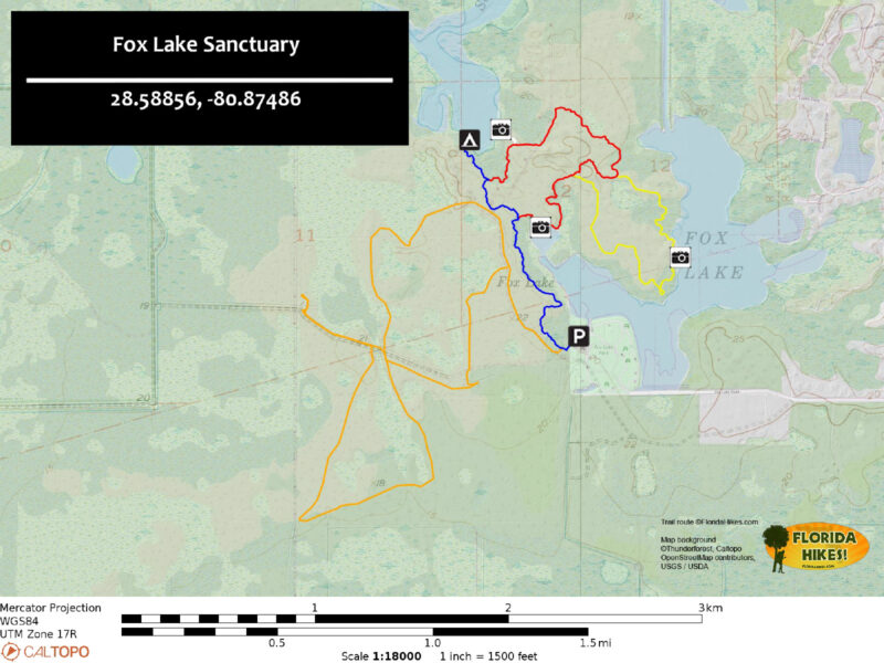
Fox Lake Sanctuary Trail Map
Hiking Trails: Blue, White, Red, Yellow. Multi-use: Orange (parts we’ve biked)

Explore More!

Learn more about Fox Lake Sanctuary
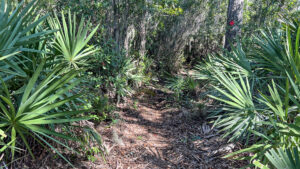
Saw palmetto on edges of footpath with red diamond blaze Fox Lake Sanctuary Protecting more than 2,500 acres along the western edge of Titusville, Fox Lake Sanctuary provides an immense landscape for exploration.


Slideshow

See our photos from this hike


Nearby Adventures

Forest road between tall trees Salt Lake WMA Spanning nearly 8,000 acres between Salt Lake, Lake Loughman, and South Lake, Salt Lake WMA is a popular birding and fishing destination with many miles of trails.
Enchanted Forest Titusville trail Enchanted Forest Sanctuary It's not rocket science: the first and finest of the Brevard Environmental Endangered Lands, Enchanted Forest Sanctuary in Titusville is a fabulous destination for family hiking.
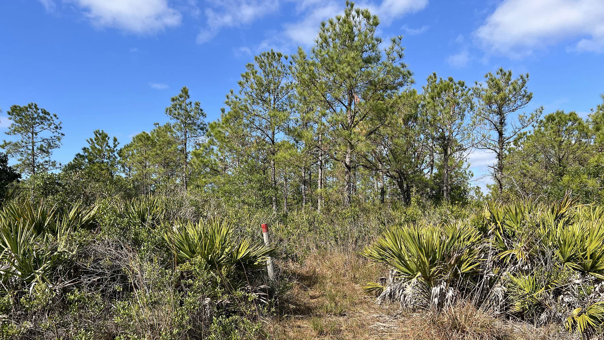
Pine trees and a red blazed post Scottsmoor Flatwoods Sanctuary Straddling the sandy uplands of the Atlantic Coastal Ridge, Scottsmoor Flatwoods Sanctuary protects 1,700 acres of flatwoods, scrub, and wetlands in North Brevard.
Dummett Cove Merritt Island Merritt Island National Wildlife Refuge With recreational activities ranging from hiking to biking, boating, fishing, and bioluminscent kayaking, Florida's top destination for birding is also home to Kennedy Space Center.

Official Website

  • Author
  • Recent Posts
Sandra Friend
Sandra Friend
Author of 45 books, Sandra Friend established FloridaHikes.com in 2006 to expand on the field research she'd completed for her first six hiking guides. She has been honored with lifetime achievement awards from the Florida Trail Association and the Florida Outdoor Writers Association.
Sandra Friend
Latest posts by Sandra Friend (see all)
  • Michael Crotty Bicentennial Park - November 3, 2026
  • A.J. Henry Park - November 1, 2026
  • Okeeheelee Nature Center Trails - October 22, 2026
Category: Access by water, Central Florida, Day Hikes, Hikes, Loop Hikes, TrailsTag: Big Trees, Birding, Boardwalks, Botanical, Florida's Space Coast, Observation Decks, Titusville, Wildlife Viewing

Sidebar

FarOut Guides

Our comprehensive trail logistics presented on offline maps:

Florida National Scenic Trail (1,500 miles)
Florida Keys Overseas Heritage Trail (108 miles)
Eastern Continental Trail in Florida (92 miles)


We earn a small commission on sales through these links. Thanks for your support!


Our Florida Guidebooks

We’ve written Florida guidebooks for over 25 years. These include Central Florida destinations.

Book cover with woman hiking through palms with baby carrier
Book cover of Florida Trail Hikes
The Florida Trail Guide fifth edition
50 Hikes in Central Florida 3rd edition

Explore More

Newest Articles for Central Florida

Two-track through pine savanna Hal Scott Yellow Trail
Footpath through coastal hammock Michael Crotty Bicentennial Park
Young longleaf pines at Hal Scott Hal Scott Preserve
FT sign under blue blaze next to trail corridor Land Bridge Loop

  • Facebook
  • Flickr
  • Instagram
  • Pinterest
  • Substack
  • Vimeo

FIND A TRAIL OR PARK

METROS: Bradenton. Clearwater. Crestview. Daytona Beach. Destin. Fort Lauderdale. Fort Myers. Fort Walton Beach. Gainesville. Jacksonville. Kissimmee. Lakeland. Melbourne. Miami. Naples. Ocala. Orlando. Panama City Beach. Pensacola. Port St. Lucie. Punta Gorda. St. Petersburg. Sanford. Sarasota. Sebring. Stuart. Tallahassee. Tampa. Vero Beach. West Palm Beach.

MULTI-REGION: Atlantic Coastal Ridge. Atlantic Coast. Bartram Trail. Big Bend. East Coast Greenway. Everglades National Park. Florida National Scenic Trail. Gulf Coast. Lake Wales Ridge. WATERWAYS: Indian River Lagoon. Intracoastal Waterway. Kissimmee River. St. Johns River. Withlacoochee River.

NORTHWEST FLORIDA: Altha. Apalachicola. Apalachicola National Forest. Big Bend Scenic Byway. Blackwater River State Forest. Blountstown. Bonifay. Bristol. Bruce. Cantonment. Cape San Blas. Carrabelle. Chattahoochee. Chipley. Crawfordville. DeFuniak Springs. Eastpoint. Ebro. Eglin Air Force Base. Freeport. Fountain. Gulf Breeze. Gulf Islands National Seashore. Holt. Madison. Marianna. Milton. Monticello. Mossy Head. Munson. Navarre. Navarre Beach. Newport. Niceville. Panacea. Panama City . Perdido Key. Ponce De Leon. Port St. Joe. Quincy. Santa Rosa Beach. Sopchoppy. South Walton. St. George Island. St. Marks. St. Marks NWR. Sumatra. Vernon. Wakulla. Wewahitchka. Woodville. WATERWAYS: Apalachicola River. Blackwater Bay. Blackwater River. Chipola River. Choctawhatchee Bay. Choctawhatchee River. Coastal Dune Lakes. Ochlockonee Bay. Perdido River. St. Marks River. Wacissa River. Wakulla River. Yellow River.

NORTH FLORIDA: Alachua. Amelia Island. Archer. Baldwin. Branford. Bronson. Bunnell. Callahan. Cedar Key. Chiefland. Crescent City. Cross City. Cross Creek. Dowling Park. Ellaville. Fanning Springs. Fernandina Beach. Flagler Beach. Fort White. Glen St. Mary. Green Cove Springs. Hawthorne. High Springs. Inglis. Jacksonville Beaches. Jacksonville Northshore. Jasper. Jennings. Keystone Heights. Lake Butler. Lake City. Live Oak.Macclenny. Mandarin. Mayo. Mayport. Micanopy. Middleburg. Old Town. Olustee. Orange Park. Osceola National Forest. Palatka. Palatka-Lake Butler Trail. Palm Coast. Palm Valley. Perry. Ponte Vedra. Rodman. Salt Springs. St. Augustine. Starke. Steinhatchee. Suwannee. Suwannee River Wilderness Trail. Suwannee Springs. Talbot Islands. Timucuan Preserve. Trenton. Waldo. Welaka. White Springs. Williston. Worthington Springs. Yankeetown. WATERWAYS: Santa Fe River. St. Marys River. Suwannee River. Tolomato River. Upper Withlacoochee River.

CENTRAL FLORIDA: Altamonte Springs. Apollo Beach. Apopka. Astatula. Astor. Auburndale. Bartow. Babson Park. Bayport. Belleview. Bithlo. Brandon. Brooksville. Bushnell. Canaveral National Seashore. Cassadaga. Christmas. Chuluota. Citrus Springs. Clearwater Beach. Clermont. Coast to Coast Trail. Cocoa. Cocoa Beach. Cross Florida Greenway. Crystal River. Dade City. De Leon Springs. DeBary. Deland. Deltona. Dunedin. Dunnellon. Edgewater. Enterprise. Eustis. Ferndale. Fort Meade. Frostproof. Geneva. Gibsonton. Haines City. Hernando. Hernando Beach. Holopaw. Homosassa. Inverness. Kenansville. Kissimmee. Lake Mary. Lake Wales. Largo. Leesburg. Lithia. Longwood. Lutz. Maitland. Malabar. McIntosh. Melbourne Beach. Merritt Island. Merritt Island NWR. Mims. Mount Dora. Narcoossee/Lake Nona. New Port Richey. New Smyrna Beach. Nobleton. Oak Hill. Oakland. Ocala National Forest. Ocklawaha. Ocoee. Oldsmar. Orange City. Ormond Beach. Osteen. Oviedo. Paisley. Palm Bay. Plant City. Poinciana. Polk City. Ponce Inlet. Port Orange. Ridge Manor. Riverview. Ruskin. Safety Harbor. Silver Springs. Sorrento. Spring Hill. St. Cloud. Tarpon Springs. Thonotosassa. Titusville . Umatilla. Viera. Walt Disney World. Weeki Wachee. Weirsdale. Wimauma. Windermere. Winter Garden. Winter Haven. Winter Park. Winter Springs. Withlacoochee State Forest. Withlacoochee State Trail. Yeehaw Junction. Zephyrhills. WATERWAYS: Alafia River. Halifax River. Hillsborough River. Lake Apopka. Little Manatee River. Ochlawaha River. Rainbow River. Tampa Bay. Wekiva River. Wekiva River Basin.

SOUTHWEST FLORIDA: Alva. Boca Grande. Cape Coral. Charlotte Harbor. Ding Darling NWR. Ellenton. Englewood. Estero. Immokalee. Marco Island. North Port. Osprey. Palma Sola. Palmetto. Pine Island. Port Charlotte. Sanibel Island. Venice. WATERWAYS: Caloosahatchee River. Manatee River. Myakka River. Pine Island Sound.

SOUTH FLORIDA: Arcadia. Basinger. Big Cypress National Preserve. Big Cypress Seminole Reservation. Big Cypress Swamp. Bowling Green. Clewiston. Everglades City. Indiantown. LaBelle. Lake Okeechobee Scenic Trail. Lake Placid. Lakeport. Moore Haven. Okeechobee. Ortona. Pahokee. Palmdale. Port Mayaca. South Bay. Wauchula. Zolfo Springs. WATERWAYS: Fisheating Creek. Lake Okeechobee. Peace River.

SOUTHEAST FLORIDA: Biscayne Bay. Biscayne National Park. Boca Raton. Boynton Beach. Coconut Creek. Coral Gables. Coral Springs. Davie. Delray Beach. Fellsmere. Flamingo. Fort Pierce. Hobe Sound. Hollywood. Homestead. Indrio. Jensen Beach. Juno Beach. Jupiter. Jupiter Farms. Key Biscayne. North Hutchison Island. Ocean to Lake Greenway. Palm Beach. Palm Beach Gardens. Pompano Beach. Redland. Sebastian. South Hutchinson Island. WATERWAYS: Florida Bay. St. Lucie River.

FLORIDA KEYS: Big Pine Key. Islamorada. Key Largo. Key West. Marathon. Overseas Heritage Trail.


©2006-2026, Sandra Friend & John Keatley | Disclosure | Site Index | Work with Us | Advertise with Us | Terms of Service and Privacy Policy

Florida Hikes PO Box 93 Mims FL 32754 | Contact
