• Skip to main content
  • Skip to header right navigation
  • Skip to after header navigation
  • Skip to site footer
Florida Hikes logo

Florida Hikes

Hike Bike Paddle Camp Florida with authors Sandra Friend and John Keatley as your guides

  • Trails
  • Maps
  • Guidebooks
  • Hike
    • Scenic Hikes
    • Loop Trails
    • Dog-friendly Hikes
    • Hikes for Kids
    • National Parks in Florida
    • Florida State Parks
  • Bike
    • Major Bike Trails
    • Paved Bike Trails
    • Off Road Biking
    • Biking Articles
  • Paddle
    • Canoe & Kayak Rentals
    • Paddling Destinations
    • Paddling Articles
  • Camp
    • Cabin Rentals
    • Car Camping
    • Primitive Camping
  • Florida Trail
    • Plan your Hike
    • Best Scenic Hikes
    • Best Backpacking
    • Section Hiking
    • Thru-Hiking
    • Trail Updates
  • Travel
Sea grapes Gasparilla Island

Gasparilla Island State Park

Protecting a string of beaches along the Gulf shore of Boca Grande on Gasparilla Island, this far-flung outpost of Lee County has one of Florida’s most delightful lighthouse museums.

March 2025 update. Beaches have reopened but the main parking lot and lighthouse museum remain closed due to damage from Hurricane Milton.

Charlotte Harbor pours into the Gulf through the Boca Grande Pass between Gasparilla Island and distant La Costa Island, home of Cayo Costa State Park.

The state park occupies the tip of the island as well as a sweep of oceanfront along the Gulf of Mexico fronting the community of Boca Grande.

Deep water in Charlotte Harbor attracted industrialists to Gasparilla Island in 1905 to develop Boca Grande as a railroad terminus for shipping ore.

Gasparilla Island phosphate docks Remains of the phosphate loading docks


The ore? Phosphate. Starting in 1911, it was shipped from mines along the Peace River down the Charlotte Harbor and Northern Railroad.

A two-mile trestle from Placida crossed Gasparilla Sound to the island. At the phosphate docks, ore cars were poured into the open holds of freighters.

In 1911, the Gasparilla Inn was built as a railroad hotel. Now one of the last of its era, it attracted well-to-do city folks to Boca Grande for the balmy winters.

Gasparilla Inn The Gasparilla Inn still welcomes guests today


Resources

Resources for exploring the area
50 Hikes in South Florida book cover South Florida Explorers Guide book cover Hikers Guide to the Sunshine State book cover Paddlers Guide Florida
 
Disclosure: As authors and affiliates, we receive earnings when you buy through our links. This helps us provide public information on this website.

Overview

Location: Boca Grande
Trailhead: 26.717968, -82.260658
Address: 880 Belcher Rd, Boca Grande FL 33921
Fees: $3 per vehicle
Restroom: At beach parking areas
Land manager: Florida State Parks
Phone: 941-964-0375

Open daily 8 AM to sundown. Pay at the iron ranger at the first stop you make and put the hangtag on your rearview mirror for the remaining stops.

While leashed pets are welcome, they are not permitted on beaches. When beach walking, avoid areas marked off as sea turtle nests.

Mind all warning signage about water dangers. Do not swim in or launch kayaks into Boca Grande Pass, where Charlotte Harbor flows into the Gulf of Mexico.


Directions


From Englewood, follow CR 775 (Placida Rd) south. From Port Charlotte, follow SR 771 (Gasparilla Rd) south. Both meet at the turnoff for the toll causeway and bridge to Gasparilla Island. Follow Gasparilla Rd across the causeway to Gasparilla Island. Downtown, turn right onto Gilchrist Street and follow signs to the park.

About the Park

It’s hard to believe, after driving through Boca Grande, that this park occupies what was once a bustling commercial seaport, Port Boca Grande. Especially when you see the view across the pass.

Encompassing 127 acres at the southern tip of Gasparilla Island, this is a state park with more to it than meets the eye. Most people come here for the beaches, of course.

Shore fishing is big thanks to the unique location, and the shelling here is simply amazing after a storm blows through.

Gasparilla Island sea shells Densely packed sea shells on the beach


Up until 1979, this was an active commercial shipping port just like the Port of Tampa. That’s where the phosphate companies moved their operations after abandoning Boca Grande.

Two of the former industrial sites – the seawall and the location of the fuel oil storage tanks – have been turned into upscale condo communities.

The remainder of the waterfront was gifted to the state of Florida, and is now Gasparilla Island State Park.

Gasparilla Island Visitors shelling near the remains of an old fishing pier


Beaches

You’ll pass each of these beaches on the way to Boca Grande Pass via Gulf Blvd or the Boca Grande Bike Path.

Range Light Park is the closest to the town of Boca Grande. A row of picnic shelters fronts this beach.

Standing tall above it is the Gasparilla Island Light, the metal tower with a beacon on top. It was formerly called the Range Light.

Gasparilla Island Light Gasparilla Island Light


Built in 1888 in Delaware at the mouth of the Delaware River, it was shipped to Florida and assembled here in 1927.

Range Light Park is a hangout for the surfing crowd, catching waves on one of the few beaches on the Gulf of Mexico where you can find any.

Gasparilla Island State Park surfers Surfers at Range Light Park


The next parking area is Sea Grape Beach, with a nice natural oceanfront and a fair bit of buffer from oceanfront homes to its north.

It’s a quarter mile farther to the Seawall Parking Area, immediately after an oceanfront restaurant, South Beach, that feels like it’s been there forever.

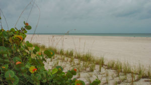
Sea grapes Gasparilla Island
On the beach at Gasparilla Island State Park

The road jogs around the Boca Grande Pass condo complex at the seawall and crosses Belcher Rd.

A public promenade was established along the seawall in the 1920s, but recent reports state it is no longer accessible, so you can’t assume you can connect the park’s beaches by walking the beachfront.

The next parking area on the right is the largest one, at the Dunes Beach. An accessible walkway leads to the bathhouse and to the beach.

Black skimmers
Black skimmers on the beach at Gasparilla Island

The final parking area is where the road ends at the Port Boca Grande Lighthouse. It provides access to the Dunes Beach as well as the beach along Boca Grande Pass.

Thanks to the wave action at this deep pass – the water is 80 feet deep relatively close to shore, and the land you see across the water is La Costa Island – seashells pile along the mouth of the pass.

Boca Grande Pass Looking across the pass to Cayo Costa


Shelling is excellent both along the shoreline facing the pass and around the bend along the Gulf dunes.

Swimming, however, should be avoided south of the Seawall area. The currents are swift and dangerous just offshore. Beach swimmers should stick to Range Light and Sea Grape.

Gasparilla Boca Grande Pass Deep water and high waves make this pass very dangerous


Biking

The southern terminus of the the Boca Grande Bike Path adjoins the Dunes Parking Area and the Port Boca Grande Lighthouse.

Look for it by the picnic shelter. It quickly starts paralleling Gulf Blvd just north of here. It extends north 1.8 miles through the park, connecting all the beach access points.

In its own dedicated greenway corridor, it enters Boca Grande and works its way through the historic residential and commercial districts.

Here, it provides access to restaurants and ice cream shops around 2.5 miles north of the lighthouse.

Following the former route of the Charlotte Harbor and Northern Railroad, it keeps going all the way to the north end of Gasparilla Island, ending after 6 miles near the Boca Grande Fishing Pier.

Hudsons Boca Grande Hudson’s Grocery in Boca Grande


Hiking

Other than walking on the bike path, your other option is to stroll the beach. The Seawall separates the two beaches in the park.

The Gulf of Mexico beach between the Sandspur Beach and Seawall Parking Areas is 1.5 miles each way.

It’s a little over a mile round-trip to walk from the Dunes Parking Area out to the old ore loading dock piers and back.

Gulf of Mexico Gasparilla Island You can walk 3 miles round-trip on this beach


Museum

In addition to admiring the Gasparilla Island Light, a visit to the Port Boca Grande Lighthouse is a must. It’s where the park’s museum is located.

Built in 1890 to guide ships to Charlotte Harbor, the Port Boca Grande Lighthouse served as a working lighthouse for nearly 70 years, with a lighthouse keepers’ quarters.

Put out of service when the Coast Guard decided to use an automated light in 1956, the lighthouse was abandoned by 1968.

It was fully restored between 1980 and 1986. It is again an active lighthouse, recommissioned as a navigational aid so ships can find their way to Charlotte Harbor. A 5th order Fresnel lens supplies the light.

The multi-room museum covers local history, from Spanish fish ranchos to tarpon fishing, the phosphate industry, and the ancient peoples who once populated these islands.

Let’s not forget pirates! While legend has it that the reason for the island’s name is the pirate José Gaspar, in reality, that was just a fable cooked up for storytelling and marketing.

In fact, the name “Boca Gasparilla” appeared in 1777 for this location on a British military map, well before the pirate Gaspar started a life of plunder in 1783.

A volunteer group, the Barrier Island Parks Society, manages the museum and gift shop. Hours may vary with volunteer availability. Call ahead to ensure the museum is open.

Gasparilla Island State Park Port Boca Grande Lighthouse


Explore More!

Nearby Adventures

View of La Costa Island south tip Cayo Costa State Park To spend a day or a weekend on your own deserted island? Heaven. This is one of the tougher and costlier state parks to get to, but well worth it.
Needlerush marsh Charlotte Harbor Preserve State Park Charlotte Harbor Preserve State Park Stretched long and thin to follow the convoluted shoreline of Charlotte Harbor, Charlotte Harbor Preserve State Park protects more than 100 miles of coastline along the Gulf Coast.
Cape Haze Pioneer Trail bridge Cape Haze Pioneer Trail A legacy of Florida's early phosphate mining, the Cape Haze Pioneer Trail now provides a protected greenway through a very residential corner of Charlotte County.
Shell bed along Gulf of Mexico Don Pedro Island State Park Imagine your own private island: a sweep of bright white sand along the shallows of the Gulf of Mexico. That's Don Pedro Island, a Florida State Park that is mostly offshore.

Trail Map (PDF) Official Website

  • Author
  • Recent Posts
Sandra Friend
Sandra Friend
Author of 45 books, Sandra Friend established FloridaHikes.com in 2006 to expand on the field research she'd completed for her first six hiking guides. She has been honored with lifetime achievement awards from the Florida Trail Association and the Florida Outdoor Writers Association.
Sandra Friend
Latest posts by Sandra Friend (see all)
  • Michael Crotty Bicentennial Park - November 3, 2026
  • A.J. Henry Park - November 1, 2026
  • Okeeheelee Nature Center Trails - October 22, 2026
Category: Beach Hikes, Beaches, Biking, Florida State Parks, Parks, Paved Bike Trails, Southwest FloridaTag: Boca Grande, Charlotte Harbor, Diving, Dog-friendly, Fishing, Florida State Parks, Gulf of Mexico, Historic Sites, Lighthouses, Snorkeling, Surfing, Swimming, Wildlife Viewing

Sidebar

FarOut Guides

Our comprehensive trail logistics presented on offline maps:

Florida National Scenic Trail (1,500 miles)
Florida Keys Overseas Heritage Trail (108 miles)
Eastern Continental Trail in Florida (92 miles)


We earn a small commission on sales through these links. Thanks for your support!


Our Guidebooks

We’ve written Florida guidebooks for over 25 years. These include Southwest Florida destinations.

Book cover with woman hiking through palms with baby carrier
Book cover of Florida Trail Hikes
The Florida Trail Guide fifth edition

Explore More

Newest Articles for Southwest Florida

View of open water framed by trees Calusa Heritage Trail
Footpath dipping into dampness amid mangroves Nancy Weir Mangrove Preserve
Firebreak and grassy strip through pine flatwoods Scherer Thaxton Preserve
Rounded open water amid grassland Deep Hole

  • Facebook
  • Flickr
  • Instagram
  • Pinterest
  • Substack
  • Vimeo

FIND A TRAIL OR PARK

METROS: Bradenton. Clearwater. Crestview. Daytona Beach. Destin. Fort Lauderdale. Fort Myers. Fort Walton Beach. Gainesville. Jacksonville. Kissimmee. Lakeland. Melbourne. Miami. Naples. Ocala. Orlando. Panama City Beach. Pensacola. Port St. Lucie. Punta Gorda. St. Petersburg. Sanford. Sarasota. Sebring. Stuart. Tallahassee. Tampa. Vero Beach. West Palm Beach.

MULTI-REGION: Atlantic Coastal Ridge. Atlantic Coast. Bartram Trail. Big Bend. East Coast Greenway. Everglades National Park. Florida National Scenic Trail. Gulf Coast. Lake Wales Ridge. WATERWAYS: Indian River Lagoon. Intracoastal Waterway. Kissimmee River. St. Johns River. Withlacoochee River.

NORTHWEST FLORIDA: Altha. Apalachicola. Apalachicola National Forest. Big Bend Scenic Byway. Blackwater River State Forest. Blountstown. Bonifay. Bristol. Bruce. Cantonment. Cape San Blas. Carrabelle. Chattahoochee. Chipley. Crawfordville. DeFuniak Springs. Eastpoint. Ebro. Eglin Air Force Base. Freeport. Fountain. Gulf Breeze. Gulf Islands National Seashore. Holt. Madison. Marianna. Milton. Monticello. Mossy Head. Munson. Navarre. Navarre Beach. Newport. Niceville. Panacea. Panama City . Perdido Key. Ponce De Leon. Port St. Joe. Quincy. Santa Rosa Beach. Sopchoppy. South Walton. St. George Island. St. Marks. St. Marks NWR. Sumatra. Vernon. Wakulla. Wewahitchka. Woodville. WATERWAYS: Apalachicola River. Blackwater Bay. Blackwater River. Chipola River. Choctawhatchee Bay. Choctawhatchee River. Coastal Dune Lakes. Ochlockonee Bay. Perdido River. St. Marks River. Wacissa River. Wakulla River. Yellow River.

NORTH FLORIDA: Alachua. Amelia Island. Archer. Baldwin. Branford. Bronson. Bunnell. Callahan. Cedar Key. Chiefland. Crescent City. Cross City. Cross Creek. Dowling Park. Ellaville. Fanning Springs. Fernandina Beach. Flagler Beach. Fort White. Glen St. Mary. Green Cove Springs. Hawthorne. High Springs. Inglis. Jacksonville Beaches. Jacksonville Northshore. Jasper. Jennings. Keystone Heights. Lake Butler. Lake City. Live Oak.Macclenny. Mandarin. Mayo. Mayport. Micanopy. Middleburg. Old Town. Olustee. Orange Park. Osceola National Forest. Palatka. Palatka-Lake Butler Trail. Palm Coast. Palm Valley. Perry. Ponte Vedra. Rodman. Salt Springs. St. Augustine. Starke. Steinhatchee. Suwannee. Suwannee River Wilderness Trail. Suwannee Springs. Talbot Islands. Timucuan Preserve. Trenton. Waldo. Welaka. White Springs. Williston. Worthington Springs. Yankeetown. WATERWAYS: Santa Fe River. St. Marys River. Suwannee River. Tolomato River. Upper Withlacoochee River.

CENTRAL FLORIDA: Altamonte Springs. Apollo Beach. Apopka. Astatula. Astor. Auburndale. Bartow. Babson Park. Bayport. Belleview. Bithlo. Brandon. Brooksville. Bushnell. Canaveral National Seashore. Cassadaga. Christmas. Chuluota. Citrus Springs. Clearwater Beach. Clermont. Coast to Coast Trail. Cocoa. Cocoa Beach. Cross Florida Greenway. Crystal River. Dade City. De Leon Springs. DeBary. Deland. Deltona. Dunedin. Dunnellon. Edgewater. Enterprise. Eustis. Ferndale. Fort Meade. Frostproof. Geneva. Gibsonton. Haines City. Hernando. Hernando Beach. Holopaw. Homosassa. Inverness. Kenansville. Kissimmee. Lake Mary. Lake Wales. Largo. Leesburg. Lithia. Longwood. Lutz. Maitland. Malabar. McIntosh. Melbourne Beach. Merritt Island. Merritt Island NWR. Mims. Mount Dora. Narcoossee/Lake Nona. New Port Richey. New Smyrna Beach. Nobleton. Oak Hill. Oakland. Ocala National Forest. Ocklawaha. Ocoee. Oldsmar. Orange City. Ormond Beach. Osteen. Oviedo. Paisley. Palm Bay. Plant City. Poinciana. Polk City. Ponce Inlet. Port Orange. Ridge Manor. Riverview. Ruskin. Safety Harbor. Silver Springs. Sorrento. Spring Hill. St. Cloud. Tarpon Springs. Thonotosassa. Titusville . Umatilla. Viera. Walt Disney World. Weeki Wachee. Weirsdale. Wimauma. Windermere. Winter Garden. Winter Haven. Winter Park. Winter Springs. Withlacoochee State Forest. Withlacoochee State Trail. Yeehaw Junction. Zephyrhills. WATERWAYS: Alafia River. Halifax River. Hillsborough River. Lake Apopka. Little Manatee River. Ochlawaha River. Rainbow River. Tampa Bay. Wekiva River. Wekiva River Basin.

SOUTHWEST FLORIDA: Alva. Boca Grande. Cape Coral. Charlotte Harbor. Ding Darling NWR. Ellenton. Englewood. Estero. Immokalee. Marco Island. North Port. Osprey. Palma Sola. Palmetto. Pine Island. Port Charlotte. Sanibel Island. Venice. WATERWAYS: Caloosahatchee River. Manatee River. Myakka River. Pine Island Sound.

SOUTH FLORIDA: Arcadia. Basinger. Big Cypress National Preserve. Big Cypress Seminole Reservation. Big Cypress Swamp. Bowling Green. Clewiston. Everglades City. Indiantown. LaBelle. Lake Okeechobee Scenic Trail. Lake Placid. Lakeport. Moore Haven. Okeechobee. Ortona. Pahokee. Palmdale. Port Mayaca. South Bay. Wauchula. Zolfo Springs. WATERWAYS: Fisheating Creek. Lake Okeechobee. Peace River.

SOUTHEAST FLORIDA: Biscayne Bay. Biscayne National Park. Boca Raton. Boynton Beach. Coconut Creek. Coral Gables. Coral Springs. Davie. Delray Beach. Fellsmere. Flamingo. Fort Pierce. Hobe Sound. Hollywood. Homestead. Indrio. Jensen Beach. Juno Beach. Jupiter. Jupiter Farms. Key Biscayne. North Hutchison Island. Ocean to Lake Greenway. Palm Beach. Palm Beach Gardens. Pompano Beach. Redland. Sebastian. South Hutchinson Island. WATERWAYS: Florida Bay. St. Lucie River.

FLORIDA KEYS: Big Pine Key. Islamorada. Key Largo. Key West. Marathon. Overseas Heritage Trail.


©2006-2026, Sandra Friend & John Keatley | Disclosure | Site Index | Work with Us | Advertise with Us | Terms of Service and Privacy Policy

Florida Hikes PO Box 93 Mims FL 32754 | Contact
