
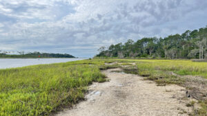
On the western shore of the Tolomato River across from Guana River WMA, Nocatee Landing anchors the south end of Nocatee Preserve.
Launch a kayak or canoe, fish from its sandy strand, or walk its wild shoreline. Bisecting this park, the Main Trail of Nocatee Preserve leads north into a panorama of estuary.
South, access little-visited Deep Creek State Forest. Our figure-eight loop through this landscape the Timucua called home provides plenty of scenic views.
 Shoreline of the Tolomato River
Resources




Disclosure: As authors and affiliates, we receive earnings when you buy through our links. This helps us provide public information on this website.
Overview
Location: Ponte Vedra
Length: 2 miles
Trailhead: 30.06531, -81.37204
Address: 2015 Nocatee Landing Trail, St. Augustine
Fees: Free
Restroom: At the trailhead
Land Manager: St. Johns County
Phone: 904-209-0333
Open dawn to dusk. Leashed dogs welcome. Main Trail shared with off-road cyclists and equestrians. Insect repellent a must.
Directions
From Interstate 95 exit 329 north of St. Augustine, follow Palm Valley Rd (CR 210) east for 3.2 miles. Soon after crossing US 1, merge onto Valley Ridge Rd and continue a mile to Cross Town Dr in Nocatee. Turn right. Drive 0.4 mile and make a right on Preservation Trail. Continue 1.3 miles to a traffic circle. Take the first exit onto Crosswater Parkway. After 2.5 miles on Crosswater Parkway, meet the next traffic circle. Take the third exit onto Nocatee Landing Trail. Follow it 2 miles to the parking area at its very end, within sight of a picnic pavilion and restrooms.
Hike
From the parking area, walk towards the picnic pavilion to start. A pathway leads towards the waterfront, slipping between fenceposts to a launch for paddlers.
Across the sparkling surface of the Tolomato River, the vast salt marsh on its far side is part of Guana River WMA, a preserve extending nearly ten miles north from Palm Valley.
 Approach to pavilion and landing
Flowing towards St. Augustine, the Tolomato is fed by the Guana River, Deep Creek, and countless smaller streams threading through its estuaries.
Trees felled by floodwaters block the beach to the south. Turn left to walk north up the shoreline.
 Launch
The Tolomato once rose from the surrounding cypress swamps and freshwater marshes. Its natural flow was disrupted in 1908 by a canal connecting it to the San Pablo River to the north.
The canal spurred settlement of Palm Valley, a historic farming and fishing community usurped in our lifetime by development expanding inland from Ponte Vedra Beach.
 Shoreline north of the launch
Broadened in 1916 for ease of commercial navigation from Jacksonville to St. Augustine, the Tolomato River is now part of the Atlantic Intracoastal Waterway.
Tidally influenced, it’s largely brackish but tannic, the beach striped by wrack lines left by the tannins. Walk up to where the salt marsh edges shoreline, noting shell fragments in the sand.
 Shoreline south of the launch
Returning to the launch, walk up it towards the trailhead. Veer left onto a two-track towards an interpretive sign.
At the time the first Spanish conquistadors sailed up this river, native peoples now collectively called the Timucua lived on these shores.
 Nocatee Landing ramp
The embedded shell fragments in the beach and more you’ll see scattered in these woods were once part of mounds they built and middens where they discarded harvested shells.
Some of their mounds kept homes off seasonally flooded ground, others were for navigation, worship, and burials.
 Interpretive sign among the cedars
A path to the left of the sign leads to a bench overlooking the Tolomato, a nice perch for birders.
Continue past the sign, the path curving around the parking area and along a marshy plain behind the cedars. Take the next left for another perspective on the river’s shoreline.
 Walkway through cedars and oaks
Red mangroves are starting to make a foothold on this grassy beach. Groundsel bushes burst into puffy white blooms each fall, attracting migrating monarch butterflies.
After a little exploration of the beach, backtrack to the T intersection and turn left. Mostly in the open, the path curves along the marsh. Make a left at the next T intersection.
 Shrubby beach
Slipping between well-established cedars, this pathway emerges at the river. Swarms of fiddler crabs bustle along the muddy flats between grassy islands.
Turn right to follow the sandy strand downriver between the grassy frontage and the groundsel bushes waving in the breeze.
 Shell fragments pepper the beach
Channel marker 24 rises from the middle of the river, the remains of an old dock beyond it. The sloped passage along the wrack line terminates in front of a slight shell ridge.
At its base, a salt marsh spreads back towards treeline, fed by a small creek flowing into the Tolomato.
 Marker 24 and old dock pilings
Depending on tides, you can walk a fair distance on the salt flats towards the creek. Armies of tiny fiddler crabs cluster together and scurry towards the grass roots, fascinating to watch.
Turn around and retrace your route along the shoreline, meeting the pathway under the cedars at a half mile.
 Fiddler crabs along estuary pond
Continue straight ahead where it meets the incoming two-track, walking past tall terrible thistles and spindly slash pines.
The next T intersection is with the Main Trail of Nocatee Preserve. To the left, it ends within a tenth of a mile at the gate for Deep Creek State Forest.
 Junction with Main Trail
Protecting a peninsula where Deep Creek empties into a vast estuary along the Tolomato, the forest has no marked trails, just more worn pathways like this one.
 Deep Creek State Forest Well hidden at the north end of St. Johns County, Deep Creek State Forest protects 379 acres along the flow of its namesake to where it meets the Tolomato River.
Better hiking lies north within Nocatee Preserve. Turn right, following the Main Trail along the west side of the marshy depression, completing the lower loop after 0.9 mile.
 Return to parking area
From the parking area, aim for the trio of posts on the opposite side of the park road. A worn path leads past a lightly etched post with the words “Mile 4.0” and “Main Trail.”
Walk through the gap into the cedar forest and emerge onto a causeway with an outstanding panorama of an estuary creek fringed by salt marsh and pine forest.
 Main Trail to estuary
The causeway has a feel and width of an early Florida road. The marsh extends to the distant Tolomato River, a tree-topped island breaking the flat plain.
An unusual feature of this marsh is immediately evident: rounded open water ponds within it. Perhaps they are where fill was removed for this causeway. Perhaps they are much older.
 Island view
A quarter mile in along this upper loop, a bench sits at a T intersection. Turn right. The spur trail is barely above marsh level, so it may flood or hold puddles at times.
The expanse of marsh on its south side sweeps towards the river and Nocatee Landing; to the north, it’s a puzzle of waterways with more rounded ponds within them.
 Causeway to the island
Sea oxeye and St. Johns Wort grow along the trail. Reaching the island, ascend to its flattened center. Gleaming shards of shells draw attention to open patches of soil.
On older maps, this area is marked as Spanish Landing, likely the northernmost navigable point along the original Tolomato River at the time.
It would not be surprising if the Spanish disembarked missionaries at the village that once occupied this high ground.
 High ground on the island
Continue along the trail to the riverfront, where a small bluff drops to a broad sandy beach with phenomenal views.
Excepting the channel markers and passing boats, it’s an exceptional panorama of what Florida’s coastline would have looked like for millennia.
 Looking south from Spanish Landing
Retrace the path across the island and along the causeway, with better views of the perhaps hand-dug waterways in the marsh from this direction.
Returning to the intersection with the bench at 1.6 miles, bear right. Leaving the estuary behind, enter the pine flatwoods along its edge.
 Estuary ponds
Groundsel and St. John’s wort sprout in front of wax myrtle and saw palmetto. Pale purple butterfly pea blossoms call attention to slender vines entangled in young cedars.
Curve into a straightaway lined with white star-shaped blooms of star rush atop slender stems. Emerge from the woods through a gap in the fence at 1.7 miles.
 Looking back at the narrow passage
From this point, the Main Trail continues alongside the park road past a pond and trailhead to its entry point to the heart of Nocatee Preserve. To return to Nocatee Landing, turn left.
Walk along not-so-busy Nocatee Landing Rd to make a loop back to the parking area through the pine forest, crossing the creek basin before spotting the trailhead up ahead.
You can also return via the causeway through the salt marsh. Either route wraps up a 2 mile hike when you reach the trailhead.
 The Main Trail continues north
Trail Map

Explore More!
Learn more about Nocatee Preserve
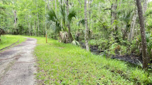 Nocatee Preserve A linear buffer between a massive planned community and the Tolomato River in Palm Valley, Nocatee Preserve protects 2,400 acres of riverfront habitats north of St. Augustine.
Video
A walk through Nocatee Landing
Slideshow
See our photos from Nocatee Landing
Nearby Adventures
 Stokes Landing Conservation Area Fronting a vast estuary along the Tolomato River basin, Stokes Landing Conservation Area contrasts deeply shaded maritime hammock and marsh rims with panoramic views.
 GTM Reserve Trails Circling a peninsula between the Guana River and the Tolomato River, the extensive trail system at GTM Research Reserve is one of Florida's most beautiful hiking destinations.

- Michael Crotty Bicentennial Park - November 3, 2026
- A.J. Henry Park - November 1, 2026
- Okeeheelee Nature Center Trails - October 22, 2026