
On 128 acres of conservation land along the shores of Lake Apopka, Oakland Nature Preserve is a Town of Oakland park with a mission of environmental education.
Restoration of sandhills in what is now suburbia in the Orlando metro complements a lengthy boardwalk through the lake floodplain to open water and connectivity to the West Orange Trail.
 Walk-in entrance off the West Orange Trail
Lake Apopka is Florida’s fourth largest lake and, like Lake Okeechobee, one that has undergone dramatic change due to human intervention.
Part of the purpose of this preserve is to educate visitors about the damage done to Lake Apopka and how it is slowly being corrected. Volunteers help with this mission.
 Creative way to illustrate the poisoning of Lake Apopka
Our route below pairs two separate hikes: 1.4 miles in the floodplain, 2.1 miles in the uplands. The boardwalk to Lake Apopka is fully accessible.
The uplands route follows the edge of a large network of trails on the hillside above the lake. Choose either or tackle both for a 3.5 mile hike at this diverse urban preserve.
 Start both hikes at the parking area
Resources





Disclosure: As authors and affiliates, we receive earnings when you buy through our links. This helps us provide public information on this website.
Overview
Location: Oakland
Length: 3.5 miles
Trailhead: 28.554992, -81.639834
Address: 747 Machete Trail, Oakland
Fees: Free
Restroom: At the Environmental Education Center
Land manager: Town of Oakland
Phone: 407-905-0054
Open daily sunrise to sunset. No dogs or bicycles permitted on trails. Stay on marked trails.
Generally open Mon-Fri 9-4, the Jim Thomas Environmental Education Center is sometimes busy with school groups. Stop in to visit with resident wildlife in the building and on the porch.
Directions
From Florida’s Turnpike exit for Clermont / Winter Garden (SR 50), go east less than a mile to the first road on your left. There is no light or blinker, so it’s tricky to cross traffic. There is a “Post Office” sign here. Follow this road, Tubb St, to its intersection with SR 438, Oakland Avenue. Turn left. Continue less than a mile, turning right at the sign for the nature preserve. Proceed through the front gate and follow the preserve road around to the parking area.
Hike
Floodplain Loop
Slipping downhill from the main trailhead at the upper end of the parking lot, a curving sidewalk switchbacks to the boardwalk entry.
Renamed the Healthy West Orange Boardwalk Trail since its inception, this broad walk hovers over splashes of wetland along the very rim of Lake Apopka’s marshes.
 Start of the boardwalk
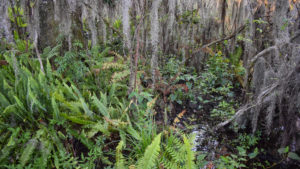
Bay trees intermingle with sweetgum and red maples along a cove dense with ferns. Dark waters trickle through a deeper channel.
A tenth of a mile in, the first segment of boardwalk ends in an oak hammock, the pathway continuing forward as a broad sidewalk.
Plan to explore the footpaths into the hammock on the return trip.
 Break in the boardwalk
When the next segment of boardwalk begins, it’s a commitment to a round-trip as far out as you want to go, the observation deck on Lake Apopka a half mile ahead the goal.
Hurricanes toppled many of the older, larger trees in this swamp, their soaked roots no match against the wind.
The result is a landscape of loss and renewal, vines swarming across tattered trees and fallen trunks.
 Boardwalk on a damp day
Pass beneath a rain shelter in another tenth of a mile. Each one has a bench. Elderberry crowds the railing, while grapevines hide the shrubs of the herbacious marsh below.
Curving past a small island topped with red maples, continue by a teepee created by vines stretched over a crumpled tree.
Continue through another rain shelter on a small forested island at 0.4 miles, where a pair of benches face each other.
 Island shelter
Leaving this tiny peak of high ground, the boardwalk winds gently through the floodplain. Primrose willow and lizard tail are among the more easily identified wildflowers below.
One of many aquatic plants named along the boardwalk, green arrow arum grows thickly over dark waters where young red maples find footing on hummocks.
Duckweed floats atop inky shallows. A bumpout hosts a pair of facing benches.
 The marsh below
Winding ever closer to the lake, hover above more open patches of water, perhaps glimpsing gallinules or egrets browsing sheltered pools.
A scrim of water below a distant shoreline appears beyond the mounded vines on the left. After a sharp curve, a cove in Lake Apopka comes into view.
Draperies of Spanish moss dangle from the lakeshore trees. Drawing closer to the cove, the sounds of birds become persistent.
 Cove beyond the marsh
At 0.6 mile, the roofed observation deck at the end of the boardwalk commands a view of the cove and a corner of vast Lake Apopka.
A dock extending from it is used for scheduled ecotours by pontoon boat on the lake.
 Lake Apopka
Returning along the boardwalk, take the time to read the helpful plant identifications more closely.
Where boardwalk yields to sidewalk at 1.1 mile, make a left to enter the oak hammock. The first left leads to a bird blind on the edge of the marsh.
 Start of the Hammock Loop
A footpath marked with green-tipped posts loops through the hammock through a clearing and past an outdoor classroom and picnic tables.
Edging a perimeter fence briefly, emerge into an outdoor play area ideal for young children, a gazebo overlooking it and Jennifer’s Rainbow Garden.
 Jennifer’s Rainbow Garden
Past the gazebo, make a right at Marker 1 to walk along the other side of the play area.
The footpath leads under the beautiful oak canopy past another outdoor learning space, the Prehistoric Trail.
 Walking towards the Prehistoric Trail
Emerge into the clearing where the boardwalks are and make a left on the near one.
Exiting the boardwalk, return up the switchback to the trailhead by the parking lot, completing this 1.4 mile hike to the lake.
 Return to the trailhead
Uplands Loop
The second loop at Oakland Nature Preserve starts with a walk from the parking area to the Environmental Education Center.
Climb up to the porch and take a peek inside, visiting their permanent residents on the porch.
 Inside the Jim Thomas Environmental Education Center
Descend the staircase at the far end of the porch. A wooden canoe over a century old is on display under a small shelter.
Follow earthen steps downhill to a trail junction facing maintenance sheds.
 Steps to the trail below
Turn left to walk along the edge of the first section of sandhill restoration within the preserve.
Sweeping uphill, the grassy slope under the pines is dotted with colorful wildflowers each fall.
 Restored sandhills
Beyond a signposted trail junction for a short loop, follow a bridge over a pretty seepage stream basin.
At the next junction, make a right. Walk past a sheltered bench before emerging at a fenceline corner with houses on the hillside. Turn right to follow the fence.
 Seepage stream bridge
It’s an ugly traverse compared to the other trails in the preserve, but a necessary connector to a place of hidden beauty.
A half mile into the hike, at the next sheltered bench, a loop begins around a more recently restored sandhill.
 Start of the loop
Bear left to stay on the upper edge of the hillside, which sweeps towards the lakefront marshes traversed by the floodplain loop.
Hemmed in by subdivisions in several directions, it is nevertheless an outstanding example of bringing a habitat back to life.
 The sandhills sweep towards the marsh below
Climbing uphill the entire way, turn away from the fence at Marker 25. The mowed path on this prominatory best showcases the transition of habitats from uplands to marsh basin.
Descending, make a right at a T, facing a subdivision for the remainder of the descent until the next right turn on the perimeter trail.
 Descent to the property boundary
Walk the ecotone between sandhill and marsh to complete the loop, reaching the sheltered bench at 0.9 mile.
Retrace the route along the fence to the fence corner with the Sinkhole sign. Bear right for the short spur to the overlook of this marshy basin below the subdivision.
 Sinkhole
Return to the fence corner junction and turn right, with views into the sinkhole on the right. A gentle climb leads to the junction at Marker 12.
Make a right, passing a park bench as the trail continues to climb uphill within sight of the adjoining neighborhood.
 Marker 12 junction
Curve left past a sprawling live oak, its spider-leg limbs splayed above a leafy forest floor. Keep climbing.
Reaching the preserve fenceline, make a left for a downhill past a bench into a leafy glade.
 Sprawling live oak
Ascend again to the fence, paralleling it eastbound within sight of cyclists racing by on the West Orange Trail on the other side.
Cross a sandy washout where floodwaters spilled into the preserve from the high ground behind the fence. Oaks crowd the trail in this relict sandhill.
 Fence at the bike path
Beyond an interpretive sign about gopher tortoises, approach the back entrance to the Amon Pavilion.
It’s a walk-in trailhead at 1.4 miles where visitors can enter the preserve from the West Orange Trail or simply take a break in the shade and grab a drink of water at the fountain.
 Amon Pavilion and West Orange Trail
On the opposite side of the pavilion is a restoration area with native plants and interpretive signage.
Bear right to stay with the perimeter trail, following along the fence. Rounding the corner past Marker 29, note tufts of deer moss growing on the duff under the trees.
Where the trail broadens at a junction, turn left to leave the fence behind for a walk towards the restored sandhills.
 Deer moss in leaf litter
At 1.7 miles, make a right at Marker 3, heading towards the Environmental Education Center.
Passing a large kiosk describing the longleaf pine savanna restoaration, curve through the sandhills past Marker 2 and descend through them.
 Sandhills kiosk
Complete a loop at a T intersection with the trail that led to the seepage stream. Turn right and continue uphill to the Environmental Education Center.
Exit via the raptor enclosures outdoors to the parking area to complete a 2.1 mile hike.
 Well above the raptor enclosures
Trail Map

Explore More!
Video
Hiking Oakland Nature Preserve
Slideshow
See our photos from Oakland Nature Preserve
Nearby Adventures
 Green Mountain Overlook and Trail At Green Mountain Scenic Overlook, take in a sweeping panorama of Lake Apopka from the highest elevations in Central Florida and hike Florida's longest set of trail switchbacks.
 Ferndale Preserve On Lake Apopka's western shore, Ferndale Preserve offers amazing panoramas of Florida's fourth largest lake, along with serious elevation changes on its four miles of multi-use trails.
 Lake Louisa State Park As longleaf pine reaches for the sky, the rolling hills of Lake Louisa State Park near Clermont return to their forested roots
 Crooked River Preserve On a 1.7-mile loop, Crooked River Preserve showcases a wide variety of habitats in a short hike on the northernmost extent of the Lake Wales Ridge in Clermont.

- Baseline Trails - November 7, 2026
- Hal Scott Yellow Trail - November 3, 2026
- Hal Scott Preserve - October 28, 2026