
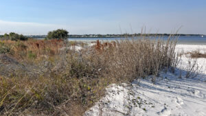
Encompassing an arc of soft white sands along the shallows of Choctawhatchee Bay, the Okaloosa Area of Gulf Islands National Seashore is all about the waterfront.
Visitors picnic, sun, paddle, and fish along this protected stretch of bayside beach on Okaloosa Island across from Eglin Air Force Base.
 Entrance sign
When the wind is up in the winter months, you’ll find a regular crowd of windsurfers taking advantage of the shallows, too.
At the end of the park road, a small craft launch enables paddlers and windsurfers easy access to the water. It is not suitable for trailered watercraft.
 Sandbars persist in the shallows
Resources



Disclosure: As authors and affiliates, we receive earnings when you buy through our links. This helps us provide public information on this website.
Overview
Location: Okaloosa Island
Length: Up to a mile
Trailhead: 30.39642, -86.57909
Address: 1 Gulf Islands National Seashore Dr, Okaloosa Island
Fees: $15-25 pass good for one week, $45 pass good for a year. All National Park and interagency passes accepted.
Restroom: At parking area
Land Manager: National Park Service
Phone: 850-934-2600
Open 8 AM to sunset unless the gates are closed. Stay off dunes; use crossover paths.
No pets or glass containers. Parasailing (kite surfing) season runs September through March.
Directions
From downtown Fort Walton Beach at Eglin Pkwy and US 98, follow US 98 east across the developed portion of Okaloosa Island. Turn left into the Okaloosa Area after 1.9 miles. The turnout is also 9.3 miles west of the intersection of SR 293 (the Mid-Bay Toll Bridge from Niceville) and US 98 in Destin.
Hike
There are no marked trails in the Oklaloosa Area, the easternmost unit of Gulf Islands National Seashore.
However, this is the only public access area with a substantial beach along Choctawhatchee Bay worth walking.
 Easternmost crossover
Start by using the easternmost crossover path at the first parking area. Soft white sand makes for tricky footing until you reach the beach.
At the waterfront, turn right and walk the curve of the shoreline, taking care to stay out of the low dunes.
 Shoreline heading east
In the distance, the tall dunes along the Gulf are part of Eglin Air Force Base at Matterhorn Beach across US 98.
This cove along the Choctawhatchee Bay is shallow and clear, its grass flats essential to marine life.
 Westward sweep of beach
Follow the curve of the cove to the point and return. Passing the crossover you used to reach the beach, keep following the waterfront to the final crossover.
It turns south to emerge at the picnic area. Either walk back along the beach or the edge of the park road for a mile hike.
 Picnic area
Trail Map

Explore More!
Learn more about Gulf Islands National Seashore
 Gulf Islands National Seashore Stretching across three Gulf Coast states, Gulf Islands National Seashore protects portions of the barrier islands between Navarre Beach, Florida and Gulfport, Mississippi.
Video
A walk through the Okaloosa Area
Slideshow
See our photos from the Okaloosa Area
Nearby Adventures
 Oklaloosa Island Veterans Park Adjoining Ross Mahler Park along Choctawhatchee Bay, Veterans Park hosts an important rookery for great blue herons and a unique Women's Veteran Memorial amid the dunes.
 Henderson Beach State Park Dunes as white as ski slopes tumble towards the Gulf of Mexico at Henderson Beach State Park, a precious slice of natural waterfront along the crowded sweep of developed beaches in Destin.
 Oak Tree Nature Park A canopied oasis occupying a city block east of Hurlburt Field, Oak Tree Nature Park surrounds the floodplain of Silver Sands Creek along US 98.
 Topsail Hill Preserve State Park With one of Florida's most beautiful sweeps of beach, Topsail Hill Preserve State Park is a linear preserve with tall dunes along three miles of shoreline.

- Michael Crotty Bicentennial Park - November 3, 2026
- A.J. Henry Park - November 1, 2026
- Okeeheelee Nature Center Trails - October 22, 2026