• Skip to main content
  • Skip to header right navigation
  • Skip to after header navigation
  • Skip to site footer
Florida Hikes logo

Florida Hikes

Hike Bike Paddle Camp Florida with authors Sandra Friend and John Keatley as your guides

  • Trails
  • Maps
  • Guidebooks
  • Hike
    • Scenic Hikes
    • Loop Trails
    • Dog-friendly Hikes
    • Hikes for Kids
    • National Parks in Florida
    • Florida State Parks
  • Bike
    • Major Bike Trails
    • Paved Bike Trails
    • Off Road Biking
    • Biking Articles
  • Paddle
    • Canoe & Kayak Rentals
    • Paddling Destinations
    • Paddling Articles
  • Camp
    • Cabin Rentals
    • Car Camping
    • Primitive Camping
  • Florida Trail
    • Plan your Hike
    • Best Scenic Hikes
    • Best Backpacking
    • Section Hiking
    • Thru-Hiking
    • Trail Updates
  • Travel
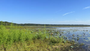
Expanse of lake

Jackson View Park

Take in two very different panoramas of Lake Jackson in Tallahassee from two almost-contiguous parks along its western shoreline.

Tallahassee (30.52039, -84.34611)   1.1 miles  

Lake Jackson is a fascinating geologic anomaly north of Tallahassee, edged by residential areas and preserves.

It’s a karst feature known as a polje, which means its waters rise and fall in concert with the Floridan aquifer.

When it is dry, it can expose the large sinkhole that both drains and feeds it.

Large lake Lake Jackson


A prominent wayside along US 27, tiny Jackson View Landing shows off the lake from two short boardwalks, one adjoining its boat ramp.

A kiosk at its parking area calls attention to nearby Jackson View Park.

Deck with picnic tables along lake Jackson View Landing provides accessible lake views


A manicured 45 acre expanse, Jackson View Park surrounds a stormwater filtration basin.

Its not-quite-mile loop has a boardwalk to an observation deck above the sweep of the lake.

Grassy expanse beyond a boardwalk railing Lake Jackson as seen at Jackson View Park


Only a quarter mile of shoreline lies between the two parks. Lakefront residences prevent a connection.

Depending on water levels, you can approach the shoreline down a short side path into Lake Jackson Aquatic Preserve.

Wall of vegetation Wall of vegetation in the Lake Jackson lakebed


Resources

Resources for exploring the area
Hikers Guide to the Sunshine State book cover North Florida Panhandle Explorers Guide book cover Paddlers Guide Florida The Hiking Trails of Floridas National Forests Parks Preserves book cover
 
Disclosure: As authors and affiliates, we receive earnings when you buy these through our links. This helps us provide public information on this website.

Overview

Location: Tallahassee
Length: 1.1 miles in two hikes
Trailhead: 30.52039, -84.34611
Address: 2585 Clara Kee Blvd, Tallahassee
Fees: Free
Restroom: At the US 27 trailhead
Land manager: Leon County
Phone: 850-606-1470

Open sunrise to sunset. Leashed dogs welcome. Picnic tables provided.

Only Jackson View Landing is fully accessible. Be cautious of alligators and snakes near the lakeshore at both locations.


Directions


From Interstate 10 exit 199 in Tallahassee, exit northbound on US 27. Drive 3.4 miles north and make a right on Clara Kee Blvd. After 0.2 miles, the parking area for Jackson View Park is on the left.

Hike

Jackson View Park

From the parking area, start a clockwise loop by following a sidewalk past a Little Free Library towards a picnic grove under the pines.

The sidewalk ends, but a worn path continues, curving left through an opening in a stand of oaks. A park bench sits in the shade near a large sycamore tree.

Picnic grove under pines A small segment of sidewalk yields to natural surface walking


The path fades away. Cross the open grassy space past more picnic benches, aiming for an opening between trees to the west.

Reaching the trees, look out towards a boundary fence for the park, across a grassy lawn. Turn right.

Blue skies over park setting Opening leading towards the boundary fence


Come to a low levee along the edge of the lakeside forest, one of the subtle structures within this park meant to constrain water flow.

Turn right and walk atop the levee. This well-worn path quickly meets the turnoff for the boardwalk out over Lake Jackson at 0.3 miles.

Levee with woods on left and hint of boardwalk Outer levee


Freshly reconstructed on our visit, the lengthy span aims straight through treeline, culminating in an observation deck above the lake.

The panorama it commands is the best you’ll find along Lake Jackson. Even during dry periods, a shimmer of water lies out in the middle of the basin.

Deck overlooking lake basin with marsh plants Observation deck


Return along the boardwalk and make a left on the levee. From this point on, the path is more substantial.

Curve along the forest edge and into the shade of the oaks, looking out through openings into marshy basins that sometimes cradle water.

Marshy basin under trees A basin between the levee and parking area


Past a fenced water control structure, the pathway curves towards another set of picnic benches and a playground in a clearing.

Skim the fenced rim of the playground, where there are additional picnic benches. The landscape beyond the clearing drops off noticeably into the lake basin.

Playground in distance along levee path Heading towards the playground clearing


At 0.6 miles, a worn path leads downhill through an opening marked with a Lake Jackson Aquatic Preserve sign with a “Proceed at your own risk” warning.

Because of karst features, it’s dangerous to walk out on the dry lakebed unless you’re on a guided hike with a geologist.

Pathway under pines with sign Side path to edge of lakeshore


Continue looping the picnic area and playground, following a worn path to an expanse of grassy lawn.

This is the same floodplain basin the levee led along towards the playground. Walk across the grass to a wooden bridge.

Wooden bridge amid grassy basin Bridge in the basin


The wide bridge spans a sometimes-dry watercourse. On its other side, head towards the series of benches fronting a marsh.

Returning to the shade of the hardwoods in front of the parking area, loop around the parking corral to complete this hike after 0.9 miles.

Bench overlooking marsh and parking corral under pines Returning towards the parking area


For the overlook and boat ramp, return to US 27 by vehicle and continue 0.4 miles northbound on US 27 past Clara Kee Blvd.

Turn in at the sign on the right for Jackson View Landing just as the causeway over the lake begins.

Picnic tables with grills and prominent privy Picnic area at Jackson View Landing


Jackson View Landing

Providing a boat ramp and scenic overlook, Jackson View Landing also has a privy and picnic tables next to its small parking area.

The launch marks the start of the Lake Jackson Paddling Trail, a marked route around the lake that extends as far south as Meginnis Arm next to Okeeheepkee Prairie Preserve.

Catwalk and boat ramp on lake Launch and adjoining catwalk


Follow the accessible walkway from the parking area towards the boat ramp. A raised metal catwalk with railings adjoins the concrete ramp.

At its end, a ramp leads down to water level—if there is, indeed, any water. At times there is not. When there is, lilies bloom profusely in summer and fall.

Blooming water lilies in front of an observation deck Shallows next to the boat ramp catwalk


Return up the walkway and turn right twice to join a short wooden boardwalk to a small observation deck above the lake.

When the lake drains, this cove is one of the few spots that retains any water. Take in the lily-dotted expanse, scanning for alligators, turtles, and otters.

Visiting these two observation points at Jackson View Landing adds 0.2 miles to your lakeside walk, or 1.1 miles between the two almost-adjacent destinations.

Boardwalk and observation deck on lake Boardwalk and observation deck


Trail Map
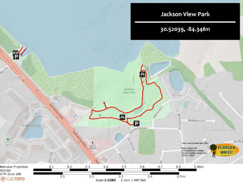
Jackson View Park Trail Map


Explore More!

Video

Hiking Jackson View Park


Slideshow

See our photos of Jackson View Park


Nearby Adventures

Picnic grounds and a mound under trees Lake Jackson Mounds Archaeological State Park A clearing in the deep forest along the north shore of Lake Jackson reveals reminders of a civilization long gone from the face of Florida.
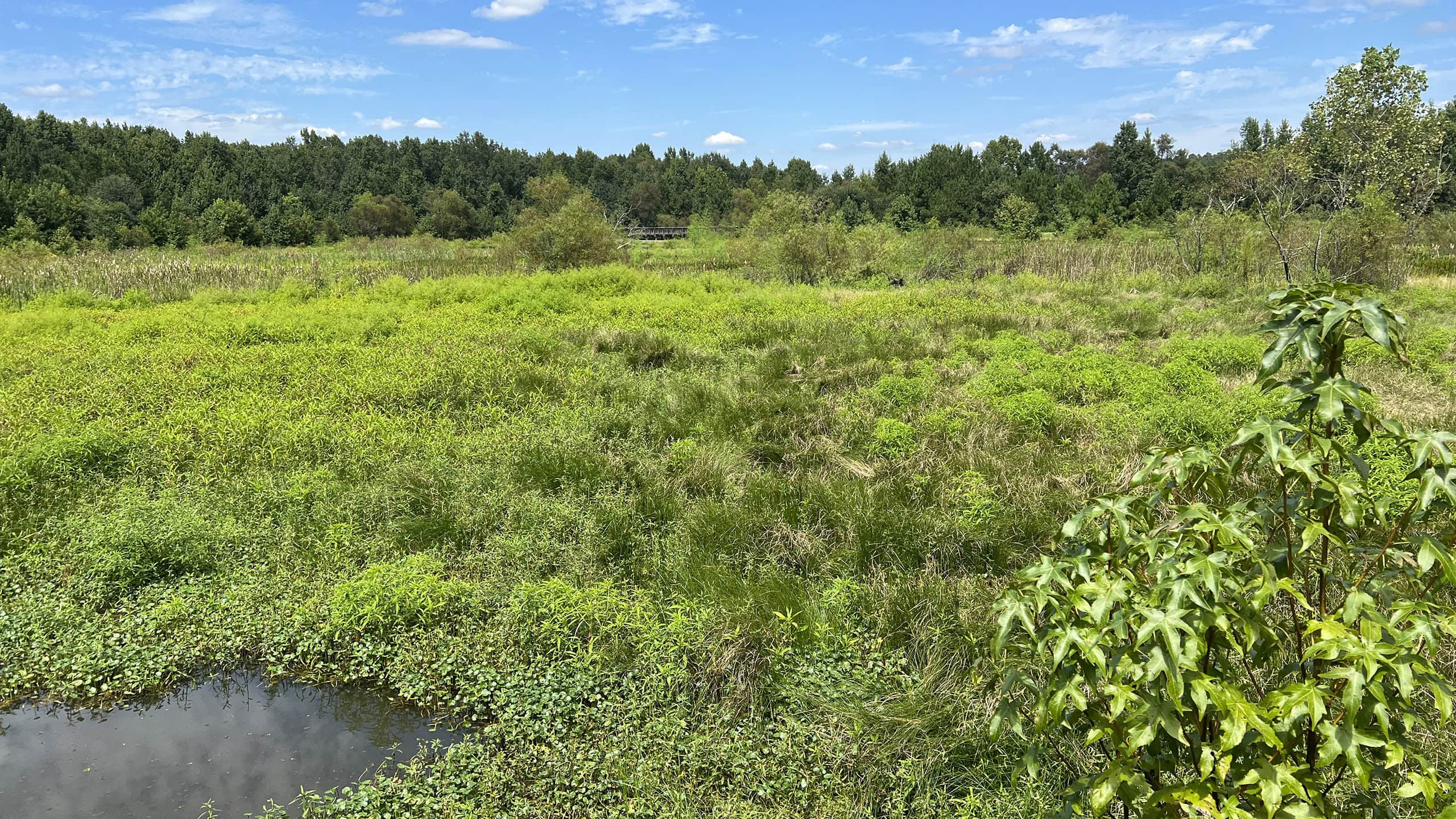
Wet prairie rimmed by trees Okeeheepkee Prairie Preserve A scenic half mile loop around a wet prairie within the Lake Jackson floodplain provides a pleasant birding stop fronted by a creative outdoor play space at Parwez Alam Park.
Beech-magnolia forest Elinor Klapp-Phipps Park A hiker's paradise in Tallahassee, Elinor Klapp-Phipps Park offers miles of trails exploring contoured terrain and winding streams under a tall, shady canopy of majestic trees.
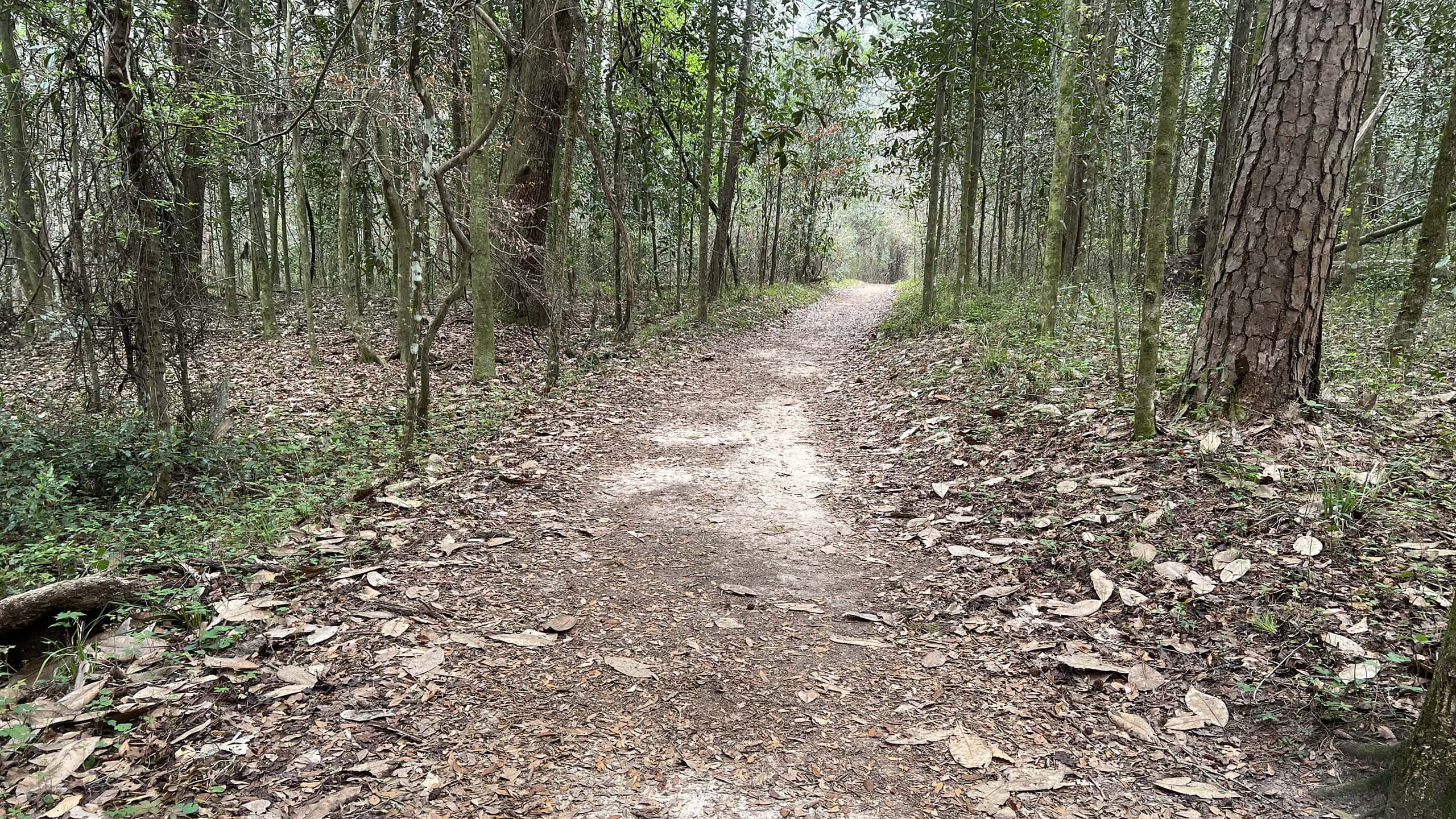
Sandy pathway through a bluff forest Maclay Gardens Ravine Trail Under a mature canopy of hardwood forest, the mostly-level Ravine Trail at MacLay Gardens Lake Overstreet Addition makes an easy 2.2 mile hike with stunning seasonal wildflowers.

Official Website

  • Author
  • Recent Posts
Sandra Friend & John Keatley
Articles jointly researched, written, and photographed by Sandra Friend & John Keatley, authors and publishers of FloridaHikes.com.
Sandra Friend & John Keatley
Latest posts by Sandra Friend & John Keatley (see all)
  • Fort Matanzas National Monument - November 21, 2026
  • Carney Island Conservation Area - November 19, 2026
  • Hal Scott Red Trail - November 13, 2026
Category: Access by water, County Parks, Hikes, Launch Points, Loop Hikes, Northwest Florida, Paddling, TrailsTag: Accessible, Birding, Boardwalks, Family-Friendly, Geology, Observation Decks, Picnic, Playgrounds, Tallahassee, Waterfront, Wildflowers

Sidebar

FarOut Guides

Our comprehensive trail logistics presented on offline maps:

Florida National Scenic Trail (1,500 miles)
Florida Keys Overseas Heritage Trail (108 miles)
Eastern Continental Trail in Florida (92 miles)


We earn a small commission on sales through these links. Thanks for your support!


Our Guidebooks

We’ve written Florida guidebooks for over 25 years. These include Northwest Florida destinations.

Book cover with woman hiking through palms with baby carrier
Book cover of Florida Trail Hikes
The Florida Trail Guide fifth edition
Explorer's Guide North Florida & The Panhandle guidebook

Explore More

Newest Articles for Northwest Florida

Footpath in lush river hammock Florida Trail, Wakulla River
Large pond with a boardwalk on its far shore Pedrick Pond Park
Sweep of bay beyond dunes and path through them Okaloosa Area
Wet prairie rimmed by trees Okeeheepkee Prairie Preserve

  • Facebook
  • Flickr
  • Instagram
  • Pinterest
  • Substack
  • Vimeo

FIND A TRAIL OR PARK

METROS: Bradenton. Clearwater. Crestview. Daytona Beach. Destin. Fort Lauderdale. Fort Myers. Fort Walton Beach. Gainesville. Jacksonville. Kissimmee. Lakeland. Melbourne. Miami. Naples. Ocala. Orlando. Panama City Beach. Pensacola. Port St. Lucie. Punta Gorda. St. Petersburg. Sanford. Sarasota. Sebring. Stuart. Tallahassee. Tampa. Vero Beach. West Palm Beach.

MULTI-REGION: Atlantic Coastal Ridge. Atlantic Coast. Bartram Trail. Big Bend. East Coast Greenway. Everglades National Park. Florida National Scenic Trail. Gulf Coast. Lake Wales Ridge. WATERWAYS: Indian River Lagoon. Intracoastal Waterway. Kissimmee River. St. Johns River. Withlacoochee River.

NORTHWEST FLORIDA: Altha. Apalachicola. Apalachicola National Forest. Big Bend Scenic Byway. Blackwater River State Forest. Blountstown. Bonifay. Bristol. Bruce. Cantonment. Cape San Blas. Carrabelle. Chattahoochee. Chipley. Crawfordville. DeFuniak Springs. Eastpoint. Ebro. Eglin Air Force Base. Freeport. Fountain. Gulf Breeze. Gulf Islands National Seashore. Holt. Madison. Marianna. Milton. Monticello. Mossy Head. Munson. Navarre. Navarre Beach. Newport. Niceville. Panacea. Panama City . Perdido Key. Ponce De Leon. Port St. Joe. Quincy. Santa Rosa Beach. Sopchoppy. South Walton. St. George Island. St. Marks. St. Marks NWR. Sumatra. Vernon. Wakulla. Wewahitchka. Woodville. WATERWAYS: Apalachicola River. Blackwater Bay. Blackwater River. Chipola River. Choctawhatchee Bay. Choctawhatchee River. Coastal Dune Lakes. Ochlockonee Bay. Perdido River. St. Marks River. Wacissa River. Wakulla River. Yellow River.

NORTH FLORIDA: Alachua. Amelia Island. Archer. Baldwin. Branford. Bronson. Bunnell. Callahan. Cedar Key. Chiefland. Crescent City. Cross City. Cross Creek. Dowling Park. Ellaville. Fanning Springs. Fernandina Beach. Flagler Beach. Fort White. Glen St. Mary. Green Cove Springs. Hawthorne. High Springs. Inglis. Jacksonville Beaches. Jacksonville Northshore. Jasper. Jennings. Keystone Heights. Lake Butler. Lake City. Live Oak.Macclenny. Mandarin. Mayo. Mayport. Micanopy. Middleburg. Old Town. Olustee. Orange Park. Osceola National Forest. Palatka. Palatka-Lake Butler Trail. Palm Coast. Palm Valley. Perry. Ponte Vedra. Rodman. Salt Springs. St. Augustine. Starke. Steinhatchee. Suwannee. Suwannee River Wilderness Trail. Suwannee Springs. Talbot Islands. Timucuan Preserve. Trenton. Waldo. Welaka. White Springs. Williston. Worthington Springs. Yankeetown. WATERWAYS: Santa Fe River. St. Marys River. Suwannee River. Tolomato River. Upper Withlacoochee River.

CENTRAL FLORIDA: Altamonte Springs. Apollo Beach. Apopka. Astatula. Astor. Auburndale. Bartow. Babson Park. Bayport. Belleview. Bithlo. Brandon. Brooksville. Bushnell. Canaveral National Seashore. Cassadaga. Christmas. Chuluota. Citrus Springs. Clearwater Beach. Clermont. Coast to Coast Trail. Cocoa. Cocoa Beach. Cross Florida Greenway. Crystal River. Dade City. De Leon Springs. DeBary. Deland. Deltona. Dunedin. Dunnellon. Edgewater. Enterprise. Eustis. Ferndale. Fort Meade. Frostproof. Geneva. Gibsonton. Haines City. Hernando. Hernando Beach. Holopaw. Homosassa. Inverness. Kenansville. Kissimmee. Lake Mary. Lake Wales. Largo. Leesburg. Lithia. Longwood. Lutz. Maitland. Malabar. McIntosh. Melbourne Beach. Merritt Island. Merritt Island NWR. Mims. Mount Dora. Narcoossee/Lake Nona. New Port Richey. New Smyrna Beach. Nobleton. Oak Hill. Oakland. Ocala National Forest. Ocklawaha. Ocoee. Oldsmar. Orange City. Ormond Beach. Osteen. Oviedo. Paisley. Palm Bay. Plant City. Poinciana. Polk City. Ponce Inlet. Port Orange. Ridge Manor. Riverview. Ruskin. Safety Harbor. Silver Springs. Sorrento. Spring Hill. St. Cloud. Tarpon Springs. Thonotosassa. Titusville . Umatilla. Viera. Walt Disney World. Weeki Wachee. Weirsdale. Wimauma. Windermere. Winter Garden. Winter Haven. Winter Park. Winter Springs. Withlacoochee State Forest. Withlacoochee State Trail. Yeehaw Junction. Zephyrhills. WATERWAYS: Alafia River. Halifax River. Hillsborough River. Lake Apopka. Little Manatee River. Ochlawaha River. Rainbow River. Tampa Bay. Wekiva River. Wekiva River Basin.

SOUTHWEST FLORIDA: Alva. Boca Grande. Cape Coral. Charlotte Harbor. Ding Darling NWR. Ellenton. Englewood. Estero. Immokalee. Marco Island. North Port. Osprey. Palma Sola. Palmetto. Pine Island. Port Charlotte. Sanibel Island. Venice. WATERWAYS: Caloosahatchee River. Manatee River. Myakka River. Pine Island Sound.

SOUTH FLORIDA: Arcadia. Basinger. Big Cypress National Preserve. Big Cypress Seminole Reservation. Big Cypress Swamp. Bowling Green. Clewiston. Everglades City. Indiantown. LaBelle. Lake Okeechobee Scenic Trail. Lake Placid. Lakeport. Moore Haven. Okeechobee. Ortona. Pahokee. Palmdale. Port Mayaca. South Bay. Wauchula. Zolfo Springs. WATERWAYS: Fisheating Creek. Lake Okeechobee. Peace River.

SOUTHEAST FLORIDA: Biscayne Bay. Biscayne National Park. Boca Raton. Boynton Beach. Coconut Creek. Coral Gables. Coral Springs. Davie. Delray Beach. Fellsmere. Flamingo. Fort Pierce. Hobe Sound. Hollywood. Homestead. Indrio. Jensen Beach. Juno Beach. Jupiter. Jupiter Farms. Key Biscayne. North Hutchison Island. Ocean to Lake Greenway. Palm Beach. Palm Beach Gardens. Pompano Beach. Redland. Sebastian. South Hutchinson Island. WATERWAYS: Florida Bay. St. Lucie River.

FLORIDA KEYS: Big Pine Key. Islamorada. Key Largo. Key West. Marathon. Overseas Heritage Trail.


©2006-2026, Sandra Friend & John Keatley | Disclosure | Site Index | Work with Us | Advertise with Us | Terms of Service and Privacy Policy

Florida Hikes PO Box 93 Mims FL 32754 | Contact