
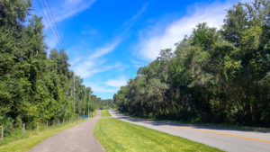
From its southern terminus north of a mine pit at a curve in a road, the northern segment of the Spring to Spring Trail provides an extremely hilly ride to start.
The trail parallels Grand Avenue north of SR 44, the one road that runs north-south closest to the St. Johns River.
Once the trail flattens out, it connects Glenwood and De Leon Springs, providing residents with a walking path and bike route.
 Passing a fernery on the way into Glenwood
Some of the neighborhoods and homes along it date back to the 1880s. Most are more modern but largely rural.
Dating to 1885, the Duvall Home was a 30-room hotel when Alanson and Thelma Duvall converted it into a campus in the 1950s to care for developmentally disabled children.
 Riding along the edge of Burwyn Park
The 1920s Burwyn Park neighborhood was an early Florida retirement village started by Fredrick Burt, who also established Spring Garden Ranch and Burt’s Park.
While Burt’s Park lives on in street name only, it was a direct competitor to De Leon Springs from the 1940s to the 1960s, offering swimming at Spring Garden Lake.

De Leon Springs is the ultimate northern goal of the Spring to Spring Trail, but Chuck Lennon Park just around the corner provides a free and rarely busy alternative terminus.
Scenic and sometimes strenuous, this portion of the trail surprised us by not just being a connector between communities, although it serves that role as well.
 Gently rolling hills south of Glenwood
Resources





Disclosure: As authors and affiliates, we receive earnings when you buy through our links. This helps us provide public information on this website.
Overview
Location: Glenwood to De Leon Springs
Length: 6.5 miles linear
Land manager: Volusia County
Land manager: Volusia County Parks
Phone: 386-423-3300
Open daylight hours. Leashed dogs welcome. Please pick up after your pet.
Much of this trail traverses a rural residential area. Cyclists should be on the lookout for cars exiting driveways, intersections, and loose dogs.
Restrooms are at the Lake Woodruff NWR Visitor Center (if open), Chuck Lennon Park (if unlocked), and De Leon Springs State Park, where an entrance fee of $2 per cyclist applies.
Lock up your bike when leaving it unattended at restrooms or trailheads.
Trail Details
We rode this segment as part of a full ride north along all three segments of Spring to Spring Trail, which we did to determine how to connect them by road.
Unlike the other two segments, the north segment has no trailhead at its south end. It simply starts at a sharp curve where Minnesota Ave turns into Grand Ave.
 The trail starts adjacent to the big arrow sign
It then parallels the west side of Grand Ave, but at nowhere near the same grade. Along the edge of a forest, the hills are steep and undulating.
Crossing Plymouth Ave, a dirt road, it comes within view of a fenced area across Grand Ave which is an old landfill. The new active landfill is close enough to catch a whiff some days.
 Taking a break at one of the oaks
Passing a sign about the Volusia ECHO Program, which helped fund this trail, the path heads downhill, splitting around a large oak.
After the uphill beyond it, you see a road on the right and a crosswalk from this path to a sidewalk into the woods.
 Crosswalk to trailhead
At a half mile, that’s the side trail to the only trailhead near the south end of this ride, with a canopied pavilion called the Fichter Trail Rest.
The trail remains hilly but the grades are less noticeable over the next half mile as it enjoys a little shade from the tree canopy before crossing Highland Park Rd.
 We’ve stayed at Highland Park Fish Camp and enjoyed their cabins
The surroundings shift a little with fences along the path and limited shade as the trail undulates past a large fernery.
The paved bike path ends at 1.6 miles. Use the crosswalk to get to the east side of Grand Ave.
 Crosswalk at the start of Glenwood
There is both a sidewalk and a wide bike lane along this part of the road, which enters Glenwood, a historic residential area.
The road is scenic and divided by a median with grand old oak trees. You pass a sign that states that this is part of the River of Lakes Scenic Byway.
Within a half mile, there is a stop sign for Glenwood Rd. Continue straight ahead along Grand Ave.
The median past this intersection it has a line of cabbage palms before it returns to grand live oak trees.
 Riding down the bike lane
Passing a sign stating that Lake Woodruff NWR is just 2 miles ahead, you ride by the Duvall Home, a large campus with its historic buildings.
Soon after, just past Lemon Rd at 3.3 miles, the bike path resumes again, this time right in front of you on the east side of Grand Ave.
It’s not a straight line, but gently curves around trees in front of nicely landscaped residences.
Passing a crosswalk before crossing Glenwood Reserve Dr, it dips into shade again and starts rolling with the terrain.
 A crosswalk into a neighborhood
Alongside farms and rural residences, it pops out into the sun again and the miles tick by quickly.
Pass Mud Lake Rd, the access to Lake Woodruff National Wildlife Refuge, at 4.5 miles. The visitor center sits on the corner behind the line of trees.
 The turnoff into the refuge
Up and over the next hill, you reach the south edge of the Burwyn Park neighborhood in De Leon Springs.
After a stop sign at Katrina St, the trail follows a crosswalk to the west side of Grand Ave for the remainder of the ride to the end of this road.
 Stop sign at Katrina Street
The path becomes scarcely the width of a wide sidewalk as it continues through Burwyn Park.
The setting feels relatively tropical for a residential neighborhood because of its proximity to one of Florida’s larger springs.
 When they say the trail narrows, they mean it
Passing a “Trail Narrows” sign, the width cuts down to less than the usual sidewalk, with a bike lane divider painted down it.
A couple blocks later, both Grand Avenue and the bike path simply end. And you’re left with no clue where to go next other than to ride the road.
 The trail ends here at Baxter Street
We made a right on this street, Baxter St, and seeing US 17 traffic ahead, made a quick left on DeSoto through a historic neighborhood.
A block later, we turned right on Audubon Ave and saw the next piece of bike path ahead, on the opposite side of Ponce De Leon Blvd.
 This piece of bike path is brand new
Crossing Ponce De Leon Blvd, turn left at 5.8 miles and continue along the north side of this road, which is often busy as it’s the access road for the state park.
This is a broad new side path along the road, crossing a handful of driveways. It ends just before the active railroad crossing at 6.4 miles.
 The path ends within sight of the state park entrance
Beware of traffic whipping around this blind curve from your right by the railroad and state park entrance.
Here’s where you can decide to continue straight on into De Leon Springs State Park to finish your ride, or to end at Chuck Lennon Park.
 De Leon Springs Park entrance
While De Leon Springs makes for a splashy and showy ending, the park fills up quickly on weekends and there is a fee for entry.
If you turn left instead of heading into the state park entrance, follow Burts Park Rd around the corner to the entrance to Chuck Lennon Park.
 This county park is literally around the corner from the state park
There’s a long, sun-drenched straightaway to get to the first big parking area on the left, but you’re rewarded with picnic tables and an easy walk to the restrooms.
Completing the ride at Chuck Lennon Park makes for a 7.1 mile linear trip from the start of this segment. Ending at De Leon Springs State Park is 6.8 miles linear at the upper parking area.
 Finishing this research ride at Chuck Lennon Park
For a round-trip ride, ride out of Fichter Trailhead south to the end of the trail, and then head north. That’ll let you tackle the toughest ups and downs while you’re fresh.
It’s a 9 mile round-trip to Lake Woodruff Visitor Center, a 11.2 mile round trip to where the bike path ends as Grand Avenue ends.
Or jump over to that final bit of side path to pivot back south from De Leon Springs for a 13 mile round trip or Chuck Lennon Park for a 14.2 mile round trip.
 Long entrance road to trailhead inside Chuck Lennon Park
Trailheads
To reach the south end of this segment, use the Fichter Trailhead. It is a large dirt lot along Humane Society Rd, with a nice shaded pavilion and interpretive information. Central to this segment, the Lake Woodruff NWR visitor center is just a block west of the trail at Mud Lake Rd, with visitor parking.
 The Fichter Trail Rest
Via a ride on back roads at the north end of this segment, Chuck Lennon Park provides trailhead access as well as restrooms and water.
While largely a community park with ballfields and a hiking trail, one wooded corner of Chuck Lennon Park is home to a system of offroad bike trails with technical features.
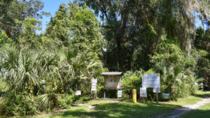 Chuck Lennon Park A top Florida destination for singletrack riders, Chuck Lennon Park also serves as a trailhead for the northern terminus of Volusia County's Spring to Spring Trail in De Leon Springs.
Mileage
0.0, South terminus at Grand Ave curve
0.5, Fichter trailhead crosswalk
0.9, Highland Park Rd with fish camp to west
1.6, Crosswalk to switch to northbound bike lane
2.1, Glenwood Rd
3.3, Bike path resumes north of Lemon Rd
4.5, Lake Woodruff NWR at Mud Lake Rd
5.0, Crosswalk to switch to west side of Grand Ave
5.6, Grand Ave and trail end at Baxter St
5.8, Join side path along Ponce De Leon Blvd
6.4, Side path ends at railroad at-grade crossing
6.5, De Leon Springs State Park entrance
7.1, Chuck Lennon Park dirt parking area
Trail Map

Explore More!
Learn more about the Spring to Spring Trail
 Spring to Spring Trail A paved bike path to link Volusia County's major springs, the Spring to Spring Trail provides a growing network of trail and park connectivity.
Video
Riding the northern section of the Spring-to-Spring Trail
Along the Route
Visit these stops along the Spring to Spring Trail North segment
 Lake Woodruff National Wildlife Refuge Six miles of trails meander through wide open spaces preserved for wintering waterfowl at 21,500-acre Lake Woodruff NWR along the St. Johns River.
 De Leon Springs State Park While pancakes and De Leon Springs go hand-in-hand thanks to the popular Old Spanish Sugar Mill Restaurant, the natural beauty of De Leon Springs is the reason to visit.
Slideshow
See our photos from biking the Spring to Spring Trail North Segment
Related Articles
Destinations near and rides along this trail segment
 The new 50 Hikes in Central Florida We launched a new full-color edition of 50 Hikes in Central Florida at the National Trails Festival in Deland the first weekend of October. Take a peek inside.
 Pancakes at the Old Spanish Sugar Mill Making pancakes at the Old Spanish Sugar Mill in De Leon Springs has been a tradition since 1961. But did you know the mill's history? Settle in and flip a flapjack after learning about its roots.
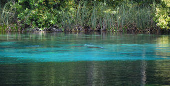 Three Days of Central Florida Springs Have a three-day weekend coming up and an urge to spend it with Florida's springs? Here's an itinerary for the Orlando area that'll have you splashing in beautiful locations.

- Hal Scott Yellow Trail - November 3, 2026
- Hal Scott Preserve - October 28, 2026
- Tradewinds Park - October 27, 2026