

Following a route where railroads once carried citrus to market, the West Orange Trail now winds through communities built around and atop those former orange groves.
Between the 1920s and 1960s, Winter Garden was a bustling citrus shipping community, at one time the largest in North America.
Orange County gets its name from the industry that made its mark here. Along the West Orange Trail, you’ll encounter historic markets and exhibits that recollect the past.
 Citrus label mosaic in Winter Garden
Resources





Disclosure: As authors and affiliates, we receive earnings when you buy through our links. This helps us provide public information on this website.
Overview
Location: Oakland to Apopka
Length: 20.8 miles
Land manager: Orange County Parks
Address: 501 Crown Point Cross Rd, Winter Garden
Phone: 407-654-1108
Open sunrise to sunset. Surface is asphalt. Leashed dogs permitted. This is an urban day use trail.
A portion of the trail north and south of Clarcona is adjoined by a treadway for equestrians, as indicated on the map. The Clarcona Horse Park is the only equestrian trailhead.
RV and tent sites are available at the Clarcona Horse Park for equestrian use. No other campgrounds are along the trail.
 Trailside equestrian facility in Clarcona
About the Trail
Now Orange County sprouts more new houses than orange trees. Since the trail’s western terminus was dedicated in 1994, its surroundings have changed.

Grand old oaks still define much of Oakland, and downtown Winter Garden is a joy to bike through.
It’s here that the trail is at its showiest in an urban space, as it was incorporated into a park right through the middle of downtown.
 Downtown Winter Garden
It passes the Tavares & Gulf Railroad depot, built in 1913, which houses the Central Florida Railroad Museum.
Once you get beyond Winter Garden, the trail is largely shielded from its changing surroundings by a long-standing tunnel of trees.
 Riding a recumbent north of Ocoee
That changes north of where toll road SR 429 passes overhead. Here, groves and forests have been bulldozed for densely packed subdivisions.
 Riding through residential Apopka
While there is still a greenway feel to the trail as it heads north from Clarcona, you ride through residential areas before topping the bridge over US 441 in Apopka.
 Bridge over US 441 in downtown Apopka
Although the ride mileage includes the trail’s extension up to Welch Rd in Apopka, there is no trailhead at that end of the path.
Stop at Apopka Station for an 18.2 mile linear ride (36.4 mile round-trip).
 Trailhead facilities at Apopka Station
Or add on another 5.2 miles (round-trip) by exploring the rest of Apopka along the trail north of Apopka Station.
Numerous trailheads along the route let you lengthen or shorten the overall trip to your own abilities.
 Wooden bridge along the West Orange Trail
If you run into an emergency on the trail, call 911 with a rough idea of the mile marker and location number you are near.
 These markers are embedded into the asphalt along the length of the trail.
Bike Rentals
Bike rentals are currently available at two locations at the southwest end of the trail: the Killarney Station terminus and Winter Garden Station.
At Winter Garden Station, Wheelworks (407-877-7433) offers rentals and has bike gear for sale. In downtown Winter Garden, you’ll ride right past their store.
 Bikes for sale outside Wheelworks in Winter Garden
At Killarney Station, West Orange Bikes and Blades (407-877-0600) had a rental fleet sitting outside when we visited. The owner offered us a trail map when we walked by.
 Gear and goodies inside Bikes and Blades
They also sell bikes, stock tires, and carry a supply of gear for emergency repairs. An air pump is available. And yes, there is ice cream.
Trailheads
Killarney Station, 17914 SR 438, Oakland
Oakland Nature Preserve, 747 Machete Trail, Oakland
Oakland Outpost, 230 N Tubb St, Oakland
Tildenville Outpost, 1064 Tildenville School Rd, Winter Garden
Winter Garden Station, 455 E Plant St, Winter Garden
Chapin Station, 501 Crown Point Cross Rd, Winter Garden
Ingram Outpost, 5995 Ingram Rd, Orlando
Apopka Vineland Outpost, 5794 N Apopka Vineland Rd, Orlando
McCormick Outpost, 58058 CR 435, Orlando
Clarcona Outpost, 3535 Damon Rd, Apopka
Apopka Station, 111 S Forest Ave, Apopka
 The western terminus of the West Orange Trail, Killarney Station was established in 1994.
Mileage
0.0 Killarney Station
1.4 Oakland Nature Preserve
2.2 Oakland Outpost
3.8 Tildenville Outpost
5.2 Winter Garden Station
7.2 Chapin Station
11.8 Ingram Outpost
13.6 Apopka-Vineland Outpost
13.8 McCormick Outpost (0.2W on side trail)
13.8 Clarcona Outpost (0.9W on side trail)
18.2 Apopka Station
20.8 Welsh Rd
Connections
Coast to Coast
Between Clarcona and Oakland, the 13.6 mile stretch of the West Orange Trail that centers on Winter Garden is also part of the statewide Coast to Coast Trail.
To the west, the West Orange Trail seamlessly becomes the Lake Minneola Scenic Trail which turns into the South Lake Trail, making a beeline across Lake County through Monteverde, Minneola, and Clermont.
 Killarney Station, the western terminus, also provides westbound access to the South Lake Trail
To the east, the Coast to Coast connection is the yet-as-unfinished corridor through Clarcona to Pine Hills.
Apopka to Rock Springs
Although it is not shown on the official Orange County map of the trail, the bike path continues north from Welch Rd in Apopka (Publix) parallel to Rock Springs Rd (SR 435).
Right now it makes it another half mile, up to Lester Rd. From there you can follow a sidewalk north another 3 miles to Kelly Park Rd.
Ride 0.6 mile east on Kelly Park Rd, sharing the dead-end, to get to the entrance to Kelly Park.
Kelly Park is a popular Orange County park that is home to beautiful Rock Springs. It offers tent camping, hiking, swimming, and tubing the run.
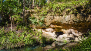 Kelly Park Tubing Rock Springs Run is why most folks visit Kelly Park, but the Kelly Loop Trail provides unique perspectives on many more natural features within the park.
Lake Apopka Loop Trail
Long-range plans also incorporate that portion with connectors to Magnolia Park and Green Mountain to create an actual loop for the Lake Apopka Loop Trail.
Signs for the Lake Apopka Loop Trail have been in Oakland for almost a decade. But those connections are tougher to make.
If you’re willing to ride the roads, braving traffic, narrow highways, curves, and hills – especially in Lake County – you can certainly circle the lake during daylight hours.
 Lake Apopka Loop Trail Discover the wild heart of Central Florida on a ride along the Lake Apopka Loop Trail, an arc spanning two counties along the lake's north shore.
Trail Map
 West Orange Trail Map (Orange County Parks)
Explore More!
Slideshow
See our photos from biking the West Orange Trail
Nearby Adventures
 Oakland Nature Preserve An accessible boardwalk through marshes to Lake Apopka pairs with an extensive network of upland trails for up to 3.5 miles of hiking at Oakland Nature Preserve.
 Magnolia Park On forested bluffs above Lake Apopka, Magnolia Park anchors the eastern terminus of the Lake Apopka Loop Trail near a campground under ancient live oaks.

- Baseline Trails - November 7, 2026
- Hal Scott Yellow Trail - November 3, 2026
- Hal Scott Preserve - October 28, 2026