• Skip to main content
  • Skip to header right navigation
  • Skip to after header navigation
  • Skip to site footer
Florida Hikes logo

Florida Hikes

Hike Bike Paddle Camp Florida with authors Sandra Friend and John Keatley as your guides

  • Trails
  • Maps
  • Guidebooks
  • Hike
    • Scenic Hikes
    • Loop Trails
    • Dog-friendly Hikes
    • Hikes for Kids
    • National Parks in Florida
    • Florida State Parks
  • Bike
    • Major Bike Trails
    • Paved Bike Trails
    • Off Road Biking
    • Biking Articles
  • Paddle
    • Canoe & Kayak Rentals
    • Paddling Destinations
    • Paddling Articles
  • Camp
    • Cabin Rentals
    • Car Camping
    • Primitive Camping
  • Florida Trail
    • Plan your Hike
    • Best Scenic Hikes
    • Best Backpacking
    • Section Hiking
    • Thru-Hiking
    • Trail Updates
  • Travel
River flowing below fern-lined bluff

Atlantic Ridge Preserve River Hammock Trails

Crowding close to the South Fork of the St. Lucie River, a network of hiking trails tunnels through the river hammocks of Atlantic Ridge Preserve State Park for scenic views.

Stuart (27.10297, -80.24158)   4.8 miles   Atlantic Ridge Preserve State Park

On former ranchland, Atlantic Ridge Preserve State Park protects nearly 5,000 acres along the east shore of the South Fork of the St. Lucie River.

Built by local volunteers, a trail network with a short stretch along the river bluffs tallies nearly five miles of hiking.

Trail through tropical hammock Tropical hammock on the River Trail


Narrow footpaths branch off of multi-use trails, leading to river views and through dense tropical river hammocks.

Different lengths of hikes can be tailored along the trio of loops and spurs. The map at the trailhead showed a 3.5 mile route. The choices we made at trail junctions made ours longer.

Exit sign pointing to road into pine forest This Exit sign pointed out River Road from the levee


“Trail,” “River,” and “Exit” signpots were critical for catching sudden turns that could use double blazing.

Exploring the outer edge of the trail system we call the River Hammock Trails gave us a 5.8 mile loop.

River view at river level in lush forest First overlook on the South Fork of the St. Lucie River


Resources

Resources for exploring the area
The Florida Trail Guide book cover Florida Trail Hikes book cover South Florida Explorers Guide book cover 50 Hikes in South Florida book cover Hikers Guide to the Sunshine State book cover
 
Disclosure: As authors and affiliates, we receive earnings when you buy through our links. This helps us provide public information on this website.

Overview

Location: Stuart
Trailhead: 27.10297, -80.24158
Address: 8120 SE Paulson Ave, Stuart
Fees: $6 per vehicle
Restrooms: Portable toilet at the trailhead
Land manager: Florida State Parks
Phone: 772-546-2771
 
Open 8 AM to 5 PM. A gate code is necessary to enter the park. You must call the number above in advance to obtain it.
 
Leashed dogs permitted. The large parking area accommodates horse trailers and has picnic tables. Expect mosquitoes. With the exception of the River Trail and other side trails to the river from the River Hammock Trails, trails are multi-use.
 

Bridge across a creek amid willows


Directions


From Interstate 95 exit 101, Kanner Hwy, follow SR 78 north. Turn right at the second light, Cove Rd. Make an immediate right onto Paulson Ave and turn left in front of Hosford Park to stay on Paulson Ave. The pavement ends in a half mile. Continue through the neighborhood to the park gate, which has a turnaround in front of it. Once through the gate, pay your fee and drive up the park road to the trailhead / picnic area across from some storage sheds.

Hike

The River Hammock Trail begins at a small kiosk adjoining a gap in the fence at the far end of the trailhead past the picnic tables. Follow the shaded forest road.

Making a quick left after a tenth of a mile, it starts following orange blazes, winding through an oak hammock.

Kiosk and trail sign next to gate Trailhead entrance


At a half mile, a spur trail on the right cuts through saw palmettos to your first glimpse of the South Fork of the St. Lucie River.

Return to the junction to pass the incoming trail and continue straight ahead to a split in the trail. Keep right, walking a corridor cut through saw palmetto.

Dense thicket of palmetto Palmetto passage


The two routes converge at a forest road in the pine flatwoods. A sign stating “Horses are not allowed past this point” marks the bail-out for the first loop.

Straight ahead you can meet River Road, turn left, and be back at the trailhead for a 1.2 mile hike.

Wooden bridge over ditch Bridge past the “No Horses” sign


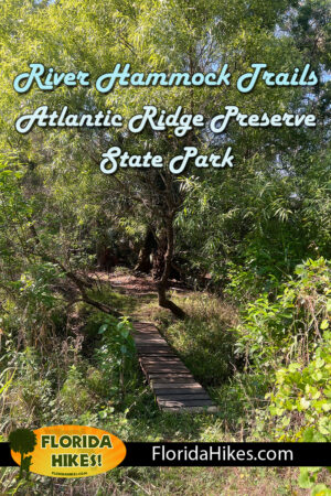
The best is yet to come, so turn right. Past the sign in the pine flatwoods, the footpath descends to a bridge and crosses a small but deep waterway.

Paralleling it downstream, reach a bench tops a bluff where the stream broadens. The flatwoods understory turns scrubby, the trail tunneling into the scrub.

oak scrub Scrubby flatwoods


Edge around a grassy swale where cabbage palms on the far side have enormous rootballs from prior periodic flooding in the river basin.

The hydrology has changed due to massive subdivisions replacing ranches and farms between the river and US 1.

Palms along a grassy clearing Mature cabbage palms edge a swale


Wind through a forest of older saw palmetto. As the trail nears the river, it becomes a narrow passage inside a tropical hardwood hammock.

Pass a mucky, bubbling pool around 1.1 miles, likely a spring flowing into the river.

Muddy swamp with giant leather ferns and a spring Spring in a mudhole


Snaking through tight squeezes in the tropical hammock, the trail can be damp in spots, especially as it edges more open areas where water pools when the river overflows.

Wild coffee and marlberry make an appearance. Watch your step through the section carved across more saw palmetto trunks.

Panorama framed by tropical hammock Peeking from the hammock towards the river basin


Passing more floodplain depressions, the trail emerges from this dense river hammock at an oxbow in a stream, the second loop decision point.

A left leads to River Rd by following this stream upstream along its bluffs, and a left on River Rd gets you back to the trailhead in 2.5 miles.

Stream with signage beyond Oxbow junction


For a walk on the river bluff, cross the bridge to your right at 1.3 miles. Just around the corner, white arrows painted on a tree point both ways at a T intersection.

Turn right for another clamber through saw palmettos, emerging at the edge of the river bluffs. Turn left.

Arrows painted on a tree trunk Junction with River Trail to right


The best river views of the hike are in this next tenth of a mile. At one spot, the trail virtually charges off the bluff towards the river down a steep slope.

You then scramble atop the bluff again. At 1.5 miles, begin moving away from the river through the dense tropical hammock, the forest floor busy with ferns.

River view through screen of vegetation South Fork of the St. Lucie


The River Trail ends a quarter mile after it reaches the bluff by emerging onto a grassy levee above a deep canal. Make a left to follow the levee, the least interesting part of the hike.

A gap in the berm on the left opens up at 2.3 miles. Turn left to follow River Road. A gentle meander through the pine flatwoods, this picturesque two-track showcases the habitat well.

Trail sign pointing away from a long levee Exit from the Levee Trail


At 2.6 miles, there is a swale directly ahead that the road plunges through towards a tall marker labeled “2”.

The slough was dry on our visit, but by the “Exit” sign pointed left, it obviously isn’t all the time. Curious, we made the left.

Dry slough with signage on both sides Start of the Slough Loop


Following that route led along the slough’s south bank, reaching the T intersection with the arrows by the oxbow at 3 miles.

Turning right per the signs, recross the bridge and make a right to parallel the north bank of the waterway, where lush vegetation thrives.

Wooden bridge over stream Bridge over the oxbow


Eventually white stripes on trees mark the well-trodden route, which pops out by the “2” marker north of the swale on River Road.

Unnecessary for us, this scenic walk around the slough added 0.8 mile to our hike.

Ferns growing along a waterway The upper reaches of the slough


Continue along River Road. It is bounded by marsh drainages which pass under it in culverts. At the junction of roads at the “1” marker at 3.8 miles, continue straight ahead.

While you can follow River Road to the trailhead, we turned off a tenth of a mile past the marker at the “Exit” sign for the northernmost loop.

Forest road outlined by fence posts Causeway portion of River Road


That two-track headed into the pine flatwoods for a slightly longer but much shadier and scenic finish, winding its way to the junction with the “no horses” sign.

Continue straight and stay to the right this time at the split in the trail; the two halves rejoin at the first river spur turnoff.

No horses sign to left in a clearing under oaks The “No Horses” junction


Pass it by and walk through the river hammock, the trail winding its way out into the more open stands of oaks. At the T with a forest road at 4.6 miles, turn right.

The final stretch is largely a straightaway retracing your initial walk under the oaks to the trailhead, completing the 4.8 mile hike.

Forest road under oaks Forest road under the oaks


Trail Map

Atlantic Ridge Preserve State Park Trail Map
Our hiking route along the River Hammock Trails

Explore More!

Learn more about Atlantic Ridge Preserve State Park

Broad sand road through sandhill habitat Atlantic Ridge Preserve State Park Protecting what remains of the forested Atlantic Ridge between the Indian River and the St. Lucie River, this secluded state park is hidden behind subdivisions in Stuart.

Video

Hiking at Atlantic Ridge Preserve State Park


Slideshow

See our photos of Atlantic Ridge Preserve State Park


Nearby Adventures

More worth exploring in this area

South Fork Nature Trail South Fork Nature Trail Along one of the Treasure Coast's most scenic waterways, the South Fork Nature Trail shows off the best side of the South Fork of the St. Lucie River.
White path through pine woods with dense understory Delaplane Preserve An easy trail through pine flatwoods and mangrove marsh leads to an overlook at the confluence of waterways.
Marshy pond rimmed with pines Kiplinger Preserve Tunnel through mangroves after pausing to watch birds in a freshwater wetland in this habitat-rich preserve along the St. Lucie River.
Well worn path through a wet pine flatwoods landscape DuPuis Loop Trail Made up of four stacked loops, the DuPuis Loop Trail lets you tailor your length of hike from 5.3 to 16.5 miles.

Trail Map (PDF) Official Website

  • Author
  • Recent Posts
Sandra Friend & John Keatley
Articles jointly researched, written, and photographed by Sandra Friend & John Keatley, authors and publishers of FloridaHikes.com.
Sandra Friend & John Keatley
Latest posts by Sandra Friend & John Keatley (see all)
  • Hal Scott Yellow Trail - November 3, 2026
  • Hal Scott Preserve - October 28, 2026
  • Tradewinds Park - October 27, 2026
Category: Biking, Day Hikes, Equestrian, Hikes, Loop Hikes, Off Road Biking, Southeast Florida, TrailsTag: Birding, Botanical, Dog-friendly, Florida State Parks, Hobe Sound, Palm City, Picnic, St. Lucie River, Stuart

Sidebar

FarOut Guides

Our comprehensive trail logistics presented on offline maps:

Florida National Scenic Trail (1,500 miles)
Florida Keys Overseas Heritage Trail (108 miles)
Eastern Continental Trail in Florida (92 miles)


We earn a small commission on sales through these links. Thanks for your support!


Our Guidebooks

We’ve written Florida guidebooks for over 25 years. These include Southeast Florida destinations.

Book cover with woman hiking through palms with baby carrier
Book cover of Florida Trail Hikes
The Florida Trail Guide fifth edition

Explore More

Newest Articles for Southeast Florida

Emerging from a tunnel of trees to a waterfront Tradewinds Park
Bench at a junction of trails in pine-palm flatwoods Okeeheelee Nature Center Trails
Dense understory beneath pines along footpath Lakewood Regional Park
Silvery-blue saw palmetto Lantana Scrub Natural Area

  • Facebook
  • Flickr
  • Instagram
  • Pinterest
  • Substack
  • Vimeo

FIND A TRAIL OR PARK

METROS: Bradenton. Clearwater. Crestview. Daytona Beach. Destin. Fort Lauderdale. Fort Myers. Fort Walton Beach. Gainesville. Jacksonville. Kissimmee. Lakeland. Melbourne. Miami. Naples. Ocala. Orlando. Panama City Beach. Pensacola. Port St. Lucie. Punta Gorda. St. Petersburg. Sanford. Sarasota. Sebring. Stuart. Tallahassee. Tampa. Vero Beach. West Palm Beach.

MULTI-REGION: Atlantic Coastal Ridge. Atlantic Coast. Bartram Trail. Big Bend. East Coast Greenway. Everglades National Park. Florida National Scenic Trail. Gulf Coast. Lake Wales Ridge. WATERWAYS: Indian River Lagoon. Intracoastal Waterway. Kissimmee River. St. Johns River. Withlacoochee River.

NORTHWEST FLORIDA: Altha. Apalachicola. Apalachicola National Forest. Big Bend Scenic Byway. Blackwater River State Forest. Blountstown. Bonifay. Bristol. Bruce. Cantonment. Cape San Blas. Carrabelle. Chattahoochee. Chipley. Crawfordville. DeFuniak Springs. Eastpoint. Ebro. Eglin Air Force Base. Freeport. Fountain. Gulf Breeze. Gulf Islands National Seashore. Holt. Madison. Marianna. Milton. Monticello. Mossy Head. Munson. Navarre. Navarre Beach. Newport. Niceville. Panacea. Panama City . Perdido Key. Ponce De Leon. Port St. Joe. Quincy. Santa Rosa Beach. Sopchoppy. South Walton. St. George Island. St. Marks. St. Marks NWR. Sumatra. Vernon. Wakulla. Wewahitchka. Woodville. WATERWAYS: Apalachicola River. Blackwater Bay. Blackwater River. Chipola River. Choctawhatchee Bay. Choctawhatchee River. Coastal Dune Lakes. Ochlockonee Bay. Perdido River. St. Marks River. Wacissa River. Wakulla River. Yellow River.

NORTH FLORIDA: Alachua. Amelia Island. Archer. Baldwin. Branford. Bronson. Bunnell. Callahan. Cedar Key. Chiefland. Crescent City. Cross City. Cross Creek. Dowling Park. Ellaville. Fanning Springs. Fernandina Beach. Flagler Beach. Fort White. Glen St. Mary. Green Cove Springs. Hawthorne. High Springs. Inglis. Jacksonville Beaches. Jacksonville Northshore. Jasper. Jennings. Keystone Heights. Lake Butler. Lake City. Live Oak.Macclenny. Mandarin. Mayo. Mayport. Micanopy. Middleburg. Old Town. Olustee. Orange Park. Osceola National Forest. Palatka. Palatka-Lake Butler Trail. Palm Coast. Palm Valley. Perry. Ponte Vedra. Rodman. Salt Springs. St. Augustine. Starke. Steinhatchee. Suwannee. Suwannee River Wilderness Trail. Suwannee Springs. Talbot Islands. Timucuan Preserve. Trenton. Waldo. Welaka. White Springs. Williston. Worthington Springs. Yankeetown. WATERWAYS: Santa Fe River. St. Marys River. Suwannee River. Tolomato River. Upper Withlacoochee River.

CENTRAL FLORIDA: Altamonte Springs. Apollo Beach. Apopka. Astatula. Astor. Auburndale. Bartow. Babson Park. Bayport. Belleview. Bithlo. Brandon. Brooksville. Bushnell. Canaveral National Seashore. Cassadaga. Christmas. Chuluota. Citrus Springs. Clearwater Beach. Clermont. Coast to Coast Trail. Cocoa. Cocoa Beach. Cross Florida Greenway. Crystal River. Dade City. De Leon Springs. DeBary. Deland. Deltona. Dunedin. Dunnellon. Edgewater. Enterprise. Eustis. Ferndale. Fort Meade. Frostproof. Geneva. Gibsonton. Haines City. Hernando. Hernando Beach. Holopaw. Homosassa. Inverness. Kenansville. Kissimmee. Lake Mary. Lake Wales. Largo. Leesburg. Lithia. Longwood. Lutz. Maitland. Malabar. McIntosh. Melbourne Beach. Merritt Island. Merritt Island NWR. Mims. Mount Dora. Narcoossee/Lake Nona. New Port Richey. New Smyrna Beach. Nobleton. Oak Hill. Oakland. Ocala National Forest. Ocklawaha. Ocoee. Oldsmar. Orange City. Ormond Beach. Osteen. Oviedo. Paisley. Palm Bay. Plant City. Poinciana. Polk City. Ponce Inlet. Port Orange. Ridge Manor. Riverview. Ruskin. Safety Harbor. Silver Springs. Sorrento. Spring Hill. St. Cloud. Tarpon Springs. Thonotosassa. Titusville . Umatilla. Viera. Walt Disney World. Weeki Wachee. Weirsdale. Wimauma. Windermere. Winter Garden. Winter Haven. Winter Park. Winter Springs. Withlacoochee State Forest. Withlacoochee State Trail. Yeehaw Junction. Zephyrhills. WATERWAYS: Alafia River. Halifax River. Hillsborough River. Lake Apopka. Little Manatee River. Ochlawaha River. Rainbow River. Tampa Bay. Wekiva River. Wekiva River Basin.

SOUTHWEST FLORIDA: Alva. Boca Grande. Cape Coral. Charlotte Harbor. Ding Darling NWR. Ellenton. Englewood. Estero. Immokalee. Marco Island. North Port. Osprey. Palma Sola. Palmetto. Pine Island. Port Charlotte. Sanibel Island. Venice. WATERWAYS: Caloosahatchee River. Manatee River. Myakka River. Pine Island Sound.

SOUTH FLORIDA: Arcadia. Basinger. Big Cypress National Preserve. Big Cypress Seminole Reservation. Big Cypress Swamp. Bowling Green. Clewiston. Everglades City. Indiantown. LaBelle. Lake Okeechobee Scenic Trail. Lake Placid. Lakeport. Moore Haven. Okeechobee. Ortona. Pahokee. Palmdale. Port Mayaca. South Bay. Wauchula. Zolfo Springs. WATERWAYS: Fisheating Creek. Lake Okeechobee. Peace River.

SOUTHEAST FLORIDA: Biscayne Bay. Biscayne National Park. Boca Raton. Boynton Beach. Coconut Creek. Coral Gables. Coral Springs. Davie. Delray Beach. Fellsmere. Flamingo. Fort Pierce. Hobe Sound. Hollywood. Homestead. Indrio. Jensen Beach. Juno Beach. Jupiter. Jupiter Farms. Key Biscayne. North Hutchison Island. Ocean to Lake Greenway. Palm Beach. Palm Beach Gardens. Pompano Beach. Redland. Sebastian. South Hutchinson Island. WATERWAYS: Florida Bay. St. Lucie River.

FLORIDA KEYS: Big Pine Key. Islamorada. Key Largo. Key West. Marathon. Overseas Heritage Trail.


©2006-2026, Sandra Friend & John Keatley | Disclosure | Site Index | Work with Us | Advertise with Us | Terms of Service and Privacy Policy

Florida Hikes PO Box 93 Mims FL 32754 | Contact
