• Skip to main content
  • Skip to header right navigation
  • Skip to after header navigation
  • Skip to site footer
Florida Hikes logo

Florida Hikes

Hike Bike Paddle Camp Florida with authors Sandra Friend and John Keatley as your guides

  • Trails
  • Maps
  • Guidebooks
  • Hike
    • Scenic Hikes
    • Loop Trails
    • Dog-friendly Hikes
    • Hikes for Kids
    • National Parks in Florida
    • Florida State Parks
  • Bike
    • Major Bike Trails
    • Paved Bike Trails
    • Off Road Biking
    • Biking Articles
  • Paddle
    • Canoe & Kayak Rentals
    • Paddling Destinations
    • Paddling Articles
  • Camp
    • Cabin Rentals
    • Car Camping
    • Primitive Camping
  • Florida Trail
    • Plan your Hike
    • Best Scenic Hikes
    • Best Backpacking
    • Section Hiking
    • Thru-Hiking
    • Trail Updates
  • Travel
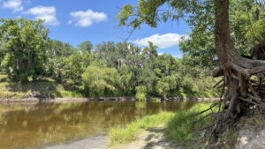
Riverbank view of tannic river

Brownville Park

Upriver from Arcadia, this 75-acre county park in the Peace River floodplain with fascinating geologic features centers on camping, paddling, and fossil hunting.

Arcadia (27.297669, -81.846395)   0.5 miles   Peace River

For fossil collectors who aren’t necessarily paddlers, Brownville Park is where to head when the Peace River starts evaporating.

In the river floodplain and partly atop sandy bluffs, it’s a family-friendly place to wade into the river’s clear waters.

Camping area under ancient live oaks Campsites at Brownville Park


A splendid canopy of ancient live oaks shades the park’s central feature, a small campground near the river.

The park also provides paddlers with a place to camp on multi-day trips, and a launch for boaters when waters are higher.

In addition to river views, some surprising geologic features are along the park’s easy nature trail loop.

Nubbly rocks adjoin creek Nubbly limestone bedrock along creek


Resources

Resources for exploring the area
South Florida Explorers Guide book cover 50 Hikes in South Florida book cover Hikers Guide to the Sunshine State book cover Paddlers Guide Florida
 
Disclosure: As authors and affiliates, we receive earnings when you buy through our links. This helps us provide public information on this website.

Overview

Location: Brownville
Length: 0.5 mile
Trailhead: 27.297669, -81.846395
Address: 1885 NE Brownville St, Arcadia
Fees: $2 per car
Restroom: Adjoining the campground
Land Manager: DeSoto County
Phone: 863-491-5333

Open sunrise to sunset. Leashed dogs welcome except where posted. Mosquitoes can be persistent certain times of year.

The 22 campsites are a mix of car camping and trailer sites with a dump station provided and an older bathhouse. Call ahead to reserve. There is also a walk-in group campsite.

Overnight parking for non-campers (multi-day paddlers) costs $10. A $25 annual pass is available. A camp host is on site.


Directions


From the junction of US 17 and SR 70 in Arcadia, follow US 17 north 6.2 miles to Brownville. Turn left on Brownville Rd and follow it 1.1 miles to the park entrance on the left immediately before the bridge over the river. Pay the entrance fee at the kiosk and continue down a narrow unpaved road into the floodplain. The first parking area provides access to a worn path to the fossil-hunting area. Continue through the campground to a parking area closer to the boat launch, past the restrooms. Mind the no parking signs in several spots.

Hike

Starting beneath the live oak canopy, walk to the picnic table on the river bluff for a view of the Peace River.

Before phosphate mining ate up vast tracts of landscape between Bartow and here, river levels stayed relatively steady thanks to many springs feeding its length.

Man looking at river from picnic table Picnic table with the best view


Radical changes to surface hydrology by extensive mining since the 1950s dried up springs and wiped out natural depression marshes feeding the floodplain.

Now heavily rainfall-dependent, the flow of the Peace River varies tremendously over the course of the year.

Launch in low depression with high concrete walls Reinforcement at the launch shows how high the river normally rises. It overwhelmed the surrounding area for miles higher during Hurricane Ian.


It’s most obvious in this corridor between Wauchula and Arcadia, which is why fossil hunters gravitate to this area.

The overall basin is nicknamed Bone Valley. The phosphorous content of ancient fossils attracted the mining companies, who extract phosphate for fertilizer.

Kiosk behind picnic tables Picnic area with kiosk


Crossing the boat launch entrance, walk over to the picnic area and kiosk for descriptions and photos of birds commonly seen here and information about the Peace River watershed.

Return past the downriver picnic table and aim for the Nature Trail sign adjoining a line of wooden posts.

Nature trail sign under live oaks Nature Trail access


A two-track leads into a sparse bluff forest dominated by oaks and hickory on sandy soil. Views of the river are obscured by saw palmetto.

Descend gradually, curving around a floodplain opposite from the bluffs. The path reaches a T intersection with a worn slope leading to river level.

River at base of sand slope Slope to river level


As long as you can see a beach to walk on, descend to the grayish area where fossilized shark’s teeth may be found.

Turn left to see the first notable geologic feature, a clear waterway flowing into the Peace River.

Cascade and waters flowing between rock ledges A waterway etched in layers of limestone


It has carved a well-worn channel in the limestone with a series of deep ledges, and drops past them in a small cascade.

Is it spring-fed? The water clarity and surface karst (limestone bedrock) says yes. The source of this stream is on private property.

River view Looking upriver


After a peek upriver to see the bluffs, ascend back to the trail and follow the broad grassy expanse under the trees.

There are many social trails; a worn side path is worth walking for an overview of the creek above its cascade.

Low depression with creek Creek outflow from above


Grassy and dappled with shade, the trail parallels the waterway upstream, the floodplain swamp opposite.

Drawing close to the creek at a quarter mile, descend a side trail to a limestone ledge above it.

Nubbly white rocks with stream Limestone ledge


The rocky surface is typical of karst, another indicator of a probable spring. The rocky bottom of the stream reveals a lower level of flow.

A small cascade appears to be a man-made dam of rocks, but the stream curves and drops through more water-carved limestone ledges at the base of a bluff.

Unusual creek with holes Water flows above and below holes in the rocky bottom of the stream


Return to the main path and continue. The path splits, the branch to the left leading to the group campsite, a collection of picnic tables under the oaks.

Take the branch to the right, still following the creek upstream. Vegetation blocks off most views of it, but gaps reveal glimpses of just how rocky it is.

Picnic tables under oak Group campsite


Pathway and waterway part ways, the two-track approaching a line of wooden posts. Meet the park road at 0.4 mile. Turn left and follow it into the live oak canopy.

Passing a side trail to the group camp, continue along the edge of of the parking area to the picnic table along the Peace River to complete this half mile circuit.

Car parked over huge live oaks with river beyond Returning to the riverfront


Trail Map

Brownville Park Trail Map


Explore More!

Learn more about the Peace River

Bluffs above a river basin Peace River Rising from marshes in the Green Swamp basin in Lakeland, the Peace River winds through fossil-rich Bone Valley west of the Lake Wales Ridge, reaching the Gulf of Mexico at Charlotte Harbor.

Video

A walk through the nature trail at Brownville Park


Slideshow

See our photos from this park


Nearby Adventures

Solomon's Castle Solomon’s Castle A glimmering monument to recycling and ingenuity, Solomon's Castle is a quirky work of art. A nature trail leads along the forested edge of Horse Creek.
View of river from high bluffs Morgan Park On an easy-to-follow trail network, enjoy exceptional views of the Peace River from surprisingly high bluffs just west of downtown Arcadia.
Slope to waterfront of river from bluff Pioneer Park A surprisingly scenic walk along the Peace River and through its floodplain, the loop trail at Pioneer Park starts and ends near the Cracker Trail Museum at Zolfo Springs.
Myakka Canopy Walk Tower Myakka River State Park With tall waving grasses, saw palmetto, and the sound of birds, Myakka River State Park is Florida's Big Sky country, blanketing more than 37,000 acres east of Sarasota.

Official Website

  • Author
  • Recent Posts
Sandra Friend
Sandra Friend
Author of 45 books, Sandra Friend established FloridaHikes.com in 2006 to expand on the field research she'd completed for her first six hiking guides. She has been honored with lifetime achievement awards from the Florida Trail Association and the Florida Outdoor Writers Association.
Sandra Friend
Latest posts by Sandra Friend (see all)
  • Michael Crotty Bicentennial Park - November 3, 2026
  • A.J. Henry Park - November 1, 2026
  • Okeeheelee Nature Center Trails - October 22, 2026
Category: Access by water, Camping, County Parks, Hikes, Launch Points, Loop Hikes, Nature Trails, Paddling, Parks, South Florida, TrailsTag: Arcadia, Big Trees, Birding, Boating, Car Camping, Family-Friendly, Fishing, Geology, Peace River, Zolfo Springs

Sidebar

FarOut Guides

Our comprehensive trail logistics presented on offline maps:

Florida National Scenic Trail (1,500 miles)
Florida Keys Overseas Heritage Trail (108 miles)
Eastern Continental Trail in Florida (92 miles)


We earn a small commission on sales through these links. Thanks for your support!


Our Guidebooks

We’ve written Florida guidebooks for over 25 years. These include South Florida destinations.

Book cover with woman hiking through palms with baby carrier
Book cover of Florida Trail Hikes
The Florida Trail Guide fifth edition

Explore More

Newest Articles for South Florida

Shelter in cypress strand along boardwalk beside channel Lake Istokpoga Park
Waving golden grasses in a flatwoods-edged prairie Paynes Creek Flatwoods Trail
View of creek far below over railing Paynes Creek Historic Trail
Two track amid lush forest Fakahatchee East Main Trail

  • Facebook
  • Flickr
  • Instagram
  • Pinterest
  • Substack
  • Vimeo

FIND A TRAIL OR PARK

METROS: Bradenton. Clearwater. Crestview. Daytona Beach. Destin. Fort Lauderdale. Fort Myers. Fort Walton Beach. Gainesville. Jacksonville. Kissimmee. Lakeland. Melbourne. Miami. Naples. Ocala. Orlando. Panama City Beach. Pensacola. Port St. Lucie. Punta Gorda. St. Petersburg. Sanford. Sarasota. Sebring. Stuart. Tallahassee. Tampa. Vero Beach. West Palm Beach.

MULTI-REGION: Atlantic Coastal Ridge. Atlantic Coast. Bartram Trail. Big Bend. East Coast Greenway. Everglades National Park. Florida National Scenic Trail. Gulf Coast. Lake Wales Ridge. WATERWAYS: Indian River Lagoon. Intracoastal Waterway. Kissimmee River. St. Johns River. Withlacoochee River.

NORTHWEST FLORIDA: Altha. Apalachicola. Apalachicola National Forest. Big Bend Scenic Byway. Blackwater River State Forest. Blountstown. Bonifay. Bristol. Bruce. Cantonment. Cape San Blas. Carrabelle. Chattahoochee. Chipley. Crawfordville. DeFuniak Springs. Eastpoint. Ebro. Eglin Air Force Base. Freeport. Fountain. Gulf Breeze. Gulf Islands National Seashore. Holt. Madison. Marianna. Milton. Monticello. Mossy Head. Munson. Navarre. Navarre Beach. Newport. Niceville. Panacea. Panama City . Perdido Key. Ponce De Leon. Port St. Joe. Quincy. Santa Rosa Beach. Sopchoppy. South Walton. St. George Island. St. Marks. St. Marks NWR. Sumatra. Vernon. Wakulla. Wewahitchka. Woodville. WATERWAYS: Apalachicola River. Blackwater Bay. Blackwater River. Chipola River. Choctawhatchee Bay. Choctawhatchee River. Coastal Dune Lakes. Ochlockonee Bay. Perdido River. St. Marks River. Wacissa River. Wakulla River. Yellow River.

NORTH FLORIDA: Alachua. Amelia Island. Archer. Baldwin. Branford. Bronson. Bunnell. Callahan. Cedar Key. Chiefland. Crescent City. Cross City. Cross Creek. Dowling Park. Ellaville. Fanning Springs. Fernandina Beach. Flagler Beach. Fort White. Glen St. Mary. Green Cove Springs. Hawthorne. High Springs. Inglis. Jacksonville Beaches. Jacksonville Northshore. Jasper. Jennings. Keystone Heights. Lake Butler. Lake City. Live Oak.Macclenny. Mandarin. Mayo. Mayport. Micanopy. Middleburg. Old Town. Olustee. Orange Park. Osceola National Forest. Palatka. Palatka-Lake Butler Trail. Palm Coast. Palm Valley. Perry. Ponte Vedra. Rodman. Salt Springs. St. Augustine. Starke. Steinhatchee. Suwannee. Suwannee River Wilderness Trail. Suwannee Springs. Talbot Islands. Timucuan Preserve. Trenton. Waldo. Welaka. White Springs. Williston. Worthington Springs. Yankeetown. WATERWAYS: Santa Fe River. St. Marys River. Suwannee River. Tolomato River. Upper Withlacoochee River.

CENTRAL FLORIDA: Altamonte Springs. Apollo Beach. Apopka. Astatula. Astor. Auburndale. Bartow. Babson Park. Bayport. Belleview. Bithlo. Brandon. Brooksville. Bushnell. Canaveral National Seashore. Cassadaga. Christmas. Chuluota. Citrus Springs. Clearwater Beach. Clermont. Coast to Coast Trail. Cocoa. Cocoa Beach. Cross Florida Greenway. Crystal River. Dade City. De Leon Springs. DeBary. Deland. Deltona. Dunedin. Dunnellon. Edgewater. Enterprise. Eustis. Ferndale. Fort Meade. Frostproof. Geneva. Gibsonton. Haines City. Hernando. Hernando Beach. Holopaw. Homosassa. Inverness. Kenansville. Kissimmee. Lake Mary. Lake Wales. Largo. Leesburg. Lithia. Longwood. Lutz. Maitland. Malabar. McIntosh. Melbourne Beach. Merritt Island. Merritt Island NWR. Mims. Mount Dora. Narcoossee/Lake Nona. New Port Richey. New Smyrna Beach. Nobleton. Oak Hill. Oakland. Ocala National Forest. Ocklawaha. Ocoee. Oldsmar. Orange City. Ormond Beach. Osteen. Oviedo. Paisley. Palm Bay. Plant City. Poinciana. Polk City. Ponce Inlet. Port Orange. Ridge Manor. Riverview. Ruskin. Safety Harbor. Silver Springs. Sorrento. Spring Hill. St. Cloud. Tarpon Springs. Thonotosassa. Titusville . Umatilla. Viera. Walt Disney World. Weeki Wachee. Weirsdale. Wimauma. Windermere. Winter Garden. Winter Haven. Winter Park. Winter Springs. Withlacoochee State Forest. Withlacoochee State Trail. Yeehaw Junction. Zephyrhills. WATERWAYS: Alafia River. Halifax River. Hillsborough River. Lake Apopka. Little Manatee River. Ochlawaha River. Rainbow River. Tampa Bay. Wekiva River. Wekiva River Basin.

SOUTHWEST FLORIDA: Alva. Boca Grande. Cape Coral. Charlotte Harbor. Ding Darling NWR. Ellenton. Englewood. Estero. Immokalee. Marco Island. North Port. Osprey. Palma Sola. Palmetto. Pine Island. Port Charlotte. Sanibel Island. Venice. WATERWAYS: Caloosahatchee River. Manatee River. Myakka River. Pine Island Sound.

SOUTH FLORIDA: Arcadia. Basinger. Big Cypress National Preserve. Big Cypress Seminole Reservation. Big Cypress Swamp. Bowling Green. Clewiston. Everglades City. Indiantown. LaBelle. Lake Okeechobee Scenic Trail. Lake Placid. Lakeport. Moore Haven. Okeechobee. Ortona. Pahokee. Palmdale. Port Mayaca. South Bay. Wauchula. Zolfo Springs. WATERWAYS: Fisheating Creek. Lake Okeechobee. Peace River.

SOUTHEAST FLORIDA: Biscayne Bay. Biscayne National Park. Boca Raton. Boynton Beach. Coconut Creek. Coral Gables. Coral Springs. Davie. Delray Beach. Fellsmere. Flamingo. Fort Pierce. Hobe Sound. Hollywood. Homestead. Indrio. Jensen Beach. Juno Beach. Jupiter. Jupiter Farms. Key Biscayne. North Hutchison Island. Ocean to Lake Greenway. Palm Beach. Palm Beach Gardens. Pompano Beach. Redland. Sebastian. South Hutchinson Island. WATERWAYS: Florida Bay. St. Lucie River.

FLORIDA KEYS: Big Pine Key. Islamorada. Key Largo. Key West. Marathon. Overseas Heritage Trail.


©2006-2026, Sandra Friend & John Keatley | Disclosure | Site Index | Work with Us | Advertise with Us | Terms of Service and Privacy Policy

Florida Hikes PO Box 93 Mims FL 32754 | Contact
