• Skip to main content
  • Skip to header right navigation
  • Skip to after header navigation
  • Skip to site footer
Florida Hikes logo

Florida Hikes

Hike Bike Paddle Camp Florida with authors Sandra Friend and John Keatley as your guides

  • Trails
  • Maps
  • Guidebooks
  • Hike
    • Scenic Hikes
    • Loop Trails
    • Dog-friendly Hikes
    • Hikes for Kids
    • National Parks in Florida
    • Florida State Parks
  • Bike
    • Major Bike Trails
    • Paved Bike Trails
    • Off Road Biking
    • Biking Articles
  • Paddle
    • Canoe & Kayak Rentals
    • Paddling Destinations
    • Paddling Articles
  • Camp
    • Cabin Rentals
    • Car Camping
    • Primitive Camping
  • Florida Trail
    • Plan your Hike
    • Best Scenic Hikes
    • Best Backpacking
    • Section Hiking
    • Thru-Hiking
    • Trail Updates
  • Travel
Rocky terrain in a hardwood forest

Citrus Loop D

The southernmost of four loop trails in the Citrus Tract of the Withlacoochee State Forest, Loop D showcases rocky limestone karst and rolling sandhill forests.

Inverness (28.709278, -82.451472)   14.7 miles   Withlacoochee State Forest

One of several separate units of the expansive Withlacoochee State Forest, the Citrus Tract protects almost 50,000 acres of countryside in rural west Central Florida.

A popular destination for hiking, horseback riding, hunting, and off roading, the property boasts countless miles of forest roads, and one of the largest hiking loops in the state.

Yellow blaze on pine tree Sandhills predominate the Citrus Tract


Connector trails break the 39.1-mile Citrus Hiking Trail into four parts, labeled A, B, C, and D.

The trail system was established and is currently maintained by the Florida Trail Association, and all four loops include a piece of the statewide Florida Trail.

Rocky terrain with blazed footpath The southwest corner of the Citrus Hiking Trail is surprisingly rocky


Loop D is arguably the most fascinating route, as it travels through unusual habitats, passing remarkable landforms sculpted by water over time.

The official parking for the trail system is at Holder Mine in the northeastern corner of the forest, and should be used if leaving a car overnight.

For this day hike, access the D Loop via a forest road leading past a collection of well-known caves.

Descending footpath in woods Descending into an area with caves


Resources

Resources for exploring the area
Florida Trail Hikes book cover The Florida Trail Guide book cover 50 Hikes in Central Florida Central Florida Orlando Explorers Guide book cover Hikers Guide to the Sunshine State book cover Paddlers Guide Florida
 
Disclosure: As authors and affiliates, we receive earnings when you buy through our links. This helps us provide public information on this website.

Overview

Location: Lecanto
Length: 14.7 miles
Trailhead: 28.709278, -82.451472
Address: S Lecanto Hwy, Lecanto
Fees: Free
Restrooms: None
Land manager: Florida Forest Service
Phone: 352-797-4140

Open dawn to dusk unless camping. Leashed dogs allowed.

This is an extraordinarily popular hunting ground, so be mindful of scheduled hunts and wear blaze orange. Avoid backpacking during deer hunting season.

Do not leave a car overnight alongside trail access points at S Lecanto Hwy or Stagecoach Trail. The only official overnight parking is at Holder Mine.


Directions


From the intersection of US 98 and W Jefferson St. in Brooksville, head north on US 98 for 7.8 miles, taking the first turn at a traffic circle onto Citrus Way. Continue straight for 4.1 miles, and the unmarked gravel parking area will be on the right side of the road.

Hike

Beginning at the roadside pull off, look for a sandy forest road leading into the woods behind concrete barriers meant to prevent vehicles from driving into the forest.

Follow the wide pathway eastward, reaching the first karst feature in a half mile. Dame’s Cave is hard to miss, with a large tree standing alongside an opening in the earth.

Person emerging from cave Hole leading into Dame’s Cave


Thick tree roots slither down into the cave, providing a sort of handhold for folks who wish to descend into the subterranean chamber.

The forest road passes a few smaller caves and intriguingly rocky landscapes before reaching the yellow-blazed trail at 0.7 miles.

Path outlined with logs Sandhill community


Turn left to begin the loop clockwise, following a well-defined pathway cast with dappled shade under an open canopy of pine and oak.

Tree cover gradually becomes sparser as the trail traverses contoured terrain in an expansive sandhill forest, reaching a blue blazed cross trail at the 4 mile mark.

Green snake among pine needles Rough green snake


Turn right, following the blue trail eastward into a strikingly quiet part of the forest where the sound of wind whooshes in the treetops against a backdrop of chirping crickets and birds.

Lizards skitter through the leaves as hikers approach, and snakes might take advantage of the mowed pathway to bask in the sun.

Turn right at an intersection with the Florida Trail at 5.7 miles to stay on the D Loop.

Orange blazed trail in sandhills Florida Trail


Orange blazes lead across grassy pine prairies dotted with gnarled live oaks and clusters of saw palmetto as the trail heads southward.

Reach Stagecoach Trail at 9 miles. At this point, the Florida Trail turns to follow the road east.

D Loop continues across paved CR 480, switching back to yellow blazes while entering a deeply shaded hardwood forest.

Circling a grassy prairie around Stage Pond, the path curves to the west, passing a camp zone with benches and a fire ring at 10.6 miles.

Campsite Taylor Camp Zone


The trail crosses FR 13 in a quarter mile, then begins to descend into a low area where it traces the ravine of a seasonal creek.

Depending on the time of year and recent rains, the stream may be dry or rushing over large chunks of limestone in the creek bed.

Steeply rounded slope of clay ravine in woods Ravine


Rounding a small clay canyon near the origin point of the ravine, the path turns north to cross Stagecoach Trail (CR 480) again.

Leave the hardwood hammock, entering a patch of sandhill habitat.

The terrain becomes increasingly rough while following sloping topography towards Lizzie Hart Sink, a large area of exposed karst.

Rugged rocks and ferns in hardwood forest Lizzie Hart Sink


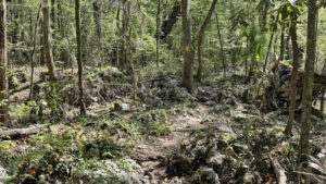
The trail carefully weaves across a surprisingly rocky environment, circumnavigating the craggy depression where bunches of wild coffee grow right on top of limestone boulders.

Heading north from the sink, begin a slow ascent from the rock-strewn mixed hardwood forest, passing a stand of cabbage palms.

Rocks under hardwoods Rocky terrain


Return to a sunny, fire dependent sandhill community. In a short distance, the trail reaches the first forest road.

Close the loop at 14 miles. Turn left to follow the road for 0.7 miles back to the parking pull-off near Dames Cave.

Scattered rocks on forest floor Leaving the hardwood hammock


Trail Map

Citrus Loop D Trail Map
Red: route described. Orange: Florida Trail. Blue: Citrus Hiking Trail.

Explore More!

Learn more about the Citrus Hiking Trail

Citrus Trail at Lizzie Hart Sink Citrus Hiking Trail 39.1 miles. Savor a rugged hike through rolling hills and rocky terrain on one of Florida's longest backpacking loops when you take on the Citrus Hiking Trail near Inverness

Video

Hiking Citrus Loop D


Slideshow

See our photos from Citrus Loop D


Nearby Adventures

Boulders in a hardwood forest Annutteliga Hammock Trail Explore fascinating karst topography with exposed limestone under a shady canopy in the Withlacoochee State Forest, passing a primitive camping area along this 4.8 mile loop.
Large oak on woodland path Potts Preserve Span a scenic jungle of shady hammocks, floodplain forests, pine flatwoods, and scrub habitats on a trail system created and maintained by Florida Trail Association volunteers.
Forested corridor Whispering Pines Park At Whispering Pines Park, a network of nature trails explores a densely wooded family-friendly city park with racketball courts, disc golf, a public pool, splash pad, and more.
Showy prairie with wetlands and cypress Chinsegut Conservation Center Tract Discover the beauty of May's Prairie at the heart of the Chinsegut WEA Conservation Center Tract, a vast wetland where sandhill cranes gather.

Trail Map (PDF) Hunt Dates Reserve Campsite Official Website

  • Author
  • Recent Posts
Chris Stevens
Chris Stevens
Along with his wife Chelsey, Chris Stevens shares outdoor adventures on Instagram and Facebook as @sunshinestateseekers and is a co-host of a podcast about Florida's outdoors, The Florida Madcaps. An avid hiker and camper, Chris serves as a Trailmaster and a board member for the Florida Trail Association.
Chris Stevens
Latest posts by Chris Stevens (see all)
  • Calusa Heritage Trail - November 5, 2026
  • Scherer Thaxton Preserve - October 21, 2026
  • Little Awesome Preserve - October 19, 2026
Category: Backpacking, Central Florida, Day Hikes, Hikes, Loop Hikes, TrailsTag: Brooksville, Caves, Florida State Forests, Florida Trail, Geology, Inverness, Primitive Camping, Sinkholes, Wildlife Viewing, Withlacoochee State Forest

Sidebar

FarOut Guides

Our comprehensive trail logistics presented on offline maps:

Florida National Scenic Trail (1,500 miles)
Florida Keys Overseas Heritage Trail (108 miles)
Eastern Continental Trail in Florida (92 miles)


We earn a small commission on sales through these links. Thanks for your support!


Our Florida Guidebooks

We’ve written Florida guidebooks for over 25 years. These include Central Florida destinations.

Book cover with woman hiking through palms with baby carrier
Book cover of Florida Trail Hikes
The Florida Trail Guide fifth edition
50 Hikes in Central Florida 3rd edition

Explore More

Newest Articles for Central Florida

Two-track through pine savanna Hal Scott Yellow Trail
Footpath through coastal hammock Michael Crotty Bicentennial Park
Young longleaf pines at Hal Scott Hal Scott Preserve
FT sign under blue blaze next to trail corridor Land Bridge Loop

  • Facebook
  • Flickr
  • Instagram
  • Pinterest
  • Substack
  • Vimeo

FIND A TRAIL OR PARK

METROS: Bradenton. Clearwater. Crestview. Daytona Beach. Destin. Fort Lauderdale. Fort Myers. Fort Walton Beach. Gainesville. Jacksonville. Kissimmee. Lakeland. Melbourne. Miami. Naples. Ocala. Orlando. Panama City Beach. Pensacola. Port St. Lucie. Punta Gorda. St. Petersburg. Sanford. Sarasota. Sebring. Stuart. Tallahassee. Tampa. Vero Beach. West Palm Beach.

MULTI-REGION: Atlantic Coastal Ridge. Atlantic Coast. Bartram Trail. Big Bend. East Coast Greenway. Everglades National Park. Florida National Scenic Trail. Gulf Coast. Lake Wales Ridge. WATERWAYS: Indian River Lagoon. Intracoastal Waterway. Kissimmee River. St. Johns River. Withlacoochee River.

NORTHWEST FLORIDA: Altha. Apalachicola. Apalachicola National Forest. Big Bend Scenic Byway. Blackwater River State Forest. Blountstown. Bonifay. Bristol. Bruce. Cantonment. Cape San Blas. Carrabelle. Chattahoochee. Chipley. Crawfordville. DeFuniak Springs. Eastpoint. Ebro. Eglin Air Force Base. Freeport. Fountain. Gulf Breeze. Gulf Islands National Seashore. Holt. Madison. Marianna. Milton. Monticello. Mossy Head. Munson. Navarre. Navarre Beach. Newport. Niceville. Panacea. Panama City . Perdido Key. Ponce De Leon. Port St. Joe. Quincy. Santa Rosa Beach. Sopchoppy. South Walton. St. George Island. St. Marks. St. Marks NWR. Sumatra. Vernon. Wakulla. Wewahitchka. Woodville. WATERWAYS: Apalachicola River. Blackwater Bay. Blackwater River. Chipola River. Choctawhatchee Bay. Choctawhatchee River. Coastal Dune Lakes. Ochlockonee Bay. Perdido River. St. Marks River. Wacissa River. Wakulla River. Yellow River.

NORTH FLORIDA: Alachua. Amelia Island. Archer. Baldwin. Branford. Bronson. Bunnell. Callahan. Cedar Key. Chiefland. Crescent City. Cross City. Cross Creek. Dowling Park. Ellaville. Fanning Springs. Fernandina Beach. Flagler Beach. Fort White. Glen St. Mary. Green Cove Springs. Hawthorne. High Springs. Inglis. Jacksonville Beaches. Jacksonville Northshore. Jasper. Jennings. Keystone Heights. Lake Butler. Lake City. Live Oak.Macclenny. Mandarin. Mayo. Mayport. Micanopy. Middleburg. Old Town. Olustee. Orange Park. Osceola National Forest. Palatka. Palatka-Lake Butler Trail. Palm Coast. Palm Valley. Perry. Ponte Vedra. Rodman. Salt Springs. St. Augustine. Starke. Steinhatchee. Suwannee. Suwannee River Wilderness Trail. Suwannee Springs. Talbot Islands. Timucuan Preserve. Trenton. Waldo. Welaka. White Springs. Williston. Worthington Springs. Yankeetown. WATERWAYS: Santa Fe River. St. Marys River. Suwannee River. Tolomato River. Upper Withlacoochee River.

CENTRAL FLORIDA: Altamonte Springs. Apollo Beach. Apopka. Astatula. Astor. Auburndale. Bartow. Babson Park. Bayport. Belleview. Bithlo. Brandon. Brooksville. Bushnell. Canaveral National Seashore. Cassadaga. Christmas. Chuluota. Citrus Springs. Clearwater Beach. Clermont. Coast to Coast Trail. Cocoa. Cocoa Beach. Cross Florida Greenway. Crystal River. Dade City. De Leon Springs. DeBary. Deland. Deltona. Dunedin. Dunnellon. Edgewater. Enterprise. Eustis. Ferndale. Fort Meade. Frostproof. Geneva. Gibsonton. Haines City. Hernando. Hernando Beach. Holopaw. Homosassa. Inverness. Kenansville. Kissimmee. Lake Mary. Lake Wales. Largo. Leesburg. Lithia. Longwood. Lutz. Maitland. Malabar. McIntosh. Melbourne Beach. Merritt Island. Merritt Island NWR. Mims. Mount Dora. Narcoossee/Lake Nona. New Port Richey. New Smyrna Beach. Nobleton. Oak Hill. Oakland. Ocala National Forest. Ocklawaha. Ocoee. Oldsmar. Orange City. Ormond Beach. Osteen. Oviedo. Paisley. Palm Bay. Plant City. Poinciana. Polk City. Ponce Inlet. Port Orange. Ridge Manor. Riverview. Ruskin. Safety Harbor. Silver Springs. Sorrento. Spring Hill. St. Cloud. Tarpon Springs. Thonotosassa. Titusville . Umatilla. Viera. Walt Disney World. Weeki Wachee. Weirsdale. Wimauma. Windermere. Winter Garden. Winter Haven. Winter Park. Winter Springs. Withlacoochee State Forest. Withlacoochee State Trail. Yeehaw Junction. Zephyrhills. WATERWAYS: Alafia River. Halifax River. Hillsborough River. Lake Apopka. Little Manatee River. Ochlawaha River. Rainbow River. Tampa Bay. Wekiva River. Wekiva River Basin.

SOUTHWEST FLORIDA: Alva. Boca Grande. Cape Coral. Charlotte Harbor. Ding Darling NWR. Ellenton. Englewood. Estero. Immokalee. Marco Island. North Port. Osprey. Palma Sola. Palmetto. Pine Island. Port Charlotte. Sanibel Island. Venice. WATERWAYS: Caloosahatchee River. Manatee River. Myakka River. Pine Island Sound.

SOUTH FLORIDA: Arcadia. Basinger. Big Cypress National Preserve. Big Cypress Seminole Reservation. Big Cypress Swamp. Bowling Green. Clewiston. Everglades City. Indiantown. LaBelle. Lake Okeechobee Scenic Trail. Lake Placid. Lakeport. Moore Haven. Okeechobee. Ortona. Pahokee. Palmdale. Port Mayaca. South Bay. Wauchula. Zolfo Springs. WATERWAYS: Fisheating Creek. Lake Okeechobee. Peace River.

SOUTHEAST FLORIDA: Biscayne Bay. Biscayne National Park. Boca Raton. Boynton Beach. Coconut Creek. Coral Gables. Coral Springs. Davie. Delray Beach. Fellsmere. Flamingo. Fort Pierce. Hobe Sound. Hollywood. Homestead. Indrio. Jensen Beach. Juno Beach. Jupiter. Jupiter Farms. Key Biscayne. North Hutchison Island. Ocean to Lake Greenway. Palm Beach. Palm Beach Gardens. Pompano Beach. Redland. Sebastian. South Hutchinson Island. WATERWAYS: Florida Bay. St. Lucie River.

FLORIDA KEYS: Big Pine Key. Islamorada. Key Largo. Key West. Marathon. Overseas Heritage Trail.


©2006-2026, Sandra Friend & John Keatley | Disclosure | Site Index | Work with Us | Advertise with Us | Terms of Service and Privacy Policy

Florida Hikes PO Box 93 Mims FL 32754 | Contact
