• Skip to main content
  • Skip to header right navigation
  • Skip to after header navigation
  • Skip to site footer
Florida Hikes logo

Florida Hikes

Hike Bike Paddle Camp Florida with authors Sandra Friend and John Keatley as your guides

  • Trails
  • Maps
  • Guidebooks
  • Hike
    • Scenic Hikes
    • Loop Trails
    • Dog-friendly Hikes
    • Hikes for Kids
    • National Parks in Florida
    • Florida State Parks
  • Bike
    • Major Bike Trails
    • Paved Bike Trails
    • Off Road Biking
    • Biking Articles
  • Paddle
    • Canoe & Kayak Rentals
    • Paddling Destinations
    • Paddling Articles
  • Camp
    • Cabin Rentals
    • Car Camping
    • Primitive Camping
  • Florida Trail
    • Plan your Hike
    • Best Scenic Hikes
    • Best Backpacking
    • Section Hiking
    • Thru-Hiking
    • Trail Updates
  • Travel
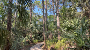
Sidewalk through pine flatwoods

Kristin Jacobs Natural Area

Discover an oasis of natural habitats in the heart of suburbia within the 57 acre Hillsborough Pineland on 1.8 miles of largely accessible trails in Coconut Creek.

Coconut Creek (26.324355, -80.197728)   1.8 miles  

In 1911, the Hillsboro River fell victim to the campaign promise of Governor Napoleon Bonaparte Broward to drain the Everglades.

It was one of the first of seven rivers to vanish along this coastline, replaced by five long straight drainage canals dredged to “drain the swamp.”

Floodplain with sandy open area The Hillsboro River floodplain in this preserve


Hundreds more canals came in its wake, changing Southeast Florida forever.

Where the Everglades nudged up to the Atlantic Coastal Ridge, it was taken over for farmland, which in turn was replaced by a grid of homes and businesses.

Interpretive sign An interpretive sign illustrates the changes here


Hillsboro Pineland Natural Area began by preserving a patch of pinelands on the county line, part of a once vast forest east of the Everglades.

Purchased in 1989 as part of the Environmentally Sensitive Lands program, it has one of the larger preserve pine flatwoods in the county.

Pines rising tall beyond saw palmetto Pine flatwoods


It was renamed as a memorial to Kristin Jacobs for the commissioner, mayor, and state representative who worked tirelessly for environmental consciousness in this urban space.

The preserve sits close to where both the Hillsboro River and Cypress Creek flowed out of the Everglades marshes towards the sea.

Interpretive sign with map The drainage area


Its trio of accessible trails interpret plants and wildlife you may see along its loops and round-trips.

Extending into the newest corner conserved, a natural-surface quarter mile loop delves into a tropical hardwood hammock.

Footpath through wooded corridor Along the Swallowtail Loop


Resources

Resources for exploring the area
South Florida Explorers Guide book cover 50 Hikes in South Florida book cover Hikers Guide to the Sunshine State book cover Paddlers Guide Florida
 
Disclosure: As authors and affiliates, we receive earnings when you buy through our links. This helps us provide public information on this website.

Overview

Location: Coconut Creek
Length: 1.8 miles
Trailhead: 26.324355, -80.197728
Address: 5591 NW 74th PL, Coconut Creek
Fees: Free
Restroom: At the trailhead
Land Manager: Broward County
Phone: 954-357-8109

Open 8 AM to 6 PM. No bicycles or pets permitted. No smoking.

In addition to its accessible paths, there are many benches along the trails. Do not disturb wildlife: this is a rare oasis of wild for them in a very urban area.


Directions


The entrance is off US 441 in Coconut Creek, just north of Hillsboro Blvd on the right hand side. Signage points to the entrance road, which winds past a condo complex.

Hike

From the parking area, begin at the central entry walkway into a gap in the forest. Stop at the kiosk. A large overview map shows the sprawling trail system.

The first and oldest of the trails, the Pineland Trail, starts here. Turn left, passing the restrooms and teaching pavilion.

Entry point with benches and signs Main entrance to trails


Benches adjoin the sidewalk path within a thicket of saw palmetto and grapevine in the pine flatwoods.

Mature saw palmetto sprout from the earth in clusters, tall stems splaying their leaves overhead like fans.

Saw palmetto along footpath Saw palmetto under the pines


Curve through a shady passageway, reaching the start of the loop. Continue straight ahead past a bench.

Opening up a little, the understory yields to tropical species like marlberry and wild coffee, a strangler fig shading them.

Bench by shaded sidewalk Starting the loop counterclockwise


Tunneling through the understory, emerge under a stand of tall South Florida slash pines. Join a boardwalk into the pines, climbing to a roofed shelter with benches.

Descending to ground level from the Pineland Overlook as the loop continues, the boardwalk ends and the sidewalk begins again.

Roofed shelter Pineland Overlook


Continue curving through the pine flatwoods past saw palmetto with a silvery-blue hue. Walk among lush palm fronds, grapevines, and ferns at the bases of tall pines.

Finish the loop and turn right to exit through the palmetto-lined passageway. Complete the Pineland Trail by passing the restrooms after 0.3 miles.

Man sitting by kiosk Kiosk at the trail junction


Walk past the kiosk at the entry point to continue onto the Prairie Trail. The sidewalk curves through a tunnel of tropical understory.

Walls of wild coffee rise beneath cabbage palms, skinny South Florida slash pines tower beyond.

Tunnel of vegetation around trail Side path to parking area


Pass an exit tunnel to the parking area, curving out of the shade to a sunny intersection with an incoming footpath from a pedestrian entrance to the preserve.

Curve past a interpretive sign about natural resource management and a picnic bench in the shade above a grassy slope.

Picnic bench and interpretive sign Shady picnic spot


Enormous woods ferns edge the now sun-drenched path on the approach to a boardwalk. The unmistakable aroma of dog was a clue coyotes likely live here.

Sizable pond apple trees edge the basin the boardwalk enters, once the floodplain of the Hillsboro River.

Sidewalk to boardwalk Approaching the boardwalk


Many of Florida’s natural marshes have been dried out by humans, nowhere moreso than in Broward County, ironically named for the man responsible.

Under Governor Broward’s plan to drain swamps for agriculture and residences, the eastern Everglades were no more by 1912, drained by canals replacing its waterways.

Prairie with giant ferns Giant leather ferns in the prairie


Follow the curve of the boardwalk across this basin, imagining the shallow river that was. Cypress trees edge the grassy wet prairie.

Clusters of giant leather fern reach skyward among the grasses. In the distance is another section of the basin, a former dome swamp ringed by cypress.

Long curving boardwalk Boardwalk


Restoring natural hydrology to this land-locked preserve is key to keeping it natural.

A spur observation deck has a bench for looking towards the dome swamp. Turn a corner past it. Willows edge a depression marsh.

Cypress and willow swamp View from the observation deck


Slash pines rise along the higher elevations beyond the basin. When it rains, water collects below, nourishing plant and animal species.

The boardwalk culminates in an roofed overlook with an interpretive sign for identifying seasonal wildflowers.

View out from roofed overlook towards large interpretive sign End of the Prairie Trail


Returning along the Prairie Trail boardwalk, retrace your curve through the forest to the entry kiosk, reaching it at 0.7 miles.

Step out to the parking area and turn right. The sidewalk edging it continues around a curve to follow the north side of the entrance road.

Sidewalk past large ficus tree Sidewalk next to entrance road


Walk beside the pine flatwoods, passing a ficus of significant size. After a culvert, meet the sign at the crosswalk. Cross it to begin the round-trip Tillandsia Trail.

Also a sidewalk, it jogs through the tropical hammock and slips behind a large condo complex as a straightaway along its fence.

Sign pointing down a sidewalk Start of the Tillandsia Trail


Per its name, it’s fascinating to see air plants growing in people’s backyards on the fence. Hooking to the right, it leaves the condos to reach the deeply wooded southwest corner of the preserve.

Near a bench is a series of historic images showing how much this area has changed. Wild coffee and marsh ferns sprout from surface limestone.

Air plant stuck in a chain link fence behind a condo Tillandsia


Curve through the forest under the tall, skinny pines, passing a second bench. The rocky base of the tropical understory is attention-getting.

The sidewalk ends at an overlook over a small depression marsh at 1.2 miles. Take in the view before turning back to tackle the only natural surface path in the preserve.

Roofed observation deck with view Overlook


The Swallowtail Loop begins on the left. A wild walk, it requires attention to your surroundings and the footpath, as poison ivy is present.

Bear right at the loop sign to start down a slender leaf-strewn corridor half-hidden by palm fronds Curve through a puzzle of tropical understory to the next straightaway.

Sign for loop hike in hammock Swallowtail Loop


Traffic noise is persistent, since a major intersection is nearby. Framed by dangling grapevines, grassy patches are sunlit between the pines.

A grassy corridor yields to another leafy walk among the palms. Curve through an oak hammock on the worn footpath, emerging to a sunsplashed corridor uner the pines.

Grassy footpath in full sun Sunny spot


The forest becomes thicker, the trail curving north into a mix of oaks, pines, and palms. Finish up through several shifts of habitat, palm fronds often dangling low.

Emerging at the Tillandsia Trail 1.5 miles into the hike, turn left to exit.

Low hanging fronds over footpath Palm passage


Retrace this concrete walk out of the hammock and past the condos to the crosswalk.

Make a right to return along the sidewalk adjoining the entrance road back to the parking area, completing a 1.8 mile hike.

Sidewalk to crosswalk in woods Exiting the Tillandsia Trail


Trail Map

Kristin Jacobs Natural Area Trail Map
Red: Pineland Trail. Green: Prairie Trail. Brown: Tillandsia Trail and Swallowtail Loop.

Explore More!

Video

Hiking Kristin Jacobs Natural Area


Slideshow

See our photos from Kristin Jacobs Natural Area


Nearby Adventures

Helene Klein Pineland Preserve boardwalk Helene Klein Pineland Preserve In just 13 acres, Helene Klein Pineland Preserve packs in a nice walk through a variety of habitats within an urban forest along busy Hillsboro Blvd.
Tropical hammock Parkland Doris Davis Foreman Wilderness A pretty patch of tropical hammock hides amid the bustle of suburbia in Parkland in Broward County on the half-mile loop through Doris Davis Foreman Wilderness Preserve.
Tangle of South Florida pond apple swamp Tall Cypress Natural Area Hover above an outstanding gradient of lush habitats on a gentle half mile boardwalk in a 66-acre wild corner of Coral Springs.
Pond apple tree Daggerwing Nature Center Behind Daggerwing Nature Center in busy South County Regional Park, an accessible boardwalk trail leads you into a remnant of tropical habitat with ancient trees.

Official Website

  • Author
  • Recent Posts
Sandra Friend & John Keatley
Articles jointly researched, written, and photographed by Sandra Friend & John Keatley, authors and publishers of FloridaHikes.com.
Sandra Friend & John Keatley
Latest posts by Sandra Friend & John Keatley (see all)
  • Hal Scott Yellow Trail - November 3, 2026
  • Hal Scott Preserve - October 28, 2026
  • Tradewinds Park - October 27, 2026
Category: County Parks, Hikes, Loop Hikes, Natural Lands, Nature Trails, Southeast Florida, TrailsTag: Accessible, Birding, Boardwalks, Boca Raton, Coconut Creek, Coral Springs, Easy Hikes, Family-Friendly, Fort Lauderdale, Geology, Observation Decks, Tropical Forests, Wildflowers, Wildlife Viewing

Sidebar

FarOut Guides

Our comprehensive trail logistics presented on offline maps:

Florida National Scenic Trail (1,500 miles)
Florida Keys Overseas Heritage Trail (108 miles)
Eastern Continental Trail in Florida (92 miles)


We earn a small commission on sales through these links. Thanks for your support!


Our Guidebooks

We’ve written Florida guidebooks for over 25 years. These include Southeast Florida destinations.

Book cover with woman hiking through palms with baby carrier
Book cover of Florida Trail Hikes
The Florida Trail Guide fifth edition

Explore More

Newest Articles for Southeast Florida

Emerging from a tunnel of trees to a waterfront Tradewinds Park
Bench at a junction of trails in pine-palm flatwoods Okeeheelee Nature Center Trails
Dense understory beneath pines along footpath Lakewood Regional Park
Silvery-blue saw palmetto Lantana Scrub Natural Area

  • Facebook
  • Flickr
  • Instagram
  • Pinterest
  • Substack
  • Vimeo

FIND A TRAIL OR PARK

METROS: Bradenton. Clearwater. Crestview. Daytona Beach. Destin. Fort Lauderdale. Fort Myers. Fort Walton Beach. Gainesville. Jacksonville. Kissimmee. Lakeland. Melbourne. Miami. Naples. Ocala. Orlando. Panama City Beach. Pensacola. Port St. Lucie. Punta Gorda. St. Petersburg. Sanford. Sarasota. Sebring. Stuart. Tallahassee. Tampa. Vero Beach. West Palm Beach.

MULTI-REGION: Atlantic Coastal Ridge. Atlantic Coast. Bartram Trail. Big Bend. East Coast Greenway. Everglades National Park. Florida National Scenic Trail. Gulf Coast. Lake Wales Ridge. WATERWAYS: Indian River Lagoon. Intracoastal Waterway. Kissimmee River. St. Johns River. Withlacoochee River.

NORTHWEST FLORIDA: Altha. Apalachicola. Apalachicola National Forest. Big Bend Scenic Byway. Blackwater River State Forest. Blountstown. Bonifay. Bristol. Bruce. Cantonment. Cape San Blas. Carrabelle. Chattahoochee. Chipley. Crawfordville. DeFuniak Springs. Eastpoint. Ebro. Eglin Air Force Base. Freeport. Fountain. Gulf Breeze. Gulf Islands National Seashore. Holt. Madison. Marianna. Milton. Monticello. Mossy Head. Munson. Navarre. Navarre Beach. Newport. Niceville. Panacea. Panama City . Perdido Key. Ponce De Leon. Port St. Joe. Quincy. Santa Rosa Beach. Sopchoppy. South Walton. St. George Island. St. Marks. St. Marks NWR. Sumatra. Vernon. Wakulla. Wewahitchka. Woodville. WATERWAYS: Apalachicola River. Blackwater Bay. Blackwater River. Chipola River. Choctawhatchee Bay. Choctawhatchee River. Coastal Dune Lakes. Ochlockonee Bay. Perdido River. St. Marks River. Wacissa River. Wakulla River. Yellow River.

NORTH FLORIDA: Alachua. Amelia Island. Archer. Baldwin. Branford. Bronson. Bunnell. Callahan. Cedar Key. Chiefland. Crescent City. Cross City. Cross Creek. Dowling Park. Ellaville. Fanning Springs. Fernandina Beach. Flagler Beach. Fort White. Glen St. Mary. Green Cove Springs. Hawthorne. High Springs. Inglis. Jacksonville Beaches. Jacksonville Northshore. Jasper. Jennings. Keystone Heights. Lake Butler. Lake City. Live Oak.Macclenny. Mandarin. Mayo. Mayport. Micanopy. Middleburg. Old Town. Olustee. Orange Park. Osceola National Forest. Palatka. Palatka-Lake Butler Trail. Palm Coast. Palm Valley. Perry. Ponte Vedra. Rodman. Salt Springs. St. Augustine. Starke. Steinhatchee. Suwannee. Suwannee River Wilderness Trail. Suwannee Springs. Talbot Islands. Timucuan Preserve. Trenton. Waldo. Welaka. White Springs. Williston. Worthington Springs. Yankeetown. WATERWAYS: Santa Fe River. St. Marys River. Suwannee River. Tolomato River. Upper Withlacoochee River.

CENTRAL FLORIDA: Altamonte Springs. Apollo Beach. Apopka. Astatula. Astor. Auburndale. Bartow. Babson Park. Bayport. Belleview. Bithlo. Brandon. Brooksville. Bushnell. Canaveral National Seashore. Cassadaga. Christmas. Chuluota. Citrus Springs. Clearwater Beach. Clermont. Coast to Coast Trail. Cocoa. Cocoa Beach. Cross Florida Greenway. Crystal River. Dade City. De Leon Springs. DeBary. Deland. Deltona. Dunedin. Dunnellon. Edgewater. Enterprise. Eustis. Ferndale. Fort Meade. Frostproof. Geneva. Gibsonton. Haines City. Hernando. Hernando Beach. Holopaw. Homosassa. Inverness. Kenansville. Kissimmee. Lake Mary. Lake Wales. Largo. Leesburg. Lithia. Longwood. Lutz. Maitland. Malabar. McIntosh. Melbourne Beach. Merritt Island. Merritt Island NWR. Mims. Mount Dora. Narcoossee/Lake Nona. New Port Richey. New Smyrna Beach. Nobleton. Oak Hill. Oakland. Ocala National Forest. Ocklawaha. Ocoee. Oldsmar. Orange City. Ormond Beach. Osteen. Oviedo. Paisley. Palm Bay. Plant City. Poinciana. Polk City. Ponce Inlet. Port Orange. Ridge Manor. Riverview. Ruskin. Safety Harbor. Silver Springs. Sorrento. Spring Hill. St. Cloud. Tarpon Springs. Thonotosassa. Titusville . Umatilla. Viera. Walt Disney World. Weeki Wachee. Weirsdale. Wimauma. Windermere. Winter Garden. Winter Haven. Winter Park. Winter Springs. Withlacoochee State Forest. Withlacoochee State Trail. Yeehaw Junction. Zephyrhills. WATERWAYS: Alafia River. Halifax River. Hillsborough River. Lake Apopka. Little Manatee River. Ochlawaha River. Rainbow River. Tampa Bay. Wekiva River. Wekiva River Basin.

SOUTHWEST FLORIDA: Alva. Boca Grande. Cape Coral. Charlotte Harbor. Ding Darling NWR. Ellenton. Englewood. Estero. Immokalee. Marco Island. North Port. Osprey. Palma Sola. Palmetto. Pine Island. Port Charlotte. Sanibel Island. Venice. WATERWAYS: Caloosahatchee River. Manatee River. Myakka River. Pine Island Sound.

SOUTH FLORIDA: Arcadia. Basinger. Big Cypress National Preserve. Big Cypress Seminole Reservation. Big Cypress Swamp. Bowling Green. Clewiston. Everglades City. Indiantown. LaBelle. Lake Okeechobee Scenic Trail. Lake Placid. Lakeport. Moore Haven. Okeechobee. Ortona. Pahokee. Palmdale. Port Mayaca. South Bay. Wauchula. Zolfo Springs. WATERWAYS: Fisheating Creek. Lake Okeechobee. Peace River.

SOUTHEAST FLORIDA: Biscayne Bay. Biscayne National Park. Boca Raton. Boynton Beach. Coconut Creek. Coral Gables. Coral Springs. Davie. Delray Beach. Fellsmere. Flamingo. Fort Pierce. Hobe Sound. Hollywood. Homestead. Indrio. Jensen Beach. Juno Beach. Jupiter. Jupiter Farms. Key Biscayne. North Hutchison Island. Ocean to Lake Greenway. Palm Beach. Palm Beach Gardens. Pompano Beach. Redland. Sebastian. South Hutchinson Island. WATERWAYS: Florida Bay. St. Lucie River.

FLORIDA KEYS: Big Pine Key. Islamorada. Key Largo. Key West. Marathon. Overseas Heritage Trail.


©2006-2026, Sandra Friend & John Keatley | Disclosure | Site Index | Work with Us | Advertise with Us | Terms of Service and Privacy Policy

Florida Hikes PO Box 93 Mims FL 32754 | Contact
