

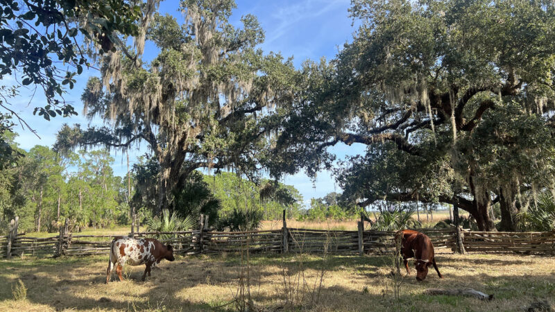
Deep in the heart of Florida’s heartland, ranching heritage lives on at Lake Kissimmee State Park, home of the 1876 Florida Cow Hunters Camp.
These frontier cowmen – never cowboys, ma’am – stir up storytelling completely in character on weekends, right in the middle of a historic ranch.
But the most compelling reason to visit Lake Kissimmee State Park is hiking. Sixteen miles of well-marked trails connect oak hammocks to prairies to the shores of Lake Kissimmee itself.
Backpackers will delight in two backcountry camping areas set in beauty spots. Campers find the frontcountry campground one of the finest in Florida.
 At the park entrance
Resources





Disclosure: As authors and affiliates, we receive earnings when you buy through our links. This helps us provide public information on this website.
Overview
Location: Lake Wales
Length: 16 miles in four trails
Trailhead: 27.972226,-81.378925
Address: 14248 Camp Mack Rd, Lake Wales
Fees: $4-5 per vehicle
Restroom: At the marina and the picnic area
Land manager: Florida State Parks
Phone: 863-696-1112
Open 8 AM to sunset. Leashed pets welcome.
Carry plenty of water when hiking. Wildlife is abundant, so bring a camera and keep well away from alligators along the canals and lakes.

Directions
From the junction of US 27 and SR 60 in Lake Wales, head east on FL 60 for 9.7 miles to Boy Scout Camp Road. Turn left and drive 3.5 miles to Camp Mack Road. Turn right, following this road 5.4 miles to the park entrance on the right. After you enter through the ranger station, the park road twists and winds through the oak hammocks that dominate the North Loop. Continue along the park road past the campground and the turnoff to the Cow Camp, reaching the parking area next to the marina. All trails can be accessed here.
About the Park
Protecting more than 5,800 acres along the Kissimmee Chain of Lakes, Lake Kissimmee State Park sits between Lake Kissimmee, Lake Rosalie, and Tiger Lake.
It is both intimate and immense. In ancient live oak hammocks, delicate orchids bob in the canopy. Sandhill cranes offer haunting cries as they glide over broad open prairies.
 Sandhill cranes walk through an oak hammock
For an overview of the contrast between the two, your first stop should be the observation tower at the edge of the picnic area.
Standing at the edge of an oak hammock, it overlooks a vast grassland stretching to the shores of Lake Kissimmee.
 The tower provides a distant view of Lake Kissimmee
Living history is a core facet of this park. This landscape was previously a cattle ranch. The 1876 Florida Cow Hunters Camp teaches lessons from the past.
Herds of Florida scrub cattle, hearty stock dating back to Hernando de Soto’s march across Florida in 1539, roam the wide open spaces of Buster Island.
 Trail users on Buster Island may encounter free-roaming cattle
Equestrians have a six mile loop around Buster Island – an actual island between the lakes – to explore, and their very own primitive campground.
For a state park that is largely focused on recreation, the amount of wildlife here is astounding. We’ve never had a visit where herds of deer didn’t appear.
 We’ve seen armadillos and tortoises along the trails, too
Flocks of turkeys roam across the roads. Caracaras and other uncommon birds are regularly sighted, including whooping cranes and Florida scrub-jays.
In addition to the popular campground and the miles of hiking trails that draw visitors to explore the park, recreation also extends to the water.
A marked paddling loop tests the mettle of serious paddlers to connect together the three lakes.
 Walkway near the marina
Boaters can make use of the marina and canal to navigate the Kissimmee Chain of Lakes for some fine fishing.
For simply relaxing in nature, there are picnic tables at the marina. Closer to the campground is a large picnic area with pavilions and a playground, overlooking the prairie.
 Picnic area in a live oak hammock
Hiking
There are four named trails within the park, three of which interconnect and two of which have primitive campsites along them for backpackers.
All of the trails are well marked at intersections. The longer loops have mileage markers along them.
 Three of the trails start at this kiosk near the marina
Flatwoods Pond Trail
The shortest and gentlest of the hikes, the Flatwoods Pond Trail is an easy 0.4-mile interpretive loop that circles a pond in the woods across from the main trailhead kiosk.
Along it, look for some ancient saw palmetto as well as pines that bear the scars from a prior turpentine operation in these woods.
 Flatwoods Pond Trail The sole interpretive trail at Lake Kissimmee State Park, the Flatwoods Pond Trail shows off habitats and history in a short loop not far from the campground
Gobbler Ridge Trail
The 2.8 mile Gobbler Ridge Trail is the only one that takes you to Lake Kissimmee. It starts at a kiosk at the picnic area parking area.
It first leads out through the edge of the hammock to the park’s only observation tower, which provides a sweeping view of the prairies and the distant lake.
 Along the Gobbler Ridge Trail
Follow the lime green blazes from the base of the tower along the rim of the prairie to a junction that leads to a loop out along the lakeshore.
The walk along the lake is always windy and provides panoramic views, from the wide open water of Lake Kissimmee to the narrower channel occupied by a fish camp.
 Lake Kissimmee as seen from Gobbler Ridge
The loop portion is strictly in the open spaces near the lake. To get there, it’s a round-trip along the prairie edge.
This trail interconnects with the North Loop, should you want to plan a longer hike.
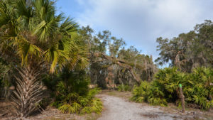 Gobbler Ridge Trail From its showy start with a climb up an observation tower to its breezy loop along Lake Kissimmee, the 2.8 mile Gobbler Ridge Trail offers scenic views all along its length
North Loop
The main trailhead by the marina provides a connector trail to the 6.8 mile yellow-blazed North Loop, which winds its way through hammocks and pine flatwoods just south of the park drive.
After it crosses the park drive within sight of the entrance station, it continues through open prairies and scrubby flatwoods.
 Pine flatwoods along the North Loop
Its primitive campsite is set in a showy live oak hammock about three-quarters of the way through the loop.
A 0.8 mile linear connector trail links the North Loop and the Gobbler Ridge Trail. Using the outer side of both, you can make an 8.7 mile loop back to the main trailhead.
 Junction with the connector trail to Gobbler Ridge
It’s also possible to shorten the loop by way of a couple of crossovers along it. Two trailheads along the park drive provide access to these.
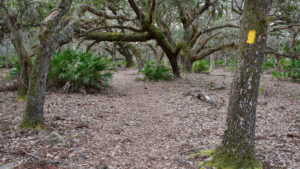 Lake Kissimmee North Loop Crossing the Lake Kissimmee State Park park drive multiple times, the 6.8-mile North Loop is the easiest trail to access within the park, offering excellent birding
Buster Island Loop
The more popular loop for backpackers because it leads out into a wilder area of the park, the Buster Island Loop is a 6.9 mile hike shared with cyclists and equestrians.
This white-blazed trail starts at the main trailhead by the marina, which also connects to the North Loop. Cross the wooden bridge over the Zipprer Canal to access the start of the loop.
 White-tailed deer on the Buster Island Loop
For much of its length, the hike stays in the shade of the oak hammocks along the rim of a large prairie, another of the reasons for its popularity.
A favorite destination for families easing into backpacking, the primitive campsite is roughly halfway around the loop.
About 5 miles into the hike, the trail emerges from the oaks and leads across scrub, pine flatwoods, and the prairie before sealing the loop.
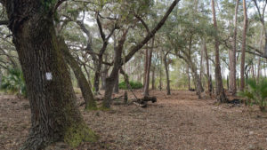 Buster Island Loop The 6.9-mile Buster Island Loop at Lake Kissimmee State Park is a favorite for both day hikers and backpackers, as it shows off a variety of habitats along the open prairies
Biking
Since it winds for nearly 3.5 miles through the wild habitats of the park, the park drive is a popular destination for cyclists.
The extensive system of forest roads on Buster Island as well as much of the trail system is open to cyclists, except where posted.
 Biking a dirt road on Buster Island
Boating
Slicing through the park and built long before its acquisition, the Zipprer Canal drains Lake Rosalie into Lake Kissimmee.
Boaters are welcome to use the ramps at the park marina for access into the lakes. A camp store is located at the marina and is open during the winter months.
 Launch area at the marina
Camping
Set under a canopy of live oaks, the campground at Lake Kissimmee State Park is one of the more popular ones in the state park system.
Fifty-four campsites accommodate RVs, trailers, and tents in the main campground. Four sites are accessible and one is tent-only. Leashed pets permitted at all sites.
Water and 30 amp service are provided. There is a dump station and bathhouses that include laundry facilities.
Fees run $20 per night plus the booking fee to Reserve America, which you do not get back if you cancel or change your reservation.
 Deer in the woods near the campground
Since there is an easy two day’s worth of hiking at the park, it’s worth an overnight stay to enjoy the starry skies after dark.
Backpackers have their choice of two backcountry destinations, each of which is only a few miles from the trailhead. Sites must be reserved in advance, and water must be carried in.
 Flatwoods campsite along the North Loop
Organized youth groups have the opportunity of renting a beautiful destination campground set along the Gobbler Ridge Trail in its own oak hammock.
It includes picnic tables and an outdoor amphitheater area. Its proximity to the prairie’s edge facing Lake Kissimmee makes it a perfect place for star parties.
As we’ve learned on our hikes and overnights here, the buzz of airboats from both Lake Kissimmee and Lake Rosalie can be very annoying after dark. Make sure you bring earplugs, especially on weekends.
 Group campsite along the Gobbler Ridge Trail
Paddling
Paddlers are welcome to put in at the marina or the bridge to Buster Island to explore the Zipprer Canal connecting Lake Rosalie and Lake Kissimmee.
A designated 11 mile loop, the Buster Island Paddling Trail, connects the three lakes at the park.
It’s a fair-weather journey that requires some planning. Check with the park to see if water levels are high enough for the journey. Wind can be an issue on the open water.
 Lake Kissimmee
Due to currents, a counterclockwise loop is recommended. The trail uses the Zipprer Canal, Rosalie Creek, and Tiger Creek to make a loop around Buster Island.
There are open water paddles along the edge of Lake Rosalie, Tiger Lake, and a cove in Lake Kissimmee. Airboats may be a concern as they don’t expect paddlers.
Kayak and canoe rentals are available during the season when the camp store at the marina is open, November to April.
Download a map and guide from the Office of Greenways and Trails
 Zipprer Canal
Trail Map

Purple: North Loop-Gobbler connector. Orange: Cow Camp. Blue: connectors and spurs.
Explore More!
Slideshow
See our photos of Lake Kissimmee State Park
Nearby Adventures
 Tiger Creek Preserve Edward Bok's "Jungle," a deeply folded landscape between Tiger Creek and Patrick Creek south of Lake Wales, is protected by The Nature Conservancy as Tiger Creek Preserve.
 SUMICA With up to 6.2 miles of trails - many of them a bit wet - SUMICA is one of the natural lands in Polk County where birding is especially superb.
 Crooked Lake Prairie At Crooked Lake Prairie, the dunes of the Lake Wales Ridge meet showy prairie grasslands along the eastern shore of Crooked Lake.
 Bok Tower Gardens Art, architecture, and nature intersect among fifty acres of gardens first planted a century ago atop Iron Mountain at Lake Wales.

- Hal Scott Red Trail - November 13, 2026
- Baseline Trails - November 7, 2026
- Hal Scott Yellow Trail - November 3, 2026