• Skip to main content
  • Skip to header right navigation
  • Skip to after header navigation
  • Skip to site footer
Florida Hikes logo

Florida Hikes

Hike Bike Paddle Camp Florida with authors Sandra Friend and John Keatley as your guides

  • Trails
  • Maps
  • Guidebooks
  • Hike
    • Scenic Hikes
    • Loop Trails
    • Dog-friendly Hikes
    • Hikes for Kids
    • National Parks in Florida
    • Florida State Parks
  • Bike
    • Major Bike Trails
    • Paved Bike Trails
    • Off Road Biking
    • Biking Articles
  • Paddle
    • Canoe & Kayak Rentals
    • Paddling Destinations
    • Paddling Articles
  • Camp
    • Cabin Rentals
    • Car Camping
    • Primitive Camping
  • Florida Trail
    • Plan your Hike
    • Best Scenic Hikes
    • Best Backpacking
    • Section Hiking
    • Thru-Hiking
    • Trail Updates
  • Travel
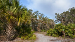
Oaks and palms along the path

Gobbler Ridge Trail

From its showy start with a climb up an observation tower to its breezy loop along Lake Kissimmee, the 2.8 mile Gobbler Ridge Trail offers scenic views all along its length

Lake Wales (27.9444, -81.3520)   2.8 miles   Lake Kissimmee State Park

While for the most part a forest road rather than a narrow footpath, the Gobbler Ridge Trail is the one must-hike destination at Lake Kissimmee State Park.

First, for the scenery. While the treadway is nothing special, the sweep of prairie to the east and the oak hammocks that it weaves in and out of are places of special beauty.

Next, for the lake. It’s the only hike at Lake Kissimmee State Park that actually touches the shoreline of any of the three lakes that surround the park.

While the walk along the lakeshore isn’t long compared to the hike to get there, it’s worth it for the views, the breeze, and the birds overhead.

Grassy trail by oaks Following the trail along the prairie rim


Resources

Resources for exploring the area
Florida Trail Hikes book cover The Florida Trail Guide book cover 50 Hikes in Central Florida Central Florida Orlando Explorers Guide book cover Hikers Guide to the Sunshine State book cover Paddlers Guide Florida
 
Disclosure: As authors and affiliates, we receive earnings when you buy through our links. This helps us provide public information on this website.

Overview

Location: Lake Wales
Length: 2.8 mile round-trip
Trailhead: 27.9444, -81.3520
Address: 14248 Camp Mack Rd, Lake Wales
Fees: $4-5 per vehicle
Restroom: At the marina trailhead
Land manager: Florida State Parks
Phone: 863-696-1112

Open 8 AM to sunset. Hours may change due to current events, check ahead. Leashed pets welcome. However, alligators are often present at Lake Kissimmee. Be cautious.

Palm trees along lake shore


Directions


From the junction of US 27 and SR 60 in Lake Wales, head east on SR 60 for 9.7 miles to Boy Scout Camp Road. Turn left and drive 3.5 miles to Camp Mack Road. Turn right, following this road 5.4 miles to the park entrance on the right. After you enter through the ranger station, the park road twists and winds through the oak hammocks along the North Loop. Pass Cow Camp Rd after 3.5 miles and the marina on the right. Look for the parking area on the left under the oaks, near the restrooms.

Hike

The kiosk for the Gobbler Ridge Trail is near the restrooms at the main picnic area within the oak hammock just north of the marina.

Follow the accessible path towards the picnic pavilion before cutting across the hammock to the prominent tower at the edge of the oaks.

Trailhead kiosk at Gobbler Ridge The trailhead for the Gobbler Ridge trailhead


It’s a bit of a climb to the top, but well worth it for the panorama. The sweep of open prairie to the east meets the horizon at Lake Kissimmee.

The lake stretches from one end of your view to the other. It is 54 square miles of water, one of Florida’s largest lakes, and the birthplace of the Kissimmee River.

Lake Kissimmee Lake Kissimmee on the horizon


The Gobbler Ridge Trail will take you to its shoreline. Descend the stairs and you’ll face both the trail and the first lime green tipped post.

The route is easy. It’s a broad road along the edge of the prairie, just off the edge of the oak hammocks that form the prairie rim.

Green blazed post and oaks Following the blazes into the oak hammock


Winding into the oak hammock, the trail is surrounded by large live oaks heavily draped in Spanish moss.

Pass a side path to the group campsite,where there are picnic tables within view. Leading out through the oaks, the trail pops out along the marshy edge of a wet prairie.

Prairie grasses Wet prairie along the trail


It rounds the prairie and passes through another piece of oak hammock before coming to the trail junction with the incoming 0.8 mile connector from the North Loop.

This trail junction in front of Marker 81 has a bench. Turn right at this T intersection to head out to Lake Kissimmee.

Making a turn in the trail Turning towards the lake at Marker 81


As this is part of the floodplain of the lake, your surroundings are more prairie than oaks, with clusters of oaks forming small islands in the expanse.

Coming to another junction – this one with an alligator warning – continue straight ahead. The path dips into a low marshy area and may require wading.

Gap in the forest with lake beyond Climbing onto Gobbler Ridge


The trail rises up towards an illuminated gap in a line of forest. The forest is atop Gobbler Ridge.

A bench is on the other side of the gap, where the expanse of Lake Kissimmee opens up in front of you.

Grasses waving on Lake Kissimmee It’s always breezy on Lake Kissimmee


Water levels and recent mowing determine how close you can get to the lake itself. Avoid drawing too close due to tall grasses, deep mud, and alligators hidden by vegetation.

We walked the mowed path close to the forest along the ridge, with views of the lake all along it. As it swung around, two eagles fussed overhead.

Cabbage palms near lake Palms near where the trail leaves the lake


Where the path pops out by some palm trees along the lakeshore, the lake is narrowing and traffic heading to the fish camp tends to buzz past. A bench sits under a palm.

The trail turns soon after the bench and crosses another marshy area where there may be water or mud. It soon seals the loop as it reaches the alligator sign.

Trail junction with bench Junction with the connector to the North Loop


Returning to the trail you came in on, follow it back along the prairie rim. You pass marker 81 at the trail junction for the North Loop.

Hiking that loop after doing this hike thus far will net an 8.7-mile hike if you follow the outer perimeter counterclockwise. Carry plenty of water if you do.

Oaks with Spanish moss Walking through the oak hammock


Otherwise bear left and follow the lime green blazes back along the road along the prairie rim, passing by the group campsite again.

The blazes lead up to the observation tower once more, and then into the hammock. The full round-trip is 2.8 miles.

Turkeys on the trail Gobblers crossed the trail right in front of us near the end of our hike


Trail Map

Lake Kissimmee State Park Hiking Trails Map
Red: Buster Island Loop. Yellow: North Loop. Green: Gobbler Ridge Trail. Light blue: Flatwoods Pond Trail.
Purple: North Loop-Gobbler connector. Orange: Cow Camp. Blue: connectors and spurs.

Explore More!

Learn more about Lake Kissimmee State Park and its trails.

View from the observation tower at Lake Kissimmee State Park Lake Kissimmee State Park Discover the beauty of the land between the lakes east of Lake Wales while exploring the vast prairies and fern-laden hammocks of Lake Kissimmee State Park.
White blazed tree and trail into forest Buster Island Loop The 6.9-mile Buster Island Loop at Lake Kissimmee State Park is a favorite for both day hikers and backpackers, as it shows off a variety of habitats along the open prairies
Trail leading to ancient live oak trees Lake Kissimmee North Loop Crossing the Lake Kissimmee State Park park drive multiple times, the 6.8-mile North Loop is the easiest trail to access within the park, offering excellent birding
Oaks, saw palmetto, and pines Flatwoods Pond Trail The sole interpretive trail at Lake Kissimmee State Park, the Flatwoods Pond Trail shows off habitats and history in a short loop not far from the campground

Slideshow

See our photos from the Gobbler Ridge Trail


Nearby Adventures

Expanse of lake with grass foreground and ridge on far shore Crooked Lake Prairie At Crooked Lake Prairie, the dunes of the Lake Wales Ridge meet showy prairie grasslands along the eastern shore of Crooked Lake.
Wet prairie at SUMICA SUMICA With up to 6.2 miles of trails - many of them a bit wet - SUMICA is one of the natural lands in Polk County where birding is especially superb.
Long Hammock at KICCO Florida Trail, KICCO South 10.1 miles. Ancient live oaks break up the expanse of cattle pastures and prairies along the Florida Trail adjoining the Kissimmee River in KICCO
Rolling hills at Catfish Creek Preserve Catfish Creek Preserve Trails Allan David Broussard Catfish Creek Preserve State Park isn’t just “a perfect example of Lake Wales Ridge Scrub,” it’s a landscape unlike any other you’ll find in Florida.

Trail Map (PDF) Reserve Campsite Official Website

  • Author
  • Recent Posts
Sandra Friend
Sandra Friend
Author of 45 books, Sandra Friend established FloridaHikes.com in 2006 to expand on the field research she'd completed for her first six hiking guides. She has been honored with lifetime achievement awards from the Florida Trail Association and the Florida Outdoor Writers Association.
Sandra Friend
Latest posts by Sandra Friend (see all)
  • Michael Crotty Bicentennial Park - November 3, 2026
  • A.J. Henry Park - November 1, 2026
  • Okeeheelee Nature Center Trails - October 22, 2026
Category: Central Florida, Day Hikes, Hikes, TrailsTag: Dog-friendly, Florida State Parks, Lake Kissimmee State Park, Lake Wales, Observation Towers, Scenic Hikes, Waterfront, Wildlife Viewing

Sidebar

FarOut Guides

Our comprehensive trail logistics presented on offline maps:

Florida National Scenic Trail (1,500 miles)
Florida Keys Overseas Heritage Trail (108 miles)
Eastern Continental Trail in Florida (92 miles)


We earn a small commission on sales through these links. Thanks for your support!


Our Florida Guidebooks

We’ve written Florida guidebooks for over 25 years. These include Central Florida destinations.

Book cover with woman hiking through palms with baby carrier
Book cover of Florida Trail Hikes
The Florida Trail Guide fifth edition
50 Hikes in Central Florida 3rd edition

Explore More

Newest Articles for Central Florida

Path through pine flatwoods Hal Scott Red Trail
Grassy slope edged with trees Sandhill Preserve
Two-track through pine savanna Hal Scott Yellow Trail
Footpath through coastal hammock Michael Crotty Bicentennial Park

  • Facebook
  • Flickr
  • Instagram
  • Pinterest
  • Substack
  • Vimeo

FIND A TRAIL OR PARK

METROS: Bradenton. Clearwater. Crestview. Daytona Beach. Destin. Fort Lauderdale. Fort Myers. Fort Walton Beach. Gainesville. Jacksonville. Kissimmee. Lakeland. Melbourne. Miami. Naples. Ocala. Orlando. Panama City Beach. Pensacola. Port St. Lucie. Punta Gorda. St. Petersburg. Sanford. Sarasota. Sebring. Stuart. Tallahassee. Tampa. Vero Beach. West Palm Beach.

MULTI-REGION: Atlantic Coastal Ridge. Atlantic Coast. Bartram Trail. Big Bend. East Coast Greenway. Everglades National Park. Florida National Scenic Trail. Gulf Coast. Lake Wales Ridge. WATERWAYS: Indian River Lagoon. Intracoastal Waterway. Kissimmee River. St. Johns River. Withlacoochee River.

NORTHWEST FLORIDA: Altha. Apalachicola. Apalachicola National Forest. Big Bend Scenic Byway. Blackwater River State Forest. Blountstown. Bonifay. Bristol. Bruce. Cantonment. Cape San Blas. Carrabelle. Chattahoochee. Chipley. Crawfordville. DeFuniak Springs. Eastpoint. Ebro. Eglin Air Force Base. Freeport. Fountain. Gulf Breeze. Gulf Islands National Seashore. Holt. Madison. Marianna. Milton. Monticello. Mossy Head. Munson. Navarre. Navarre Beach. Newport. Niceville. Panacea. Panama City . Perdido Key. Ponce De Leon. Port St. Joe. Quincy. Santa Rosa Beach. Sopchoppy. South Walton. St. George Island. St. Marks. St. Marks NWR. Sumatra. Vernon. Wakulla. Wewahitchka. Woodville. WATERWAYS: Apalachicola River. Blackwater Bay. Blackwater River. Chipola River. Choctawhatchee Bay. Choctawhatchee River. Coastal Dune Lakes. Ochlockonee Bay. Perdido River. St. Marks River. Wacissa River. Wakulla River. Yellow River.

NORTH FLORIDA: Alachua. Amelia Island. Archer. Baldwin. Branford. Bronson. Bunnell. Callahan. Cedar Key. Chiefland. Crescent City. Cross City. Cross Creek. Dowling Park. Ellaville. Fanning Springs. Fernandina Beach. Flagler Beach. Fort White. Glen St. Mary. Green Cove Springs. Hawthorne. High Springs. Inglis. Jacksonville Beaches. Jacksonville Northshore. Jasper. Jennings. Keystone Heights. Lake Butler. Lake City. Live Oak.Macclenny. Mandarin. Mayo. Mayport. Micanopy. Middleburg. Old Town. Olustee. Orange Park. Osceola National Forest. Palatka. Palatka-Lake Butler Trail. Palm Coast. Palm Valley. Perry. Ponte Vedra. Rodman. Salt Springs. St. Augustine. Starke. Steinhatchee. Suwannee. Suwannee River Wilderness Trail. Suwannee Springs. Talbot Islands. Timucuan Preserve. Trenton. Waldo. Welaka. White Springs. Williston. Worthington Springs. Yankeetown. WATERWAYS: Santa Fe River. St. Marys River. Suwannee River. Tolomato River. Upper Withlacoochee River.

CENTRAL FLORIDA: Altamonte Springs. Apollo Beach. Apopka. Astatula. Astor. Auburndale. Bartow. Babson Park. Bayport. Belleview. Bithlo. Brandon. Brooksville. Bushnell. Canaveral National Seashore. Cassadaga. Christmas. Chuluota. Citrus Springs. Clearwater Beach. Clermont. Coast to Coast Trail. Cocoa. Cocoa Beach. Cross Florida Greenway. Crystal River. Dade City. De Leon Springs. DeBary. Deland. Deltona. Dunedin. Dunnellon. Edgewater. Enterprise. Eustis. Ferndale. Fort Meade. Frostproof. Geneva. Gibsonton. Haines City. Hernando. Hernando Beach. Holopaw. Homosassa. Inverness. Kenansville. Kissimmee. Lake Mary. Lake Wales. Largo. Leesburg. Lithia. Longwood. Lutz. Maitland. Malabar. McIntosh. Melbourne Beach. Merritt Island. Merritt Island NWR. Mims. Mount Dora. Narcoossee/Lake Nona. New Port Richey. New Smyrna Beach. Nobleton. Oak Hill. Oakland. Ocala National Forest. Ocklawaha. Ocoee. Oldsmar. Orange City. Ormond Beach. Osteen. Oviedo. Paisley. Palm Bay. Plant City. Poinciana. Polk City. Ponce Inlet. Port Orange. Ridge Manor. Riverview. Ruskin. Safety Harbor. Silver Springs. Sorrento. Spring Hill. St. Cloud. Tarpon Springs. Thonotosassa. Titusville . Umatilla. Viera. Walt Disney World. Weeki Wachee. Weirsdale. Wimauma. Windermere. Winter Garden. Winter Haven. Winter Park. Winter Springs. Withlacoochee State Forest. Withlacoochee State Trail. Yeehaw Junction. Zephyrhills. WATERWAYS: Alafia River. Halifax River. Hillsborough River. Lake Apopka. Little Manatee River. Ochlawaha River. Rainbow River. Tampa Bay. Wekiva River. Wekiva River Basin.

SOUTHWEST FLORIDA: Alva. Boca Grande. Cape Coral. Charlotte Harbor. Ding Darling NWR. Ellenton. Englewood. Estero. Immokalee. Marco Island. North Port. Osprey. Palma Sola. Palmetto. Pine Island. Port Charlotte. Sanibel Island. Venice. WATERWAYS: Caloosahatchee River. Manatee River. Myakka River. Pine Island Sound.

SOUTH FLORIDA: Arcadia. Basinger. Big Cypress National Preserve. Big Cypress Seminole Reservation. Big Cypress Swamp. Bowling Green. Clewiston. Everglades City. Indiantown. LaBelle. Lake Okeechobee Scenic Trail. Lake Placid. Lakeport. Moore Haven. Okeechobee. Ortona. Pahokee. Palmdale. Port Mayaca. South Bay. Wauchula. Zolfo Springs. WATERWAYS: Fisheating Creek. Lake Okeechobee. Peace River.

SOUTHEAST FLORIDA: Biscayne Bay. Biscayne National Park. Boca Raton. Boynton Beach. Coconut Creek. Coral Gables. Coral Springs. Davie. Delray Beach. Fellsmere. Flamingo. Fort Pierce. Hobe Sound. Hollywood. Homestead. Indrio. Jensen Beach. Juno Beach. Jupiter. Jupiter Farms. Key Biscayne. North Hutchison Island. Ocean to Lake Greenway. Palm Beach. Palm Beach Gardens. Pompano Beach. Redland. Sebastian. South Hutchinson Island. WATERWAYS: Florida Bay. St. Lucie River.

FLORIDA KEYS: Big Pine Key. Islamorada. Key Largo. Key West. Marathon. Overseas Heritage Trail.


©2006-2026, Sandra Friend & John Keatley | Disclosure | Site Index | Work with Us | Advertise with Us | Terms of Service and Privacy Policy

Florida Hikes PO Box 93 Mims FL 32754 | Contact
