• Skip to main content
  • Skip to header right navigation
  • Skip to after header navigation
  • Skip to site footer
Florida Hikes logo

Florida Hikes

Hike Bike Paddle Camp Florida with authors Sandra Friend and John Keatley as your guides

  • Trails
  • Maps
  • Guidebooks
  • Hike
    • Scenic Hikes
    • Loop Trails
    • Dog-friendly Hikes
    • Hikes for Kids
    • National Parks in Florida
    • Florida State Parks
  • Bike
    • Major Bike Trails
    • Paved Bike Trails
    • Off Road Biking
    • Biking Articles
  • Paddle
    • Canoe & Kayak Rentals
    • Paddling Destinations
    • Paddling Articles
  • Camp
    • Cabin Rentals
    • Car Camping
    • Primitive Camping
  • Florida Trail
    • Plan your Hike
    • Best Scenic Hikes
    • Best Backpacking
    • Section Hiking
    • Thru-Hiking
    • Trail Updates
  • Travel
Log and stone park buildings from the 1930s

O’Leno State Park

At the site of an 1826 pioneer community along the Old Bellamy Road connecting St. Augustine and Tallahassee, O’Leno State Park protects one of North Florida’s weirder geologic wonders, a disappearing river.

Notable as one of Florida’s first state parks, O’Leno State Park is a showcase of geologic beauty amid natural habitats along the upper Santa Fe River.

Within the confines of the park, the river plays peek-a-boo, diving into a swallet and re-emerging as a flow within sinkholes before emerging threee miles south at River Rise.

River rapids as seen from above Rapids in the Santa Fe River


Showy park architecture (“parkitecture”) dates to the 1930s. The Civilian Conservation Corps used native pines and limestone to construct buildings, picnic shelters, trails, and a swinging bridge.

A uniquely shaped “log cabin fort” contains a museum dedicated to the efforts of the CCC across Florida.

Log fort The CCC Museum


Resources

Resources for exploring the area
50 Hikes in North Florida book cover North Florida Panhandle Explorers Guide book cover Five Star Trails Gainesville Ocala book cover Hikers Guide to the Sunshine State book cover
 
Disclosure: As authors and affiliates, we receive earnings when you buy these through our links. This helps us provide public information on this website.

Overview

Location: High Springs
Trailhead: 29.919707,-82.608359
Address: 410 SE O’Leno Park Rd, High Springs
Fees: $5 per vehicle
Restroom: At the recreation area
Land manager: Florida State Parks
Phone: 386-454-1853
 
Open 8 AM to sunset. Leashed dogs welcome.

Directions


From Interstate 75 exit 399, follow US 441 north into High Springs. After 5.2 miles, in downtown High Springs, US 41 merges in. Cross the Santa Fe River. Continue 4.6 miles north of the river and watch for the sign at Sprite Loop on the right. Take this side road to turn right into the park entrance road. The entrance road leads 2.6 miles to the riverside recreation area at its end. If you’re southbound on I-75, use exit 414 for US 41/441 to head south to the park entrance road.

About the Park

Under the leafy shade of a hardwood forest, its location along the Santa Fe River makes O’Leno State Park a compelling destination.

It was that way in the 1930s, when young men put in long hours for the sake of building park infrastructure to send a paycheck from the Federal government back to their families.

Sculpture of barechested strapping young man with an axe Monument to the CCC workers


President Roosevelt’s program to pull citizens out of the Great Depression resulted in outstanding parks and trails that have stood the test of time.

Here, a forestry camp and training center which served as the CCC camp led to what you see today along the banks of the Santa Fe.

Decorative log and stone picnic shelter One of the picnic shelters


The camp supplanted a frontier-era Florida town named Leno, established along the Bellamy Road between St. Augustine and Tallahassee because of the natural bridge.

Not far from the picnic shelters and CCC museum, a walk on the River Trail along the old “Wire Road” follows the arc of the river to River Sink.

River trail sign and CCC building Start of the River Trail


It’s at this swallet that the Santa Fe dives underground, reappearing to the south as a hazy smear of water inside sinkholes in a cypress swamp floodplain.

The might of the river doesn’t re-emerge until it bubbles up at River Rise, becoming navigable for paddlers the rest of its route to the Suwannee River.

Broad river basin with big trees At River Rise, the Santa Fe re-emerges from the Floridan Aquifer (Dan Bell)


Between River Sink and River Rise, a well-established network of trails is open to hikers, cyclists, and, from the Old Bellamy Rd south, equestrians.

Permitted types of trail users are noted on signage and the park map. Off-road cyclists may encounter rough, sandy, and soggy terrain.

We tallied nearly 14 miles of hiking on the trail network while researching 50 Hikes in North Florida.

Winding footpath under pines and cypress Winding through the floodplain on the River Trail


Hiking

The easiest hikes for visitors cluster close to the campgrounds and picnic area. The Limestone Trail is an interpretive 0.6 mile hiking only loop off the park entrance road.

It loops a quarry used for chimney stone. The Dogwood Trail runs 1.2 miles linear beside the park entrance road, connecting the Dogwood and Magnolia campground loops.

Sign with map and description Limestone Trail trailhead


The River Trail is a must, since the showy swinging bridge attracts anyone who wants to explore this park.

This 1.4 mile hike crosses the bridge, loops a horseshoe curve in the river, and returns back to the picnic area and bridge by passing the River Sink.

old fashioned wooden suspension footbridge The swinging bridge


The River Trail provides access to the larger trail network via the Sink to Rise and Parener’s Branch Trails. The Sink to Rise Trail connects O’Leno with adjacent River Rise Preserve State Park.
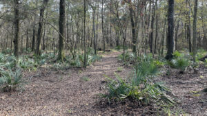
Broad trail through sparse forest O’Leno Sink to Rise Trail Starting where the waters of the Santa Fe River dive underground at O'Leno State Park, this scenic hike roughly follows the river's subterranean flow to its emergence at River Rise Preserve.

Old Bellamy Rd is the dividing line between the two, with a multi-use trailhead located along it.

Bellamy Rd marker Bellamy Road was THE road across territorial Florida


Within River Rise State Park, the trail system is trickier to follow but showcases the weirdness of the karst through which the river flows under your feet.

Inside this part of the trail system is a backcountry campground at Sweetwater Lake, and an extensive puzzle of equestrian trails all the way to and across US 41.

Jug Lake sign and pond Named “lakes” along the trail are sinkholes of river water (Dan Bell)


Camping

Along the entrance road, the Dogwood and Magnolia Loops have 61 sites between them, each with electric and water hookups.

They are lovely old-fashioned campsites, tucked in the forest and along narrow roads where 50′ is the maximum for a trailer.

Hammock camping is permitted in a handful of sites, and each of the loops have an accessible campsite. Sites start at $18 per night plus reservation fee.

Magnolia is more central to park activities, with its own playground. Both campgrounds have bathhouses. Bring a bicycle if you’re camping along the Dogwood Loop.

Flat trail under pines Multi-use trails near the camping areas are largely flat


Nearby, the park’s complex of historic cabins can handle a group of up to 120 people.

This was formerly Camp O’Leno, a forestry camp along the lines of a Boy Scout camp. Dating to 1938, cabins are CCC-era: basic and outdoorsy.

Screened stone building One of the camp buildings


Buildings do not have heating or air conditioning. But use of the camp includes a set of historic buildings including as a recreation hall, dining hall, crafts building, and concession.

The park also has primitive group camps for tent camping in the forest. For group camping, call the park directly to make arrangements.

The backpacker’s campsite at Sweetwater Lake is 3 miles out along the trail. Up to ten people can camp there, and a privy is provided. Camping is $5 per night. Call the park to reserve.

Sinkhole lake with alligator warning sign Sweetwater Lake (Dan Bell)


Trail Map

O'Leno State Park Trail Map
Green: Dogwood Trail. Yellow: Limestone Trail. Blue: River Trail. Brown: Parener’s Branch Trail. Red: Sink to Rise Trail. Purple: East Entrance to River Rise.

Explore More!

Learn more about adjoining River Rise Preserve State Park
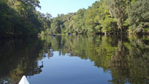
Tip of canoe with tree-lined river ahead River Rise Preserve State Park Birthing the Santa Fe River from a journey underground, River Rise Preserve State Park offers trails open to hikers and equestrians via adjoining O'Leno State Park.

Video

Hiking the Sink to Rise Trail


Slideshow

See our photos of O’Leno State Park


Nearby Adventures

Tubing the Ichetucknee Tubing the Ichetucknee Tubing the Ichetucknee River means letting go and going with the flow, letting the waters carry you past beautiful springs and through ever-changing habitats. Here's how.
Gilchrist Blue Springs Paddling the Santa Fe River On a mellow paddling trip down the Santa Fe River, John discovers several swimming springs, thousands of turtles, and miles of quiet waterway.
Turquoise waterway flowing through forest in fall colors Gilchrist Blue Springs State Park Cradling a collection of spectacular springs in a forested glen along the Santa Fe River, Gilchrist Blue Springs State Park is one of the finest places to experience springs up close
Poe Springs Park Poe Springs Park At Poe Springs Park, the Poe Springs Nature Trail carries you across a landscape shaped by water acting on limestone, where surface rock is obvious and studded with fossils.

Trail Map (PDF) Reserve Campsite Official Website

  • Author
  • Recent Posts
Sandra Friend
Sandra Friend
Author of 45 books, Sandra Friend established FloridaHikes.com in 2006 to expand on the field research she'd completed for her first six hiking guides. She has been honored with lifetime achievement awards from the Florida Trail Association and the Florida Outdoor Writers Association.
Sandra Friend
Latest posts by Sandra Friend (see all)
  • Michael Crotty Bicentennial Park - November 3, 2026
  • A.J. Henry Park - November 1, 2026
  • Okeeheelee Nature Center Trails - October 22, 2026
Category: Backpacking, Biking, Camping, Canoe & Kayak Rentals, Day Hikes, Equestrian, Florida State Parks, Hikes, Loop Hikes, Nature Trails, North Florida, Paddling, Parks, PlacesTag: Best Camping, Big Trees, Cabins, Car Camping, CCC, Developed Camping, Dog-friendly, Family-Friendly, Favorites, Fishing, Florida State Parks, Geology, Group Camping, High Springs, Historic Sites, Lake City, OLeno State Park, Picnic, Playgrounds, Primitive Camping, Rivers, Santa Fe River, Sinkholes, Swimming

Sidebar

FarOut Guides

Our comprehensive trail logistics presented on offline maps:

Florida National Scenic Trail (1,500 miles)
Florida Keys Overseas Heritage Trail (108 miles)
Eastern Continental Trail in Florida (92 miles)


We earn a small commission on sales through these links. Thanks for your support!


Our Guidebooks

We’ve written Florida guidebooks for over 25 years. These include North Florida destinations.

Book cover with woman hiking through palms with baby carrier
Book cover of Florida Trail Hikes
The Florida Trail Guide fifth edition
Explorer's Guide North Florida & The Panhandle guidebook

Explore More

Newest Articles for North Florida

Deep water-filled crevices Little Awesome Preserve
Longleaf pine forest LEAFS Preserve South
Paved bike path surrounded by pines and grassy slope Lehigh Trail
Aqua blaze on pine trunk next to footpath in flatwoods Dahoma Historic Trail

  • Facebook
  • Flickr
  • Instagram
  • Pinterest
  • Substack
  • Vimeo

FIND A TRAIL OR PARK

METROS: Bradenton. Clearwater. Crestview. Daytona Beach. Destin. Fort Lauderdale. Fort Myers. Fort Walton Beach. Gainesville. Jacksonville. Kissimmee. Lakeland. Melbourne. Miami. Naples. Ocala. Orlando. Panama City Beach. Pensacola. Port St. Lucie. Punta Gorda. St. Petersburg. Sanford. Sarasota. Sebring. Stuart. Tallahassee. Tampa. Vero Beach. West Palm Beach.

MULTI-REGION: Atlantic Coastal Ridge. Atlantic Coast. Bartram Trail. Big Bend. East Coast Greenway. Everglades National Park. Florida National Scenic Trail. Gulf Coast. Lake Wales Ridge. WATERWAYS: Indian River Lagoon. Intracoastal Waterway. Kissimmee River. St. Johns River. Withlacoochee River.

NORTHWEST FLORIDA: Altha. Apalachicola. Apalachicola National Forest. Big Bend Scenic Byway. Blackwater River State Forest. Blountstown. Bonifay. Bristol. Bruce. Cantonment. Cape San Blas. Carrabelle. Chattahoochee. Chipley. Crawfordville. DeFuniak Springs. Eastpoint. Ebro. Eglin Air Force Base. Freeport. Fountain. Gulf Breeze. Gulf Islands National Seashore. Holt. Madison. Marianna. Milton. Monticello. Mossy Head. Munson. Navarre. Navarre Beach. Newport. Niceville. Panacea. Panama City . Perdido Key. Ponce De Leon. Port St. Joe. Quincy. Santa Rosa Beach. Sopchoppy. South Walton. St. George Island. St. Marks. St. Marks NWR. Sumatra. Vernon. Wakulla. Wewahitchka. Woodville. WATERWAYS: Apalachicola River. Blackwater Bay. Blackwater River. Chipola River. Choctawhatchee Bay. Choctawhatchee River. Coastal Dune Lakes. Ochlockonee Bay. Perdido River. St. Marks River. Wacissa River. Wakulla River. Yellow River.

NORTH FLORIDA: Alachua. Amelia Island. Archer. Baldwin. Branford. Bronson. Bunnell. Callahan. Cedar Key. Chiefland. Crescent City. Cross City. Cross Creek. Dowling Park. Ellaville. Fanning Springs. Fernandina Beach. Flagler Beach. Fort White. Glen St. Mary. Green Cove Springs. Hawthorne. High Springs. Inglis. Jacksonville Beaches. Jacksonville Northshore. Jasper. Jennings. Keystone Heights. Lake Butler. Lake City. Live Oak.Macclenny. Mandarin. Mayo. Mayport. Micanopy. Middleburg. Old Town. Olustee. Orange Park. Osceola National Forest. Palatka. Palatka-Lake Butler Trail. Palm Coast. Palm Valley. Perry. Ponte Vedra. Rodman. Salt Springs. St. Augustine. Starke. Steinhatchee. Suwannee. Suwannee River Wilderness Trail. Suwannee Springs. Talbot Islands. Timucuan Preserve. Trenton. Waldo. Welaka. White Springs. Williston. Worthington Springs. Yankeetown. WATERWAYS: Santa Fe River. St. Marys River. Suwannee River. Tolomato River. Upper Withlacoochee River.

CENTRAL FLORIDA: Altamonte Springs. Apollo Beach. Apopka. Astatula. Astor. Auburndale. Bartow. Babson Park. Bayport. Belleview. Bithlo. Brandon. Brooksville. Bushnell. Canaveral National Seashore. Cassadaga. Christmas. Chuluota. Citrus Springs. Clearwater Beach. Clermont. Coast to Coast Trail. Cocoa. Cocoa Beach. Cross Florida Greenway. Crystal River. Dade City. De Leon Springs. DeBary. Deland. Deltona. Dunedin. Dunnellon. Edgewater. Enterprise. Eustis. Ferndale. Fort Meade. Frostproof. Geneva. Gibsonton. Haines City. Hernando. Hernando Beach. Holopaw. Homosassa. Inverness. Kenansville. Kissimmee. Lake Mary. Lake Wales. Largo. Leesburg. Lithia. Longwood. Lutz. Maitland. Malabar. McIntosh. Melbourne Beach. Merritt Island. Merritt Island NWR. Mims. Mount Dora. Narcoossee/Lake Nona. New Port Richey. New Smyrna Beach. Nobleton. Oak Hill. Oakland. Ocala National Forest. Ocklawaha. Ocoee. Oldsmar. Orange City. Ormond Beach. Osteen. Oviedo. Paisley. Palm Bay. Plant City. Poinciana. Polk City. Ponce Inlet. Port Orange. Ridge Manor. Riverview. Ruskin. Safety Harbor. Silver Springs. Sorrento. Spring Hill. St. Cloud. Tarpon Springs. Thonotosassa. Titusville . Umatilla. Viera. Walt Disney World. Weeki Wachee. Weirsdale. Wimauma. Windermere. Winter Garden. Winter Haven. Winter Park. Winter Springs. Withlacoochee State Forest. Withlacoochee State Trail. Yeehaw Junction. Zephyrhills. WATERWAYS: Alafia River. Halifax River. Hillsborough River. Lake Apopka. Little Manatee River. Ochlawaha River. Rainbow River. Tampa Bay. Wekiva River. Wekiva River Basin.

SOUTHWEST FLORIDA: Alva. Boca Grande. Cape Coral. Charlotte Harbor. Ding Darling NWR. Ellenton. Englewood. Estero. Immokalee. Marco Island. North Port. Osprey. Palma Sola. Palmetto. Pine Island. Port Charlotte. Sanibel Island. Venice. WATERWAYS: Caloosahatchee River. Manatee River. Myakka River. Pine Island Sound.

SOUTH FLORIDA: Arcadia. Basinger. Big Cypress National Preserve. Big Cypress Seminole Reservation. Big Cypress Swamp. Bowling Green. Clewiston. Everglades City. Indiantown. LaBelle. Lake Okeechobee Scenic Trail. Lake Placid. Lakeport. Moore Haven. Okeechobee. Ortona. Pahokee. Palmdale. Port Mayaca. South Bay. Wauchula. Zolfo Springs. WATERWAYS: Fisheating Creek. Lake Okeechobee. Peace River.

SOUTHEAST FLORIDA: Biscayne Bay. Biscayne National Park. Boca Raton. Boynton Beach. Coconut Creek. Coral Gables. Coral Springs. Davie. Delray Beach. Fellsmere. Flamingo. Fort Pierce. Hobe Sound. Hollywood. Homestead. Indrio. Jensen Beach. Juno Beach. Jupiter. Jupiter Farms. Key Biscayne. North Hutchison Island. Ocean to Lake Greenway. Palm Beach. Palm Beach Gardens. Pompano Beach. Redland. Sebastian. South Hutchinson Island. WATERWAYS: Florida Bay. St. Lucie River.

FLORIDA KEYS: Big Pine Key. Islamorada. Key Largo. Key West. Marathon. Overseas Heritage Trail.


©2006-2026, Sandra Friend & John Keatley | Disclosure | Site Index | Work with Us | Advertise with Us | Terms of Service and Privacy Policy

Florida Hikes PO Box 93 Mims FL 32754 | Contact
