
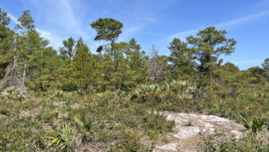
Once part of the vast IBM complex in Boca Raton where the personal computer was born, Pondhawk Natural Area protects 79 acres of scrub habitats and wetlands.
The slough sits between two sand ridges and was where the Hillsboro River began, but dried up as IBM excavated the area to create Blue Lake.
 Blue Lake
When we first visited, a relict pond apple swamp contained some of the largest trees we’d seen. In 2025, it was surprising to find them gone.
In their place, a wetland has been re-created within a fold of scrub habitats topping the Atlantic Coastal Ridge.
 Wetland
Resources





Disclosure: As authors and affiliates, we receive earnings when you buy through our links. This helps us provide public information on this website.
Overview
Location: Boca Raton
Length: 2.5 miles
Trailhead: 26.387421, -80.115656
Address: 1501 Spanish River Blvd, West Palm Beach
Fees: Free
Restroom: At the library
Land Manager: Palm Beach County
Phone: 561-233-2400
Open sunrise to sunset. No pets or bicycles. Use sun protection as much of the hike is in open scrub.
Restrooms and a water bottle filling station are inside the library.
Directions
From Interstate 95 exit 48, follow Yamato Rd west to the first light at Technology Way. Turn left and drive 0.9 mile through the complex to Communication Ave. Turn left and continue up to Spanish River Blvd. Turn right and drive 0.2 mile to the entrance for the Spanish River Library. Turn left. Parking is in the library parking lot, west of the library building.
Hike
From the Spanish River Library, follow the broad concrete walkway along the waterway to a pedestrian bridge with a sign for the natural area.
Turn right after crossing the bridge to walk the Spanish River Trail along a rewilded shoreline of Blue Lake.
 Bridge to Pondhawk
At a large kiosk with maps at 0.2 mile, enter Pondhawk Natural Area on a sidewalk leading to a boardwalk. As with all Palm Beach County natural areas, it has a core accessible route.
Past a strangler fig, meet the start of a Storywalk, pages from a children’s book arranged in order on interpretive-style signs around the loop.
 Pondhawk trailhead kiosk
Turn left, curving along a restored marsh rim between waving sheafs of cordgrass to reach an observation deck.
Water levels vary, but there is usually a pond at the south edge of this marshy depression.
 Marsh rim
Continue along the pathway along a line of palmettos and oaks, turning off it at 0.4 miles onto a narrow sandy path, the South Hiking Trail.
Marked with posts with a yellow circle, it winds through a low scrub habitat within sight of a line of condos to the southwest.
 Start of the South Hiking Trail
Loop through a mature stand of sand pines providing an island of shade. Condos stand in the distance beyond the property fence.
Snaking through open scrub, the trail doubles back on itself before proceeding past the condos into scrubby flatwoods with scattered pines.
 Scrub expanse
Cross a two-track road at a bench at a mile and enter the shade of a mature sand live oak hammock. Keep watch for those marker posts in this open understory.
Emerge on a sandy path in the sun to graze the south edge of the restored wetlands.
 Shady hammock
Staying in the woodlands along its edge, the footpath is once again tricky to follow; follow the markers. Rounding a small hill, walk past a dense cluster of ferns in a low spot
Reach the accessible path at the entrance boardwalk after 1.3 miles. A return to the parking area from this point makes for a 1.5 mile hike.
 Circling the marsh
To continue your hike to explore the remainder of the preserve on the North Hiking Trail, turn left.
Pass by the loop turnoff on the concrete walkway and enter the shade of an oak hammock.
 Rejoining the main trail near the entrance boardwalk
Curving along a line of blue-tinted saw palmetto, the path enters a palm-pine flatwoods.
Step off the concrete at 1.5 miles to follow a softly cushioned footpath on pine needles beneath tall pines. Red squares on posts mark the trail.
 Start of the North Hiking Trail
A transition to scrubby flatwoods and scrub happens quickly, the footpath becoming sandy.
A sharp left curve steers the path past the condos along Blue Lake and turns the trail inward into a very immersive sand pine scrub.
 Sand pine scrub
Zigzag between stands of large fluffy sand pines, traffic noise briefly filtering in from Yamato Blvd along the preserve’s northern boundary.
Watch for gopher tortoises as the trail swings south through the scrub. Marsh ferns rise from a damp area.
 Gopher tortoises
Not far past a sand road crossing, the North Hiking Trail ends where it meets the sidewalk at 1.9 miles. Turn right to complete that loop.
Pass the entrance to the South Hiking Trail and the observation deck before sealing the loop at 2 miles.
 End of the North Hiking Trail
Make a right to exit via the boardwalk to the kiosk along the Spanish River Trail.
Another right turn leads south to the pedestrian bridge for Spanish River Library to complete this 2.5 mile hike.
 Return to the library
Trail Map

Explore More!
Video
Hiking Pondhawk Natural Area
Explore More!
Slideshow
See our photos from this hike
Nearby Adventures
 Yamato Scrub Natural Area Meander a mazy route through a scrub forest fronting Interstate 95 in Boca Raton for colorful wildflowers and a wetland area for birding.
 Blazing Star Nature Preserve Traverse a scrub forest amid remnants of the ancient dunes of the Atlantic Coastal Ridge at Blazing Star Preserve, a Boca Raton natural land with a 1 mile loop trail.
 Sugar Sand Park In Boca Raton, the trails at Sugar Sand Park radiate from a nature center and playground surrounded by the remains of a coastal scrub and pine flatwoods in this urbanized area.
 Serenoa Glade Preserve Atop one of the higher elevations in Boca Raton, Serenoa Glade Preserve is a rare undeveloped piece of the Atlantic Coastal Ridge with both scrub and pine flatwoods habitats.

- Hal Scott Red Trail - November 13, 2026
- Baseline Trails - November 7, 2026
- Hal Scott Yellow Trail - November 3, 2026