• Skip to main content
  • Skip to header right navigation
  • Skip to after header navigation
  • Skip to site footer
Florida Hikes logo

Florida Hikes

Hike Bike Paddle Camp Florida with authors Sandra Friend and John Keatley as your guides

  • Trails
  • Maps
  • Guidebooks
  • Hike
    • Scenic Hikes
    • Loop Trails
    • Dog-friendly Hikes
    • Hikes for Kids
    • National Parks in Florida
    • Florida State Parks
  • Bike
    • Major Bike Trails
    • Paved Bike Trails
    • Off Road Biking
    • Biking Articles
  • Paddle
    • Canoe & Kayak Rentals
    • Paddling Destinations
    • Paddling Articles
  • Camp
    • Cabin Rentals
    • Car Camping
    • Primitive Camping
  • Florida Trail
    • Plan your Hike
    • Best Scenic Hikes
    • Best Backpacking
    • Section Hiking
    • Thru-Hiking
    • Trail Updates
  • Travel
Hilltop with switchbacks below

Robinson Preserve Eagle Loop

Hilly, with outstanding views: that’s why the loop around the island in the middle of the Eagle Loop at Robinson Preserve is a must.

Bradenton (27.509647, -82.664976)   2.0 miles   Robinson Preserve
Mar 2025 update. Due to hurricane damage in October 2024, the connecting bridge between the Osprey Trail and Eagle Trail remains closed.

Runners find the sun-drenched Eagle Loop in the middle of Robinson Preserve perfect for training.

It boasts a pedestrian-only cushioned recycled-rubber path and surprising elevation changes along the part of its route on a man-made island.

The overall loop circles an enormous restored wetland area on what was once agricultural land, but the inner loop on the island is the most compelling part of the trail for a hike.

Shelter atop a hill Shelter atop the highest hill in Robinson Preserve


Resources

Resources for exploring the area
South Florida Explorers Guide book cover 50 Hikes in South Florida book cover Hikers Guide to the Sunshine State book cover Paddlers Guide Florida Hiking the Gulf Coast book cover
 
Disclosure: As authors and affiliates, we receive earnings when you buy through our links. This helps us provide public information on this website.

Overview

Location: Palma Sola
Length: 0.7 mile inner loop, 2 mile full circuit
Trailhead: 27.509647, -82.664976
Address: 10299 99th St NW, Bradenton
Fees: Free
Restroom: Near the north end of the parking area
Land Manager: Manatee County
Phone: 941-742-5923

Open sunrise to sunset. Leashed dogs welcome. The trail system has accessible surfaces, including graded pathway and recycled rubber, but has steep grades.

Kayak rentals available. Picnic pavilions may also be rented.


Directions


From US 41 in downtown Bradenton, follow Manatee Ave (SR 64) west 4 miles to 75th St W. Turn right and continue north 1.3 miles to 17th Ave NW. Drive west 1.5 miles. Turn left onto 99th Ave and pass the preserve’s North Entrance. Continue a half mile along 99th Ave to the South Entrance. Turn right. The road splits. Take the right fork to the parking area adjoining the kayak condos and launch and park at the far end.

Hike

Start from the parking area adjoining the southern kayak launch and kayak condos.

Walk to the northwest corner with the small screened picnic pavilion to join a short stretch of the broad Anhinga Trail towards the bridge you see up ahead.

Turn off at the gate into the Eagle Loop, posted with No Bicycles and Foot Traffic only signs.

Gate and signage on shell path Entrance to the Eagle Loop from the Anhinga Trail at South Entrance parking


Make a left onto the unusual bouncy recycled rubber surface, a treadway that takes some getting used to after hiking hardpacked footpaths.

It leads to and crosses the bridge to the island, undoubtedly a series of spoil piles now blanketed in grasses and scattered native shrubs and cabbage palms.

Rubberized footpath Rubberized footpath


Newly planted mangroves were in place along the shoreline on our visit. Eventually they’ll obscure direct views of the water but they’ll provide a natural buffer against erosion.

At the fork in the trail, bear right to walk the island’s perimeter, sweeping along the waterway where kayakers launch into the greater system of water trails in the preserve.

Wetlands beyond footpath Curve with a wetlands view


After a long curve, an expansive view opens across wetlands being cultivated in what was once farmland.

Glance left to note how the landscape has risen sharply to a forested hilltop. That’s where this trail is eventually headed.

Forested hilltop with roofed benches Peak of the hill


Along the edge of the big wetland, it’s open and sunny and windswept. Sea oxeye dances in the breeze. The pathway gently gains elevation.

Sweeping around the next curve, a bridge across the water is now visible, part of the outer rim of the Eagle Loop closer to the NEST.

Curve in trail by watery expanse The outer Eagle Loop follows the far shore


Keep climbing around the curve, pavilions on the hilltop in view. They provide the only shade along this hike.

At 0.4 mile, meet the next trail junction with a bridge to the right. It leads to the full outer Eagle Loop and the restrooms at the south end of the parking lot.

Trail junction with waterway and bridge Junction to outer Eagle Loop and restrooms


To loop the island instead, make a left. Ascend steeply to a shaded bench at pavilion 17, which the trail sweeps around on a curve. Keep climbing.

Looking downhill, it’s obvious the path makes a series of switchbacks to reach the crest.

Switchbacks on a hillside Climb to Pavilion 17


At the highest point are a pair of benches under a pavilion and an outstanding panorama of the entire restoration area encompassed by the Eagle Loop.

Panorama of marshes and trails Panorama at the peak


Continue around to pavilion 15 and examine the far north horizon. It may take a moment to spot it, but look for the observation tower in the distance.

Beyond it, the Sunshine State Skyway bridge over Tampa Bay looms over the treeline, seeming surprisingly close as seen from this high point.

View from hilltop with suspension bridge on horizon The Sunshine Skyway bridge is on the far horizon above treeline


Descend past the cedars and palms topping the hillside. Unlike the climb, this side isn’t tightly switchbacked.

It curves gently through the reforestation towards the glimmer of water below. Soon the bridge you originally crossed to reach the island is visible.

Pathway snaking down a hillside to a bridge Descending the hillside gently to the bridge


Take in one final panorama of the open marsh. Reaching the base of the hill, meet the original trail junction at the start of the loop. Cross the bridge.

At this point, having the high point of the Eagle Loop behind you, decide if you want to do the outer loop. As it was late afternoon and in full sun, we didn’t.

Bridge across waterway Bridge from island to the outer loop


However, if you’re looking for more miles, stay on the rubberized path for a 0.9 mile outer circuit of the wetlands you saw from the island.

The Eagle Loop mainly stays on a high berm, with connectivity to the Spoonbill Trail near pavilion 20.

Bridge with signage to berm Pavilion 20 near the connection to the Spoonbill Trail


Near pavilion 19, there is also a connection to the Heron Trail, which leads to the NEST. Beyond that pavilion are the bridges you saw in the distance from the island.

The Eagle Loop returns to this same parking area near the restrooms, meeting the bridge to the island on its far side.

Waterfront activity area in park Launch and picnic area at South Trailhead as seen from the island bridge


Leaving the Eagle Loop for the limerock pathway beyond the gate, aim up the Anhinga Trail to the screened picnic shelter to exit to the parking area.

Depending on your route, complete either a 0.7 mile hike (just the island) or a 2 mile hike (the island loop and the full Eagle Loop).

Waterway in restored wetland Waterway along the Anhinga Trail en route to the parking lot


Trail Map

Robinson Preserve Trail Map
Red: Osprey Loop. Green: Eagle Island Loop. Brown: NEST Trail. Aqua/Lt Green: Perico Preserve.

Explore More!

Learn more about Robinson Preserve

Observation tower on a lagoon Robinson Preserve Edging Tampa Bay, the vast sweep of Robinson Preserve is a puzzle of natural and restored habitats circled by more than ten miles of mixed-use trails.

Video

A walk through the island portion of the Eagle Loop


Slideshow

See our photos from this hike


Nearby Adventures

Canopy walk above rope bridges Robinson Preserve NEST Trail Providing access to the Canopy Zone at Robinson Preserve, the NEST Trail is a showy canopy walk with views of the bordering wetlands.
Mangroves framing a lagoon view Robinson Preserve Osprey Loop The oldest of the loop trails inside Robinson Preserve, the Osprey Loop offers waterfront views and boardwalks as it skims the southern shore of Tampa Bay.
Boardwalk with palm tree Neal Preserve Discover the botany and prehistory of Perico Island through excellent interpretation and observation points with outstanding views at Neal Preserve.
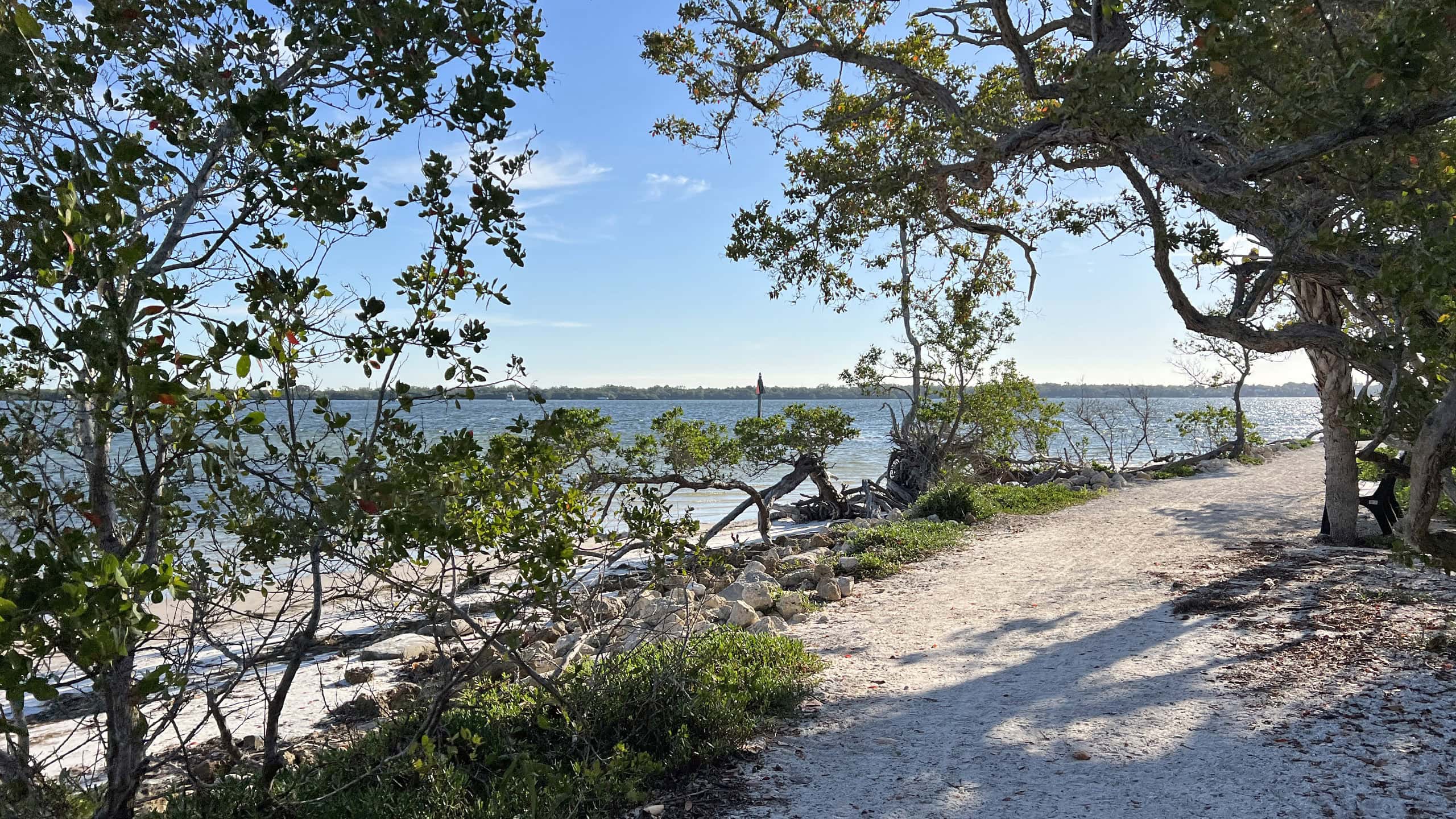
Waterfront trail amid sea grapes and mangroves De Soto National Memorial Interpreting the landing of Spanish conquistador Hernando De Soto, De Soto National Memorial occupies a peninsula where the Manatee River flows into Tampa Bay.

Trail Map (PDF) Official Website

  • Author
  • Recent Posts
Sandra Friend & John Keatley
Articles jointly researched, written, and photographed by Sandra Friend & John Keatley, authors and publishers of FloridaHikes.com.
Sandra Friend & John Keatley
Latest posts by Sandra Friend & John Keatley (see all)
  • Hal Scott Yellow Trail - November 3, 2026
  • Hal Scott Preserve - October 28, 2026
  • Tradewinds Park - October 27, 2026
Category: County Parks, Day Hikes, Hikes, Loop Hikes, Natural Lands, Southwest Florida, TrailsTag: Birding, Bradenton, Hilly Trails, Islands, Palma Sola, Robinson Preserve, Scenic Hikes

Sidebar

FarOut Guides

Our comprehensive trail logistics presented on offline maps:

Florida National Scenic Trail (1,500 miles)
Florida Keys Overseas Heritage Trail (108 miles)
Eastern Continental Trail in Florida (92 miles)


We earn a small commission on sales through these links. Thanks for your support!


Our Guidebooks

We’ve written Florida guidebooks for over 25 years. These include Southwest Florida destinations.

Book cover with woman hiking through palms with baby carrier
Book cover of Florida Trail Hikes
The Florida Trail Guide fifth edition

Explore More

Newest Articles for Southwest Florida

View of open water framed by trees Calusa Heritage Trail
Footpath dipping into dampness amid mangroves Nancy Weir Mangrove Preserve
Firebreak and grassy strip through pine flatwoods Scherer Thaxton Preserve
Rounded open water amid grassland Deep Hole

  • Facebook
  • Flickr
  • Instagram
  • Pinterest
  • Substack
  • Vimeo

FIND A TRAIL OR PARK

METROS: Bradenton. Clearwater. Crestview. Daytona Beach. Destin. Fort Lauderdale. Fort Myers. Fort Walton Beach. Gainesville. Jacksonville. Kissimmee. Lakeland. Melbourne. Miami. Naples. Ocala. Orlando. Panama City Beach. Pensacola. Port St. Lucie. Punta Gorda. St. Petersburg. Sanford. Sarasota. Sebring. Stuart. Tallahassee. Tampa. Vero Beach. West Palm Beach.

MULTI-REGION: Atlantic Coastal Ridge. Atlantic Coast. Bartram Trail. Big Bend. East Coast Greenway. Everglades National Park. Florida National Scenic Trail. Gulf Coast. Lake Wales Ridge. WATERWAYS: Indian River Lagoon. Intracoastal Waterway. Kissimmee River. St. Johns River. Withlacoochee River.

NORTHWEST FLORIDA: Altha. Apalachicola. Apalachicola National Forest. Big Bend Scenic Byway. Blackwater River State Forest. Blountstown. Bonifay. Bristol. Bruce. Cantonment. Cape San Blas. Carrabelle. Chattahoochee. Chipley. Crawfordville. DeFuniak Springs. Eastpoint. Ebro. Eglin Air Force Base. Freeport. Fountain. Gulf Breeze. Gulf Islands National Seashore. Holt. Madison. Marianna. Milton. Monticello. Mossy Head. Munson. Navarre. Navarre Beach. Newport. Niceville. Panacea. Panama City . Perdido Key. Ponce De Leon. Port St. Joe. Quincy. Santa Rosa Beach. Sopchoppy. South Walton. St. George Island. St. Marks. St. Marks NWR. Sumatra. Vernon. Wakulla. Wewahitchka. Woodville. WATERWAYS: Apalachicola River. Blackwater Bay. Blackwater River. Chipola River. Choctawhatchee Bay. Choctawhatchee River. Coastal Dune Lakes. Ochlockonee Bay. Perdido River. St. Marks River. Wacissa River. Wakulla River. Yellow River.

NORTH FLORIDA: Alachua. Amelia Island. Archer. Baldwin. Branford. Bronson. Bunnell. Callahan. Cedar Key. Chiefland. Crescent City. Cross City. Cross Creek. Dowling Park. Ellaville. Fanning Springs. Fernandina Beach. Flagler Beach. Fort White. Glen St. Mary. Green Cove Springs. Hawthorne. High Springs. Inglis. Jacksonville Beaches. Jacksonville Northshore. Jasper. Jennings. Keystone Heights. Lake Butler. Lake City. Live Oak.Macclenny. Mandarin. Mayo. Mayport. Micanopy. Middleburg. Old Town. Olustee. Orange Park. Osceola National Forest. Palatka. Palatka-Lake Butler Trail. Palm Coast. Palm Valley. Perry. Ponte Vedra. Rodman. Salt Springs. St. Augustine. Starke. Steinhatchee. Suwannee. Suwannee River Wilderness Trail. Suwannee Springs. Talbot Islands. Timucuan Preserve. Trenton. Waldo. Welaka. White Springs. Williston. Worthington Springs. Yankeetown. WATERWAYS: Santa Fe River. St. Marys River. Suwannee River. Tolomato River. Upper Withlacoochee River.

CENTRAL FLORIDA: Altamonte Springs. Apollo Beach. Apopka. Astatula. Astor. Auburndale. Bartow. Babson Park. Bayport. Belleview. Bithlo. Brandon. Brooksville. Bushnell. Canaveral National Seashore. Cassadaga. Christmas. Chuluota. Citrus Springs. Clearwater Beach. Clermont. Coast to Coast Trail. Cocoa. Cocoa Beach. Cross Florida Greenway. Crystal River. Dade City. De Leon Springs. DeBary. Deland. Deltona. Dunedin. Dunnellon. Edgewater. Enterprise. Eustis. Ferndale. Fort Meade. Frostproof. Geneva. Gibsonton. Haines City. Hernando. Hernando Beach. Holopaw. Homosassa. Inverness. Kenansville. Kissimmee. Lake Mary. Lake Wales. Largo. Leesburg. Lithia. Longwood. Lutz. Maitland. Malabar. McIntosh. Melbourne Beach. Merritt Island. Merritt Island NWR. Mims. Mount Dora. Narcoossee/Lake Nona. New Port Richey. New Smyrna Beach. Nobleton. Oak Hill. Oakland. Ocala National Forest. Ocklawaha. Ocoee. Oldsmar. Orange City. Ormond Beach. Osteen. Oviedo. Paisley. Palm Bay. Plant City. Poinciana. Polk City. Ponce Inlet. Port Orange. Ridge Manor. Riverview. Ruskin. Safety Harbor. Silver Springs. Sorrento. Spring Hill. St. Cloud. Tarpon Springs. Thonotosassa. Titusville . Umatilla. Viera. Walt Disney World. Weeki Wachee. Weirsdale. Wimauma. Windermere. Winter Garden. Winter Haven. Winter Park. Winter Springs. Withlacoochee State Forest. Withlacoochee State Trail. Yeehaw Junction. Zephyrhills. WATERWAYS: Alafia River. Halifax River. Hillsborough River. Lake Apopka. Little Manatee River. Ochlawaha River. Rainbow River. Tampa Bay. Wekiva River. Wekiva River Basin.

SOUTHWEST FLORIDA: Alva. Boca Grande. Cape Coral. Charlotte Harbor. Ding Darling NWR. Ellenton. Englewood. Estero. Immokalee. Marco Island. North Port. Osprey. Palma Sola. Palmetto. Pine Island. Port Charlotte. Sanibel Island. Venice. WATERWAYS: Caloosahatchee River. Manatee River. Myakka River. Pine Island Sound.

SOUTH FLORIDA: Arcadia. Basinger. Big Cypress National Preserve. Big Cypress Seminole Reservation. Big Cypress Swamp. Bowling Green. Clewiston. Everglades City. Indiantown. LaBelle. Lake Okeechobee Scenic Trail. Lake Placid. Lakeport. Moore Haven. Okeechobee. Ortona. Pahokee. Palmdale. Port Mayaca. South Bay. Wauchula. Zolfo Springs. WATERWAYS: Fisheating Creek. Lake Okeechobee. Peace River.

SOUTHEAST FLORIDA: Biscayne Bay. Biscayne National Park. Boca Raton. Boynton Beach. Coconut Creek. Coral Gables. Coral Springs. Davie. Delray Beach. Fellsmere. Flamingo. Fort Pierce. Hobe Sound. Hollywood. Homestead. Indrio. Jensen Beach. Juno Beach. Jupiter. Jupiter Farms. Key Biscayne. North Hutchison Island. Ocean to Lake Greenway. Palm Beach. Palm Beach Gardens. Pompano Beach. Redland. Sebastian. South Hutchinson Island. WATERWAYS: Florida Bay. St. Lucie River.

FLORIDA KEYS: Big Pine Key. Islamorada. Key Largo. Key West. Marathon. Overseas Heritage Trail.


©2006-2026, Sandra Friend & John Keatley | Disclosure | Site Index | Work with Us | Advertise with Us | Terms of Service and Privacy Policy

Florida Hikes PO Box 93 Mims FL 32754 | Contact