
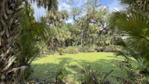
Along the merest eight-acre sliver of protected land on the banks of Ten Mile Creek, a surprisingly rugged nature trail scales up, over, and around man-made bluffs formed by eroded spoil piles dumped creekside long ago.
Providing the majority of the flow for the North Fork of the St. Lucie River, Ten Mile Creek has a loose chain of preserves protecting its waterfront. This is the northernmost one, encompassing showy oxbows.
 Ten Mile Creek at oxbow bridge
Resources





Disclosure: As authors and affiliates, we receive earnings when you buy through our links. This helps us provide public information on this website.
Overview
Location: Fort Pierce
Length: 0.5 miles
Trailhead: 27.403385, -80.399734
Address: 3401 Gordy Rd, Fort Pierce
Fees: Free
Restroom: None
Land Manager: St. Lucie County
Phone: 772-462-2526
Open sunrise to sunset. Hiking only. Leashed dogs welcome; pick up after your pet. Expect mosquitoes; use insect repellent.
Picnic tables and a kayak launch are at the trailhead, which is also a popular place for anglers to drop a line.
Directions
Exit Interstate 95 or Florida’s Turnpike at SR 70 in Fort Pierce. Drive west under the overpass for the Turnpike and make the first left onto Gordy Rd. Follow the road 1.3 miles to the turn-in on the right, just before the bridge.
Hike
Pass by the gate in front of an old earthen ramp used as a paddling launch and walk up to the trailhead kiosk.
On it is a 90-year comparison of a hand-drawn map to a satellite map showing the extent of this preserve and how the waterway used to flow before canals were dredged for agriculture.
 Trailhead kiosk
There may be interpretive brochures on hand; if so, it’s handy to understand the numbered stops.
Walk by the bike rack to the start point, a worn path through the grass leading to a bridge flanked by giant leather ferns along a small creek.
 First bridge
Ascending, enjoy a good view downstream framed by cabbage palms and the giant ferns.
The eroded footpath has roots exposed from the younger oaks scattered through the palm hammock.
 View of creek
Walk between the tall, slender columns, an occasional red blaze and the well-worn path your guides. Climb again. The palm hammock is natural.
This ridge and the others in the preserve are not. These spoil piles have been here long enough to be reforested by species that prefer their roots tapping into moister soil.
 Palm hammock
Narrowing, the path reaches the end of this ridge and makes a mild curving descent to the interior side of it. Pass marker 3 at a steep ascent along the roots of a large slash pine.
The top of the flat ridge rewards you with a view across the waterway, also wooded on its other shore.
 Steep ascent
Continue to climb, the views constant, until a sharp up-and-over where an arrow directs you through a steep furrowed descent.
Drop into a palm hammock with larger live oaks. Meet a second bridge, this one across where the marshy oxbow touches the creek.
 Furrowed descent
Scramble up the bluff on the other side and take the right fork at 0.2 mile as directed by the arrow.
Buried in water lettuce, the surface of the oxbow pond glows through the palm fronds along its rim.
 Oxbow pond
Red blazes resume, the footpath twisting through the palms while paralleling the oxbow. At marker 5, turn away from a bluff on the oxbow.
Follow an even broader section of the oxbow, an interconnected marsh just visible at the foot of the trees.
 Edge of the marsh
Round the base of a large live oak and wind deeper into the palm hammock. A glimpse of tannic waters confirms the big marsh is still near.
Marlberry and yaupon holly appear in the understory. The forest floor becomes a riot of green textures as you leave the oxbow behind.
 Textured forest
On the approach to the ridge, a boardwalk spans a damp area. Climb upslope, ignoring the side path to the right, blocked by a low railing.
Descend a sharp curve on the very rim of the bluff above Ten Mile Creek. The waterway glimmers beyond the palms before the descent to a footbridge over a sluggish dark stream.
 Climb to the bluff above the creek
Climb up the rooty path to follow the front of the ridge, which slopes towards the water.
Squeezed between a thick oak trunk and a cabbage palm, the footpath reaches the end of the loop soon after.
 Rooty slope above the creek
Cross the bridge over the oxbow and retrace your walk. We were tempted down a side trail by a forest of giant clumps of bamboo before the climb up the next ridge.
Otherwise stick to the worn track. Reach the trailhead to complete this very scenic half mile hike.
 Loop junction and exit bridge
Trail Map

Explore More!
Video
A walk through Ten Mile Creek Preserve
Slideshow
See our photos from this hike
Nearby Adventures
 Gordy Road Recreation Area Follow a gentle interpretive trail to explore scrub and oak hammock bordering a reclaimed sand mine on uplands recharging Ten Mile Creek.
 Paleo Hammock Preserve Discover a maze of wild coffee, an observation tower, and an archaeological site along a short loop, or walk miles more into scenic habitats within Stephen J Fousek Preserve.
 Teague Hammock Preserve Stepping back in time before the arrival of extensive agriculture in South Florida, the trails at Teague Hammock cross open prairies and loop through shady hardwood hammocks.
 George LeStrange Preserve A mix of restoration areas and natural habitats, George LeStrange Preserve has trails both easy and rugged surrounding its centerpiece of Lake Zobel.

- Michael Crotty Bicentennial Park - November 3, 2026
- A.J. Henry Park - November 1, 2026
- Okeeheelee Nature Center Trails - October 22, 2026