

Protecting a historic spring while providing family recreation, Wall Springs Park has an easy accessible spur to a loop on a mangrove-fringed island.
Along it are picnic pavilions, multiple overlooks on Boggy Bayou, and a stunning view across St. Joseph Sound on the Gulf of Mexico from its 35-foot observation tower.
 Boggy Bayou
This largely paved 1.2-mile circuit has an optional footpath component near the spring. But it’s not the only trail you’ll find at this coastal park.
Grazing past the entrance gate, the Pinellas Trail extends north to Tarpon Springs and south to St. Petersburg. This park serves as one of its trailheads for cyclists.
 Pinellas Trail at Wall Springs Park entrance
Bordering Girl Scout Camp Wai Lani, a newer portion of the park, the Wall Springs Addition, has a separate trailhead and a set of natural-surface loops for another 1.2 mile hike.
Starting at this trailhead, a 2.5-mile round trip on a paved multi-use trail to the tip of a peninsula passes that trailhead, ending at observation decks and a fishing pier on the Gulf.

As shown on our map, you can hike over 5 miles around Wall Springs Park and Wall Springs Addition out to Kloisterman Bayou.
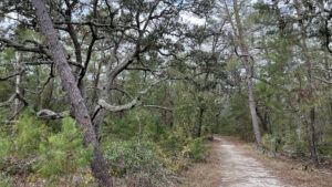 Wall Springs Addition Protecting coastal habitats between Boggy Bayou and Kloisterman Bayou, Wall Springs Coastal Addition offers accessible and natural surface paths to hike and bike.
Resources





Disclosure: As authors and affiliates, we receive earnings when you buy through our links. This helps us provide public information on this website.
Overview
Location: Palm Harbor
Length: 1.2 miles
Trailhead: 28.106405, -82.771371
Address: 3725 Desoto Blvd, Palm Harbor
Fees: Free
Restroom: At the trailhead
Land Manager: Pinellas County
Phone: 727-582-2100
Open 7 AM to sunset daily except the day after Thanksgiving and Christmas. Bicycles and leashed dogs welcome except on boardwalks.
Directions
From the intersection of US 19 and Tarpon Ave in Tarpon Springs, drive south on US 19 for 1.7 miles to E Klosterman Rd. Turn right and continue 1.3 miles to Palm Harbor Blvd (Alt US 19). Turn left and drive south 1.4 miles to Brevard St. Make a right and cross over the Pinellas Trail to enter the park gate. Parking areas are around a one-way circle that goes past the restrooms.
Hike
Start by the kiosk at the west end of the parking area near the picnic tables. The paved path leads towards two ramps with a bike ramp between them.
Take the one on the left for the boardwalk around Wall Springs. As interpretive panels explain, the spring was bought by Charles F. Wall from the state in 1876.
 Wall Springs
He enclosed it and added bathing houses. By 1926, this alkaline mineral spring attracted wealthy visitors from around the country to “take the waters” for their health.
His original enclosure around the basin is where the deep main spring rises, pouring its waters into a basin that becomes Boggy Bayou.
 Spring outflow
A roofed shelter with a bench looks over the outflow. Continue through it as the boardwalk edges the basin and its vigorous flow of crystalline waters.
Stay on the shoreline boardwalk, passing by the boardwalk over the water. It’ll be your return route at the end of the hike.
 Boardwalk over the spring run
Next to a large cedar tree, the boardwalk ends at a wide concrete path through a coastal hammock. Turn right, paralleling a split-rail fence.
The natural basin created by the spring stretches behind the palms. Occasional breaks in vegetation provide views of the expanse of clear water.
 Spring pool behind the palms
Hemmed in by fences, the concrete path reaches a junction with a natural surface trail at 0.2 miles.
Swing left to cross a bridge over a puzzle of mangrove-lined channels along Boggy Bayou.
 Bayou bridge
A straightaway walled on both sides by tall white mangroves meets a junction in front of picnic shelter 3. Bear right, following the curve past the restrooms.
Unfortunately, the hurricanes of 2024 created a ghost forest. Many of the oaks and pines were unable to withstand salt water intrusion and salt spray.
Cabbage palms and a handful of hardy slash pines survived, along with a rim of oak hammock on the eastern edge of the island.
 Start of paved loop
Curve past Shelter 5 to a Y junction with a artsy bench shaped like a fish. Bear right.
The coastal hammock opens up into a large green space with another sculptured bench. The observation tower draws attention from afar.
 Curving past a bench towards the tower
Reaching the concrete path branching off to it, head towards the enormous structure, a half mile into the hike. Skip past the spur boardwalk to head up the tower first.
Most of its massive bulk is a zigzag of ramps to reach the top deck. Alternatively, a staircase ascends up the middle of the main structure.
 Observation tower
Two wraparound decks provide panoramic views. The lower one is at the upper canopy level of the largely-dead pines and oaks surrounding it.
The view from the top reveals a long island offshore with the Gulf of Mexico beyond, and more greenery in the coastal hammock below.
A mangrove-lined channel lies due north along a spur of land within Girl Scout Camp Wai Lani.
 View towards the Gulf of Mexico
The ramp provides more views than the stairs, but whichever way you descend the tower, take the spur to the left.
The mangrove tunnel parts to reveal an observation deck along the waterway along the east side of this island.
It’s shallow and tidal, so when the tide is out, mud flats appear. Watch for bird activity along its edges.
 Observation deck
Leaving the tower complex, turn right. Pass another uniquely sculptured bench on the curve to an opening to an observation deck that also serves as a fishing pier.
While fishing is not allowed in the spring basin, it’s a popular pasttime along the decks fronting open waters.
 Fishing pier
Stay with this coastline path, separated from the water by mangroves and sea grapes, as it passes a picnic shelter and comes to a second deck.
After taking in this different perspective on the bayou, reach Shelter 3 and the end of the loop at 0.9 mile.
 Fog swooping in on the waterfront
Proceed straight ahead between the mangroves to the bridge. At the curve after it ends, bear left past the bench onto a footpath.
Shaded by palms, it follows a causeway along the north side of the spring basin.
 Causeway along the spring pool
A wilder take on the natural beauty of Wall Spring, it offers glimpses of the water framed by giant leather ferns.
The closer you draw to the upwelling of the spring, the more vivid the color of the water.
 Spring run
This beaten path exits onto the concrete path within sight of the two boardwalks at the start of the hike. Take the rightmost one this time, adjoined by massive red cedars.
Loop through the trees out across the water. Aquatic plants like coontail are visible in the clear water below, small fish wriggling between sandy spots and green stalks.
 Take the boardwalk to the right of the cedar
Meet the boardwalk from the spring at a T and make a left to walk by it and stare into its depths a final time.
Exit the boardwalk to the concrete path to the parking area, completing a 1.2 mile walk.
 A look at the spring from the crossover boardwalk
Trail Map

Explore More!
Learn more about the Pinellas Trail
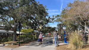 Pinellas Trail A paved ribbon stretching the length of Pinellas County from St. Petersburg to Tarpon Springs, the Fred Marquis Pinellas Trail provides nearly 38 miles of low-stress cruising.
Video
Hiking Wall Springs Park
Slideshow
See our photos from Wall Springs Park
Nearby Adventures
 John Chesnut Sr. Park Weaving through floodplain forests and cypress swamps, the boardwalks and trails of John Chesnut Sr. Park add a place to pause for wildlife along a wild shoreline on Lake Tarpon.
 Lake Conservation Park A forested escape north of Tampa, Lake Conservation Park features a network of trails where you can loop nearly four miles around a series of small lakes.
 Lake Dan Nature Preserve Two loop trails explore cypress domes and expansive pine flatwoods, while a side trail leads to a sturdy fishing dock over Lake Dan.
 Lake Rogers Park A 2.4-mile loop trail circling Lake Rogers weaves through oak hammocks, shrubs, pine flatwoods, and scenic vistas along the water’s edge.

- Baseline Trails - November 7, 2026
- Hal Scott Yellow Trail - November 3, 2026
- Hal Scott Preserve - October 28, 2026