
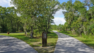
Where it slices through the massive subdivision known as Silver Springs Shores, the Cross Florida Greenway provides passive recreation for residents and visitors alike.
At its south end, there’s a Boundless Playground and picnic pavilions. At its north end, a disc golf course spans challenging terrain.
 Picnic pavilions at Baseline Rd Trailhead
Planted decades ago to reclaim the landscape, longleaf pines have filled in pastures edged by scrub and sandhill habitat.
A chain of paved loops across these gentle hills makes up the Baseline Trails, with ample access from both sides of the Greenway.
 Pines along the Red Oak Mile
Linear spurs, including the Ship Canal Trailhead, lead to six trailheads, with ample parking at Baseline Road, Banyan Rd, and SE 64th Ave Rd.
The other three trailheads – Teak Way Dr, Pecan Pass, and Pecan Course Circle – are community access points for residents to walk or bike in.
 A fun find at Pecan Course Circle trailhead
In the middle of it all, the Florida Trail provides a separate corridor for hiking, the orange-blazed footpath in the woods crossing the paved paths.
Explore an outer circuit of of up to 6.1 miles along the Red Oak Mile, Meadowlark Loop, Gopher Trail Loop, and Ship Canal Trail.
Or use the maps posted at every junction to trim your mileage down to whatever suits you on a walk or ride along the Baseline Trails.
 Florida Trail crossing
Resources





Disclosure: As authors and affiliates, we receive earnings when you buy through our links. This helps us provide public information on this website.
Overview
Location: Silver Springs Shores
Length: Up to 6.1 miles
Trailhead: 29.14216, -82.05287
Address: 4255 Baseline Rd, Ocala
Fees: Free
Restroom: At Baseline and SE 64th Ave trailheads
Land manager: Cross Florida Greenway
Phone: 352-236-7143
Open sunrise to sunset. Leashed dogs welcome. Cyclists, yield to pedestrians. Bicycle helmets required for children under 16.
Directions
From the junction of US 27/301/441 and SE 17th St (SR 464) in Ocala, drive east 2.2 miles. The road name changes to Maricamp Rd. Continue 3.7 miles to Baseline Rd (SR 35). Turn left at that light. In 0.4 miles, Baseline Rd Trailhead is on the right. Enter and drive another quarter mile for parking at the south end.
Hike/Bike
From the traihead, enter the recreation area along a sidewalk past picnic pavilions and the restrooms, the playground behind them.
At a T with the broad paved path, orange blazes for the Florida Trail go straight ahead to the start of its footpath.
 Entry point to trails
Turn left to begin the Baseline Trails, up a moderate hill through the grassy expanse.
Before reaching a treeline of pines, a striped line and marker denotes the start of a marked 5K route for runners.
 5K starting line
After 0.2 miles, reach Marker 1 at the bottom of Red Oak Mile. These large wooden markers and maps at junctions are helpful for navigating.
Turn left. A gradual curve through the pines leads into the sandhills, the sounds of traffic filtering in from Baseline Rd.
 Marker 1 junction
This half mile stretch enters the pines again, reaching the top of the mile-long Red Oak Mile loop. To return along it to Marker 1, bear right at Marker 4.
To continue the longer perimeter route, bear left at this junction, joining the upper west quadrant of the Meadowlark Loop.
 Sweeping past a bench
Crossing the Florida Trail along this short arc, meet the next Y junction at the top of the Meadowlark Loop.
It bears right at Marker 5. To stay with the clockwise perimeter, bear left onto a short connector.
 Marker 5 junction
At 1 mile, the junction at Marker 6 is at the south end of the Gopher Track Loop. Bear left to begin this loop clockwise.
Cross the Florida Trail again. The surrounding pines thin on the approach to Marker 8 at the turnoff to Banyan Rd trailhead.
 Taking a break at Banyan Rd trailhead
It’s a worthwhile spur trail adding 0.4 miles to the route. We’ve spotted gopher tortoises along it on every trip.
Return to the Gopher Track Loop to resume the loop. The surrounding habitat shifts into sandhills.
 Trailside gopher tortoise
Turkey oaks rise from the center of the junction at Marker 9. A Florida Trail crossing is at its most visible here.
At 2.1 miles, this is the north end of the Gopher Track Loop. Bear left for a round-trip on the Ship Canal Trail.
 Orange blaze marks the Florida Trail crossings
There is a noticeable amount of elevation gain on this stretch, as well as sharp curves and obvious dropoffs beyond the path.
In the 1930s, a government project to keep men employed had them digging pits by hand as part of a canal across Florida.
 Riding around a steep curve
Out of sight of this path, the disc golf course makes use of the rugged terrain of the abandoned pits.
At Marker 10, a short spur leads to a neighborhood entrance into the trail system.
 Teak Way Dr trailhead
Round a curve soon after. A prominent walk-in entry point to the Florida Trail northbound invites hikers into its Marshall Swamp Section.
The Ship Canal Trail becomes a shaded straightaway leading to the SW 64th Ave trailhead, passing Marker 11.
 Florida Trail Marshall Swamp section entrance
At 3.1 miles, this is the northermost point of the Baseline Trails. A walk-in entrance from one corner of the parking area leads to the disc golf course.
Turn around to retrace your route, tunneling under the forest canopy past the Florida Trail crossing before the curve south.
 The Ship Canal Trail curves south
Finishing the round-trip on the Ship Canal Trail, reach Marker 9 at the top of the Gopher Track Loop at 3.9 miles.
Bear left to take the west side of this loop, skimming along the edge of the sandhills for most of a half mile.
 Marker 9 junction
At 4.5 miles, a short spur at Marker 7 extends west to Pecan Pass trailhead. The bottom of the loop comes up quickly.
Bear left at Marker 6 to leave the Gopher Track Loop, and left at the Marker 5 junction to start the west side of the Meadowlark Loop.
 Bear left at two junctions in quick succession
The surroundings shift from sandhills to longleaf pines, growing for more than two decades atop the old pastures topping these hills.
Join the Red Oak Mile at Marker 3 by bearing left at 5.2 miles. At Marker 2, take the left for a side trip to Pecan Course Circle trailhead.
This corner of the greenway immerses you in sandhills ever so briefly. Return to the main loop at 5.7 miles and make a left.
 Amid the sandhills on the spur trail
Continue along Red Oak Mile. Small markers in front of planted trees are memorial plaques flanking the final Florida Trail crossing.
Reaching the Marker 1 junction at 5.9 miles, bear left to exit the loop trail system. Return to Baseline Rd trailhead, exiting to the parking area at 6.1 miles.
 Memorial plaques in front of trees
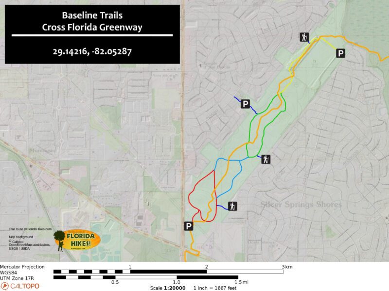
Trail Map
Explore More!
Hike the Florida Trail north from Baseline Rd trailhead
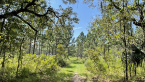 Florida Trail, Baseline to SE 64th Ave 2.7 miles. On a sliver of restored sandhill, the Baseline section of the Florida Trail provides a stroll within a forested oasis surrounded by suburbia.
Learn more about the Marjorie Harris Carr Cross Florida Greenway
 Cross Florida Greenway Spanning 110 miles between the St. Johns River near Palatka and the Gulf of Mexico, the Marjorie Harris Carr Cross Florida Greenway is a mile-wide recreational corridor.
Slideshow
See our photos from the Baseline Trails
Nearby Adventures
 Florida Trail, Marshall Swamp 3 miles. Marvel at towering trees in an ancient forest along this Florida Trail segment on the Cross Florida Greenway.
 Florida Trail, Santos to Baseline 5.1 miles. History is on display along this segment of the abandoned Cross Florida Barge Canal, from a town demolished nearly a century ago to agricultural land undergoing habitat restoration.
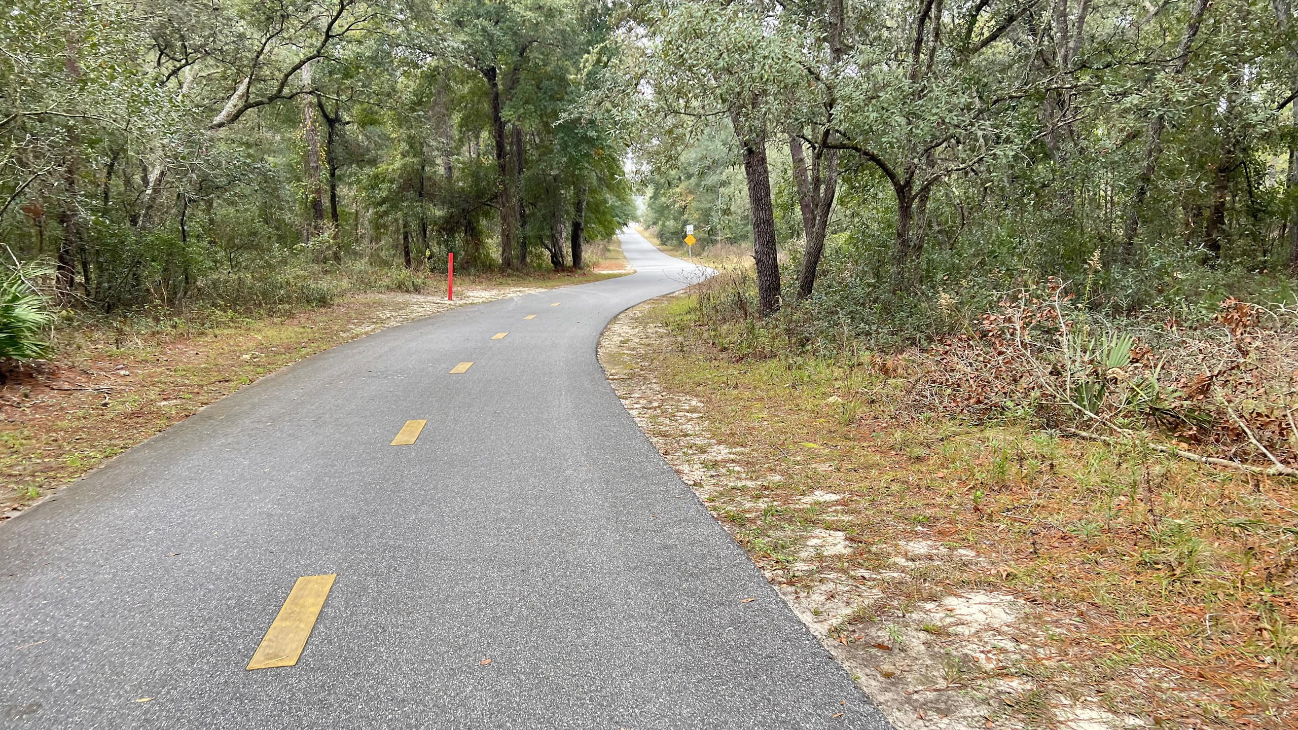 Cross Florida Greenway Multiuse Path Over fifteen miles long, this linear paved path along the Cross Florida Greenway connects Santos to Ross Prairie with direct access from several trailheads.
 Silver Springs State Park One of the world's largest and deepest springs, Silver Springs pours out more than 550 million gallons of water daily, forming the Silver River.
Official Map (PDF) Official Website

- Baseline Trails - November 7, 2026
- Hal Scott Yellow Trail - November 3, 2026
- Hal Scott Preserve - October 28, 2026