

For a taste of tidal pools and black rock beaches, get out of your car and take a hike to the unique shoreline of Big Talbot Island State Park.
The pirate Blackbeard landed on these shores, leaving behind a rumored buried treasure, but you’re more likely to find half-buried trees tumbled off the bluffs.

If you’re after a true treasure, bring a camera. Florida’s most colorful bird, the painted bunting, nests here in the spring, and roseate spoonbills feed in the marshes.
A birder’s delight, Big Talbot Island provides cyclists, hikers, and paddlers with coastal habitats to explore.
 Marsh view at the end of the Big Pine Trail
Resources



Disclosure: As authors and affiliates, we receive earnings when you buy these through our links. This helps us provide public information on this website.
Overview
Location: Talbot Islands
Trailhead: 30.501652,-81.451843
Address: 15500 Bucaneer Trail, Jacksonville
Fees: $3 vehicle, $2 fishing pier, $4 boat launch
Restroom: At Sawpit Creek
Land manager: Florida State Parks
Phone: 904-251-2320
Open 8 AM to sundown. Boat ramp at Sawpit Marsh open 24 hours.
Bring insect repellent. Mosquitos are prevalent in the coastal hammock and marshes.
Directions
From Jacksonville, drive north via I-295E over the Dames Point Bridge and exit at Heckscher Dr (SR 105). Drive east. After the highway passes the St. Johns River ferry dock 9 miles into the drive, the road becomes A1A. Continue another 9 miles, driving through Little Talbot Island State Park before crossing a bridge to Big Talbot Island State Park. Pass the trailheads for Big Pine Trail and Blackrock Beach. The entrance to Bluffs Picnic Area is the next one on the right.
About the Park
Change. It’s inevitable on a wave-pounded coastline, but never so obvious along Florida’s coast as it is at Big Talbot Island.
Since our first visit over two decades ago for 50 Hikes in North Florida, the relentless pounding of the surf and wind have scooped even more of the island away.
 A staircase formerly led to the beach from Bluffs Picnic Area.
A waterfront walk amid the tidal pools, the boneyard of fallen trees, and the black rocks is still possible, but no longer accessible directly at the parking area.
Instead, the Shoreline Access Trail winds along the tall bluffs to guide you to a beach access point a half mile north of Bluffs Picnic Area.
 The boneyard of fallen trees on the beach
The trail at Blackrock Beach leads to a view of one of the weirdest and most beautiful beaches in Florida.
Black “rock” lines the shore, forming tidal pools brimming with sea life. It’s actually highly compressed peat and sand shaped by waves to look like rock.

Smidgens of sandbars offshore add to the tropical scene. The tidal marsh side of the island is popular for paddling through dense mazes of needlegrass.
Boaters and paddlers can access the marsh at Sawpit Creek, a recreation area with launch and ramp at the north end of the island.
 Sawpit Creek
For cyclists, the Timucuan Trail, a paved bicycle trail, parallels A1A through the park.
It is a part of the East Coast Greenway, with the paved path extending north and south of this park.
 Timucuan Trail
Short nature trails off both sides of A1A provide walks under the shady canopy of coastal forest.
Beach access is only possible at the Bluffs Picnic Area, and it’s more of a walking beach than a sunning one. Swimming isn’t advisable due to organic debris.
 Bluffs Picnic Area
For sunning and swimming and more hiking, look to Little Talbot Island State Park to the south.
This adjacent state park is also home to the nearest state park campground.
 Beach at Little Talbot Island
Hike
 Big Talbot Big Pine Trail The southernmost trail on Big Talbot Island is a short walk out to a bluff above the Simpson Creek estuary through a coastal hammock riffled by breezes.
 Big Talbot Black Rock Trail An unusual and picturesque geologic anomaly, Blackrock Beach at Big Talbot Island is covered with formations that look like black lava rocks but are made of sand.
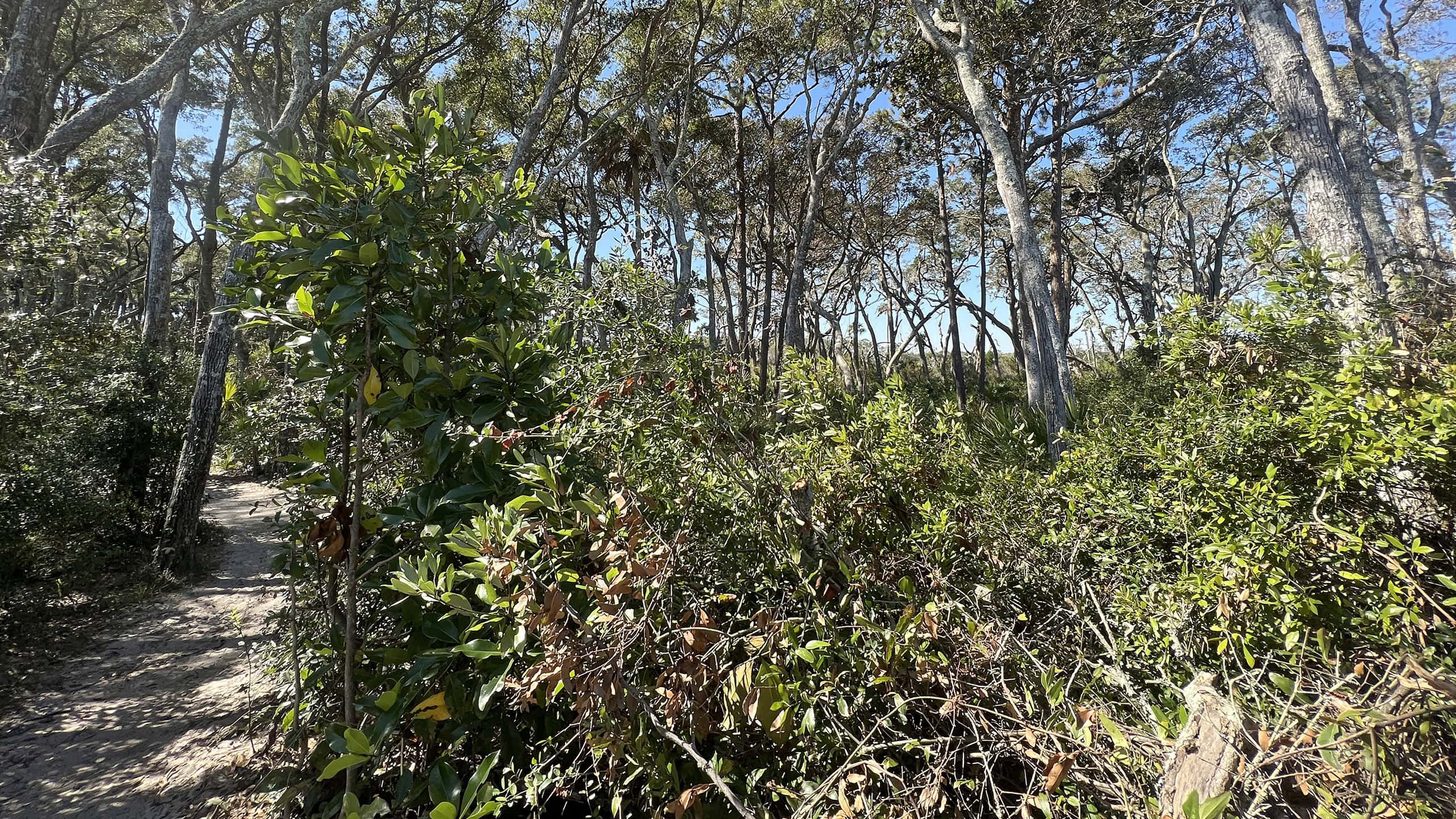 Big Talbot Shoreline Access Trail Slipping through coastal habitats on the bluffs of Big Talbot Island, this linear path keeps extending as erosion forces shifts in shoreline access.
 Timucuan Trail Connecting a series of state parks north of the St. Johns River in Jacksonville, the Timucuan Trail is a delightfully scenic segment of the East Coast Greenway.
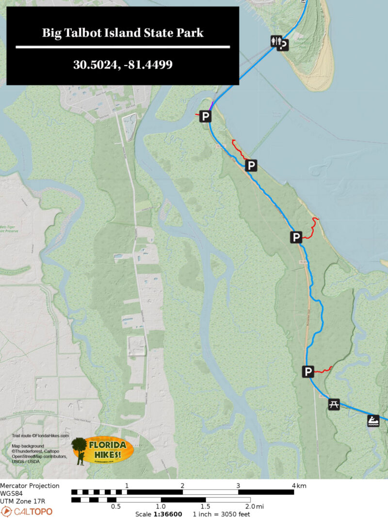
Trail Map
Explore More!
Video
Hiking the Big Pine Trail
Slideshow
See our photos from Big Talbot Island State Park
Nearby Adventures
More worth exploring while you’re in this area.
 Little Talbot Island State Park One of the closest wild beaches to Jacksonville, Little Talbot Island State Park provides a front-row seat to the tumultous flow of Fort George Inlet into the Atlantic Ocean.
 George Crady Fishing Pier State Park A broken highway span between Big Talbot Island and Amelia Island State Parks, this park encompasses not just bridge stubs but a white sand beach along Nassau Sound.
 Amelia Island State Park The thud of horse's hooves on sand makes for a unique experience at Amelia Island State Park, the only Florida State Park where you can ride horses on the beach
 American Beach Home to the largest dune system on the Atlantic Coast in Florida, American Beach has a rich history as a vacation destination that served the African-American community during the days of segregation in the South.

- Hal Scott Yellow Trail - November 3, 2026
- Hal Scott Preserve - October 28, 2026
- Tradewinds Park - October 27, 2026