• Skip to main content
  • Skip to header right navigation
  • Skip to after header navigation
  • Skip to site footer
Florida Hikes logo

Florida Hikes

Hike Bike Paddle Camp Florida with authors Sandra Friend and John Keatley as your guides

  • Trails
  • Maps
  • Guidebooks
  • Hike
    • Scenic Hikes
    • Loop Trails
    • Dog-friendly Hikes
    • Hikes for Kids
    • National Parks in Florida
    • Florida State Parks
  • Bike
    • Major Bike Trails
    • Paved Bike Trails
    • Off Road Biking
    • Biking Articles
  • Paddle
    • Canoe & Kayak Rentals
    • Paddling Destinations
    • Paddling Articles
  • Camp
    • Cabin Rentals
    • Car Camping
    • Primitive Camping
  • Florida Trail
    • Plan your Hike
    • Best Scenic Hikes
    • Best Backpacking
    • Section Hiking
    • Thru-Hiking
    • Trail Updates
  • Travel
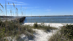
Old bridge adjoining sparkling white sand beach

George Crady Fishing Pier State Park

A broken highway span between Big Talbot Island and Amelia Island State Parks, this park encompasses not just bridge stubs but a white sand beach along Nassau Sound.

Amelia Island (30.522094, -81.444751)   1.0 miles  

Part of the array of coastal parks between Jacksonville’s Northside and Fernandina Beach, George Crady Bridge Fishing Pier State Park sits in two counties.

The East Coast Greenway was routed across it, and its signage still implies that. But the span now has missing pieces across the expanse.

State Park sign Sign at the north end of the span


On its north side, parking at Amelia Island State Park is a must to walk under the current highway bridge to reach the former one.

On its south side, access to the park is via Sawpit Creek Recreation Area in Big Talbot Island State Park.

Big brown sign with marshes beyond Sign at south end of the span


Resources

Resources for exploring the area
Hikers Guide to the Sunshine State book cover 50 Hikes in North Florida book cover North Florida Panhandle Explorers Guide book cover Paddlers Guide Florida
 
Disclosure: As authors and affiliates, we receive earnings when you buy through our links. This helps us provide public information on this website.

Overview

Location: Nassau Sound
Length: 1 mile in two round trips
Trailhead: 30.522094, -81.444751 (north) 30.510315, -81.458674 (south)
Address: 9550 First Coast Hwy, Fernandina Beach
Fees: $3 per vehicle
Restroom: At the north end
Land manager: Florida State Parks
Phone: 904-251-2320

Open 8 AM to sunset. Pets are prohibited. Swimming is not safe due to strong currents within Nassau Sound. There is no shade.


Directions


From Jacksonville, drive north via I-295E over the Dames Point Bridge and exit at Heckscher Dr (SR 105). Drive east. After the highway passes the St. Johns River ferry dock 9 miles into the drive, the road becomes A1A. Continue another 9 miles, driving through Little Talbot Island State Park before crossing a bridge to Big Talbot Island State Park. Pass all of the trailheads on the right side of the road. Where the boardwalk begins north of the park’s main entrance, watch for the turnoff on the left before the Nassau Sound bridge for the south span. Bear right upon entering the parking lot to use the non-boater parking area close to the old bridge. For the north span, continue across the bridge to the entrance to Amelia Island State Park. Turn right once inside the park and follow the park road to park close to the Nassau Sound bridge.

About the Park

Preserved from demolition in 1998 due to the active efforts of Florida Representative George Crady, this bridge across Nassau Sound dates to 1949.

While the bridge was a mile long, sections of it have collapsed in the middle of the sound and have not been repaired. It is not possible to cross it.

Two bridge spans with islands between in distance Sections to the island in the middle have collapsed


At its north end, a ramp leads up and under the active highway bridge from an access point adjoining the beach ramp for vehicles at Amelia Island State Park.

Emerging from under the A1A bridge, continue up to the bathhouse and bait shop along Old A1A.

Underpass with railing and building on hill Underpass between state parks


Behind this structure, a path leads to a lovely white sand beach along Nassau Sound. It’s a nice spot for sunbathing.

Anglers sometimes cast from this shore, but most head out onto the bridge, setting up lawn chairs, umbrellas, and pop-up tents for shade.

White sand beach Beach behind the bait shack


Draining a vast estuary between Jacksonville’s Northshore, Yulee, and Fernandina Beach, Nassau Sound teems with saltwater species. Redfish and tarpon pass under the span every fall.

Accessed from Sawpit Creek Recreation Area, the quieter south end is where fishing is best. Grass flats provide hiding places for smaller fish.

Shoreline of estuary Shoreline access on the south end


Hiking

The park discourages cyclists from riding out onto the bridge, but you are welcome to walk it. A round-trip to the end of the north span is 0.6 miles.

Whenever it’s possible to step over to the side instead of walking down the middle, enjoy the expansive view up the Nassau River.

Folks fishing can’t see behind themselves, so it’s up to you to steer clear of anyone casting.

People on an old bridge Visitors enjoying the north end of the bridge


The south span is a superior destination for birders. We’ve spotted both white pelicans and roseate spoonbills soaring across this landscape.

From the parking area at Sawpit Creek Recreation Area, follow Old A1A into the extensive marshes where Sawpit Creek empties into Nassau Sound.

Expanse of salt marsh Marshes to the west of Old A1A


Where the bridge is fenced off so you can walk no further, worn pathways flank it down to water level.

Anglers use these to reach a slim line of beach in the salt marsh. They provide another angle to scan for birds. Return to the parking area after 0.4 miles.

Worn path to beach below bridge span Shoreline access at the south end


Pass through the parking lot, edging the pines, for a different look at the estuary from the path adjoining the boat ramp, adding another 0.2 miles.

Across A1A from the entrance to Sawpit Marsh Recreation Area, birders will find a long boardwalk along Nassau Sound valuable. A crosswalk leads to stairs up to the boardwalk.

Boardwalk along waterway The boardwalk provides a great birding spot


In addition to paralleling a cove along the south, the boardwalk continues south into a coastal hammock where painted buntings appear each spring while migrating.

A round-trip along the boardwalk adds another mile to a walk at the south end of this state park. Add more miles by following the Timucuan Trail farther south.

Paved path under canopy of oaks with East Coast Greenway sign Timucuan Trail Connecting a series of state parks north of the St. Johns River in Jacksonville, the Timucuan Trail is a delightfully scenic segment of the East Coast Greenway.

Trail Map

George Crady Bridge Fishing Pier State Park Trail Map
Red: George Crady Bridge. Blue: Timucuan Trail.

Explore More!

Learn more about Big Talbot and Amelia Island State Parks

Lumpy dark rocks along a calm shoreline with forested bluffs Big Talbot Island State Park Wind and water perpetually reshape the landscape along this rugged Atlantic shoreline with tidal pools, black rock beaches, and a boneyard of sand-scoured trees.
Beach with vehicles and people Amelia Island State Park The thud of horse's hooves on sand makes for a unique experience at Amelia Island State Park, the only Florida State Park where you can ride horses on the beach


Slideshow

See our photos from George Crady Bridge Fishing Pier State Park


Nearby Adventures
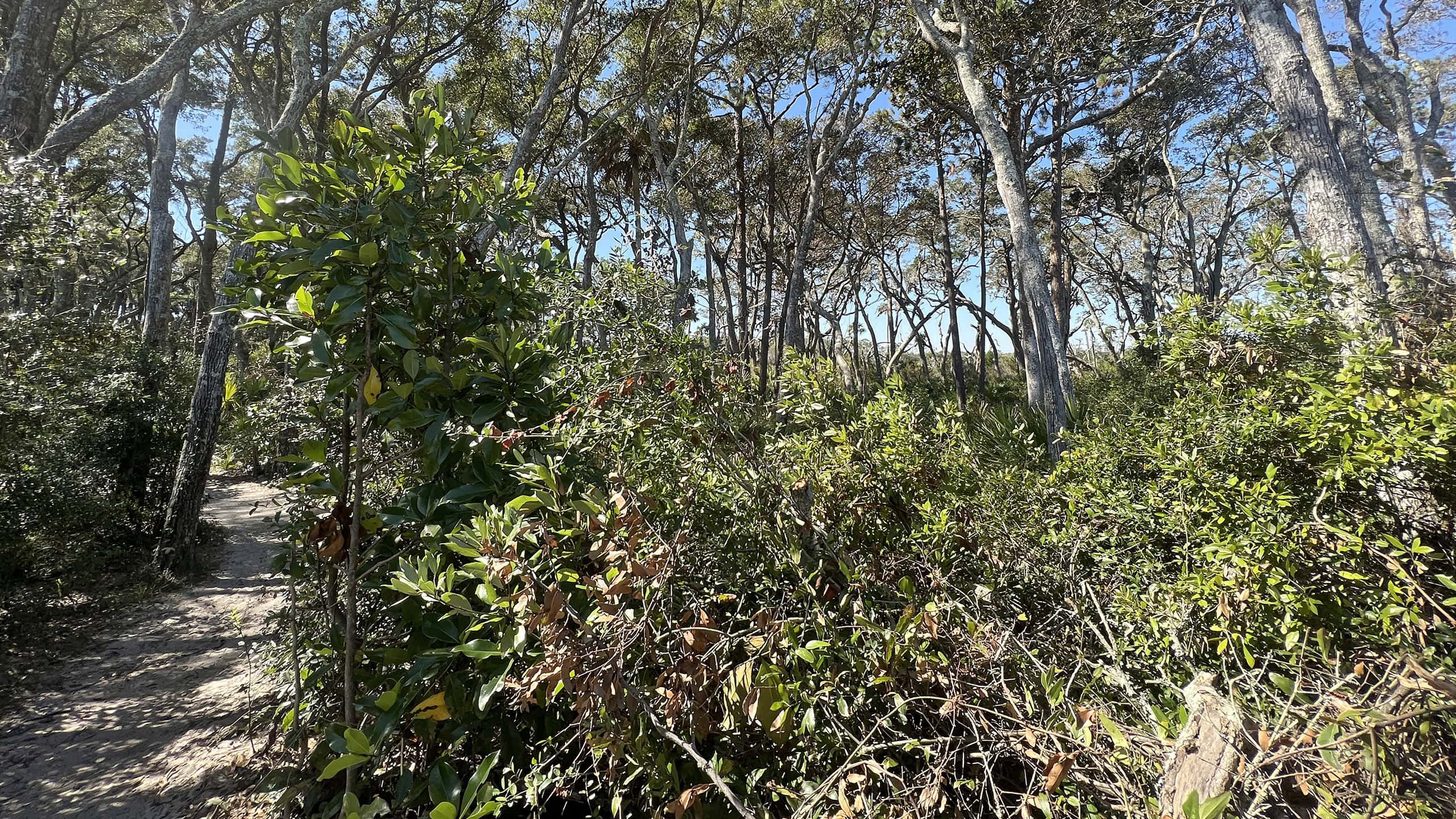
Shady path in maritime hammock Big Talbot Shoreline Access Trail Slipping through coastal habitats on the bluffs of Big Talbot Island, this linear path keeps extending as erosion forces shifts in shoreline access.
Tidal pools along shoreline Big Talbot Black Rock Trail An unusual and picturesque geologic anomaly, Blackrock Beach at Big Talbot Island is covered with formations that look like black lava rocks but are made of sand.
Massive dune with interpretive info American Beach Home to the largest dune system on the Atlantic Coast in Florida, American Beach has a rich history as a vacation destination that served the African-American community during the days of segregation in the South.
Dune field Peters Point Park At the south end of Fernandina Beach, a park with a small swath of Atlantic Ocean beachfront includes a trailhead for the East Coast Greenway.

Trail Map (PDF) Official Website

  • Author
  • Recent Posts
Sandra Friend & John Keatley
Articles jointly researched, written, and photographed by Sandra Friend & John Keatley, authors and publishers of FloridaHikes.com.
Sandra Friend & John Keatley
Latest posts by Sandra Friend & John Keatley (see all)
  • Hal Scott Red Trail - November 13, 2026
  • Baseline Trails - November 7, 2026
  • Hal Scott Yellow Trail - November 3, 2026
Category: Florida State Parks, Hikes, Nature Trails, North Florida, Parks, Places, TrailsTag: Accessible, Amelia Island, Birding, East Coast Greenway, Fernandina Beach, Fishing, Florida State Parks, Talbot Islands

Sidebar

FarOut Guides

Our comprehensive trail logistics presented on offline maps:

Florida National Scenic Trail (1,500 miles)
Florida Keys Overseas Heritage Trail (108 miles)
Eastern Continental Trail in Florida (92 miles)


We earn a small commission on sales through these links. Thanks for your support!


Our Guidebooks

We’ve written Florida guidebooks for over 25 years. These include North Florida destinations.

Book cover with woman hiking through palms with baby carrier
Book cover of Florida Trail Hikes
The Florida Trail Guide fifth edition
Explorer's Guide North Florida & The Panhandle guidebook

Explore More

Newest Articles for North Florida

Deep water-filled crevices Little Awesome Preserve
Longleaf pine forest LEAFS Preserve South
Paved bike path surrounded by pines and grassy slope Lehigh Trail
Aqua blaze on pine trunk next to footpath in flatwoods Dahoma Historic Trail

  • Facebook
  • Flickr
  • Instagram
  • Pinterest
  • Substack
  • Vimeo

FIND A TRAIL OR PARK

METROS: Bradenton. Clearwater. Crestview. Daytona Beach. Destin. Fort Lauderdale. Fort Myers. Fort Walton Beach. Gainesville. Jacksonville. Kissimmee. Lakeland. Melbourne. Miami. Naples. Ocala. Orlando. Panama City Beach. Pensacola. Port St. Lucie. Punta Gorda. St. Petersburg. Sanford. Sarasota. Sebring. Stuart. Tallahassee. Tampa. Vero Beach. West Palm Beach.

MULTI-REGION: Atlantic Coastal Ridge. Atlantic Coast. Bartram Trail. Big Bend. East Coast Greenway. Everglades National Park. Florida National Scenic Trail. Gulf Coast. Lake Wales Ridge. WATERWAYS: Indian River Lagoon. Intracoastal Waterway. Kissimmee River. St. Johns River. Withlacoochee River.

NORTHWEST FLORIDA: Altha. Apalachicola. Apalachicola National Forest. Big Bend Scenic Byway. Blackwater River State Forest. Blountstown. Bonifay. Bristol. Bruce. Cantonment. Cape San Blas. Carrabelle. Chattahoochee. Chipley. Crawfordville. DeFuniak Springs. Eastpoint. Ebro. Eglin Air Force Base. Freeport. Fountain. Gulf Breeze. Gulf Islands National Seashore. Holt. Madison. Marianna. Milton. Monticello. Mossy Head. Munson. Navarre. Navarre Beach. Newport. Niceville. Panacea. Panama City . Perdido Key. Ponce De Leon. Port St. Joe. Quincy. Santa Rosa Beach. Sopchoppy. South Walton. St. George Island. St. Marks. St. Marks NWR. Sumatra. Vernon. Wakulla. Wewahitchka. Woodville. WATERWAYS: Apalachicola River. Blackwater Bay. Blackwater River. Chipola River. Choctawhatchee Bay. Choctawhatchee River. Coastal Dune Lakes. Ochlockonee Bay. Perdido River. St. Marks River. Wacissa River. Wakulla River. Yellow River.

NORTH FLORIDA: Alachua. Amelia Island. Archer. Baldwin. Branford. Bronson. Bunnell. Callahan. Cedar Key. Chiefland. Crescent City. Cross City. Cross Creek. Dowling Park. Ellaville. Fanning Springs. Fernandina Beach. Flagler Beach. Fort White. Glen St. Mary. Green Cove Springs. Hawthorne. High Springs. Inglis. Jacksonville Beaches. Jacksonville Northshore. Jasper. Jennings. Keystone Heights. Lake Butler. Lake City. Live Oak.Macclenny. Mandarin. Mayo. Mayport. Micanopy. Middleburg. Old Town. Olustee. Orange Park. Osceola National Forest. Palatka. Palatka-Lake Butler Trail. Palm Coast. Palm Valley. Perry. Ponte Vedra. Rodman. Salt Springs. St. Augustine. Starke. Steinhatchee. Suwannee. Suwannee River Wilderness Trail. Suwannee Springs. Talbot Islands. Timucuan Preserve. Trenton. Waldo. Welaka. White Springs. Williston. Worthington Springs. Yankeetown. WATERWAYS: Santa Fe River. St. Marys River. Suwannee River. Tolomato River. Upper Withlacoochee River.

CENTRAL FLORIDA: Altamonte Springs. Apollo Beach. Apopka. Astatula. Astor. Auburndale. Bartow. Babson Park. Bayport. Belleview. Bithlo. Brandon. Brooksville. Bushnell. Canaveral National Seashore. Cassadaga. Christmas. Chuluota. Citrus Springs. Clearwater Beach. Clermont. Coast to Coast Trail. Cocoa. Cocoa Beach. Cross Florida Greenway. Crystal River. Dade City. De Leon Springs. DeBary. Deland. Deltona. Dunedin. Dunnellon. Edgewater. Enterprise. Eustis. Ferndale. Fort Meade. Frostproof. Geneva. Gibsonton. Haines City. Hernando. Hernando Beach. Holopaw. Homosassa. Inverness. Kenansville. Kissimmee. Lake Mary. Lake Wales. Largo. Leesburg. Lithia. Longwood. Lutz. Maitland. Malabar. McIntosh. Melbourne Beach. Merritt Island. Merritt Island NWR. Mims. Mount Dora. Narcoossee/Lake Nona. New Port Richey. New Smyrna Beach. Nobleton. Oak Hill. Oakland. Ocala National Forest. Ocklawaha. Ocoee. Oldsmar. Orange City. Ormond Beach. Osteen. Oviedo. Paisley. Palm Bay. Plant City. Poinciana. Polk City. Ponce Inlet. Port Orange. Ridge Manor. Riverview. Ruskin. Safety Harbor. Silver Springs. Sorrento. Spring Hill. St. Cloud. Tarpon Springs. Thonotosassa. Titusville . Umatilla. Viera. Walt Disney World. Weeki Wachee. Weirsdale. Wimauma. Windermere. Winter Garden. Winter Haven. Winter Park. Winter Springs. Withlacoochee State Forest. Withlacoochee State Trail. Yeehaw Junction. Zephyrhills. WATERWAYS: Alafia River. Halifax River. Hillsborough River. Lake Apopka. Little Manatee River. Ochlawaha River. Rainbow River. Tampa Bay. Wekiva River. Wekiva River Basin.

SOUTHWEST FLORIDA: Alva. Boca Grande. Cape Coral. Charlotte Harbor. Ding Darling NWR. Ellenton. Englewood. Estero. Immokalee. Marco Island. North Port. Osprey. Palma Sola. Palmetto. Pine Island. Port Charlotte. Sanibel Island. Venice. WATERWAYS: Caloosahatchee River. Manatee River. Myakka River. Pine Island Sound.

SOUTH FLORIDA: Arcadia. Basinger. Big Cypress National Preserve. Big Cypress Seminole Reservation. Big Cypress Swamp. Bowling Green. Clewiston. Everglades City. Indiantown. LaBelle. Lake Okeechobee Scenic Trail. Lake Placid. Lakeport. Moore Haven. Okeechobee. Ortona. Pahokee. Palmdale. Port Mayaca. South Bay. Wauchula. Zolfo Springs. WATERWAYS: Fisheating Creek. Lake Okeechobee. Peace River.

SOUTHEAST FLORIDA: Biscayne Bay. Biscayne National Park. Boca Raton. Boynton Beach. Coconut Creek. Coral Gables. Coral Springs. Davie. Delray Beach. Fellsmere. Flamingo. Fort Pierce. Hobe Sound. Hollywood. Homestead. Indrio. Jensen Beach. Juno Beach. Jupiter. Jupiter Farms. Key Biscayne. North Hutchison Island. Ocean to Lake Greenway. Palm Beach. Palm Beach Gardens. Pompano Beach. Redland. Sebastian. South Hutchinson Island. WATERWAYS: Florida Bay. St. Lucie River.

FLORIDA KEYS: Big Pine Key. Islamorada. Key Largo. Key West. Marathon. Overseas Heritage Trail.


©2006-2026, Sandra Friend & John Keatley | Disclosure | Site Index | Work with Us | Advertise with Us | Terms of Service and Privacy Policy

Florida Hikes PO Box 93 Mims FL 32754 | Contact