

77.6 miles. Diving into the heart of Florida’s largest National Forest, the Apalachicola section of the Florida Trail traverses some of the wettest, wildest swamp forest found outside of the Big Cypress Swamp.
The legendary Bradwell Bay, a swamp basin in the heart of the Apalachicola National Forest, protects a stand of virgin pine forest. Crossing it when it is wet, which is often, is one of the most difficult feats on the Florida Trail.
Known for its botanical beauty, particularly for its pitcher plant bogs and terrestrial orchids, the Apalachicola is often soggy underfoot, with its many titi swamps and wet pine flatwoods.
By contrast, beautiful views await on the river bluffs of the Sopchoppy and Ochlockonee Rivers. Best hiked in spring, when the flowers are at their peak, it is a challenging hiking destination.

Our Florida Trail Books & Guides


Disclosure: As authors and affiliates, we receive earnings when you buy through our links. This helps us provide public information on this website.
Trip Planning
This is one of the more remote sections of the Florida Trail. Cell coverage does not extend across the entire route for all carriers. Paved road crossings are few.
The Apalachicola National Forest is always generally wet. Expect to wade a portion of your hike every day.
Hiking poles are a must for traversing gnarled, rooty swamps of black gum, cypress, and titi.
Camping and Lodging
Lodging is only available at the two ends of this section, Sopchoppy and Bristol. Sopchoppy has a delightful AirBnB called The Treehouse as well as a city campground along the river.
Camel Lake Campground is at the north end of the forest on the way to Bristol, and there is one small motel in the town itself, a block from the roadwalk.
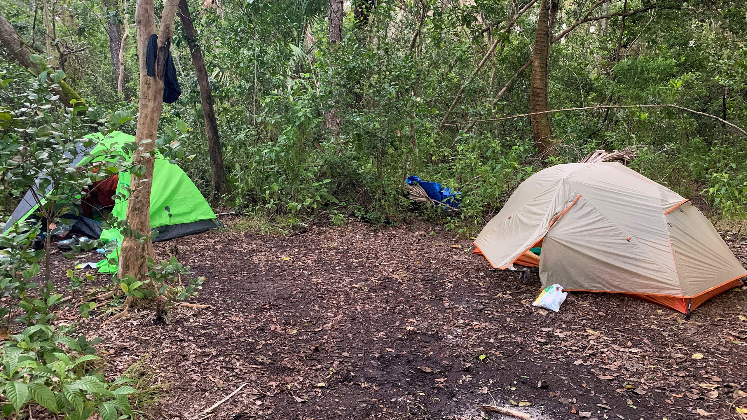
Random camping is permitted in the Apalachicola National Forest except during fall deer hunting season. However, habitats are largely wet or overgrown.
To make your hike more pleasant, the Apalachee Chapter of the Florida Trail Association has constructed a string of designated campsites on high ground across the entire forest.
Well-spaced, each includes benches and a fire ring plus space for a handful of tents.
Now that campsites exist north and south of Bradwell Bay, only use Bradwell Island (a slight high spot in the swamp with no infrastructure) in an emergency.
Dogs
Leashed dogs are permitted, but consider their health and safety traversing soggy ground. Wet paws for days may not be ideal for your pup.
Wildlife
Alligators live in the swamps, even under the placid waters of Bradwell Bay. A healthy population of Florida black bears inhabits the forest.
The US Forest Service requires backpackers use of a bear bag or bear canister, and car campers secure their food.
Water
Swamp water is everywhere. Flowing water is a different matter. Flowing water sources are identified in our app, but essentially anywhere the trail crosses a bridge, look for a stream.
Some are very narrow. A handful are too deep below the bridge to reach. Water sources are near all the campsites.
The trail crosses several rivers through this section, with seasonal access to the Sopchoppy possible in a few places.
Resupply
Pick up your groceries at either end of this hike, since there’s nowhere to resupply along it.
Sopchoppy has a Dollar General and a convenience store. Bristol has a Piggly Wiggly and several convenience stores as well as a Dollar General.
Parking & Shuttle
Designated trailheads are identified in the mileage chart below. Shuttles can involve significant distances across the forest.
Getting across the forest from east to west can be a challenge as there is only one possible paved route diagonally from Sopchoppy to Bristol.
Most access roads to trail crossings and to many of the trailheads are dirt, and can be rough or too muddy to drive at times, particularly in the vicinity of Bradwell Bay.
Long distance hikers should join the Florida Trail Hikers Facebook group to request assistance.
Particuarly considering the vast distances involved for drives, be sure to compensate any shuttle volunteers for their gas and time.
Safety
Flooding
Flooding makes the hike along the Sopchoppy River dangerous, since dropoffs are hidden by floodwaters.
Check the National Weather Service flood gauge before hiking and roadwalk around the Sopchoppy River if it is flooded.
Contact the Apalachicola National Forest at 850-926-3561 regards flood conditions and advisories on water levels in Bradwell Bay.
Bradwell Bay is one of the most challenging pieces of the Florida Trail, even though it can be done as a day hike.
It is almost always flooded, but the question is how high. The water levels and a muddy bottom with deep holes means slow going.
In times of high water, Bradwell Island campsite floods. Don’t count on using it except in an emergency.
Because it is so remote and the crossing is lengthy, Shuler Bay can also be troublesome to cross if flooded. Check the gauge for New River in advance.
Hunting
Check the FWC website for hunting season dates. Wear a bright orange shirt or vest if you choose to hike during hunting seasons.
Backpackers are limited to using designated campsites during general gun season, also known as deer season, late fall/early winter.
Roadwalks
Although you will follow an unpaved forest road for a long stretch north of Indian Creek to traverse a massive swamp, there is only one real roadwalk along this section.
It’s a doozy. 11.2 miles from the north end of the Apalachicola National Forest via CR 12 into Bristol and then on a high bridge across the Apalachicola River.
While it takes you right into town past services, it can be unnerving at times due to the large number of logging trucks speeding past to a lumber mill centrally located along it.
People
With the lack of dry campsites and difficult forest roads for vehicles, you will encounter very few people in the forest other than hunters.
The main exceptions are in town, where folks are friendly, and at the two recreation areas the trail crosses.
At Porter Lake, there’s a restroom and water tap. Anglers are the main day users but be cautious of people camped out there, since camping is discouraged at that spot.
Camel Lake is a pleasant fee site with a bathhouse and flush toilets and a camp host at the campground.
Trail Map

Mileages
Key mile markers south to north.
0.0 – Carraway Cutoff trailhead
0.3 – St. Marks NWR / Apalachicola NF boundary
1.9 – Bent Sapling Camp +
8.6 – Sopchoppy River Camp +
8.9 – Oak Park trailhead
10.7 – Monkey Creek bridge
12.8 – Martian Camp +
13.0 – FR 329 trailhead
18.3 – Monkey Creek trailhead
20.7 – Bradwell Bay South trailhead
22.9 – Bradwell Bay Scenic Area
25.2 – Bradwell Bay West trailhead
26.0 – Mantis Camp +
29.1 – Langston House trailhead
31.8 – Porter Lake Recreation Area
36.2 – Indian Creek Camp +
36.3 – Jewel trailhead
41.8 – Sapling Head Camp +
42.7 – Great Wall of Titi
50.5 – Vilas Camp +
50.6 – Vilas trailhead
55.1 – Shuler Bay
57.5 – junction Trail of Lakes
57.7 – Bonnet Pond Camp +
60.9 – Camel Lake Recreation Area $
62.9 – Memery Island Camp +
66.2 – Savannah trailhead
75.7 – Veterans Memorial Park
76.3 – BRISTOL
77.6 – Apalachicola River
$ fee charged. + designated campsite.
Trail Segments
Details about all segments of the Florida Trail in this section are in The Florida Trail Guide and app.
Each is described from the perspective of a day hiker, noting landmarks, water, and campsites along the way.
Not all are oriented from south to north, but this is the order they are in northbound.
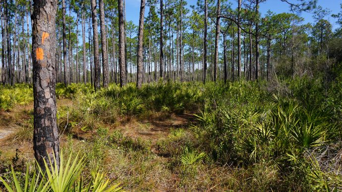 Florida Trail, Sopchoppy 8.9 miles. Slipping through pine flatwoods and sandhills to the east of Sopchoppy, the Florida Trail plays tag with a network of forest roads that criss-crosses the southern portion of the Apalachicola National Forest.
 Florida Trail, Sopchoppy River 4.1 miles. Following the gentle curves of the Sopchoppy River in the Apalachicola National Forest, this section of the Florida Trail is one of the most scenic hikes on the trail.
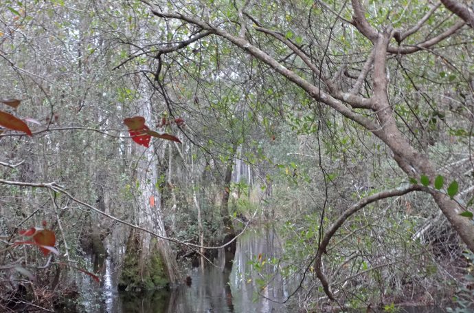 Florida Trail, Bradwell Bay 12.3 miles. You're guaranteed to get wet on Florida's roughest, wildest day hike. Situated south of Tallahassee, the Bradwell Bay Wilderness is one of the most majestic and wild places in Northwest Florida.
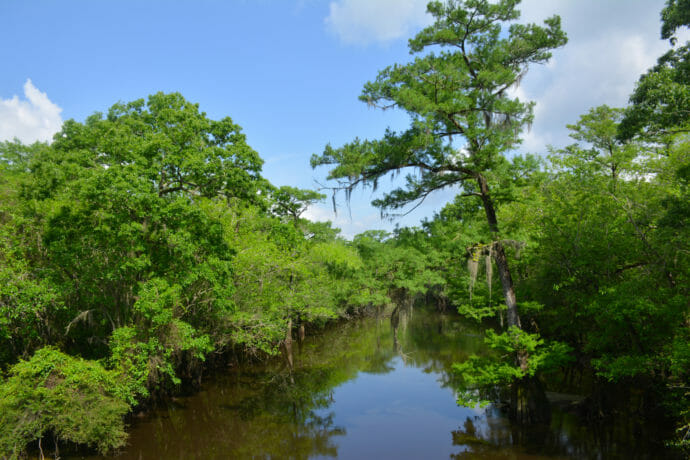 Florida Trail, Bradwell West to Porter Lake 6.8 miles. A connective piece of the Florida Trail centered on the Langston House trailhead, this stretch of trail marries wet flatwoods with roadwalking as it crosses the Ochlockonee River.
 Florida Trail, Porter Lake to Jewel 4.6 miles. A deep immersion in pine flatwoods and titi swamps awaits along this segment of the Florida Trail, which uses many old forest roads to cross tributaries draining into the Ochlockonee River.
 Florida Trail, Jewel to Vilas 14.3 miles. Delving deep into the swampy heart of the Apalachicola National Forest, this section spans some of the gnarliest titi and gum swamps you'll see outside of Bradwell Bay.
 Florida Trail, Vilas to Camel Lake 10.3 miles. Broadening your perspective on Florida's largest national forest, this hike offers an ever-shifting focus from macro to landscape amid habitat diversity in the Apalachicola National Forest.
 Florida Trail, Camel Lake to Savannahs 5.3 miles. Wet feet are expected on this traverse of the pine savannas along the edges of Johnson Juniper Swamp in the Apalachicola National Forest.
 Florida Trail, Bristol Roadwalk 11.2 miles. One of the narrowest high-speed highways that the Florida Trail follows, CR 12 into Bristol connects the Apalachicola National Forest with the Apalachicola River.
Side Trails
Trails that interconnect with and sometimes share a portion of the Florida Trail route.
 Trail of Lakes Using a portion of the Florida Trail to make a loop, the 9.5 mile Trail of Lakes circles wildflower-filled pine flatwoods, sandhills, and titi swamps, connecting two backpacker campsites near Camel Lake.
 Camel Lake Loop Explore robust sandhill habitats on a short loop hike around cypress-lined Camel Pond at Camel Lake Recreation Area in the Apalachicola National Forest.
Public Lands
Public lands this section of the Florida Trail crosses.
 Apalachicola National Forest Noted for its botanical beauty, the Apalachicola National Forest is the largest National Forest in Florida, sweeping south and west of Tallahassee.
Connections
These sections of the Florida Trail adjoin Apalachicola to its south and north.
 Florida Trail, Big Bend Crossing rural farms and forests, this 116 mile segment of the Florida Trail reveals the secrets of the Aucilla River before tracing the Gulf coastline at St. Marks National Wildlife Refuge.
 Florida Trail, Central Panhandle West of the Apalachicola River, 99 miles of the Florida Trail stitches a series of public lands together along the corridor of the Northwest Florida Greenway.
Suggested Articles
 Plan your Florida Trail Hike Thinking of section hiking, thru-hiking, or simply backpacking the Florida Trail? Plan ahead with this step-by-step guide of what to do in advance of hiking the Florida Trail.
 Florida Trail Backpacking Backpackers will appreciate the many places the Florida Trail provides a pleasant overnight, three-day-weekend, or multi-day hiking experience to escape to the outdoors.
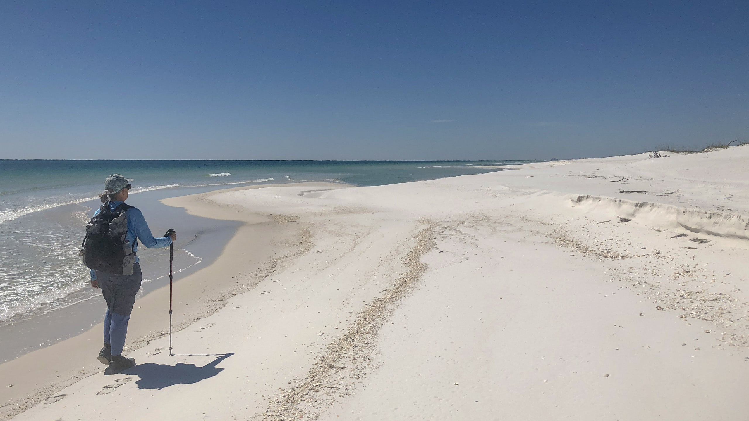 Section Hiking the Florida Trail Section hiking the Florida National Scenic Trail provides some logistical challenges, but a sense of satisfaction in being able to complete an 1,100-mile walk across Florida at your own pace.
 Thru Hike the Florida Trail A thru-hike in Florida takes sixty to ninety days across a surprising diversity of landscapes not found on other long distance trails in the United States.
 Best Hikes on the Florida Trail Explore our picks for the best scenic hikes along the Florida Trail. We've hiked the entire trail: these are pieces of the trail we'd be happy to hike again and again.
Recent Articles
 National Forests in Florida Implement New Fees (7/24/2019) Effective July 26, 2019, fees go up at many National Forest campgrounds, boat ramps, and recreation areas
 Head out on a Florida Trail adventure (1/24/2011) Take an armchair journey up the Florida Trail by reading my feature article starting on page 17 of the Winter / Spring 2011 issue of the official magazine of the National Forest Foundation.

- Hal Scott Yellow Trail - November 3, 2026
- Hal Scott Preserve - October 28, 2026
- Tradewinds Park - October 27, 2026