• Skip to main content
  • Skip to header right navigation
  • Skip to after header navigation
  • Skip to site footer
Florida Hikes logo

Florida Hikes

Hike Bike Paddle Camp Florida with authors Sandra Friend and John Keatley as your guides

  • Trails
  • Maps
  • Guidebooks
  • Hike
    • Scenic Hikes
    • Loop Trails
    • Dog-friendly Hikes
    • Hikes for Kids
    • National Parks in Florida
    • Florida State Parks
  • Bike
    • Major Bike Trails
    • Paved Bike Trails
    • Off Road Biking
    • Biking Articles
  • Paddle
    • Canoe & Kayak Rentals
    • Paddling Destinations
    • Paddling Articles
  • Camp
    • Cabin Rentals
    • Car Camping
    • Primitive Camping
  • Florida Trail
    • Plan your Hike
    • Best Scenic Hikes
    • Best Backpacking
    • Section Hiking
    • Thru-Hiking
    • Trail Updates
  • Travel
Rounded spring surrounded by forest

Florida Trail, Shepherd Spring

Visit a pair of natural treasures along the Forgotten Coast on this 6 mile hike along the Florida Trail within St. Marks National Wildlife Refuge.

Florida Trail, St. Marks West (30.145603, -84.254211)   6.0 miles   Florida Trail, Big Bend

Hugging swamps and marshes en route to two showy natural features, this is the most popular Florida Trail segment in the refuge.

It ties together an easy stroll on forest roads and uplands footpaths with a tough traverse of the Cathedral of Palms.

A hiker staring up within a forest of ancient cabbage palm trunks The Cathedral of Palms


It’s a muddy but spectacular coastal palm hammock along the edge of a massive estuary.

Beyond it is Shepherd Spring, a looking glass of clear water surrounded by a floodplain forest.

Deep spring surrounded by trees Shepherd Spring


The second half of the hike dances along the edge of the coastal floodplain, largely in a forest of ancient pines and magnolias.

A shift to sandhills and pine flatwoods occurs within the final mile, with one last swamp to cross along a causeway.

Swamp with culvert pouring water Culvert on the causeway


We describe the linear segment between trailheads, but the hike can be tackled several other ways.

From Wakulla Beach trailhead to Shepherd Spring, the round trip is 7 miles. From Spring Creek trailhead into the heart of the Cathedral of Palms, 5.4 miles.

A forest road connector shown in blue on our map also enables a lollipop loop from either trailhead.

Forest road with people in distance in tunnel of trees Blue-blazed route


Our Florida Trail Books & Guides

Florida Trail Hikes book cover The Florida Trail Guide book cover Florida Trail history book Florida Trail small coffee table book
 
Disclosure: As authors and affiliates, we receive earnings when you buy through our links. This helps us provide public information on this website.


Overview

Location: Crawfordville
Length: 6.0 miles
Trailhead: 30.145603, -84.254211
Address: 282 Wakulla Beach Rd, Crawfordville
Fees: Free
Restrooms: None
Land manager: St. Marks National Wildlife Refuge
Phone: 850-925-6121

Open sunrise to sunset. Trailheads have limited parking. Bicycles permitted on forest roads but not on the footpath.

Leashed dogs welcome, although it is dangerous due to the presence of alligators. Expect mosquitoes and wet, muddy shoes. Use a hiking stick for balance in mud.

Arrange camping at Wakulla Field in advance by permit with St. Marks NWR if you are backpacking the entire refuge.


Directions


Both trailheads are just south of US 98. For the starting point of this hike, head east from the intersection of US 319 and US 98 in Medart for 8.7 miles to Wakulla Beach Rd, which comes up quickly on the right at a curve after you pass Obediah Triplett Rd. Follow Wakulla Beach Rd south for 1 mile to the small trailhead on the right, next to a large kiosk. Do not block the gate.
 
For the terminus of this hike, go east on US 98 from the US 319 / US 98 intersection in Medart for 4.9 miles to Spring Creek Hwy. Turn left. Continue south 1.4 miles to the trailhead on the left.

Hike

Rounding the trailhead gate, start down a forest road due west, its causeway flanked on both sides by a vast cypress swamp.

Scan fallen logs for resting alligators. Sunlight dapples through a canopy of towering trees.

Alligator on a log in dark swamp Alligator in a trailside cypress swamp


Beyond a sign-swallowing tree, emerge into brighter light briefly where a tree farm lies north of the refuge boundary fence.

The tunnel effect resumes, enveloping the trail along a straightaway to a distant horizon within the forest.

Road tunneling through forest Tunnel effect


A sheen of tannic water sometimes overtops the trail and flows across it at 1.2 miles.

Cypresses stand as silent sentinels, their reflections captured across the watery expanse.

Ground level view of water flowing out of a swamp Shallow swamp seeping into the trail


Within less than a half mile, a stream flows between swamps on either side of the road. It may be narrow enough to hop or require a wade.

At 2.3 miles, reach the junction where the orange blazes turn south. Blue blazes continue forward, marking the high water route. Turn left.

Forest road in tunnel of forest with people in distance Nearing the junction


Enter a mixed hardwood forest, the trail making its way towards the coastline. Cross over two streams in the next half mile, each flowing through a culvert underfoot.

The surroundings tend to be damp, and get damper as the cabbage palms grow denser. Welcome to the Cathedral of Palms.

Dense palm hammock Entering the Cathedral


Interspersed amidst the palms, towering pines and spreading live oaks add to the grandeur of this palm hammock.

Catch brief glimpses of the coastal estuary to the east before the footpath burrows deep into the heart of this maze of palm trunks around 3.2 miles.

Many palm trunks close together A maze of palms


Footing gets sloppier as the palms thin, the understory turning greener. Bluestem palms poke up from the leaf litter.

Standing water in the low spots—the footpath—makes for boot-sucking mud at times. A hiking stick is a must through this section.

Muddy footpath amid bright green understory Sloppy going


Emerge from the palm hammock, crossing a forest road at 3.6 miles. Plunge back into the woods briefly before coming to a trail junction.

Face a bench carved as a set of directional signs: “Trail” to the right and “Spring” to the left. Turn left to visit Shepherd Spring.

Bench with arrows and words carved into them Shepherd Spring junction


The round-trip on this blue-blaze is a tenth of a mile. Starting out as a duff-covered footpath, it joins a boardwalk to approach the spring.

An observation deck with bench marks trail’s end at this natural pool deep within the forest, 25 feet deep.

Spring as seen from observation deck Shepherd Spring


Locals recommend against swimming, as a large alligator calls the spring home. Schools of mullet swirl in the depths.

Saltwater intrusion used to be normal at high tide but now is reality along this coastline. We no longer recommend it as a water source for backpackers.

Boardwalk through puzzle of trees Boardwalk leaving the spring


Return to the bench at the trail junction. For a round-trip back to your start point, make a right. Otherwise, continue straight ahead.

A thicket of native bamboo crowds the footpath, swarming the understory of a forest of pines and oaks. Pass longleaf pines of significant girth and height.

Thick trunked pine next to footpath through low understory of bamboo Massive pine in the bamboo thicket


Emerging from a showy stand of Southern magnolia, reach a sign for Wakulla Field Campsite. The campsite is a large clearing with a couple of benches.

Continue through it along the edge of a clearcut growing back in before entering a more mature forest.

Wakulla Field Campsite sign with camp beyond Wakulla Field Campsite


Longleaf pines and Southern magnolia tower above. Cross a forest road to enter an oak hammock dominated by one mature oak’s crown spread.

Ascend into a healthy longleaf pine forest with a dense understory of saw palmetto. Meeting FR 210 at a T intersection at 4.9 miles, the footpath ends.

Oak with broad limbs with pine forest beyond Uphill under an oak


To loop back towards your starting point by taking the blue-blazed forest road route east, turn right.

To continue on to the Spring Creek Trailhead, make a left, joining the forest road southwest through a pleasant stand of longleaf pines.

Forest road Longleaf pines


Descend to a causeway. As it levels out, the trail is flanked by swamp forest, with pools and ponds of water trailside and a culvert beneath the forest road.

Rising back into the pine forest, come to a Y intersection with FR 206 at 5.5 miles. Keep right.

Causeway with forest road surrounded by swamp Causeway


In a clearing at an intersection of forest roads, the orange blazes continue straight ahead, headed towards the Porter Tract and Spring Creek.

To exit this segment of the Florida Trail, turn right. Follow the blue blazes through the sandhills. Passing a sheltered kiosk, reach Spring Creek Trailhead at 6 miles.

Sheltered kiosk with bench Sheltered kiosk at Spring Creek Trailhead


FLORIDA TRAIL NORTHBOUND: Porter Tract
FLORIDA TRAIL SOUTHBOUND: Wakulla River

Suggested Articles

Planning tools for the Florida Trail Plan your Florida Trail Hike Thinking of section hiking, thru-hiking, or simply backpacking the Florida Trail? Plan ahead with this step-by-step guide of what to do in advance of hiking the Florida Trail.
Hiking trail with backpack in foreground Florida Trail Backpacking Backpackers will appreciate the many places the Florida Trail provides a pleasant overnight, three-day-weekend, or multi-day hiking experience to escape to the outdoors.
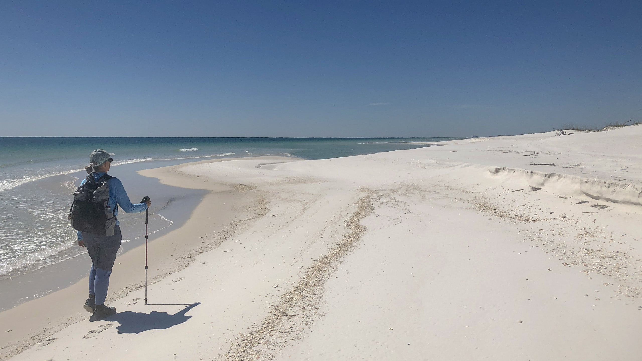
Woman with daypack walking along ocean Section Hiking the Florida Trail Section hiking the Florida National Scenic Trail provides some logistical challenges, but a sense of satisfaction in being able to complete an 1,100-mile walk across Florida at your own pace.
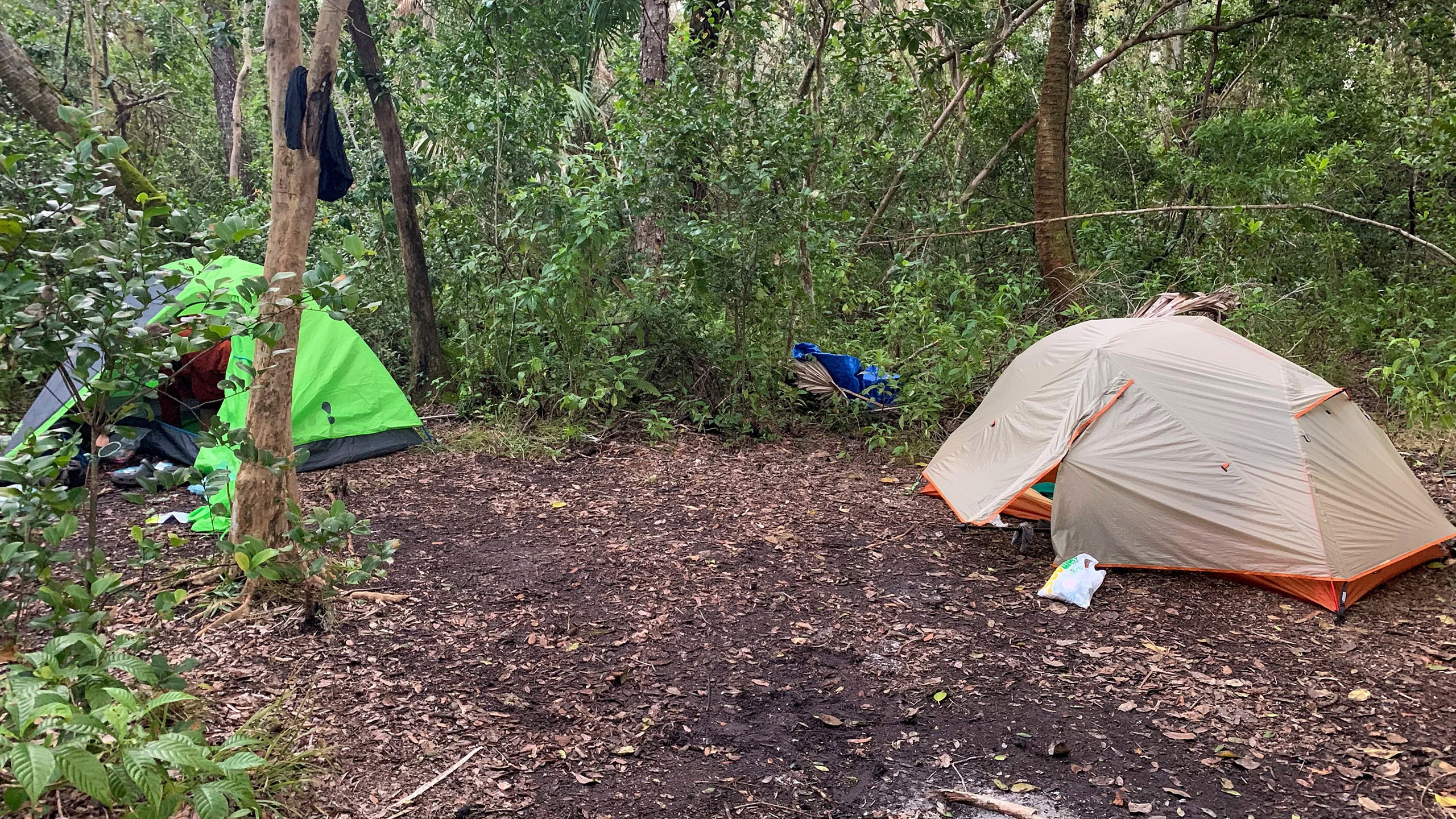
Tents pitched in a clearing in a tropical forest Thru Hike the Florida Trail A thru-hike in Florida takes sixty to ninety days across a surprising diversity of landscapes not found on other long distance trails in the United States.

Trail Map
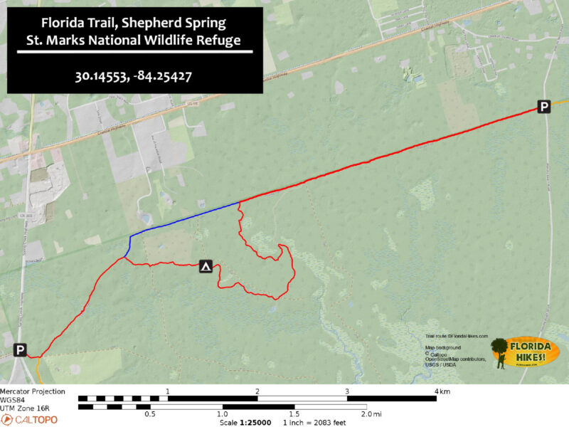
Florida Trail Shepherd Spring Trail Map
Red: route described. Blue: high water route. Orange: Florida Trail northbound/southbound

Explore More!

Learn more about the Big Bend section of the Florida Trail

Words Florida Trail Big Bend over a lush marsh lined with palms and cypress on horizon Florida Trail, Big Bend Crossing rural farms and forests, this 116 mile segment of the Florida Trail reveals the secrets of the Aucilla River before tracing the Gulf coastline at St. Marks National Wildlife Refuge.

Learn more about St. Marks National Wildlife Refuge

Lighthouse with palm trees and white sand beach on marsh St. Marks National Wildlife Refuge Stretching across 86,000 acres in Florida's Big Bend, St. Marks National Wildlife Refuge protects one of Florida's longest wild shorelines, more than 43 miles in three counties.


Slideshow

See our photos from this Florida Trail hike


Nearby Adventures

St Marks NWR Forest Road 200 St. Marks Coastal Loop Using the Tallahassee-St Marks Trail, the Coastal Trail, and the Florida Trail, ride a scenic 22-mile loop between the St. Marks and Wakulla River floodplains along the Big Bend.
Estuary with skinny cabbage palms Florida Trail, Spring Creek Discover magnificent salt marshes and pine forests where the Florida Trail traverses wild coastlines of the Big Bend in St. Marks National Wildlife Refuge.
Florida Trail, Sopchoppy Florida Trail, Sopchoppy 8.9 miles. Slipping through pine flatwoods and sandhills to the east of Sopchoppy, the Florida Trail plays tag with a network of forest roads that criss-crosses the southern portion of the Apalachicola National Forest.
Trail corridor through longleaf pine forest Tallahassee-St. Marks Trail Following the route of the first railroad chartered in Florida, this 16 mile paved trail from Tallahassee to the St. Marks River is one of Florida's oldest rail trails.

Trail Map (PDF) Interactive App Hunt Dates (PDF) Official Website

  • Author
  • Recent Posts
Sandra Friend
Sandra Friend
Author of 45 books, Sandra Friend established FloridaHikes.com in 2006 to expand on the field research she'd completed for her first six hiking guides. She has been honored with lifetime achievement awards from the Florida Trail Association and the Florida Outdoor Writers Association.
Sandra Friend
Latest posts by Sandra Friend (see all)
  • Michael Crotty Bicentennial Park - November 3, 2026
  • A.J. Henry Park - November 1, 2026
  • Okeeheelee Nature Center Trails - October 22, 2026
Category: Backpacking, Day Hikes, Florida Trail, Hikes, Loop Hikes, Northwest Florida, TrailsTag: Big Bend, Big Bend Scenic Byway, Crawfordville, Dog-friendly, Family-Friendly, Favorites, Florida Trail, FT Big Bend, FT St Marks West, National Wildlife Refuges, Sopchoppy, St. Marks, St. Marks National Wildlife Refuge

Sidebar

FarOut Guides

Our comprehensive trail logistics presented on offline maps:

Florida National Scenic Trail (1,500 miles)
Florida Keys Overseas Heritage Trail (108 miles)
Eastern Continental Trail in Florida (92 miles)


We earn a small commission on sales through these links. Thanks for your support!


Our Florida Guidebooks

We’ve written guidebooks to Florida’s outdoors for over twenty years. These help you plan a hike on the Florida Trail.


The Florida Trail Guide

Book cover of forest with diminutive hiker among tall trees

FIND A TRAIL OR PARK

METROS: Bradenton. Clearwater. Crestview. Daytona Beach. Destin. Fort Lauderdale. Fort Myers. Fort Walton Beach. Gainesville. Jacksonville. Kissimmee. Lakeland. Melbourne. Miami. Naples. Ocala. Orlando. Panama City Beach. Pensacola. Port St. Lucie. Punta Gorda. St. Petersburg. Sanford. Sarasota. Sebring. Stuart. Tallahassee. Tampa. Vero Beach. West Palm Beach.

MULTI-REGION: Atlantic Coastal Ridge. Atlantic Coast. Bartram Trail. Big Bend. East Coast Greenway. Everglades National Park. Florida National Scenic Trail. Gulf Coast. Lake Wales Ridge. WATERWAYS: Indian River Lagoon. Intracoastal Waterway. Kissimmee River. St. Johns River. Withlacoochee River.

NORTHWEST FLORIDA: Altha. Apalachicola. Apalachicola National Forest. Big Bend Scenic Byway. Blackwater River State Forest. Blountstown. Bonifay. Bristol. Bruce. Cantonment. Cape San Blas. Carrabelle. Chattahoochee. Chipley. Crawfordville. DeFuniak Springs. Eastpoint. Ebro. Eglin Air Force Base. Freeport. Fountain. Gulf Breeze. Gulf Islands National Seashore. Holt. Madison. Marianna. Milton. Monticello. Mossy Head. Munson. Navarre. Navarre Beach. Newport. Niceville. Panacea. Panama City . Perdido Key. Ponce De Leon. Port St. Joe. Quincy. Santa Rosa Beach. Sopchoppy. South Walton. St. George Island. St. Marks. St. Marks NWR. Sumatra. Vernon. Wakulla. Wewahitchka. Woodville. WATERWAYS: Apalachicola River. Blackwater Bay. Blackwater River. Chipola River. Choctawhatchee Bay. Choctawhatchee River. Coastal Dune Lakes. Ochlockonee Bay. Perdido River. St. Marks River. Wacissa River. Wakulla River. Yellow River.

NORTH FLORIDA: Alachua. Amelia Island. Archer. Baldwin. Branford. Bronson. Bunnell. Callahan. Cedar Key. Chiefland. Crescent City. Cross City. Cross Creek. Dowling Park. Ellaville. Fanning Springs. Fernandina Beach. Flagler Beach. Fort White. Glen St. Mary. Green Cove Springs. Hawthorne. High Springs. Inglis. Jacksonville Beaches. Jacksonville Northshore. Jasper. Jennings. Keystone Heights. Lake Butler. Lake City. Live Oak.Macclenny. Mandarin. Mayo. Mayport. Micanopy. Middleburg. Old Town. Olustee. Orange Park. Osceola National Forest. Palatka. Palatka-Lake Butler Trail. Palm Coast. Palm Valley. Perry. Ponte Vedra. Rodman. Salt Springs. St. Augustine. Starke. Steinhatchee. Suwannee. Suwannee River Wilderness Trail. Suwannee Springs. Talbot Islands. Timucuan Preserve. Trenton. Waldo. Welaka. White Springs. Williston. Worthington Springs. Yankeetown. WATERWAYS: Santa Fe River. St. Marys River. Suwannee River. Tolomato River. Upper Withlacoochee River.

CENTRAL FLORIDA: Altamonte Springs. Apollo Beach. Apopka. Astatula. Astor. Auburndale. Bartow. Babson Park. Bayport. Belleview. Bithlo. Brandon. Brooksville. Bushnell. Canaveral National Seashore. Cassadaga. Christmas. Chuluota. Citrus Springs. Clearwater Beach. Clermont. Coast to Coast Trail. Cocoa. Cocoa Beach. Cross Florida Greenway. Crystal River. Dade City. De Leon Springs. DeBary. Deland. Deltona. Dunedin. Dunnellon. Edgewater. Enterprise. Eustis. Ferndale. Fort Meade. Frostproof. Geneva. Gibsonton. Haines City. Hernando. Hernando Beach. Holopaw. Homosassa. Inverness. Kenansville. Kissimmee. Lake Mary. Lake Wales. Largo. Leesburg. Lithia. Longwood. Lutz. Maitland. Malabar. McIntosh. Melbourne Beach. Merritt Island. Merritt Island NWR. Mims. Mount Dora. Narcoossee/Lake Nona. New Port Richey. New Smyrna Beach. Nobleton. Oak Hill. Oakland. Ocala National Forest. Ocklawaha. Ocoee. Oldsmar. Orange City. Ormond Beach. Osteen. Oviedo. Paisley. Palm Bay. Plant City. Poinciana. Polk City. Ponce Inlet. Port Orange. Ridge Manor. Riverview. Ruskin. Safety Harbor. Silver Springs. Sorrento. Spring Hill. St. Cloud. Tarpon Springs. Thonotosassa. Titusville . Umatilla. Viera. Walt Disney World. Weeki Wachee. Weirsdale. Wimauma. Windermere. Winter Garden. Winter Haven. Winter Park. Winter Springs. Withlacoochee State Forest. Withlacoochee State Trail. Yeehaw Junction. Zephyrhills. WATERWAYS: Alafia River. Halifax River. Hillsborough River. Lake Apopka. Little Manatee River. Ochlawaha River. Rainbow River. Tampa Bay. Wekiva River. Wekiva River Basin.

SOUTHWEST FLORIDA: Alva. Boca Grande. Cape Coral. Charlotte Harbor. Ding Darling NWR. Ellenton. Englewood. Estero. Immokalee. Marco Island. North Port. Osprey. Palma Sola. Palmetto. Pine Island. Port Charlotte. Sanibel Island. Venice. WATERWAYS: Caloosahatchee River. Manatee River. Myakka River. Pine Island Sound.

SOUTH FLORIDA: Arcadia. Basinger. Big Cypress National Preserve. Big Cypress Seminole Reservation. Big Cypress Swamp. Bowling Green. Clewiston. Everglades City. Indiantown. LaBelle. Lake Okeechobee Scenic Trail. Lake Placid. Lakeport. Moore Haven. Okeechobee. Ortona. Pahokee. Palmdale. Port Mayaca. South Bay. Wauchula. Zolfo Springs. WATERWAYS: Fisheating Creek. Lake Okeechobee. Peace River.

SOUTHEAST FLORIDA: Biscayne Bay. Biscayne National Park. Boca Raton. Boynton Beach. Coconut Creek. Coral Gables. Coral Springs. Davie. Delray Beach. Fellsmere. Flamingo. Fort Pierce. Hobe Sound. Hollywood. Homestead. Indrio. Jensen Beach. Juno Beach. Jupiter. Jupiter Farms. Key Biscayne. North Hutchison Island. Ocean to Lake Greenway. Palm Beach. Palm Beach Gardens. Pompano Beach. Redland. Sebastian. South Hutchinson Island. WATERWAYS: Florida Bay. St. Lucie River.

FLORIDA KEYS: Big Pine Key. Islamorada. Key Largo. Key West. Marathon. Overseas Heritage Trail.


©2006-2026, Sandra Friend & John Keatley | Disclosure | Site Index | Work with Us | Advertise with Us | Terms of Service and Privacy Policy

Florida Hikes PO Box 93 Mims FL 32754 | Contact