
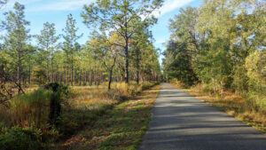
Extending south from the edge of Tallahassee to the St. Marks River, this linear rail-trail follows one of Florida’s original railroad routes.
Fully paved, it’s been in place long enough that residents often pause and wave cyclists through road crossings, something less common in other parts of Florida.
 Southern terminus in St. Marks
We became familiar with it from its south end first, both on rides and walking.
Between the St. Marks River and a trailhead north of US 98, the Florida Trail shares its route.
With connectors in place to bike paths along Capital Circle and into downtown Tallahassee to Cascades Park, more residents bike southbound than northbound.
We present that as the linear direction of travel below, from Capital Circle Trailhead to St. Marks, as well as suggested segments for short family rides and hikes.
 Capital Circle Trailhead
Resources



Disclosure: As authors and affiliates, we receive earnings when you buy through our links. This helps us provide public information on this website.
Overview
Location: Tallahassee to St. Marks
Length: 16 miles linear
Trailhead: 30.3712, -84.2684
Address: 4778 Woodville Hwy, Tallahassee
Fees: Free
Restroom: At most trailheads
Land manager: Florida State Parks
Phone: 850-487-7989
Open 8 AM to sunset. Leashed dogs welcome.
About the Trail
In the 1830s, plantation owners in Tallahassee wanted an easier way to export their goods to the coast than by wagon, Richard Keith Call among them.
Owner of the Orchard Pond and Lake Jackson plantations, Call became president and chief stockholder of the Tallahassee Railroad Company, created by the legislative council of the Florida Territory in 1834.
The following year, he was appointed Florida’s territorial governor. It took another couple of years to lay tracks and source rolling stock.
 Old trackage preserved at Capital Circle Station
Mules drew railroad cars laden with cotton bales south until a steam locomotive took over in 1839.
Period maps show the northern terminus of the railroad north of the St. Augustine-Pensacola Road (now US 90, downtown).
The route ran roughly 23 miles, ending at a wharf in Port Leon, where the cotton could be transferred to ships in the Wakulla River.
 Where the railroad once crossed the St. Marks River to Port Leon
Founded in 1838, Port Leon became the county seat for newly formed Wakulla County. But its bright future washed away in 1843.
A hurricane-driven storm surge pushed ten feet of water into the streets. Survivors moved inland to establish the village of Newport.
 The Wakulla River at Port Leon
The line remained in service, terminating in St. Marks. As with most railroads, it underwent many changes of ownership over nearly a century and a half.
In 1983, Seaboard Air Line wished to abandon the line. The state purchased the right-of-way, making it possible to establish a state trail within the 16 mile corridor traversed today.
 A segment buffered by forest north of Wakulla Station
Trailheads
North to South:
Capital Circle Trailhead, 4778 Woodville Hwy, Tallahassee
J. Lewis Hall Sr. Woodville Park, 1492 J Lewis Hall Sr Ln, Tallahassee
Wakulla Station Trailhead, 1362 Old Woodville Rd, Crawfordville
Coastal Trail Trailhead, 7125 US 98, St. Marks
St. Marks Trailhead, 59 Riverside Dr, St. Marks
Trail Details
Starting south from Capital Circle Trailhead, ride under the shade of an oak canopy south. Cross Marpan Ln, the first of two roads entering a commercial area.
The second road, for Marpan Recycling, has truck crossing warning signs at a mile. Large trucks cross here frequently.
 Capital Circle Trailhead
South of this commercial zone, enjoy a long stretch within the Munson Hills of Apalachicola National Forest amid tall pines and oaks.
An entry point to the Munson Hills Trail System, an extensive series of singletrack loops through the sandhills, starts at a trailside kiosk at 1.6 miles.
 Munson Hills Trail System entryway
A break in the forest for a utility easement reveals adjacent Woodville Hwy (SR 363) immediately east of this railroad corridor. Pass a covered bench soon after.
Within another half mile, exit the protection of the national forest and enter the outskirts of Woodville. Old Woodville Rd now parallels the trail.
 Utility easement
Crossing Backforest Rd, skim along the edge of the ballfields and parking area for J. Lewis Hall Sr. Woodville Park, a useful trailhead for riding north through the national forest.
At 2.8 miles, the entrance to the park is to the west, leading to parking and restrooms. Continue south, diverging from Old Woodville Rd to go behind the Woodville Public Library.
 Main entrance for J. Lewis Hall Sr. Woodville Park
Pass the entrance to Galilee AME Church at Lutterloh Rd before another wooded stretch with residences. At 3.9 miles, cross Oak Ridge Rd on a crosswalk.
A bench adjoins the trail, with a vault toilet just beyond it. Old Woodville Rd draws up right next to bike path soon after.
 Looking north towards Oak Ridge Rd
Enter the residential heart of Woodville. The neighborhood has larger lots with trees affording some dappled shade. No driveways bisect the trail.
Just past Natural Bridge Rd to the east, which leads across Woodville Hwy to Natural Bridge State Park, glide by the Woodville United Methodist Church.
 Northbound through Woodville
Reach Canyon Creek Rd at 4.9 miles. Infrequent driveways cross the path. Surroundings become rural residential, with horse paddocks and chickens.
Homes become infrequent. A pleasant stretch adjoined by forest follows, with another bench and vault toilet soon after Bob Miller Rd.
 Northbound on the forested corridor
Just south of Ace High Stables Rd, a large County Line sign at 7.2 miles marks where Leon County ends and Wakulla County begins.
Cross Dogwood Forest Rd soon after, with two more roads over the next half mile. Enter another rural residential community, this one the outskirts of Wakulla.
 County line
Trees create a tunnel effect for a brief stretch. Cross Springwood Blvd, reaching the Wakulla Station Trailhead soon after at 9.3 miles.
We found it a pleasant start point for a round-trip north. Not quite a mile south is the first truly busy road crossing of the ride.
Use the crosswalk at Old Woodville Rd and then the one over busy SR 267 (Bloxham Cutoff Rd) at Wakulla.
Savannahs Country Buffet (recommended!) and a Dollar General Market lie immediately east.
South of SR 267, enter a wooded corridor that isn’t right next to a road. It’s a delight.
 Wakulla Station Trailhead
A bench comes before unpaved Acorn Trail at 11 miles. Within the next mile, the trail draws close to a power line easement but a buffer of trees remains.
South of paved Kinsey Rd, skim closer to the easement, the greenway narrowing considerably as it approaches US 98.
At 13.3 miles, the Coastal Trail meets this trail at a T intersection with a vault toilet and parking area. The statewide Florida Trail also joins in southbound.
Use caution crossing US 98, as its high speed traffic rarely stops for anyone in the crosswalk.
 US 98 crossing
Cross a utility easement before curving through a floodplain forest past a covered bench. Resume a straightaway paralleling Port Leon Dr into St. Marks.
At 14.5 miles, a side path just past a bench beckons with a sign pointing out the Village of St. Marks, a small shopping plaza.
 Straightaway
Curving east, straighten out southbound, passing a bench. A thin screen of trees separates the path from a power line easement.
Cross Fire Escape Rd at the north edge of town. A half mile later is the final privy along the bike path, on the edge of a power line crossing.
 Bench after curve
Enter the residential portion of St. Marks, crossing Shell Island Rd at 15.5 miles. Paralleled by Ladd Dr, the trail is crossed by it near the water tower.
At 16 miles, emerge under the archway at the southern terminus of the Tallahassee-St. Marks Historic Railroad State Trail.
 Trail’s end in St. Marks
To the left is the main parking area for St. Marks, adjoining historic Bo-Lynn’s Grocery. Across the road, the Florida Trail continues across the St. Marks River.
Making a right, follow the road to another path on the left, leading to a boardwalk into St. Marks River Park.
That path ends at a boat ramp across from San Marcos De Apalache Historic State Park. A round trip to that park’s entrance from trail’s end is 0.8 miles.
 St. Marks River Park
Mileage
0.0 Capital Circle Trailhead
0.8 Marpan Ln
1.6 Munson Hills Trail System entrance
2.6 Back Forest Rd
2.8 J Lewis Hall Sr Woodville Park
3.2 Woodville Branch Library
3.9 Oak Ridge Rd
4.1 Page Rd
4.4 Elgin Rd
4.5 Church St
4.9 Canyon Creek Rd
5.7 Bob Miller Rd
7.1 Ace High Stables Rd
7.5 Dogwood Forest Rd
7.7 Summerwind Circle Dr
7.9 Laurel Ln
9.0 Springwood Blvd
9.3 Wakulla Station Trailhead
10.2 SR 267 (Bloxham Cutoff Rd)
11.1 Acorn Trail
12.3 Kinsey Rd
13.3 Coastal Trail Trailhead
13.4 US 98
14.5 Village of St. Marks
14.8 Fire Escape Rd
15.5 Shell Island Rd
16.0 St. Marks River Trailhead
Recommended Segments
St. Marks River to US 98
Popular with locals and visitors alike, this easy 5.2 mile round-trip starts at the southern terminus and leads through historic St. Marks, with interpretive information at several stops.
North of the community, the path skims past bayheads and marshes where wildlife can be spotted. Road crossings are minimal. There’s a vault toilet and benches along the stretch.
 Entering St. Marks southbound
J Lewis Hall Woodville Park to Tallahassee
This pleasant 5.6 mile round-trip minimizes road crossings and maximizes beauty, since the bulk of it adjoins the Apalachicola National Forest.
Punctuated by tall longleaf pines, the sandhills sweep off to the western horizon. Benches provide places to take a break, including at the junction for the Munson Hills Trail System.
 Apalachicola National Forest
Connections
Coastal Trail
A 23 mile linear paved path paralleling US 98, the Coastal Trail connects the Tallahassee-St. Marks Trail to the Ochlockonee Bay Trail.
For riders who can handle a little off-road, a scenic loop shows off a nice slice of St. Marks National Wildlife Refuge using both trails and refuge forest roads.
 St. Marks Coastal Loop Using the Tallahassee-St Marks Trail, the Coastal Trail, and the Florida Trail, ride a scenic 22-mile loop between the St. Marks and Wakulla River floodplains along the Big Bend.
 The Coastal Trail parallels US 98 west
Florida Trail, Port Leon
To start this hike, it takes a crossing by boat (call Shields Marina or Shell Point Marina) where the railroad trestle bridge was removed across the St. Marks River.
On the opposite side, within St. Marks National Wildlife Refuge, the Florida Trail follows the railroad causeway which once terminated at the town of Port Leon.
 On the narrow railroad causeway
At a T junction with a spur trail to the ghost town, the orange blazes head east via old Port Leon Rd, which continues to the refuge visitor center.
A linear walk from the shoreline of the St. Marks River to the visitor center is 4.8 miles. Add another mile round-trip to visit the site of Port Leon.
 Port Leon had direct access to the Gulf of Mexico at the mouth of the Wakulla River
Munson Hills Trail System
A favorite of Tallahassee mountain bikers, the longstanding complex of singletrack in the Munson Hills section of Apalachicola National Forest lies east of this trail.
A primary access point lies halfway between the Tallahassee terminus and Lewis Hall Park, with connectors to both trails making a large loop possible as well.
 Entering the Munson Hills Trail System
Trail Map

Explore More!
Slideshow
See our photos from the Tallahassee-St. Marks Trail
Nearby Adventures
 Natural Bridge Battlefield Historic State Park Memorials and reenactments keep alive the spirits of the soldiers who perished at Natural Bridge during one of the last and largest battles of the Civil War in Florida.
 Wakulla Springs State Park A 1930s resort turned nature park surrounding one of the world's largest springs, Wakulla Springs State Park is a step back in time with a historic waterfront lodge.
 San Marcos de Apalache Historic State Park With a historic timeline dating back five centuries, San Marcos de Apalache protects layers of history accumulated at the confluence of the Wakulla and St. Marks Rivers
 St. Marks National Wildlife Refuge Stretching across 86,000 acres in Florida's Big Bend, St. Marks National Wildlife Refuge protects one of Florida's longest wild shorelines, more than 43 miles in three counties.

- Hal Scott Yellow Trail - November 3, 2026
- Hal Scott Preserve - October 28, 2026
- Tradewinds Park - October 27, 2026