
Within the 4,000 acre expanse of Escribano Point WMA, Bayou Recreation Area sits on a bluff above a horseshoe curve of Fundy Bayou’s outflow to Blackwater Bay.
Formerly a camping area, it’s now day use only with picnic tables to enjoy the view and paths down the bluff for anglers to approach the water’s edge.
 Outflow of Fundy Bayou towards the bay
Starting at a kiosk along the edge of the parking area, the Fundy Bayou Trail is an easy loop of less than a mile into upland habitats above the bayou.
This well-marked excursion into scrub, sandhill, and pine flatwoods is a counterpoint to the bayou’s majestic flow below the bluff.
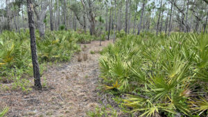
 Along the footpath
Resources





Disclosure: As authors and affiliates, we receive earnings when you buy through our links. This helps us provide public information on this website.
Overview
Length: 0.7 miles
Trailhead: 30.51015, -87.00323
Address: Choctaw Landing Rd, Milton
Fees: Free
Restroom: At the trailheads
Land Manager: Florida FWC
Phone: 850-488-6411
Open dawn to dusk. Leashed dogs welcome. No camping. Trails are multi-use. An Eglin Recreation Permit is not required to drive through the base to this WMA.
Check on scheduled hunting seasons in advance of your visit. Wear bright orange if you choose to hike during hunts.
Directions
From Interstate 10 exit 31 at Milton, follow SR 87 south for 9.2 miles. Inside Eglin Air Force Base, turn right onto Choctaw Field Rd, a paved road (Range Road 213). The pavement ends when the road reaches the airfield gate. Just before it, turn right to continue 4.2 miles on a graded clay road that first circles around the north edge of the airfield. Keep to the broader main road at any junction. Signage indicates you’ve entered the WMA. Continue straight ahead 0.2 mile to a split in the road. Veer left and continue 0.4 mile to the Bayou Recreation Area and trailhead on the left. Turn left and follow the road to where it ends at the parking area by the kiosk.
Hike
Beginning near a scenic sand bluff above Fundy Bayou, this is the shortest and driest of the hikes at the WMA.
Adjoining the vault toilet, the trailhead kiosk has several maps on it, the one in color most accurate.
 Trailhead kiosk with map
The start of the trail is marked by a yellow blaze on a pine and a hiker marker on a brown post. Enter a sand pine scrub, its understory dense with young oaks.
It was recently burned on our visit, but patches of high ground were topped with deer moss.
 Hiker markers supplement blazing in a few spots
Winding gently through this forest, transition into scrubby flatwoods.
Glimpse a distant grassy prairie beyond the pines when the footpath turns right to join a clay forest road.
The road weaves through sandhill habitat, sometimes called clayhill in this part of the state.
 Clay road
At a quarter mile, where the road is bolstered by gravel, turn left at the yellow blaze, the route confirmed by a brown post.
The broad footpath aims for the grassy prairie and skims the west edge of it within the pines.
Tiny mounds of rounded balled mud rise from the pine duff underfoot, the entrance to crayfish burrows.
 Path to the prairie
Circle saw palmetto and pass a Southern magnolia, following yellow blazes to the prairie’s grassy rim. Watch carefully for blazing.
Swinging left, the footpath ascends slightly within a corridor edged with saw palmetto.
 The prairie
Walk under a sand live oak before reaching a hiker marker with a clay road just ahead at a half mile.
The footpath resumes within the saw palmetto corridor on the other side of the road.
Curving in the direction of Fundy Bayou, it wends its way through the sandhills, meeting a sand road.
 In the sandhills
Following the directions on the marker posts, turn right onto this road, then left on a clay road.
You are now on the entrance road you drove in on to reach Bayou Recreation Area. Walk the road to the trailhead to complete a 0.7 mile loop.
 Sand road leading to entrance road
Trail Map

Explore More!
Learn more about Escribano Point WMA
 Escribano Point WMA Explore coastal habitats along the estuaries of Blackwater Bay at this remote wildlife management area with several miles of trails and a beach for paddlers to launch from.
Video
Hiking the Fundy Bayou Loop
Slideshow
See our photos from the Fundy Bayou Loop
Nearby Adventures
 Escribano Point Bayside Contrast scrubby uplands with the wild and sometimes wet shoreline of Blackwater Bay on this 2.4 mile hike to the point of Escribano Point WMA.
 Florida Trail, Weaver Creek 14.3 miles. Along the western side of Eglin Air Force Base, the Florida Trail traverses high, dry sandhills with some impressive views.
 Florida Trail, Seashore In addition to bike paths and the scenic UWF-SRIA Dunes Preserve, the 32-mile Seashore section of the Florida Trail walks you along a beach to the trail's Northern Terminus.
 Naval Live Oaks Area Spanning from Santa Rosa Sound to Pensacola Bay, Naval Live Oaks Area is one of America's oldest federally protected forests, now part of Gulf Islands National Seashore.

- Michael Crotty Bicentennial Park - November 3, 2026
- A.J. Henry Park - November 1, 2026
- Okeeheelee Nature Center Trails - October 22, 2026