
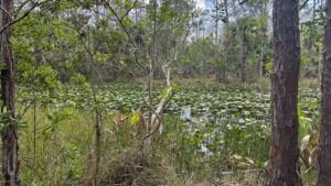
Circling the defining feature of the North Area, Gator Lake, the Eagle Trail at Grassy Waters Preserve tunnels through a tropical hammock atop a rocky and rooty causeway.
Along a route of under a mile are numerous scenic views across the wet prairies of Loxahatchee Slough and across the lake.
 Bridge along Gator Lake
The circuit has excellent observation stops for birding, including a fishing pier, a deck along a sawgrass prairie, and a lakeside boardwalk and bridge.
This is a low-lying trail with swamps, ditches, or open water on both sides, so keep very alert for alligators.
 Water sometimes hides at the base of the causeway
Resources





Disclosure: As authors and affiliates, we receive earnings when you buy these through our links. This helps us provide public information on this website.
Overview
Location: West Palm Beach
Length: 0.8 miles
Trailhead: 26.815086, -80.174231
Address: 8537 Northlake Blvd, West Palm Beach
Fees: Free
Restroom: At the trailhead
Land Manager: City of West Palm Beach
Phone: 561-804-4980
Open Mon-Sat 8 AM-4:30, Sun 8:30 AM-5 PM. No pets or bicycles. Insect repellent advised. Trails may be flooded.
Directions
From the Interstate 95 exit for Northlake Blvd, drive 4.5 miles northwest to the entrance on the north side of Northlake Blvd, a mile or so west of the Beeline Expressway. Or access from Florida’s Turnpike via PGA Boulevard west to Beeline south to Northlake Blvd west.
Hike
The Eagle Trail begins at the southeast corner of the parking area turnaround, across from the Hog Hammock Trail.
Follow a grassy swath past the launch area for the lake to the trailhead, where the trail begins as a low gravel-topped palm-lined causeway.
 Approaching the launch
It leads to a broad boardwalk to a fishing pier on Gator Lake with a roofed observation deck.
Returning to the causeway, note the cypress strand along the lake’s edge. A bike rack reminds riders that cyclists should dismount and walk.
 Observation deck on lake
Narrowing, the causeway twists and winds between the trunks of slash pines and cabbage palms through a thicket of hog plum.
Limestone and roots protrude from the footpath, making for tricky footing.
 Start of the causeway
Gaps between shrubs provide glimpses of the cypress strand to the west. At a quarter mile, a picnic table sits in a broad spot across from an observation deck.
Step up on the deck for a view across Loxahatchee Slough, a deeper channel in the overall grassy waters to the east.
 This deck is an intermediate destination
Continue along the causeway through the tropical hammock, crossing a boardwalk with a bend in it.
Pines define a ridge on the horizon. From the promontory of the trail, peek across a pond and wetlands to a pine island.
 Boardwalk
Catch more glimpses of open prairie between the trees. Rocks and roots bulge from this narrow sliver of high ground.
Losing elevation by 0.4 mile, drop to marsh level and make a sharp right. Given the number of alligator slides we counted up ahead, keep very alert.
 Adjoining a cattail marsh
Bay trees join the mix of slash pines and palms in this part of the forest, with hog plum ever-present.
The footpath tiptoes to the edge of a slough blanketed in large water lilies, pond apples growing along its edge.
 Slough
This man-made channel parallels the south side of the Eagle Trail for the remainder of the hike. Wild coffee spills out from under myrsine and wax myrtle lining the causeway.
At a half mile, cross a low boardwalk in the sawgrass, adjoined by the marshy southeast rim of Gator Lake.
 Marsh boardwalk
Scramble onto a narrow ridge for a view into the lily-covered slough. A narrow bridge with railings spans the flow.
Crossing between lake and slough, its aged boards groan under each footfall. The complex of buildings on the left is the FWC office for this region.
 Bridge past the FWC office
One last segment of sometimes-sticky causeway provides a nice panorama of the lake before the trail ends at a sign at the entrance road.
Turn right and walk along the road to return to the trailhead parking area, completing a 0.8 mile loop.
 Exit the trail to the entrance road
Trail Map

Explore More!
Learn more about Grassy Waters Preserve
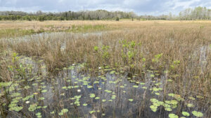 Grassy Waters Preserve Protecting a sheet flow of rainfall moving steadily southward and parallel to the Atlantic Ocean, Grassy Waters Preserve bears a striking resemblance to the Everglades - because it is.
Video
Hiking the Eagle Trail
Slideshow
See our photos of the Eagle Trail
Nearby Adventures
 Grassy Waters Hog Hammock Trail At the north end of Grassy Waters Preserve, traverse an Ice Age ridge protruding above the sheet flow of Loxahatchee Slough on a series of islands topped with tropical hammock.
 Florida Trail, Ocean to Lake: Corbett to Luckey Tract On this 12.1 miles of the Florida Trail between campsites at Corbett WMA and Luckey Hammock, discover the natural wonders of Hungryland Slough and Loxahatchee Slough.
 Loxahatchee Slough Natural Area Escape to a vast watery wilderness where you can hike, bike, or paddle through Northern Everglades habitats on the outskirts of residential Palm Beach County
 Sandhill Crane Access Park With an observation tower overlooking adjacent trails and an expanse of cypress swamp, Karen T. Marcus Sandhill Crane Access Park provides a gateway to adventure.

- Michael Crotty Bicentennial Park - November 3, 2026
- A.J. Henry Park - November 1, 2026
- Okeeheelee Nature Center Trails - October 22, 2026