• Skip to main content
  • Skip to header right navigation
  • Skip to after header navigation
  • Skip to site footer
Florida Hikes logo

Florida Hikes

Hike Bike Paddle Camp Florida with authors Sandra Friend and John Keatley as your guides

  • Trails
  • Maps
  • Guidebooks
  • Hike
    • Scenic Hikes
    • Loop Trails
    • Dog-friendly Hikes
    • Hikes for Kids
    • National Parks in Florida
    • Florida State Parks
  • Bike
    • Major Bike Trails
    • Paved Bike Trails
    • Off Road Biking
    • Biking Articles
  • Paddle
    • Canoe & Kayak Rentals
    • Paddling Destinations
    • Paddling Articles
  • Camp
    • Cabin Rentals
    • Car Camping
    • Primitive Camping
  • Florida Trail
    • Plan your Hike
    • Best Scenic Hikes
    • Best Backpacking
    • Section Hiking
    • Thru-Hiking
    • Trail Updates
  • Travel
Pathway into scrubby flatwoods

Italian Farms Trail

A round-trip through former tomato farms reclaimed by second-growth forest, this multi-use trail through Loxahatchee River Management Area leads to the Masten Dam.

Jupiter (26.93515, -80.16843)   3.6 miles   Loxahatchee River Management Area

Now a multi-use trail through Loxahatchee River Management Area, the original Italian Farms Trail was the earliest route of the Ocean to Lake Hiking Trail.

Running northbound from Riverbend Park to the Masten Dam on the Loxahatchee River, the trail had been planned to cross the waterway at this point.

Cypress lined waterway with kayak and take outTake out just above Masten Dam


Once a different route for the Ocean to Lake Hiking Trail was chosen, this trail was renamed for the road it largely follows.

A prominent sign and stile once greeted hikers after passing under Indiantown Rd. Now a more obvious route starting out on the old road leads to the dam.

Grassy path in open forest Walking through the historic Italian Farms section of Jupiter Farms


Resources

Resources for exploring the area
Florida Trail Hikes book cover The Florida Trail Guide book cover South Florida Explorers Guide book cover 50 Hikes in South Florida book cover Hikers Guide to the Sunshine State book cover Paddlers Guide Florida
 
Disclosure: As authors and affiliates, we receive earnings when you buy through our links. This helps us provide public information on this website.

Overview

Location: Jupiter Farms
Length: 3.6 miles round-trip
Trailhead: 26.93433, -80.17452
Address: 9060 Indiantown Rd, Jupiter
Fees: Free
Restroom: At Riverbend Park trailhead. Composting toilet near Masten Dam landing.
Land Manager: South Florida Water Management District
Phone: 561-686-8800

Open sunrise to sunset. No pets or camping permitted. Off-road cyclists and equestrians share the trails.


Directions


From Interstate 95 or Florida’s Turnpike, exit at Indiantown Rd in Jupiter and drive west to Riverbend Park, which has a left lane turnout for its prominent entrance. Make the first left to park near the portico and restrooms.

Hike

Start at the prominent kiosk at the end of the parking area near the Hal Valche portico pavilion at Riverbend Park, following the Riverbend Trail.

Make a left onto the East Slough Trail, curving along the edge of the park closest to Indiantown Rd.

White sand trails diverging in a forest At each trail junction in Riverbend, stay left


Meeting the Ocean to Lake Hiking Trail, turn left along the orange blazes, reaching an underpass beneath Indiantown Rd.

Pass the pedestrian ramp leading to the highway and enter the woods, coming to a trail junction in front of two fences.

Trail leading to underpass Indiantown Road underpass


The orange blazes lead left up and over a stile into a hiking-only corridor for the Ocean to Lake Hiking Trail.

Connecting to the statewide Florida National Scenic Trail, this hiking-only route follows a ribbon of tropical hammock on the property boundary.

Orange blazes with brown sign in woods with woman looking at sign The trail diverge at this junction


The Italian Farms Trail starts to the right of it at the prominent brown sign for the Loxahatchee River and Cypress Creek Management Area.

Walk through the gap in the fence. The trail is marked with multiuse symbols and arrows on signposts and occasional blue blazes.

Gap in fence next to orange blazesThis gap is the entry point for the Italian Farms Trail


Large live oaks and cabbage palms line tower behind tall grasses along this well-beaten earthen path.

An array of spring wildflowers in yellows and purples invite attention to the edges before ferns take over.

Flowers blooming next to narrow dirt trail under canopy of tall trees The well-worn multiuse track


The orange blazes of the Ocean to Lake Hiking Trail parallel in the woods behind the fence on the left.

The two trails race towards a gap in the forest at 0.7 mile where a locked gate faces Indiantown Rd. Make a right turn here to continue towards Masten Dam.

Gate in woods to highway Gate to the left at the right turn


The trail follows the old Italian Farms Road, named for the immigrants who once lived along it, tending their tomato farms.

Wind-sheared live oaks arch their limbs across this well-defined corridor, the habitat particularly lush on the right since it adjoins a creek.

Road amid lush forest Following old Italian Farms Road


A forest road comes in from the right next to an old concrete structure lined with strap ferns, hovering above a cypress swamp as if once a bridge or dam.

A pair of old floodgates sit between it and the trail. The start of Jupiter Farms, farming flourished here before World War II.

Concrete dam in cypress swamp Strap ferns thriving on a concrete dam


According to the Palm Beach Post, one of the 1920s-era tomato farms along this road belonged to gangster Al Capone and he used the property as a hideout.

Easing away from the cypress floodplain, ascend slightly into uplands with another signpost confirming this route.

Worn sign along footpath Worn out sign on the left


To the left across open grassland, ancient cypress rise like a linear green mound along the river basin.

The five miles of the Loxahatchee River protected by this management area was the first Florida waterway to be designated a federal Wild and Scenic River.

Green mound beyond grassy meadow The green mound is the cypress swamp along the Loxahatchee River


Wind-beaten oaks and cabbage palms provide puddles of shade between spots where the trail emerges into open shrubby areas on former farmland.

Delicate pink blooms of sabatia rise between clusters of bracken fern. Scattered slash pines rise above the shrubs, the worn path edged by chalky bluestem.

Grassy path with tall grasses and pines adjoining Among the former tomato fields


Broadening onto a two-track past a blue blazed pine, the trail curves into a creek basin at 1.3 miles.

The road has a deep dip that is usually wet. Leave the road to use the adjacent footpath and its plank crossing to bridge the waterway.

Woman balancing on plank Plank crossing


Rising to higher ground, enter pine flatwoods with mounds of grapevines, lyonia, and saw palmetto defining the understory.

Note the signpost across a broad gap where forest roads meet and continue that way into scrubby flatwoods. Scrub oaks squeeze up to the footpath, which becomes sandy.

Wide spot in trail Forest road crossing


Bear left at a Y intersection to see a bounty of air plants blooming among the oak limbs. At another opening in the forest, stay with the path with the signpost.

It drops into a sometimes-soggy basin with Virginia willows at its center at 1.6 miles, with another trail sign confirming your route.

Virginia willows in middle of low area Low area with willow marsh


Scramble out of the basin over a berm to a junction with a forest road and cross it, sticking with the narrow footpath paralleling a forest road.

The trail diverges from it amid mounds of grapevines, passing a silver-tinged saw palmetto. A blue blaze confirms the route just before a curve.

Silvery palmetto next to footpath Nearing the trail junction


Emerge onto a forest road, surprisingly facing a prominent composting toilet on higher ground.

Turn left to walk past it on the forest road, which narrows to a footpath on its approach to the Loxahatchee River.

Narrow footpath with whitewater beyond under cypresses Footpath towards the river


Surroundings shift to a lush hammock, a dark waterway on the left. The sounds of splashing carry up the trail from the Masten Dam.

Serving as a portage, a long platform fronts the dam, the narrow river shallow on the upper side, with an easy takeout, and deep below the lower platform.

Woman overlooking dam from platform Masten Dam


At 1.8 miles, this is the end of the Italian Farms Trail, a beauty spot worth savoring from the built-in benches on the platform.

Ancient cypress rise above the waterway, with a cove full of tall cypress knees below the trail along the next bend in the river.

Woman looking into narrow waterway from a bluff Peering into the clear, tannic waters near the cove


To savor this exquisite waterway, paddlers start at Riverbend Park and can continue on to Jonathan Dickinson State Park for a full-day paddle if they self-shuttle.

Otherwise, it’s more common to make your way here and turn around back to Riverbend. The Loxahatchee is very narrow through the cypress floodplain.

It’s a tricky enough paddle through the big cypresses and their knees without the added challenge of passing others along the river’s tight curves.

Man in waist deep water A paddler chases after his kayak


From this spot, hikers must turn around; you’re on a peninsula of public land extending north from Riverbend Park.

A short blue-blazed loop starts near the composting toilet, but as it follows a fence along Interstate 95 and edges a subdivision, why break the illusion of being deep in the woods?

Blue blaze on pine at trail junction The loop begins across from the turn towards the river


Return the way you came, taking care at crossroads and junctions to confirm you’re on the correct route.

Once back within sight of the Indiantown Rd gate at 2.9 miles, either turn left or make the second left onto the orange blazes.

Orange blaze on palm trunk Ocean to Lake Hiking Trail


That allows you to return in deep shade along the Ocean to Lake Hiking Trail. It’s a prettier route, but requires a climb over a large stile to reach the underpass.

At the prominent thatched kiosk inside Riverbend Park, keep right. Do the same at each trail junction signs for the most efficient route to the trailhead, completing a 3.6 mile round-trip.

Thatched kiosk at trail junction Riverbend Park kiosk


Trail Map

Loxahatchee River Management Area Trail Map
Green: Italian Farms Trail with Riverbend Park connection. Blue: Lainhart Dam Trail. Orange: Ocean to Lake Hiking Trail. Red: Riverbend Park.

Explore More!

Video

A walk through the Italian Farms Trail


Slideshow

See our photos from this hike


Nearby Adventures
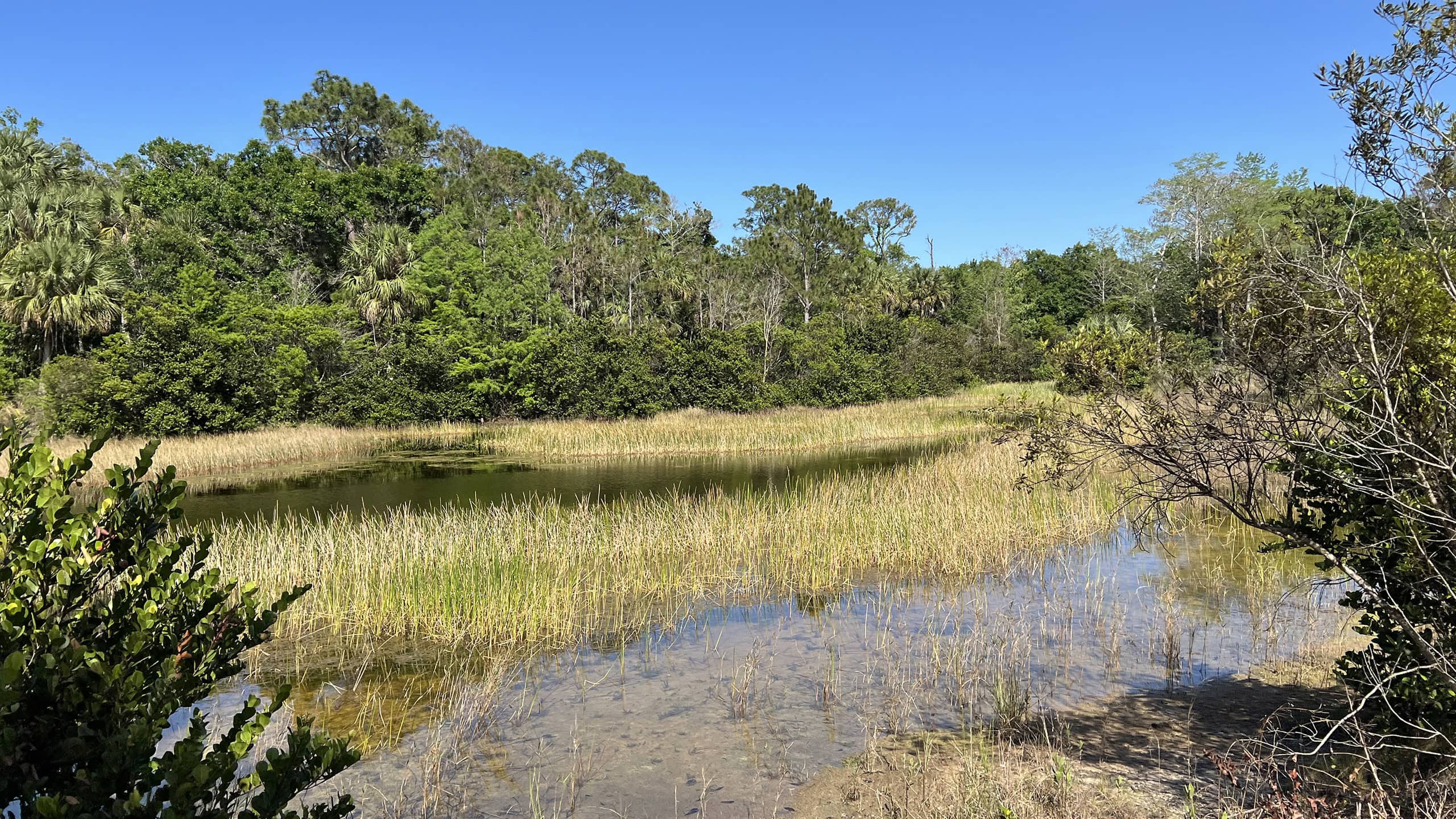
Marsh edged by South Florida pine flatwoods Riverbend Park Protecting the headwaters of the Loxahatchee River, Riverbend Park provides nature, tamed.
Man in pine scrub Florida Trail, Ocean to Lake: Luckey Tract to Kitching Creek 10.7 miles. A hike of extreme contrasts, this segment of the Florida Trail crossing Riverbend Park and Cypress Creek connects Loxahatchee Slough with Jonathan Dickinson State Park.
Boardwalk through a cypress swamp Busch Wildlife Sanctuary A wildlife rescue facility in Jupiter for forty years, Busch Wildlife Sanctuary cares for injured animals and provides education on Florida's native species.
Footpath in a sand pine scrub forest Delaware Scrub Natural Area For a tiny patch of land in the midst of bustling Jupiter, Delaware Scrub surprises with the amount of habitat diversity in such a small space.

Trail Map (PDF) Official Website

  • Author
  • Recent Posts
Sandra Friend
Sandra Friend
Author of 45 books, Sandra Friend established FloridaHikes.com in 2006 to expand on the field research she'd completed for her first six hiking guides. She has been honored with lifetime achievement awards from the Florida Trail Association and the Florida Outdoor Writers Association.
Sandra Friend
Latest posts by Sandra Friend (see all)
  • Michael Crotty Bicentennial Park - November 3, 2026
  • A.J. Henry Park - November 1, 2026
  • Okeeheelee Nature Center Trails - October 22, 2026
Category: Access by water, Biking, County Parks, Day Hikes, Equestrian, Hikes, Off Road Biking, Paddling, Southeast Florida, Trails, Water Management AreasTag: Birding, Historic Sites, Jupiter, Jupiter Farms, Loxahatchee River, Loxahatchee River Management Area, Riverbend Park, Wildflowers

Sidebar

FarOut Guides

Our comprehensive trail logistics presented on offline maps:

Florida National Scenic Trail (1,500 miles)
Florida Keys Overseas Heritage Trail (108 miles)
Eastern Continental Trail in Florida (92 miles)


We earn a small commission on sales through these links. Thanks for your support!


Our Guidebooks

We’ve written Florida guidebooks for over 25 years. These include Southeast Florida destinations.

Book cover with woman hiking through palms with baby carrier
Book cover of Florida Trail Hikes
The Florida Trail Guide fifth edition

Explore More

Newest Articles for Southeast Florida

Emerging from a tunnel of trees to a waterfront Tradewinds Park
Bench at a junction of trails in pine-palm flatwoods Okeeheelee Nature Center Trails
Dense understory beneath pines along footpath Lakewood Regional Park
Silvery-blue saw palmetto Lantana Scrub Natural Area

  • Facebook
  • Flickr
  • Instagram
  • Pinterest
  • Substack
  • Vimeo

FIND A TRAIL OR PARK

METROS: Bradenton. Clearwater. Crestview. Daytona Beach. Destin. Fort Lauderdale. Fort Myers. Fort Walton Beach. Gainesville. Jacksonville. Kissimmee. Lakeland. Melbourne. Miami. Naples. Ocala. Orlando. Panama City Beach. Pensacola. Port St. Lucie. Punta Gorda. St. Petersburg. Sanford. Sarasota. Sebring. Stuart. Tallahassee. Tampa. Vero Beach. West Palm Beach.

MULTI-REGION: Atlantic Coastal Ridge. Atlantic Coast. Bartram Trail. Big Bend. East Coast Greenway. Everglades National Park. Florida National Scenic Trail. Gulf Coast. Lake Wales Ridge. WATERWAYS: Indian River Lagoon. Intracoastal Waterway. Kissimmee River. St. Johns River. Withlacoochee River.

NORTHWEST FLORIDA: Altha. Apalachicola. Apalachicola National Forest. Big Bend Scenic Byway. Blackwater River State Forest. Blountstown. Bonifay. Bristol. Bruce. Cantonment. Cape San Blas. Carrabelle. Chattahoochee. Chipley. Crawfordville. DeFuniak Springs. Eastpoint. Ebro. Eglin Air Force Base. Freeport. Fountain. Gulf Breeze. Gulf Islands National Seashore. Holt. Madison. Marianna. Milton. Monticello. Mossy Head. Munson. Navarre. Navarre Beach. Newport. Niceville. Panacea. Panama City . Perdido Key. Ponce De Leon. Port St. Joe. Quincy. Santa Rosa Beach. Sopchoppy. South Walton. St. George Island. St. Marks. St. Marks NWR. Sumatra. Vernon. Wakulla. Wewahitchka. Woodville. WATERWAYS: Apalachicola River. Blackwater Bay. Blackwater River. Chipola River. Choctawhatchee Bay. Choctawhatchee River. Coastal Dune Lakes. Ochlockonee Bay. Perdido River. St. Marks River. Wacissa River. Wakulla River. Yellow River.

NORTH FLORIDA: Alachua. Amelia Island. Archer. Baldwin. Branford. Bronson. Bunnell. Callahan. Cedar Key. Chiefland. Crescent City. Cross City. Cross Creek. Dowling Park. Ellaville. Fanning Springs. Fernandina Beach. Flagler Beach. Fort White. Glen St. Mary. Green Cove Springs. Hawthorne. High Springs. Inglis. Jacksonville Beaches. Jacksonville Northshore. Jasper. Jennings. Keystone Heights. Lake Butler. Lake City. Live Oak.Macclenny. Mandarin. Mayo. Mayport. Micanopy. Middleburg. Old Town. Olustee. Orange Park. Osceola National Forest. Palatka. Palatka-Lake Butler Trail. Palm Coast. Palm Valley. Perry. Ponte Vedra. Rodman. Salt Springs. St. Augustine. Starke. Steinhatchee. Suwannee. Suwannee River Wilderness Trail. Suwannee Springs. Talbot Islands. Timucuan Preserve. Trenton. Waldo. Welaka. White Springs. Williston. Worthington Springs. Yankeetown. WATERWAYS: Santa Fe River. St. Marys River. Suwannee River. Tolomato River. Upper Withlacoochee River.

CENTRAL FLORIDA: Altamonte Springs. Apollo Beach. Apopka. Astatula. Astor. Auburndale. Bartow. Babson Park. Bayport. Belleview. Bithlo. Brandon. Brooksville. Bushnell. Canaveral National Seashore. Cassadaga. Christmas. Chuluota. Citrus Springs. Clearwater Beach. Clermont. Coast to Coast Trail. Cocoa. Cocoa Beach. Cross Florida Greenway. Crystal River. Dade City. De Leon Springs. DeBary. Deland. Deltona. Dunedin. Dunnellon. Edgewater. Enterprise. Eustis. Ferndale. Fort Meade. Frostproof. Geneva. Gibsonton. Haines City. Hernando. Hernando Beach. Holopaw. Homosassa. Inverness. Kenansville. Kissimmee. Lake Mary. Lake Wales. Largo. Leesburg. Lithia. Longwood. Lutz. Maitland. Malabar. McIntosh. Melbourne Beach. Merritt Island. Merritt Island NWR. Mims. Mount Dora. Narcoossee/Lake Nona. New Port Richey. New Smyrna Beach. Nobleton. Oak Hill. Oakland. Ocala National Forest. Ocklawaha. Ocoee. Oldsmar. Orange City. Ormond Beach. Osteen. Oviedo. Paisley. Palm Bay. Plant City. Poinciana. Polk City. Ponce Inlet. Port Orange. Ridge Manor. Riverview. Ruskin. Safety Harbor. Silver Springs. Sorrento. Spring Hill. St. Cloud. Tarpon Springs. Thonotosassa. Titusville . Umatilla. Viera. Walt Disney World. Weeki Wachee. Weirsdale. Wimauma. Windermere. Winter Garden. Winter Haven. Winter Park. Winter Springs. Withlacoochee State Forest. Withlacoochee State Trail. Yeehaw Junction. Zephyrhills. WATERWAYS: Alafia River. Halifax River. Hillsborough River. Lake Apopka. Little Manatee River. Ochlawaha River. Rainbow River. Tampa Bay. Wekiva River. Wekiva River Basin.

SOUTHWEST FLORIDA: Alva. Boca Grande. Cape Coral. Charlotte Harbor. Ding Darling NWR. Ellenton. Englewood. Estero. Immokalee. Marco Island. North Port. Osprey. Palma Sola. Palmetto. Pine Island. Port Charlotte. Sanibel Island. Venice. WATERWAYS: Caloosahatchee River. Manatee River. Myakka River. Pine Island Sound.

SOUTH FLORIDA: Arcadia. Basinger. Big Cypress National Preserve. Big Cypress Seminole Reservation. Big Cypress Swamp. Bowling Green. Clewiston. Everglades City. Indiantown. LaBelle. Lake Okeechobee Scenic Trail. Lake Placid. Lakeport. Moore Haven. Okeechobee. Ortona. Pahokee. Palmdale. Port Mayaca. South Bay. Wauchula. Zolfo Springs. WATERWAYS: Fisheating Creek. Lake Okeechobee. Peace River.

SOUTHEAST FLORIDA: Biscayne Bay. Biscayne National Park. Boca Raton. Boynton Beach. Coconut Creek. Coral Gables. Coral Springs. Davie. Delray Beach. Fellsmere. Flamingo. Fort Pierce. Hobe Sound. Hollywood. Homestead. Indrio. Jensen Beach. Juno Beach. Jupiter. Jupiter Farms. Key Biscayne. North Hutchison Island. Ocean to Lake Greenway. Palm Beach. Palm Beach Gardens. Pompano Beach. Redland. Sebastian. South Hutchinson Island. WATERWAYS: Florida Bay. St. Lucie River.

FLORIDA KEYS: Big Pine Key. Islamorada. Key Largo. Key West. Marathon. Overseas Heritage Trail.


©2006-2026, Sandra Friend & John Keatley | Disclosure | Site Index | Work with Us | Advertise with Us | Terms of Service and Privacy Policy

Florida Hikes PO Box 93 Mims FL 32754 | Contact
