• Skip to main content
  • Skip to header right navigation
  • Skip to after header navigation
  • Skip to site footer
Florida Hikes logo

Florida Hikes

Hike Bike Paddle Camp Florida with authors Sandra Friend and John Keatley as your guides

  • Trails
  • Maps
  • Guidebooks
  • Hike
    • Scenic Hikes
    • Loop Trails
    • Dog-friendly Hikes
    • Hikes for Kids
    • National Parks in Florida
    • Florida State Parks
  • Bike
    • Major Bike Trails
    • Paved Bike Trails
    • Off Road Biking
    • Biking Articles
  • Paddle
    • Canoe & Kayak Rentals
    • Paddling Destinations
    • Paddling Articles
  • Camp
    • Cabin Rentals
    • Car Camping
    • Primitive Camping
  • Florida Trail
    • Plan your Hike
    • Best Scenic Hikes
    • Best Backpacking
    • Section Hiking
    • Thru-Hiking
    • Trail Updates
  • Travel
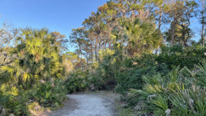
Footpath in coastal flatwoods

Key Vista Nature Park

Discover a new perspective on the Gulf of Mexico from the observation tower at Key Vista Nature Park, a coastal gem with a natural sandy beach and gentle footpaths.

Holiday (28.199413, -82.779591)   1.2 miles  

Key Vista Nature Park occupies 101 acres where Rocky Creek flows into the Anclote Anchorage, a calm shallows behind Anclote Key along the Gulf of Mexico.

Explore its easy trails through coastal flatwoods and sand pine scrub to a sandy shoreline edged with mangroves and sea grapes.

Shoreline framed by trees Sandy shoreline


This 1.2 mile perimeter loop on the trail network ties together scenic spots from the observation tower to frontage on Sleepy Lagoon along Rocky Creek.

Add more mileage by exiting the front gate for a walk along the paved Coastal Anclote Trail just outside the boundary fence. This park is its northern trailhead.

Lagoon edged with mangroves Sleepy Lagoon


Resources

Resources for exploring the area
50 Hikes in Central Florida Central Florida Orlando Explorers Guide book cover Hikers Guide to the Sunshine State book cover Paddlers Guide Florida
 
Disclosure: As authors and affiliates, we receive earnings when you buy through our links. This helps us provide public information on this website.

Overview

Location: Holiday
Length: 1.2 mile loop
Trailhead: 28.199413, -82.779591
Address: 2700 Ballies Bluff Rd, Holiday
Fees: Free
Restroom: At the trailhead
Land manager: Pasco County
Phone: 727-942-4030

Open daily dawn to dusk. Leashed dogs welcome. A dog water station is thoughtfully set up near the restrooms.

Accessible parking and restrooms are provided, but the trails are natural surface. A central picnic area is in the island formed by the circular parking lot.


Directions


From New Port Richey, follow US 19 south to Trouble Creek Rd. Turn west. After 3.1 miles, the road makes a sharp left in front of Eagle Point Park and becomes Strauber Memorial Hwy for 0.8 mile. It makes more 90-degree turns before meeting Baillies Bluff Rd. Turn left. The entrance to Key Vista Nature Park is within the next mile on the right.

Hike

Several trails radiate from the parking area in a clockwise circle around a central picnic area.

Take the first broad path clockwise, next to the restrooms. Enter a sand pine scrub where the grand champion sand pine once stood.

Tall sand pines Sand pine scrub


This forest stands out in sharp contrast to those managed by timbering by the variety of sizes of the pines.

Some are tall and skinny, others shorter and plump like Christmas trees. Turning to white sand, the footpath curves through it.

Picnic bench in clearing Picnic bench at trail junction


Slash pines enter the mix in a blend with sandhill species, scrub oaks adjoined by turkey oaks.

Emerge into a broad clearing with a picnic bench at 0.2 mile. Turn left to continue on the perimeter trail. Wiregrass gleams in the sun.

Sand pines and sand path ascending Climbing over a ridge


Ascend through a series of curves through the continued mingling of habitats. Pass a bench on a curve.

Scrub plum and Florida rosemary peep from the edges of the understory. Candle-stage longleaf pines sprout with towering wind-blown sand pines as a backdrop.

Low shrubs Florida rosemary


Meet a junction with a north-south footpath at 0.4 mile. To the left, it connects to the boardwalk at adjoining Anclote Gulf Preserve.

Straight ahead is a beaten path to a tidal flat. To the right is the observation tower. Three stories high, it provides a panoramic view of the Gulf of Mexico.

Man and dog on narrow beach with smokestack in distance Tidal flat between the parks


A sandy path in front of it reaches a strip of white sand above the flats revealed when the tide is out.

Black mangroves and sea grape grow right up to the water’s edge.

Tower framed by palms Observation tower


Looking left, the arc of flats stretches towards a power plant smokestack and around to a radar tower.

Take the sandy path to the right through a tunnel of mangroves.

Pop out on a stretch of white sand beach. Decorated with multiple wrack lines above the flats, it’s long enough for a beach walk.

Beach with mangroves Sandy beach


Passing behind another mangrove, reach the north end of the beach. A footpath exits the beach towards a bench above a small boulder pile.

At the trail junction beyond it, walk straight ahead past the incoming path from the tower.

The ribbon of white sand enters scrubby flatwoods where some of the older pines have oddly twisted trunks from surviving hurricane winds.

Sand pines and broad sand path Scrubby flatwoods


A bench overlooks the placid waters of mangrove-lined Rocky Creek at 0.6 mile, with a glimpse of the Gulf in the distance.

This tidal creek drains a natural basin, Sleepy Lagoon, at the north corner of the preserve.

Creek with rocky shore and mangroves Rocky Creek


The next overlook along it is studded with surface limestone. Cross a boardwalk to a bluff with a bench facing the water.

Walk to the rocky shoreline for a view upstream, where oyster bars emerge during low tide.

Outlined with stakes for boaters’ sakes, they’re a favorite gathering place for ibis to feed.

Oyster bed with ibis picking at it Ibis on the oyster beds


Behind the next bench, rejoin the footpath in the pine forest northbound. Here by the water, palms flourish in the understory.

At a Y intersection, bear left, passing an earthen ramp for paddlers to launch from.

Sandy cut along waterway Launch point


A panorama of the creek follows on the walk along a low bluff. After a final rocky approach to the water, leave the creek to follow the sandy path into the pine forest.

Quickly covered in pine needles, it broadens, ascending to a bench at 0.8 mile.

Park bench in front of sand pines Bench at a T intersection


The trail to the right heads directly for the trailhead. Bear left, walking a corridor into sand pine scrub.

Keep left at the next junction. Descend towards the mangroves, curving right at a bench to walk the ecotone.

palmettos and mangroves with water beyond Along upper Sleepy Lagoon


The tidal basin beyond the mangroves is only visible where they thin. Facing a warning sign at a blocked off path, curve right.

Ascend the bluff into the pine forest. The curve continues to point this loop south, passing a bench.

Climbing a sandy hill Climbing away from the mangroves


As the forest shifts to sand pine scrub, the footpath becomes soft white sand once more. A clearing with a picnic bench has a sign declaring this path the Sleepy Lagoon Trail.

Finishing it up, bear left, away from the Rocky Creek Loop Trail (which you finished earlier) to return through the scrub to the parking area, completing a 1.2 mile loop.

Picnic table and trail sign in clearing Make a left where the loops meet


Trail Map

Key Vista Nature Park Trail Map
Red: our route. Light blue: Coastal Anclote Trail.

Explore More!

Video

Hiking Key Vista Nature Park


Slideshow

See our photos from Key Vista Nature Park


Nearby Adventures

Waterfront beyond a screen of trees Anclote Gulf Park A place for spectacular sunsets, Anclote Gulf Park offers several observation points along its waterfront overlooking Anclote Key and the Gulf of Mexico.
Beaten path next to a soggy forest road Brooker Creek Preserve The largest nature preserve in Pinellas County, Brooker Creek Preserve protects a mosaic of vanishing habitats while interpreting their value along 6.2 miles of trails.
Pine flatwoods beyond a prairie Jay B. Starkey Wilderness Park Explore an expansive landscape of pine flatwoods, prairies, scrubby flatwoods, and open scrub along over 16 miles of hiking trails east of New Port Richey.
Needlerush marsh in front of pine flatwoods Werner-Boyce Salt Springs State Park Home to one of Florida's deepest springs, at 320 feet deep, Werner-Boyce Salt Springs State Park protects crucial coastal estuaries along the Gulf Coast.

Official Website

  • Author
  • Recent Posts
Sandra Friend & John Keatley
Articles jointly researched, written, and photographed by Sandra Friend & John Keatley, authors and publishers of FloridaHikes.com.
Sandra Friend & John Keatley
Latest posts by Sandra Friend & John Keatley (see all)
  • Hal Scott Red Trail - November 13, 2026
  • Baseline Trails - November 7, 2026
  • Hal Scott Yellow Trail - November 3, 2026
Category: Access by water, Central Florida, County Parks, Day Hikes, Hikes, Launch Points, Loop Hikes, Nature Trails, Paddling, TrailsTag: Dog-friendly, Family-Friendly, Fishing, Gulf of Mexico, Holiday, Nature Coast, New Port Richey, Observation Towers, Picnic, Tarpon Springs

Sidebar

FarOut Guides

Our comprehensive trail logistics presented on offline maps:

Florida National Scenic Trail (1,500 miles)
Florida Keys Overseas Heritage Trail (108 miles)
Eastern Continental Trail in Florida (92 miles)


We earn a small commission on sales through these links. Thanks for your support!


Our Florida Guidebooks

We’ve written Florida guidebooks for over 25 years. These include Central Florida destinations.

Book cover with woman hiking through palms with baby carrier
Book cover of Florida Trail Hikes
The Florida Trail Guide fifth edition
50 Hikes in Central Florida 3rd edition

Explore More

Newest Articles for Central Florida

Path through pine flatwoods Hal Scott Red Trail
Grassy slope edged with trees Sandhill Preserve
Two-track through pine savanna Hal Scott Yellow Trail
Footpath through coastal hammock Michael Crotty Bicentennial Park

  • Facebook
  • Flickr
  • Instagram
  • Pinterest
  • Substack
  • Vimeo

FIND A TRAIL OR PARK

METROS: Bradenton. Clearwater. Crestview. Daytona Beach. Destin. Fort Lauderdale. Fort Myers. Fort Walton Beach. Gainesville. Jacksonville. Kissimmee. Lakeland. Melbourne. Miami. Naples. Ocala. Orlando. Panama City Beach. Pensacola. Port St. Lucie. Punta Gorda. St. Petersburg. Sanford. Sarasota. Sebring. Stuart. Tallahassee. Tampa. Vero Beach. West Palm Beach.

MULTI-REGION: Atlantic Coastal Ridge. Atlantic Coast. Bartram Trail. Big Bend. East Coast Greenway. Everglades National Park. Florida National Scenic Trail. Gulf Coast. Lake Wales Ridge. WATERWAYS: Indian River Lagoon. Intracoastal Waterway. Kissimmee River. St. Johns River. Withlacoochee River.

NORTHWEST FLORIDA: Altha. Apalachicola. Apalachicola National Forest. Big Bend Scenic Byway. Blackwater River State Forest. Blountstown. Bonifay. Bristol. Bruce. Cantonment. Cape San Blas. Carrabelle. Chattahoochee. Chipley. Crawfordville. DeFuniak Springs. Eastpoint. Ebro. Eglin Air Force Base. Freeport. Fountain. Gulf Breeze. Gulf Islands National Seashore. Holt. Madison. Marianna. Milton. Monticello. Mossy Head. Munson. Navarre. Navarre Beach. Newport. Niceville. Panacea. Panama City . Perdido Key. Ponce De Leon. Port St. Joe. Quincy. Santa Rosa Beach. Sopchoppy. South Walton. St. George Island. St. Marks. St. Marks NWR. Sumatra. Vernon. Wakulla. Wewahitchka. Woodville. WATERWAYS: Apalachicola River. Blackwater Bay. Blackwater River. Chipola River. Choctawhatchee Bay. Choctawhatchee River. Coastal Dune Lakes. Ochlockonee Bay. Perdido River. St. Marks River. Wacissa River. Wakulla River. Yellow River.

NORTH FLORIDA: Alachua. Amelia Island. Archer. Baldwin. Branford. Bronson. Bunnell. Callahan. Cedar Key. Chiefland. Crescent City. Cross City. Cross Creek. Dowling Park. Ellaville. Fanning Springs. Fernandina Beach. Flagler Beach. Fort White. Glen St. Mary. Green Cove Springs. Hawthorne. High Springs. Inglis. Jacksonville Beaches. Jacksonville Northshore. Jasper. Jennings. Keystone Heights. Lake Butler. Lake City. Live Oak.Macclenny. Mandarin. Mayo. Mayport. Micanopy. Middleburg. Old Town. Olustee. Orange Park. Osceola National Forest. Palatka. Palatka-Lake Butler Trail. Palm Coast. Palm Valley. Perry. Ponte Vedra. Rodman. Salt Springs. St. Augustine. Starke. Steinhatchee. Suwannee. Suwannee River Wilderness Trail. Suwannee Springs. Talbot Islands. Timucuan Preserve. Trenton. Waldo. Welaka. White Springs. Williston. Worthington Springs. Yankeetown. WATERWAYS: Santa Fe River. St. Marys River. Suwannee River. Tolomato River. Upper Withlacoochee River.

CENTRAL FLORIDA: Altamonte Springs. Apollo Beach. Apopka. Astatula. Astor. Auburndale. Bartow. Babson Park. Bayport. Belleview. Bithlo. Brandon. Brooksville. Bushnell. Canaveral National Seashore. Cassadaga. Christmas. Chuluota. Citrus Springs. Clearwater Beach. Clermont. Coast to Coast Trail. Cocoa. Cocoa Beach. Cross Florida Greenway. Crystal River. Dade City. De Leon Springs. DeBary. Deland. Deltona. Dunedin. Dunnellon. Edgewater. Enterprise. Eustis. Ferndale. Fort Meade. Frostproof. Geneva. Gibsonton. Haines City. Hernando. Hernando Beach. Holopaw. Homosassa. Inverness. Kenansville. Kissimmee. Lake Mary. Lake Wales. Largo. Leesburg. Lithia. Longwood. Lutz. Maitland. Malabar. McIntosh. Melbourne Beach. Merritt Island. Merritt Island NWR. Mims. Mount Dora. Narcoossee/Lake Nona. New Port Richey. New Smyrna Beach. Nobleton. Oak Hill. Oakland. Ocala National Forest. Ocklawaha. Ocoee. Oldsmar. Orange City. Ormond Beach. Osteen. Oviedo. Paisley. Palm Bay. Plant City. Poinciana. Polk City. Ponce Inlet. Port Orange. Ridge Manor. Riverview. Ruskin. Safety Harbor. Silver Springs. Sorrento. Spring Hill. St. Cloud. Tarpon Springs. Thonotosassa. Titusville . Umatilla. Viera. Walt Disney World. Weeki Wachee. Weirsdale. Wimauma. Windermere. Winter Garden. Winter Haven. Winter Park. Winter Springs. Withlacoochee State Forest. Withlacoochee State Trail. Yeehaw Junction. Zephyrhills. WATERWAYS: Alafia River. Halifax River. Hillsborough River. Lake Apopka. Little Manatee River. Ochlawaha River. Rainbow River. Tampa Bay. Wekiva River. Wekiva River Basin.

SOUTHWEST FLORIDA: Alva. Boca Grande. Cape Coral. Charlotte Harbor. Ding Darling NWR. Ellenton. Englewood. Estero. Immokalee. Marco Island. North Port. Osprey. Palma Sola. Palmetto. Pine Island. Port Charlotte. Sanibel Island. Venice. WATERWAYS: Caloosahatchee River. Manatee River. Myakka River. Pine Island Sound.

SOUTH FLORIDA: Arcadia. Basinger. Big Cypress National Preserve. Big Cypress Seminole Reservation. Big Cypress Swamp. Bowling Green. Clewiston. Everglades City. Indiantown. LaBelle. Lake Okeechobee Scenic Trail. Lake Placid. Lakeport. Moore Haven. Okeechobee. Ortona. Pahokee. Palmdale. Port Mayaca. South Bay. Wauchula. Zolfo Springs. WATERWAYS: Fisheating Creek. Lake Okeechobee. Peace River.

SOUTHEAST FLORIDA: Biscayne Bay. Biscayne National Park. Boca Raton. Boynton Beach. Coconut Creek. Coral Gables. Coral Springs. Davie. Delray Beach. Fellsmere. Flamingo. Fort Pierce. Hobe Sound. Hollywood. Homestead. Indrio. Jensen Beach. Juno Beach. Jupiter. Jupiter Farms. Key Biscayne. North Hutchison Island. Ocean to Lake Greenway. Palm Beach. Palm Beach Gardens. Pompano Beach. Redland. Sebastian. South Hutchinson Island. WATERWAYS: Florida Bay. St. Lucie River.

FLORIDA KEYS: Big Pine Key. Islamorada. Key Largo. Key West. Marathon. Overseas Heritage Trail.


©2006-2026, Sandra Friend & John Keatley | Disclosure | Site Index | Work with Us | Advertise with Us | Terms of Service and Privacy Policy

Florida Hikes PO Box 93 Mims FL 32754 | Contact
