

Forming a backbone for recreation in Sarasota County, the Legacy Trail rests on more than a century of Florida’s railroad history.
Established after the death of railroad magnate Henry Plant, the Seaboard Air Line extended his trackage south from Tampa to Venice.
 A piece of the original rail line at Phillippi Creek
Many well-to-do northerners established winter homes in the region. Speculators purchased large tracts of land for development.
Passenger service to Venice began in 1911. In 1925, Dr. Fred Albee bought nearly 3,000 acres of land from the Sarasota-Venice Company.
The largest of the development firms, its backer was Chicago socialite Bertha Honore Palmer.
 The historic Venice Depot
Albee retained noted architect John Nolan to design the city of Venice. The Brotherhood of Locomotive Engineers bought the property and agreed to develop the planned Italian Renaissance village.
Meanwhile, John Ringling, having settled in Sarasota, moved his circus winter headquarters there in 1927, transporting performers and animals by train from and to Baraboo, Wisconsin.
 Trailside mural in Venetian Waterway Park
In 1959, the circus owners leased 15 undeveloped acres at the Venice airport, which served as an Army Air Corps training base during World War II.
On November 29, 1960, more than 10,000 people gathered to meet the first circus train to Venice.
 A passenger car from the circus train trailside in Venice
When the trackage was abandoned by the Seminole Gulf Railroad in 1992, the Ringling Brothers Barnum & Bailey Circus left Venice for good.
It took nearly 15 years for Sarasota County to complete negotiations and purchase the railroad corridor, which was opened in phases as the Legacy Trail.
 Plans unveiled at Venice Depot, 2011
Resources



Disclosure: As authors and affiliates, we receive earnings when you buy through our links. This helps us provide public information on this website.
Overview
Location: Venice to Sarasota
Length: 19.8 miles linear
Address: 303 E Venice Ave
Land manager: Sarasota County
Phone: 941-861-5000
Open 6 AM to sunset. Leashed dogs welcome; pick up after your pet. Covered benches and bike repair stations provided. No camping allowed along the corridor.
Trailheads
SOUTH to NORTH
Legacy Park, 395 E Venice Ave, Venice
Patriots Park, 800 Venetia Bay Blvd, Venice
Nokomis Community Park, 234 Nippino Trl E, Nokomis
Nokomis Riverview Park, 251 Riverview Dr S, Nokomis
Laurel Park, 509 Collins Rd, Laurel
Oscar Scherer State Park, 1843 S Tamiami Trl, Osprey
Osprey Junction Trailhead, 939 E Bay St, Osprey
McIntosh Rd Parking, 7905 McIntosh Rd, Sarasota
Culverhouse Nature Park, 7301 McIntosh Rd, Sarasota
Ashton Trailhead, 4301 Ashton Rd, Sarasota
Sarasota Springs Trailhead, 4012 Webber St, Sarasota
Pompano Trailhead, 601 S Pompano Ave, Sarasota
Payne Park, 2010 Adams Ln, Sarasota
About the Trail
Opened in stages as the county acquired and paved pieces of the former railbed, the Legacy Trail opened its first segment in 2005.
Watching it grow, we hiked and biked segments but didn’t tackle the full length until 2022. We’ve been back more than once for additional rides.
 Venice terminus, 2018
Over the years, the county has added new trailheads along the route and created links into existing community parks and neighborhoods.
They’ve also replaced road crossings with bridges for safety’s sake. We expect that transformation to continue as both ridership and traffic increases.
 Ashton Trailhead
In addition to its many trailheads, the Legacy Trail has rest stops strategically placed for hikers and runners. Each features a covered bench with the name “Station” on the roof.
All have trash cans and display boards with maps. Some of the stations include interpretion of railroad history. A handful offer a portable toilet nearby.
Historic mileposts from the railroad era do a countdown northward towards Richmond, Virginia. Markers embedded in the path every tenth of a mile provide a location number for 911 calls.
 Original milepost
Trail Details
Begin a northbound journey from Legacy Park by passing under the Legacy Trail archway. Edged by mangroves, the straightaway crosses Hatchett Creek.
A steady climb towards the US 41 bridge starts. Reaching its peak, coast down towards Venetia Bay, a restaurant and hotel complex home to Patriot Park.
 US 41 bridge
Passing a side path providing access to the complex at 0.8 miles, continue along the straightaway on a slightly elevated causeway.
A shorter climb leads to the bridge over Curry Creek, with bumpout observation decks. The creek flows towards the Gulf. Residences rise along its near shores.
 Curry Creek
An opening on the left reveals Nokomis Community Park at 1.6 miles. Come to the first shelter and first road crossing on the trail, Colonia Ln. It has a crosswalk with pedestrian warning signal.
Beyond a corridor of industrial buildings, pass the entrance to Nokomis Riverview Park. A wooded corridor provides an approach to Roberts Bay.
 Roberts Bay
Cross the bay at 1.8 miles. Observation decks tempt for views across the water. Although edged by vegetation, residences are visible behind fences along the straightaway.
A kiosk marks the entrance to the trails within Laurel Park at 2.6 miles. The steep rise to the Laurel Rd bridge is similar to the one over US 41.
 Laurel Park entrance
Returning to ground level past some industrial buildings, the straightaway becomes a pleasant unbroken wooded corridor.
Pass Mission Valley Station at 4.4 miles. A rest stop among the pines comes up quickly by the overpass of Hwy 681.
 Mission Valley Station
North of the overpass, enter the most immersive stretch of natural habitat as the trail is surrounded by the expanse of Oscar Scherer State Park.
The bridge over South Creek has a segment of historic railroad trestle adjoining. At 5.7 miles, a gate into the park provides access to restrooms and picnic pavilion (fee charged).
 Riding through Oscar Scherer State Park
A set of gates enabling a hiking trail crossing are just before Oscar Scherer Station. Oak hammock surrounds the trail as it continues to Osprey Junction Station.
Osprey Junction Trailhead sits cattycorner across Bay St at 7.1 miles. It has a large lot, restrooms, and picnic shelters.
 Crossing Bay Street in Osprey
Warning signs about alligators are posted as the trail approaches North Creek. Virginia willow surrounds the path as it comes to and crosses the bridge.
Pass Pine Ranch Station in this nicely wooded corridor. Central Sarasota Parkway Station adjoins the trail within view of the road crossing of the four lane parkway at 9.1 miles.
 North Creek bridge
Pass a railroad crossing gate north of this crossing. Dry upland forest largely flanks the next stretch, except around the Catfish Creek bridge.
Encounter more willow marsh trailside before drawing close to Palmer Ranch Station. Beyond this stop is the access path to McIntosh Rd Parking at 10 miles.
 McIntosh Rd Parking turnoff
Crossing Palmer Ranch Parkway at a traffic light, proceed north past Culverhouse Station and the entrance to Culverhouse Nature Park.
When the split-rail park fence ends, houses and condos loom behind sparse trees and shrubs. Cross Sawyer Loop using a pedestrian-activated traffic signal at 11.5 miles.
 Sawyer Loop crossing
Catfish Creek Station comes up quickly, with a bridge just past it over Catfish Creek. A not-so-subtle shift to urban occurs as warehouses adjoin the path. Cross busy Clark Rd at the traffic light at 12.2 miles.
The trail is now firmly in a business corridor. With restrooms, picnic tables, and a playground, the large Ashton Trailhead sits north of the Ashton Rd pedestrian crossing.
 Ashton Trailhead
The straightaway proceeds through an older residential area, crossing Proctor Rd at a pedestrian-activated signal. Continue behind backyards to the Wilkinson Rd crosswalk.
Reach the commercial district surrounding busy Bee Ridge Rd. At 14.4 miles, climb the bridge for an up and over traffic, a welcome replacement to the old crosswalk.
Up a fenced stretch with oaks worn ragged by hurricane winds, reach the Sarasota Springs Trailhead at 15 miles. Just past it is the Webber St crossing with a pedestrian-activated signal.
 Sarasota Springs Trailhead
Along this next stretch on a broad corridor between neighborhoods, expect to start encountering residents of Pinecraft, a historic Amish and Mennonite community.
The Amish do not drive, but they do travel by bike. The community is bisected by Bahia Vista St at 16.1 miles. Passing the Carlisle Inn, follow a gentle curve up to Phillippi Creek.
An original trestle adjoins the trail bridge. Phillippi Station offers a rest break and background on the area.
 Crossing Phillippi Creek
The curve continues through Pinecraft to a pedestrian-activated signal crossing for busy four-lane Beneva Rd. Now heading west, cross another bridge next to a historic trestle.
Despite the urban surroundings, the trail is buffered by trees and a ditch. The access path north into Pompano Trailhead is at 17.4 miles
 Beneva Rd crossing
A mile later, a Y junction splits the trail. The straight-ahead route to downtown Sarasota is not yet complete. Bear right to turn northward.
Curve along a line of condos. Where they end, a path to the left leads to Patriot Park, the northernmost trailhead for the Legacy Trail.
Cross Ringling Blvd at the crosswalk. Continue one more urban block to the official end of the Legacy Trail at Fruitville Rd.
 Northern terminus
Mileage
0.0 Legacy Park (Venice terminus)
0.6 US 41 bridge
0.8 Patriot Park access path
1.0 Curry Creek
1.1 Nokomis Community Park
1.6 Nokomis Riverview Park
1.8 Roberts Bay
2.6 Laurel Park
2.7 Laurel Rd bridge
4.4 Mission Valley Station
5.1 SR 681 overpass
5.7 Oscar Scherer State Park access
6.1 Oscar Scherer Station
7.1 Osprey Junction Station
7.1 Osprey Junction Trailhead
8.1 Pine Ranch Station
9.1 Central Sarasota Parkway Station
10.0 Palmer Ranch Station (access to McIntosh Rd parking)
10.7 Culverhouse Station
10.8 Culverhouse Nature Park
11.6 Catfish Creek Station
12.8 Ashton Trailhead
15.0 Sarasota Springs Trailhead
16.4 Phillippi Creek Station
16.8 Beneva Rd crossing light
17.4 Pompano Trailhead
18.4 Y junction (W branch towards downtown)
18.6 Payne Park access
18.9 Fruitville Rd (Sarasota terminus)
Recommended Segments
Venice to Osprey
Since road crossings are commonplace at the northern end of the trail, the southern end is more enjoyable for casual rides, hikes, and family outings.
Northbound from the Venice terminus at Legacy Park, cross the steep overpass bridge over US 41. Two long bridges span showy estuaries.
 Both afford great views
Between them lies one not-terribly-busy road crossing at Colonia Ln. Beyond it, a turnaround at Laurel Park (which has restrooms and water) makes for a 5.2 mile round-trip.
Or continue up and over the Laurel Road bridge for a nice long stretch with no road crossings, the wooded corridor becoming woodland immersion inside Oscar Scherer State Park.
 Trail corridor in Oscar Scherer State Park
There is a fee for entering the state park gate at 5.7 miles, where a picnic pavilion and restrooms await. It’s a turnaround point for a 11.4 mile ride.
Or continue through the remainder of the state park to Osprey Junction Station, which faces Osprey Junction trailhead across busy Bay St. Turn around here for a 14.2 mile ride.
 Oscar Scherer back gate
Starting at Legacy Park makes it easy to add more miles southbound, too. The east side of Venetian Waterway Park has no road crossings southbound.
Take a straightforward round trip of 8 miles to Shamrock Park and back, or mix it up by crossing the Circus Bridge for a trip to Caspersen Beach Park or into downtown on a dedicated bike path.
 Venetian Waterway Park
Osprey to Stoneybrook
From Osprey Junction trailhead, it’s 2.1 miles northbound in a wooded corridor between subdivisions to Central Sarasota Parkway Station.
A left before the road crossing diverts onto the Stoneybrook Nature Trail and its extensive boardwalk. Reaching McIntosh Rd, turn around and return to Osprey Junction for a 5.6 mile round-trip.
 Pine Ranch Station north of North Creek
Palmer Ranch
Use the McIntosh Rd parking area for access to the Palmer Ranch section of the trail, which is largely surrounded by a nicely wooded basin.
Head southbound, reaching Central Sarasota Parkway at 1.1 miles. Turn around and proceed northbound past Palmer Ranch Station to Palmer Ranch Parkway.
Reach it at 2.4 miles. Return south to Palmer Ranch Station and take the side path to exit to the McIntosh Rd parking area to complete a 3.1 mile trip.
 Near the McIntosh Rd turnoff
Culverhouse Nature Park
A destination in its own right, Culverhouse Nature Park provides pleasant surroundings for a mile-long trail segment within natural habitats.
Pivoting off the parking area at the park, walk up to two miles between the road crossings at Palmer Ranch Pkwy and Sawyer Loop Rd. Or explore the park itself on natural surfaces.
 Culverhouse Station
Connections
Venetian Waterway Park
Encompassing paved pathways on both sides of the Venetian Waterway south of Legacy Park, Venetian Waterway Park tacks on another continuous 4 mile linear ride south from mile 0 of the Legacy Trail.
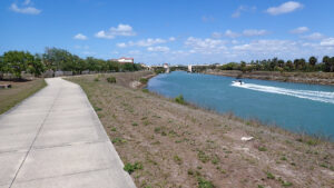 Venetian Waterway Park Featuring concrete paths on both sides of the Venetian Waterway, this linear trail system provides breezy waterfront views along the length of Venice.
Interconnections across the Circus Bridge enable a round-trip to Caspersen Beach park and a loop into downtown Venice on the bike path.
 Entry to Venetian Waterway Park from Legacy Park
Legacy Trail North Port Extension
This 5.8 mile linear paved trail stands on its own, edging Deer Creek Prairie Preserve and Shewe Ranch WMA parallel to Interstate 75 between the Forbes Trail trailhead in Venice and the Calera St trailhead in North Port.
Road rides enable connections to both the Legacy Trail and the option of a 23.3 mile loop using the graded Powerline Trail across Big Slough Preserve and Carlton Reserve. Gravel tires are a must for the loop.
 The path is in a pleasant wooded setting
Trail Map

Explore More!
Visit these parks along the Legacy Trail
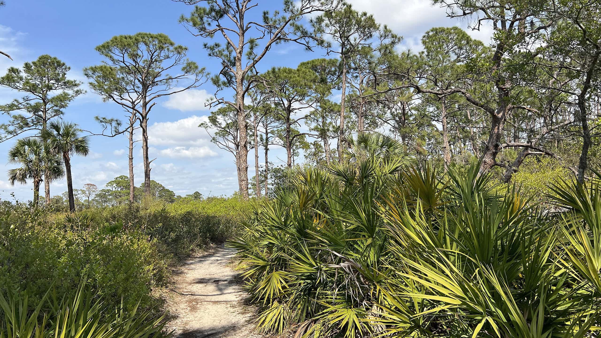 Oscar Scherer State Park A stronghold for Florida scrub-jays north of Venice, Oscar Scherer State Park is an important island of biodiversity in an increasingly overdeveloped region.
Video
Riding the Legacy Trail
Slideshow
See our photos from the Legacy Trail
Nearby Adventures
 Curry Creek Preserve East Amid expanding suburbia in Venice, this 71-acre island of botanical delights circled by a 1.6 mile loop buffers wildflower-rich longleaf pine flatwoods along a mangrove-lined stream.
 Historic Spanish Point A prominent peninsula in Little Sarasota Bay at Osprey, Historic Spanish Point fascinates with its layer cake of Florida’s past, both human and floral.
 Red Bug Slough Preserve Walk beneath a mature live oak canopy along the rim of a protected waterway within the heart of residential Sarasota.
 Urfer Family Park Share nature with the kids along Bee Ridge on 1.4 miles of family-friendly trails in a popular county park with four playgrounds surrounding a 1905 home open for tours.

- Hal Scott Yellow Trail - November 3, 2026
- Hal Scott Preserve - October 28, 2026
- Tradewinds Park - October 27, 2026