• Skip to main content
  • Skip to header right navigation
  • Skip to after header navigation
  • Skip to site footer
Florida Hikes logo

Florida Hikes

Hike Bike Paddle Camp Florida with authors Sandra Friend and John Keatley as your guides

  • Trails
  • Maps
  • Guidebooks
  • Hike
    • Scenic Hikes
    • Loop Trails
    • Dog-friendly Hikes
    • Hikes for Kids
    • National Parks in Florida
    • Florida State Parks
  • Bike
    • Major Bike Trails
    • Paved Bike Trails
    • Off Road Biking
    • Biking Articles
  • Paddle
    • Canoe & Kayak Rentals
    • Paddling Destinations
    • Paddling Articles
  • Camp
    • Cabin Rentals
    • Car Camping
    • Primitive Camping
  • Florida Trail
    • Plan your Hike
    • Best Scenic Hikes
    • Best Backpacking
    • Section Hiking
    • Thru-Hiking
    • Trail Updates
  • Travel
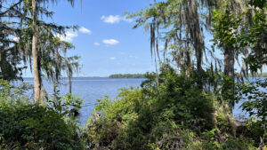
View of river framed by trees

RiverTown Riverfront Park

Statuesque live oaks canopy an unparalleled 1.7 mile walk along the eastern shore of the St. Johns River at Riverfront Park in Rivertown, northwest of St. Augustine.

St. Augustine (30.020703, -81.641111)   1.7 miles  

A large planned community northwest of St. Augustine along the St. Johns River, RiverTown has made the most of its natural setting.

Its neighborhoods are set within large conservation areas and trails interconnect between many of them.

Map showing trails Overview map of this park across from a neighborhood


A notable landmark for travelers down the Bartram Highway (SR 13) between Jacksonville and Palatka, Riverfront Park belongs to and is maintained by the community but open to all.

Cleared, the understory beneath the ancient oaks revealed spectacular views of the river, further enhanced by two observation decks and a pier.

Pier with covered shelter at end Pier into the St. Johns River


Paddlers can launch next to the northern deck to explore the wild cypress-lined eastern shore of the river.

A network of paved paths provides accessible enjoyment of the waterfront, but the park also has a wild side.

View of river from oak canopy Waterfront views from under the oaks


Its northernmost extent remains a river bluff forest with trees of impressive size, two natural-surface loops built by SORBAJAX for mountain bikers, open to hikers as well.

This walk blends both the mild and wild sides of Riverfront Park.

Mountain bike on trail On the natural surface bike trail


Resources

Resources for exploring the area
50 Hikes in North Florida book cover North Florida Panhandle Explorers Guide book cover Hikers Guide to the Sunshine State book cover Paddlers Guide Florida
 
Disclosure: As authors and affiliates, we receive earnings when you buy through our links. This helps us provide public information on this website.

Overview

Location: St. Johns
Length: 1.7 miles
Trailhead: 30.020703, -81.641111
Address: 4065 SR 13 N, St. Johns
Fees: Free
Restroom: Near the pier
Land Manager: RiverTown Amenities Team
Phone: 904-679-5523

Open 9 AM to 5 PM. Leashed dogs welcome. Please pick up after your pet.

Nearly three miles of biking are possible combining the paved and unpaved trails. Do not ride natural surface trails when wet.


Directions


North of St. Augustine, take Interstate 95 exit 323 at International Golf Village. Follow International Golf Pkwy (9 Mile Rd) west 2.5 miles. Turn right on SR 16. Continue 1.5 miles and SR 16 turns left. Meet SR 13 in another 1.7 miles. Make a right and follow it north for 6.7 miles, reaching the traffic circle at Rivertown. Just past the circle turn left into Riverfront Park.

Hike

Starting from the north end of the parking area, take a short walk north on the paved path along the riverfront to a sign with an overview map of the park.

The yellow-blazed Beginner Loop diverges from the paved path just beyond it.

Continue on the paved path under the moss-draped live oaks towards a roofed structure on the riverfront.

Paved path under oaks Pathway towards the launch


A boardwalk leads to this observation deck, which stands beside and above the hand launch for paddlers.

The St. Johns is quite broad at this point; the marina and water towers visible on the far shore are in Green Cove Springs.

To the south along this shoreline, a pier juts into the river.

Observation deck Deck and hand launch


Leaving the observation deck, turn right and walk south past the parking area. Take in the sweep of river along the gently curving path.

Grapevines and shrubs crowd the edge of the bluff below towering live oaks and cypress trees.

View of pier from tree cover Walking towards the pier


Past the parking area, a paved path stretches east towards the restrooms and front lawn of the park. Turn right and continue onto the long boardwalk to the pier.

It affords great views of the tree-lined shoreline of the park, which has many little coves along the low bluff.

Treed river shoreline Shoreline of Riverfront Park


At the end, it’s topped with a decorative square roof above an observation platform.

Look to the right of the marina on the far shore to make out the waterfront of Spring Park at Green Cove Springs.

Flags atop Observation deck with view across river View towards Green Cove Springs


Returning to land, turn right to follow the paved loop through the south end of the park, its canopy of ancient trees a delight.

A side path leads to a final roofed observation deck on the water. Pause for the view before following the sinuous loop under the trees.

Covered deck on river Small riverfront deck


Draperies of Spanish moss glow in dappled sunshine. Edging towards the boundary fence, the path turns northward at a wall of river bluff forest.

Walk beneath tall southern magnolias past a crowdsourced rock sculpture and emerge onto the open lawn that faces the traffic circle to the east and the pier to the west.

Paved path in forest South end of park


Follow the path across and around the lawn past the small restroom building. At 0.7 mile, rejoin the riverfront walk that brought you here.

Pass the parking lot and the big trail map, staying to the paved path. Walk by the observation deck and launch.

Open lawn with sidewalk and river beyond Main lawn


Wind beneath the ancient live oaks, enjoying the ongoing river views. They are particularly extensive at this end of the park, with a protrusion of wooded shoreline to the north.

A cyclist or walker may pass by deeper in the woods on the gravel-surface Beginner Loop, built for beginner off-road cyclists.

View of river between trees Forested shoreline


A mile into your walk, the two trails nearly touch. Stay on the paved path for the better views, accentuated by the cleared understory.

A tenth of a mile later, the pavement does a tight loop. Leave it to walk beneath the canopy of southern magnolias and enormous live oaks towards a wooden bridge.

Two pathways in woods diverge Parallel paths


That dry stream marks the boundary between the mild and wild sides of Riverfront Park.

A dense understory closes in around the doubletrack, the well-worn west side of the Intermediate Loop.

As it is closest to the river, this is the portion of the bike trail most used by hikers.

Lush bluff forest with trails Intermediate Loop


Wind past side trails burrowing deeper into the forest, cross trails for the Intermediate Loop.

Gentle curves lead under the live oaks to a clearing with paths in several directions. Take the one to the left, quickly emerging on a small bluff along the river.

Bluff in woods with river view Approaching the bluff


The view through the cypresses frames a panorama of a cove. Turn left to follow a worn path through the river bluff forest.

It is breezy even when the river is hidden by the trees. At 1.4 miles, the footpath ends atop another small bluff with a view north into the cove.

Cypresses in shallows View along cove


From this beauty spot, backtrack to the higher bluff and turn right to return to the clearing.

While hikers are welcome to walk the Intermediate Loop clockwise from here, the turns are confusing. There are many crossovers not shown on the map.

Bluff forest with trails Along the Intermediate Loop


To return to your starting point, turn right and follow the west side of the loop back to the bridge.

Keep to the right on the lightly graveled Beginner Loop to stay closest to the river.

Step back to the paved path where the two trails parallel. Returning past the launch observation deck to the parking area, complete a 1.7 mile hike.

Bridge to park setting Exiting the wild portion of the park


Trail Map

Rivertown Riverfront Park Trail Map
Red: paved. Gold: natural surface.

Explore More!

Video

Hiking RiverTown Riverfront Park


Slideshow

See our photos from RiverTown Riverfront Park


Nearby Adventures

Green Cove Spring Park Swim in the perpetual flow of Green Cove Spring in a spring-fed swimming pool, the centerpiece of a landscaped riverfront park beneath old growth oaks along the St. Johns River.
1970s treehouse cabin on stilts in the woods Camp Chowenwaw Park In a deep forest on Black Creek north of Green Cove Springs, Camp Chowenwaw Park is a unique destination for campers and hikers, a former Girl Scout camp with a rich history.
Walkway in the woods Stokes Landing Conservation Area Fronting a vast estuary along the Tolomato River basin, Stokes Landing Conservation Area contrasts deeply shaded maritime hammock and marsh rims with panoramic views.
Dirt path elevated above swamp forest Nocatee Preserve A linear buffer between a massive planned community and the Tolomato River in Palm Valley, Nocatee Preserve protects 2,400 acres of riverfront habitats north of St. Augustine.

Official Website

  • Author
  • Recent Posts
Sandra Friend & John Keatley
Articles jointly researched, written, and photographed by Sandra Friend & John Keatley, authors and publishers of FloridaHikes.com.
Sandra Friend & John Keatley
Latest posts by Sandra Friend & John Keatley (see all)
  • Hal Scott Red Trail - November 13, 2026
  • Baseline Trails - November 7, 2026
  • Hal Scott Yellow Trail - November 3, 2026
Category: Access by water, Biking, Day Hikes, Hikes, Land Trusts, Launch Points, Loop Hikes, Nature Trails, North Florida, Off Road Biking, Paddling, Paved Bike Trails, Riverwalks, TrailsTag: Accessible, Big Trees, Boardwalks, Dog-friendly, Family-Friendly, Green Cove Springs, Observation Decks, Scenic Hikes, St. Augustine, St. Johns River

Sidebar

FarOut Guides

Our comprehensive trail logistics presented on offline maps:

Florida National Scenic Trail (1,500 miles)
Florida Keys Overseas Heritage Trail (108 miles)
Eastern Continental Trail in Florida (92 miles)


We earn a small commission on sales through these links. Thanks for your support!


Our Guidebooks

We’ve written Florida guidebooks for over 25 years. These include North Florida destinations.

Book cover with woman hiking through palms with baby carrier
Book cover of Florida Trail Hikes
The Florida Trail Guide fifth edition
Explorer's Guide North Florida & The Panhandle guidebook

Explore More

Newest Articles for North Florida

Bark chip path in pine forest Black Lake Preserve
Deep water-filled crevices Little Awesome Preserve
Longleaf pine forest LEAFS Preserve South
Paved bike path surrounded by pines and grassy slope Lehigh Trail

  • Facebook
  • Flickr
  • Instagram
  • Pinterest
  • Substack
  • Vimeo

FIND A TRAIL OR PARK

METROS: Bradenton. Clearwater. Crestview. Daytona Beach. Destin. Fort Lauderdale. Fort Myers. Fort Walton Beach. Gainesville. Jacksonville. Kissimmee. Lakeland. Melbourne. Miami. Naples. Ocala. Orlando. Panama City Beach. Pensacola. Port St. Lucie. Punta Gorda. St. Petersburg. Sanford. Sarasota. Sebring. Stuart. Tallahassee. Tampa. Vero Beach. West Palm Beach.

MULTI-REGION: Atlantic Coastal Ridge. Atlantic Coast. Bartram Trail. Big Bend. East Coast Greenway. Everglades National Park. Florida National Scenic Trail. Gulf Coast. Lake Wales Ridge. WATERWAYS: Indian River Lagoon. Intracoastal Waterway. Kissimmee River. St. Johns River. Withlacoochee River.

NORTHWEST FLORIDA: Altha. Apalachicola. Apalachicola National Forest. Big Bend Scenic Byway. Blackwater River State Forest. Blountstown. Bonifay. Bristol. Bruce. Cantonment. Cape San Blas. Carrabelle. Chattahoochee. Chipley. Crawfordville. DeFuniak Springs. Eastpoint. Ebro. Eglin Air Force Base. Freeport. Fountain. Gulf Breeze. Gulf Islands National Seashore. Holt. Madison. Marianna. Milton. Monticello. Mossy Head. Munson. Navarre. Navarre Beach. Newport. Niceville. Panacea. Panama City . Perdido Key. Ponce De Leon. Port St. Joe. Quincy. Santa Rosa Beach. Sopchoppy. South Walton. St. George Island. St. Marks. St. Marks NWR. Sumatra. Vernon. Wakulla. Wewahitchka. Woodville. WATERWAYS: Apalachicola River. Blackwater Bay. Blackwater River. Chipola River. Choctawhatchee Bay. Choctawhatchee River. Coastal Dune Lakes. Ochlockonee Bay. Perdido River. St. Marks River. Wacissa River. Wakulla River. Yellow River.

NORTH FLORIDA: Alachua. Amelia Island. Archer. Baldwin. Branford. Bronson. Bunnell. Callahan. Cedar Key. Chiefland. Crescent City. Cross City. Cross Creek. Dowling Park. Ellaville. Fanning Springs. Fernandina Beach. Flagler Beach. Fort White. Glen St. Mary. Green Cove Springs. Hawthorne. High Springs. Inglis. Jacksonville Beaches. Jacksonville Northshore. Jasper. Jennings. Keystone Heights. Lake Butler. Lake City. Live Oak.Macclenny. Mandarin. Mayo. Mayport. Micanopy. Middleburg. Old Town. Olustee. Orange Park. Osceola National Forest. Palatka. Palatka-Lake Butler Trail. Palm Coast. Palm Valley. Perry. Ponte Vedra. Rodman. Salt Springs. St. Augustine. Starke. Steinhatchee. Suwannee. Suwannee River Wilderness Trail. Suwannee Springs. Talbot Islands. Timucuan Preserve. Trenton. Waldo. Welaka. White Springs. Williston. Worthington Springs. Yankeetown. WATERWAYS: Santa Fe River. St. Marys River. Suwannee River. Tolomato River. Upper Withlacoochee River.

CENTRAL FLORIDA: Altamonte Springs. Apollo Beach. Apopka. Astatula. Astor. Auburndale. Bartow. Babson Park. Bayport. Belleview. Bithlo. Brandon. Brooksville. Bushnell. Canaveral National Seashore. Cassadaga. Christmas. Chuluota. Citrus Springs. Clearwater Beach. Clermont. Coast to Coast Trail. Cocoa. Cocoa Beach. Cross Florida Greenway. Crystal River. Dade City. De Leon Springs. DeBary. Deland. Deltona. Dunedin. Dunnellon. Edgewater. Enterprise. Eustis. Ferndale. Fort Meade. Frostproof. Geneva. Gibsonton. Haines City. Hernando. Hernando Beach. Holopaw. Homosassa. Inverness. Kenansville. Kissimmee. Lake Mary. Lake Wales. Largo. Leesburg. Lithia. Longwood. Lutz. Maitland. Malabar. McIntosh. Melbourne Beach. Merritt Island. Merritt Island NWR. Mims. Mount Dora. Narcoossee/Lake Nona. New Port Richey. New Smyrna Beach. Nobleton. Oak Hill. Oakland. Ocala National Forest. Ocklawaha. Ocoee. Oldsmar. Orange City. Ormond Beach. Osteen. Oviedo. Paisley. Palm Bay. Plant City. Poinciana. Polk City. Ponce Inlet. Port Orange. Ridge Manor. Riverview. Ruskin. Safety Harbor. Silver Springs. Sorrento. Spring Hill. St. Cloud. Tarpon Springs. Thonotosassa. Titusville . Umatilla. Viera. Walt Disney World. Weeki Wachee. Weirsdale. Wimauma. Windermere. Winter Garden. Winter Haven. Winter Park. Winter Springs. Withlacoochee State Forest. Withlacoochee State Trail. Yeehaw Junction. Zephyrhills. WATERWAYS: Alafia River. Halifax River. Hillsborough River. Lake Apopka. Little Manatee River. Ochlawaha River. Rainbow River. Tampa Bay. Wekiva River. Wekiva River Basin.

SOUTHWEST FLORIDA: Alva. Boca Grande. Cape Coral. Charlotte Harbor. Ding Darling NWR. Ellenton. Englewood. Estero. Immokalee. Marco Island. North Port. Osprey. Palma Sola. Palmetto. Pine Island. Port Charlotte. Sanibel Island. Venice. WATERWAYS: Caloosahatchee River. Manatee River. Myakka River. Pine Island Sound.

SOUTH FLORIDA: Arcadia. Basinger. Big Cypress National Preserve. Big Cypress Seminole Reservation. Big Cypress Swamp. Bowling Green. Clewiston. Everglades City. Indiantown. LaBelle. Lake Okeechobee Scenic Trail. Lake Placid. Lakeport. Moore Haven. Okeechobee. Ortona. Pahokee. Palmdale. Port Mayaca. South Bay. Wauchula. Zolfo Springs. WATERWAYS: Fisheating Creek. Lake Okeechobee. Peace River.

SOUTHEAST FLORIDA: Biscayne Bay. Biscayne National Park. Boca Raton. Boynton Beach. Coconut Creek. Coral Gables. Coral Springs. Davie. Delray Beach. Fellsmere. Flamingo. Fort Pierce. Hobe Sound. Hollywood. Homestead. Indrio. Jensen Beach. Juno Beach. Jupiter. Jupiter Farms. Key Biscayne. North Hutchison Island. Ocean to Lake Greenway. Palm Beach. Palm Beach Gardens. Pompano Beach. Redland. Sebastian. South Hutchinson Island. WATERWAYS: Florida Bay. St. Lucie River.

FLORIDA KEYS: Big Pine Key. Islamorada. Key Largo. Key West. Marathon. Overseas Heritage Trail.


©2006-2026, Sandra Friend & John Keatley | Disclosure | Site Index | Work with Us | Advertise with Us | Terms of Service and Privacy Policy

Florida Hikes PO Box 93 Mims FL 32754 | Contact
