• Skip to main content
  • Skip to header right navigation
  • Skip to after header navigation
  • Skip to site footer
Florida Hikes logo

Florida Hikes

Hike Bike Paddle Camp Florida with authors Sandra Friend and John Keatley as your guides

  • Trails
  • Maps
  • Guidebooks
  • Hike
    • Scenic Hikes
    • Loop Trails
    • Dog-friendly Hikes
    • Hikes for Kids
    • National Parks in Florida
    • Florida State Parks
  • Bike
    • Major Bike Trails
    • Paved Bike Trails
    • Off Road Biking
    • Biking Articles
  • Paddle
    • Canoe & Kayak Rentals
    • Paddling Destinations
    • Paddling Articles
  • Camp
    • Cabin Rentals
    • Car Camping
    • Primitive Camping
  • Florida Trail
    • Plan your Hike
    • Best Scenic Hikes
    • Best Backpacking
    • Section Hiking
    • Thru-Hiking
    • Trail Updates
  • Travel
Footpath in pine flatwoods

Royal Palm Beach Pines

Escape from the puzzle of subdivisions and urban strips defining densely populated Palm Beach County with a walk across this 772 acre oasis in Royal Palm Beach.

West Palm Beach (26.730950, -80.249041)   3.6 miles  

Hiking a circuit of this enormous preserve in central Palm Beach County, its suburban surroundings quickly melt away.

Rounded wet prairies shimmer in the sun between scrub ridges and expanses of pine flatwoods where wildflowers flourish.

Grassy wet prairie Prairie expanse


Common to all Palm Beach County natural lands, a core accessible path, the Blue Heron Nature Trail, ends at a beauty spot.

Leading from the trailhead to an observation deck on a depression marsh, this half mile round-trip intersects the Pine Lily Hiking Trail and the Torres Hiking Trail.

Sign with trail names at junction Trail junction


The yellow-blazed Pine Lily Hiking Trail and red-blazed Torres Hiking Trail enable up to 4.3 miles of hiking if taken separately.

Our 3.6 mile loop blends them together on an excursion into the middle of the preserve.

Post with diamond and square markers and covered shelter beyond Crossover point with equestrian trails


Resources

Resources for exploring the area
Florida Trail Hikes book cover The Florida Trail Guide book cover South Florida Explorers Guide book cover 50 Hikes in South Florida book cover Hikers Guide to the Sunshine State book cover Paddlers Guide Florida
 
Disclosure: As authors and affiliates, we receive earnings when you buy through our links. This helps us provide public information on this website.

Overview

Location: Royal Palm Beach
Length: 3.6 miles
Trailhead: 26.730950, -80.249041
Address: 110 Nature’s Way, Royal Palm Beach
Fees: Free
Restroom: None
Land Manager: Palm Beach County
Phone: 561-233-2400

Open sunrise to sunset. No pets or bicycles.

Equestrians can access a separate dedicated entrance for their trail system. Visit the official website for details and an equestrian permit.


Directions


Exit Interstate 95 or Florida’s Turnpike at Okeechobee Blvd (SR 704) and head west. Crossing Jog Rd, continue another 5.4 miles to Crestwood Blvd in Royal Palm Beach. Turn right. Drive 1.5 miles to Saratoga Blvd. Turn left. Continue 0.7 miles through the neighborhood to Natures Way. Turn left after 0.2 miles to enter the trailhead.

Hike

Begin by checking the kiosk to grab a map and start along the Blue Heron Nature Trail, immediately crossing the Pine Lily Hiking Trail at a marked junction.

The sidewalk winds into an immersive landscape of pine flatwoods with a grassy understory, colored by wildflowers in spring and fall

Kiosk at trailhead Trailhead


Curve around a cluster of saw palmetto and myrsine at the base of a pine before a straightaway.

Some of the saw palmetto clumps sport a silvery-blue hue. Pass a turnoff to the Torres Hiking Trail on the approach to a boardwalk.

The walkway stretches out over a corner of one of the many wet prairies protected by this preserve. Seasonally dry out, they become lush pools after summer rains.

Thicket of ferns Ferns along the prairie’s edge


At 0.2 miles, the end of this accessible trail is a roofed observation deck surrounded by the prairie.

Sawgrass and Virginia willow occupy the cove; if dry, the greater basin may be carpeted with sheets of periphyton peeling away from the sand below.

Return to the Torres Trail and turn right. Posts with red squares flank the narrow footpath through the flatwoods.

Red square blaze along footpath Torres Trail


Dotted with yellow blossoms, St. John’s-wort rises from grassy patches between the pines. Topped with round white blooms, bog buttons rustle in a spring breeze.

Wind between clumps of saw palmetto, watching for tiny yellow bladderworts poking from this seasonally wet flatwoods.

Rounded shrub with yellow blossoms St. John’s-wort


Curve through a stand of pines where pennyroyal thrives amid the pine duff.

Intersect a broad forest road at 0.4 miles, the route of the Pine Lily Hiking Trail. Turn left to start the longer clockwise circuit around this preserve.

A right will make a shorter loop just around the wet prairie at the end of the accessible path.

Footpath meets road with posts Trail junction


Immediately, there’s a sense of vastness thanks to the sheer size of the open prairie on the right, its rim outlined by distant pines.

Young longleaf pines rise in candle stage under their forebearers. The two-track is easy to follow, although there are yellow circle blazed posts for confirmation

Two tracks in open prairie and flatwoods Two-track


At 0.6 miles, a Y in the path isn’t marked. The left side returns to the parking area.

Bear right to rejoin the far end of the Torres Hiking Trail, now following red marker posts along a mowed two-track.

Its first marker is nearly hidden among tall, waving golden-hued chalky bluestem.

Grasses waving in front of red square marker Torres Trail marker


Another post confirms the trail veers right at what feels like a junction. Equestrians share this trail, so there may be road apples to avoid.

Bright yellow blooms of tickseed peep out of pine straw. Curve past a swath of tall, waving grasses.

The path becomes soft white fine-grained sand. It will fill your shoes; expect to empty them later on.

Short pine amid saw palmetto Young longleaf


Ascend through the pines past young longleaf in all stages of growth, some sporting furry arms. Low-bush blueberry thrives under the next stand of tall, skinny pines.

At 1.2 miles, reach clearly-marked trail junction D, where a spur trail heads east to an alternate entrance to the preserve. Continue along the red blazes.

Signage at junction Junction D


Now edged by a sea of saw palmetto under sparse pines, the two-track becomes even more sandy, not just in the ruts.

Scattered cabbage palms appear on a shift in the understory to more woody vegetation.
Swoop along the south edge of the preserve below another immense prairie.

Sand in ruts Sandy path


It’s easy to miss the turnoff at 1.7 miles where the Torres Trail makes a sharp right off the two-track. The path straight ahead leads to the equestrian trailhead.

Watch for a faint two-track heading north, a red blazed post soon confirming the route.

Shifting from sand to grass, becoming almost indistinguishable from its surroundings, it passes a big hog plum.

Footpath beside hog plum Scout for the blaze posts


Continue along the faint track amid prairie grasses through a narrows of flatwoods between prairies. Merge into a sandy road that floods.

Another post confirms the route. Shift to a well-defined footpath at the next blaze post, curving through seasonally wet flatwoods.

Emerge past the back side of a “No Horses” sign to another sandy road, joining the equestrian trail heading north.

Shelter with bench and pitcher pump Shelter


At 2.2 miles, a welcome roofed shelter with a picnic table and non-potable pitcher pump sits trailside.

Take the opportunity to empty the sand from your shoes. A kiosk here sports an overview map.

Junction with signage Keep right at this junction


Exit this clearing in the direction of the East Parking Lot sign and red blaze post. Butterworts grow in soggy mats of grass.

Ascending on a grassy two-track through the pine flatwoods, shift into a drier understory with pennyroyal and hog plum.

Drop through a minor prairie drainage lined with St. John’s-wort.

Wet area amid St Johns wort Minor drainage


At 2.7 miles, meet the next trail junction at a kiosk across from your initial junction of the Torres and Pine Lily Trails.

A sign with a P points towards the trailhead via the route that brought you to this junction from the Blue Heron Trail sidewalk.

For the longer route, turn left to continue clockwise through its northerly arc.

Kiosk and signage Trail junction


Now following yellow blaze posts, ascend into a drier pine flatwoods. There are still boggy spots nearby, bog buttons and bladderworts signaling their presence.

The hard-packed two track continues north through tall pines.

An opening on the right shows open sky over the initial prairie visited by the Blue Heron Nature Trail.

Open prairie beyond pines Distant prairie


Making gentle curves through chalky bluestem grasses, continue to ascend. Blue-eyed grass beckons from the base of a bracken fern.

At 3.1 miles, bear right past a junction with a spur trail to the North Parking Lot, as your vehicle is at the East Parking Lot.

Signage at junction with house in distance T junction


The two-track becomes sandy again. Pass a gopher tortoise crossing sign; this northeast corner of the preserve is the most likely place to see them.

Scrubby oaks and poison ivy join the mix of understory plants beneath the pines.

Turning south, walk past masses of ferns before a clearing where the fence line and houses beyond are visible.

House beyond a forest clearing Northeast corner of the preserve


Curve past the corner of the neighborhood, the trail sticking close to it to stay on high ground east of the initial wet prairie.

Becoming a broad path in an open understory, it clears the neighborhood by 3.4 miles. Head south along an isthmus of pine flatwoods between prairies.

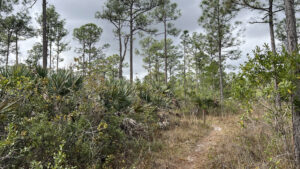
Pine flatwoods Pine flatwoods


Facing a closed vehicle gate at the trailhead, bear right at the blaze post to follow the narrow footpath.

It reaches the Blue Heron Nature Trail sidewalk. Turn left to exit, finishing the hike after 3.6 miles.

Sidewalk at end of footpath Completing the circuit


Trail Map

Royal Palm Beach Pines Trail Map


Explore More!

Video

Hiking Royal Palm Beach Pines


Slideshow

See our photos from Royal Palm Beach Pines


Nearby Adventures

Boardwalk in a cypress strand Hungryland Boardwalk A short walk from the Ocean to Lake Hiking Trail in J.W. Corbett Wildlife Management Area, a scenic boardwalk loops through cypress forests covered with native orchids and bromeliads.
Saw palmetto near the start of a boardwalk Grassy Waters Hog Hammock Trail At the north end of Grassy Waters Preserve, traverse an Ice Age ridge protruding above the sheet flow of Loxahatchee Slough on a series of islands topped with tropical hammock.
Pond with water lilies Grassy Waters Eagle Trail On a slender causeway between the marshes of Gator Lake and Loxahatchee Slough, the Eagle Trail balances immersion in a tropical hammock with scenic views.
Wet prairie with lilies and coots Winding Waters Natural Area Miles of marked trails wind through restored wetlands and pine forests teeming with birds on a large parcel of land saved from development after years of agricultural use.

Official Website

  • Author
  • Recent Posts
Sandra Friend
Sandra Friend
Author of 45 books, Sandra Friend established FloridaHikes.com in 2006 to expand on the field research she'd completed for her first six hiking guides. She has been honored with lifetime achievement awards from the Florida Trail Association and the Florida Outdoor Writers Association.
Sandra Friend
Latest posts by Sandra Friend (see all)
  • Michael Crotty Bicentennial Park - November 3, 2026
  • A.J. Henry Park - November 1, 2026
  • Okeeheelee Nature Center Trails - October 22, 2026
Category: County Parks, Day Hikes, Equestrian, Hikes, Loop Hikes, Natural Lands, Southeast Florida, TrailsTag: Accessible, Birding, Boardwalks, Observation Decks, Palm Beach Gardens, West Palm Beach, Wildflowers, Wildlife Viewing

Sidebar

FarOut Guides

Our comprehensive trail logistics presented on offline maps:

Florida National Scenic Trail (1,500 miles)
Florida Keys Overseas Heritage Trail (108 miles)
Eastern Continental Trail in Florida (92 miles)


We earn a small commission on sales through these links. Thanks for your support!


Our Guidebooks

We’ve written Florida guidebooks for over 25 years. These include Southeast Florida destinations.

Book cover with woman hiking through palms with baby carrier
Book cover of Florida Trail Hikes
The Florida Trail Guide fifth edition

Explore More

Newest Articles for Southeast Florida

Emerging from a tunnel of trees to a waterfront Tradewinds Park
Bench at a junction of trails in pine-palm flatwoods Okeeheelee Nature Center Trails
Dense understory beneath pines along footpath Lakewood Regional Park
Silvery-blue saw palmetto Lantana Scrub Natural Area

  • Facebook
  • Flickr
  • Instagram
  • Pinterest
  • Substack
  • Vimeo

FIND A TRAIL OR PARK

METROS: Bradenton. Clearwater. Crestview. Daytona Beach. Destin. Fort Lauderdale. Fort Myers. Fort Walton Beach. Gainesville. Jacksonville. Kissimmee. Lakeland. Melbourne. Miami. Naples. Ocala. Orlando. Panama City Beach. Pensacola. Port St. Lucie. Punta Gorda. St. Petersburg. Sanford. Sarasota. Sebring. Stuart. Tallahassee. Tampa. Vero Beach. West Palm Beach.

MULTI-REGION: Atlantic Coastal Ridge. Atlantic Coast. Bartram Trail. Big Bend. East Coast Greenway. Everglades National Park. Florida National Scenic Trail. Gulf Coast. Lake Wales Ridge. WATERWAYS: Indian River Lagoon. Intracoastal Waterway. Kissimmee River. St. Johns River. Withlacoochee River.

NORTHWEST FLORIDA: Altha. Apalachicola. Apalachicola National Forest. Big Bend Scenic Byway. Blackwater River State Forest. Blountstown. Bonifay. Bristol. Bruce. Cantonment. Cape San Blas. Carrabelle. Chattahoochee. Chipley. Crawfordville. DeFuniak Springs. Eastpoint. Ebro. Eglin Air Force Base. Freeport. Fountain. Gulf Breeze. Gulf Islands National Seashore. Holt. Madison. Marianna. Milton. Monticello. Mossy Head. Munson. Navarre. Navarre Beach. Newport. Niceville. Panacea. Panama City . Perdido Key. Ponce De Leon. Port St. Joe. Quincy. Santa Rosa Beach. Sopchoppy. South Walton. St. George Island. St. Marks. St. Marks NWR. Sumatra. Vernon. Wakulla. Wewahitchka. Woodville. WATERWAYS: Apalachicola River. Blackwater Bay. Blackwater River. Chipola River. Choctawhatchee Bay. Choctawhatchee River. Coastal Dune Lakes. Ochlockonee Bay. Perdido River. St. Marks River. Wacissa River. Wakulla River. Yellow River.

NORTH FLORIDA: Alachua. Amelia Island. Archer. Baldwin. Branford. Bronson. Bunnell. Callahan. Cedar Key. Chiefland. Crescent City. Cross City. Cross Creek. Dowling Park. Ellaville. Fanning Springs. Fernandina Beach. Flagler Beach. Fort White. Glen St. Mary. Green Cove Springs. Hawthorne. High Springs. Inglis. Jacksonville Beaches. Jacksonville Northshore. Jasper. Jennings. Keystone Heights. Lake Butler. Lake City. Live Oak.Macclenny. Mandarin. Mayo. Mayport. Micanopy. Middleburg. Old Town. Olustee. Orange Park. Osceola National Forest. Palatka. Palatka-Lake Butler Trail. Palm Coast. Palm Valley. Perry. Ponte Vedra. Rodman. Salt Springs. St. Augustine. Starke. Steinhatchee. Suwannee. Suwannee River Wilderness Trail. Suwannee Springs. Talbot Islands. Timucuan Preserve. Trenton. Waldo. Welaka. White Springs. Williston. Worthington Springs. Yankeetown. WATERWAYS: Santa Fe River. St. Marys River. Suwannee River. Tolomato River. Upper Withlacoochee River.

CENTRAL FLORIDA: Altamonte Springs. Apollo Beach. Apopka. Astatula. Astor. Auburndale. Bartow. Babson Park. Bayport. Belleview. Bithlo. Brandon. Brooksville. Bushnell. Canaveral National Seashore. Cassadaga. Christmas. Chuluota. Citrus Springs. Clearwater Beach. Clermont. Coast to Coast Trail. Cocoa. Cocoa Beach. Cross Florida Greenway. Crystal River. Dade City. De Leon Springs. DeBary. Deland. Deltona. Dunedin. Dunnellon. Edgewater. Enterprise. Eustis. Ferndale. Fort Meade. Frostproof. Geneva. Gibsonton. Haines City. Hernando. Hernando Beach. Holopaw. Homosassa. Inverness. Kenansville. Kissimmee. Lake Mary. Lake Wales. Largo. Leesburg. Lithia. Longwood. Lutz. Maitland. Malabar. McIntosh. Melbourne Beach. Merritt Island. Merritt Island NWR. Mims. Mount Dora. Narcoossee/Lake Nona. New Port Richey. New Smyrna Beach. Nobleton. Oak Hill. Oakland. Ocala National Forest. Ocklawaha. Ocoee. Oldsmar. Orange City. Ormond Beach. Osteen. Oviedo. Paisley. Palm Bay. Plant City. Poinciana. Polk City. Ponce Inlet. Port Orange. Ridge Manor. Riverview. Ruskin. Safety Harbor. Silver Springs. Sorrento. Spring Hill. St. Cloud. Tarpon Springs. Thonotosassa. Titusville . Umatilla. Viera. Walt Disney World. Weeki Wachee. Weirsdale. Wimauma. Windermere. Winter Garden. Winter Haven. Winter Park. Winter Springs. Withlacoochee State Forest. Withlacoochee State Trail. Yeehaw Junction. Zephyrhills. WATERWAYS: Alafia River. Halifax River. Hillsborough River. Lake Apopka. Little Manatee River. Ochlawaha River. Rainbow River. Tampa Bay. Wekiva River. Wekiva River Basin.

SOUTHWEST FLORIDA: Alva. Boca Grande. Cape Coral. Charlotte Harbor. Ding Darling NWR. Ellenton. Englewood. Estero. Immokalee. Marco Island. North Port. Osprey. Palma Sola. Palmetto. Pine Island. Port Charlotte. Sanibel Island. Venice. WATERWAYS: Caloosahatchee River. Manatee River. Myakka River. Pine Island Sound.

SOUTH FLORIDA: Arcadia. Basinger. Big Cypress National Preserve. Big Cypress Seminole Reservation. Big Cypress Swamp. Bowling Green. Clewiston. Everglades City. Indiantown. LaBelle. Lake Okeechobee Scenic Trail. Lake Placid. Lakeport. Moore Haven. Okeechobee. Ortona. Pahokee. Palmdale. Port Mayaca. South Bay. Wauchula. Zolfo Springs. WATERWAYS: Fisheating Creek. Lake Okeechobee. Peace River.

SOUTHEAST FLORIDA: Biscayne Bay. Biscayne National Park. Boca Raton. Boynton Beach. Coconut Creek. Coral Gables. Coral Springs. Davie. Delray Beach. Fellsmere. Flamingo. Fort Pierce. Hobe Sound. Hollywood. Homestead. Indrio. Jensen Beach. Juno Beach. Jupiter. Jupiter Farms. Key Biscayne. North Hutchison Island. Ocean to Lake Greenway. Palm Beach. Palm Beach Gardens. Pompano Beach. Redland. Sebastian. South Hutchinson Island. WATERWAYS: Florida Bay. St. Lucie River.

FLORIDA KEYS: Big Pine Key. Islamorada. Key Largo. Key West. Marathon. Overseas Heritage Trail.


©2006-2026, Sandra Friend & John Keatley | Disclosure | Site Index | Work with Us | Advertise with Us | Terms of Service and Privacy Policy

Florida Hikes PO Box 93 Mims FL 32754 | Contact
