

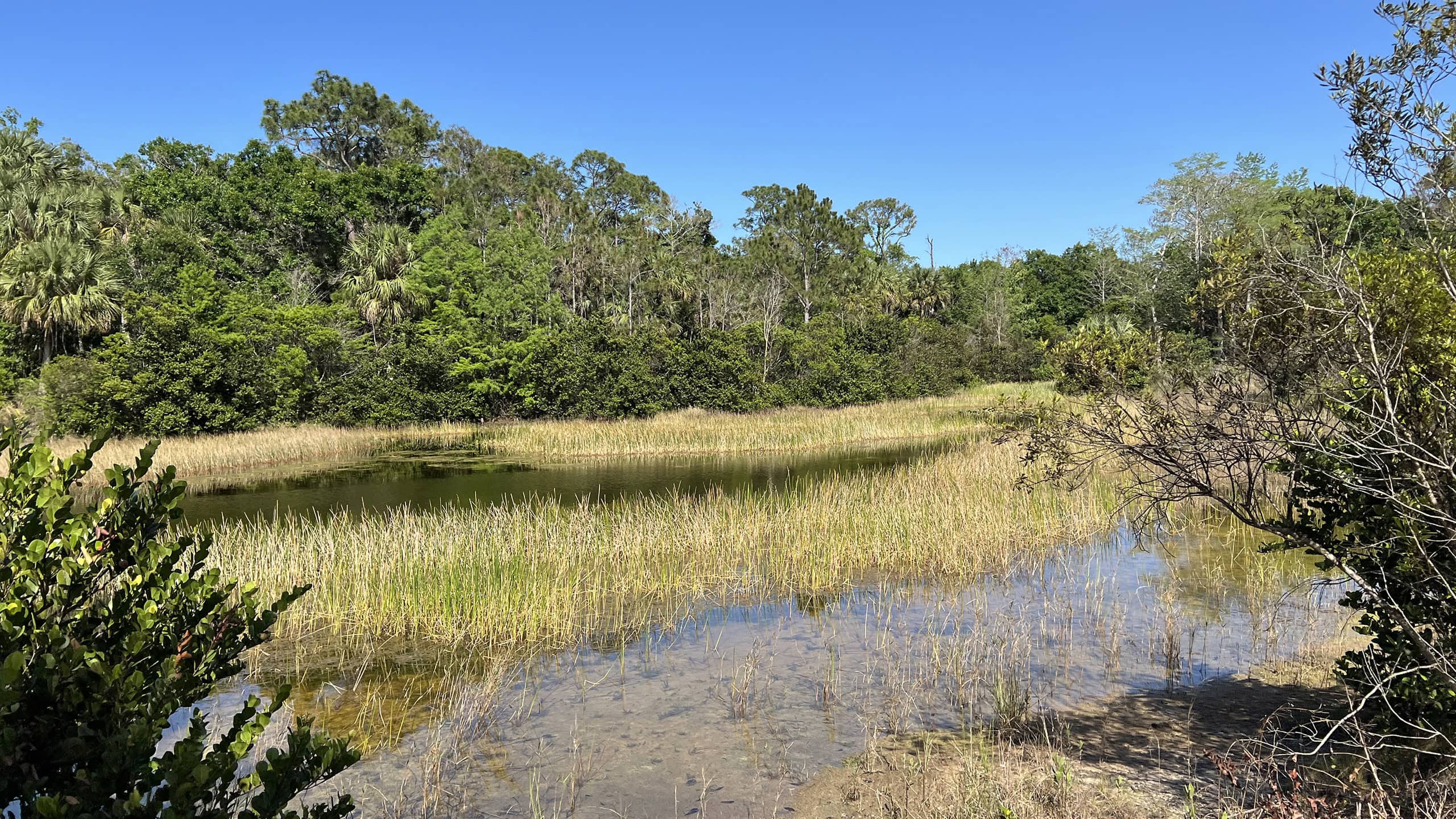
Edging a major tributary of the Loxahatchee River, Cypress Creek Natural Area showcases rapidly vanishing primordial wet landscapes.
These are restored relics of the historic Everglades ecosystem that has vanished across Southeast Florida over the past century, supplanted by farms and then subdivisions.
 Restored wetlands (Chris Stevens)
Resources





Disclosure: As authors and affiliates, we receive earnings when you buy through our links. This helps us provide public information on this website.
Overview
Location: Jupiter Farms
Length: Up to 12 miles in a network of named trails
Trailheads: 26.93836, -80.18190 and 26.943000, -80.191472
Address: 9424 Indiantown Rd and 10035 Indiantown Rd, Jupiter
Fees: Free
Restrooms: None
Land manager: Palm Beach County
Phone: 561-233-2400
Open sunrise to sunset. No pets allowed. Trails are multiuse except where posted hiking-only. Expect wet feet.
Directions
From Interstate 95 or Florida’s Turnpike, exit at Indiantown Rd (SR 706) in Jupiter. Follow Indiantown Rd west for 2.5 miles, passing Riverbend Park and crossing the Loxahatchee River. Watch for the entrance to Cypress Creek South past the strip mall on the left. For Cypress Creek North, the parking area is on the right.
About the Preserve
Encompassing over 2,000 acres, Cypress Creek Natural Area straddles Indiantown Road in Jupiter Farms.
Bisected by the highway, the preserve is divided into Cypress Creek North and Cypress Creek South, each with their own separate trailheads.
 Trailhead kiosk at Cypress Creek North (Chris Stevens)
Established in 1900 and in use until 1950, the original 16.5 mile corridor of Old Indiantown Rd has been preserved as the Historic Jupiter Indiantown Trail.
A 2.1 linear mile segment crosses Cypress Creek North and a 1.1 mile segment crosses Cypress Creek South. Both are multiuse and provide access to additional trails.
 Historic Jupiter Indiantown Trail (Chris Stevens)
The multiuse Jesup Trail runs 1.3 linear miles across Cypress Creek North. It was named for Major General Thomas Jesup.
His troops fought the Seminoles here at the Second Battle of the Loxahatchee, considered the final battle of the Second Seminole War in 1838. They established Fort Jupiter afterwards.
 Loxahatchee River near Cypress Creek
Middens and remnants of an early pioneer settlement known as Rood are also protected within Cypress Creek South in the Loxahatchee River floodplain.
The Winterhawk Trail, a paved bike path paralleling SR 706, fronts this tract, extending east to Riverbend Park and west four miles to to 132nd Trail N.
The natural surface Billy Bowlegs Trail System also has a spur trail interconnecting with Loxahatchee River Battlefield Park and Riverbend Park.
 Riverbend Park
The Historic Jupiter Indiantown Trail and Jesup Trail are considered part of the Jeaga Wildways, the county’s system of long multiuse trails in the Ocean to Lake Greenway.
Using Riverbend Park as a connector, day users (generally by bicycle or horseback) can access the linear Pantano and Bluegill Trails following canals to the south.
 A sandhill crane family along the Pantano Trail
While Cypress Creek Natural Area is day use only, the Jeaga Wildways also connect to the hiking-only Ocean to Lake Hiking Trail, a popular backpacking destination.
It’s a 61-mile piece of the statewide Florida Trail that spans from Lake Okeechobee to the Atlantic Ocean at Hobe Sound Beach.
 Orange blazes mark the Ocean to Lake Hiking Trail
Hikes
These are the hikes we’ve explored within Cypress Creek Natural Area. Expect to get your feet wet on these trails!
 Cypress Creek Osprey Trail System Spanning the northeast corner of Cypress Creek Natural Area, marked trails lead to an observation tower and beautifully restored wetland habitats on this 1.9 mile hike.
 Cypress Creek Wild Cat Trail Miles of interconnected trails provide spectacular scenery among wild South Florida pine flatwoods and cypress swamps sluggishly draining towards the Loxahatchee River.
 Cypress Creek South Restored upland pine forests, cypress swamps, and prairie ponds are on display along a network of trails featuring an observation tower and fishing pier.
Trail Map

Explore More!
Nearby Adventures
 Riverbend Park Protecting the headwaters of the Loxahatchee River, Riverbend Park provides nature, tamed.
 Italian Farms Trail A round-trip through former tomato farms reclaimed by second-growth forest, this multi-use trail through Loxahatchee River Management Area leads to the Masten Dam.
 Pine Glades Natural Area Slosh more than nine miles through restored open prairies and wet pine flatwoods on a trail system along the northeastern edge of the historic Everglades ecosystem.
 Florida Trail, Ocean to Lake: Luckey Tract to Kitching Creek 10.7 miles. A hike of extreme contrasts, this segment of the Florida Trail crossing Riverbend Park and Cypress Creek connects Loxahatchee Slough with Jonathan Dickinson State Park.

- Michael Crotty Bicentennial Park - November 3, 2026
- A.J. Henry Park - November 1, 2026
- Okeeheelee Nature Center Trails - October 22, 2026