

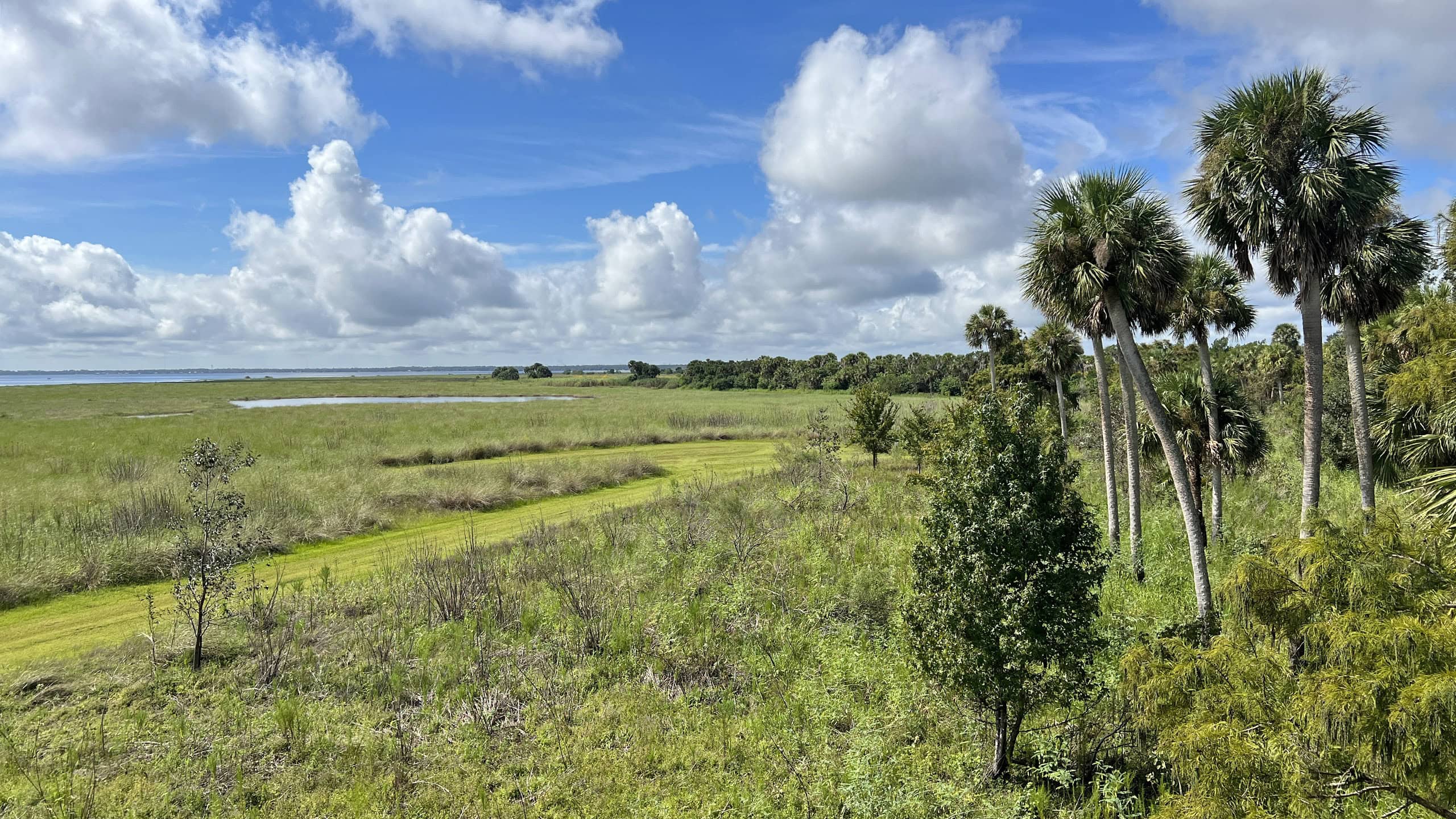
Named after a prominent flatwoods lake on the western side of the property, Lake Proctor Wilderness Area showcases an impressive mosaic of ecosystems along nearly five miles of trails.
Acquired by Seminole County in 1999, the land has undergone extensive restoration efforts to return these environments to a more natural state.
The hydrology of this area has altered significantly over the years, resulting in periods of higher water levels in Lake Proctor.
 Lake Proctor
As a result, the shoreline of the lake has changed rapidly, with many pines along the water’s edge becoming snags.
Portions of the Blue and Orange trails end up underwater during the rainy season.
Even if those side routes aren’t accessible, the Red Trail can be hiked alone as a scenic 2.5 mile loop trek.
 Flooded bench on the Orange Trail
Resources



Disclosure: As authors and affiliates, we receive earnings when you buy through our links. This helps us provide public information on this website.
Overview
Location: Geneva
Length: 4.6 miles
Trailhead: 28.726639, -81.099083
Address: 920 E. State Road 46, Geneva
Fees: Free
Restrooms: None
Land manager: Seminole County
Phone: 407-665-2211
Open sunrise to sunset. Leashed dogs welcome.
Directions
From the intersection of SR 46 and US 17-92 in Sanford, head east on SR 46 for 12.2 miles, and the entrance will be on the left.
Hike
Starting at the trailhead, take a minute to check out the information kiosk and pick up a paper map.
The trail begins along a shaded corridor for 200 feet before opening to a sandhill habitat undergoing restoration.
This section of the forest had experienced a long history of fire suppression and was treated mechanically to remove the overgrown understory.
 Trail entrance
Reaching an intersection at a tenth of a mile, turn right to remain on the Red Trail, following the arrows northward along a wide, sandy pathway for 0.2 miles.
Make another right to begin the loop. In a short distance, the route turns sharply northward, leading in a straight line under high tension power poles.
Unique wildflowers bloom along the sun-drenched edges on this stretch of trail.
 Velvet-leaved milkweed in bloom
Leaving the powerlines at 0.6 miles, follow red arrows as the trail weaves across a sandhill habitat where native lupines produce showy purple inflorescences in early spring.
After crossing a small depression that may be wet depending on the time of year, ascend an ancient sand dune as the landscape quickly transitions to scrub.
 Climbing the sandy ridge
The path snakes across this relict ridge, flanked by a dense wall of shrubby oaks, rusty lyonia, and silk bay.
Reaching a junction with the Yellow Trail at 1.2 miles, turn left and then make an immediate right to begin a trek through very different habitats on the eastern side of the property.
 Trail junction
Shade quickly envelops the trail as it dives into a lush baygall community covered in saw palmetto, grassy sedges, fetterbush lyonia, and cinnamon ferns.
In a quarter mile, the trail emerges from the woods to travel under another powerline easement where yellow bachelor’s buttons bloom profusely alongside the raised berm.
 Bachelor’s buttons
In a half mile, the trail bends to leave the utility corridor, entering a baygall for a short stretch.
It reaches the base of the ridge at a sharp ecotone between scrub and mesic flatwoods habitats.
From this point, follow yellow arrows northward for a half mile before closing the loop and continuing straight to rejoin the Red Trail.
 Baygall habitat
Curving westward across the scrub, the Red Trail passes a shelter and small depression marsh before crossing under the powerlines again.
Arrive at another shelter at the northwest corner of the loop. Turn south at this landmark, following red arrows for 0.2 miles to a decision point at the next trail junction.
 Trailside shelter
The Blue Trail branches off here, which is a much more scenic route – if it’s not flooded.
It will be evident when the path is inundated, in which case, enjoy a scenic view of the lake and return to the Red Trail to continue southward.
If the trail is dry, follow blue arrows across bumpy terrain while tracing the shoreline of Lake Proctor, keeping an eye out for spoonbills, herons, kingfishers, and sandhill cranes.
 Lake Proctor view
At the next intersection in 0.4 miles, turn right to explore the southernmost arm of the lake along the Orange Trail.
It curves along the water’s edge before returning to the Red Trail in a half mile.
From this point, continue straight for another tenth of a mile to finish the hike at the trailhead.
 Orange Loop
Trail Map

Explore More!
Video
Hiking Lake Proctor Wilderness Area
Slideshow
See our photos from Lake Proctor Wilderness
Nearby Adventures
 Geneva Wilderness Area Showcasing prairie ponds amid scrub on the edge of a pine flatwoods, Geneva Wilderness Area offers two loops of gentle paths on which to explore the habitats.
  Lake Harney Wilderness Area With an outstanding accessible observation tower offering a panorama of the St. Johns River floodplain, Lake Harney Wilderness is a must-see for birders and photographers.
 Little-Big Econ State Forest Spanning from Oviedo to Geneva and Chuluota, Little Big Econ State Forest encompasses more than 10,000 acres of diverse habitats.
  Mullet Lake Park Set along a remote sweep of vast marshes along the St. Johns River, Mullet Lake Park is home to a stunning array of swamp sunflowers each fall.
- Tates Hell Blue Spring - August 7, 2026
- Lake Proctor Wilderness Area - August 6, 2026
- Little Lake Santa Fe Preserve - August 2, 2026