
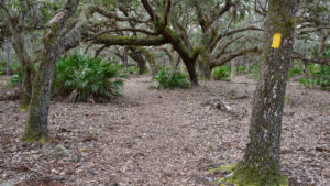
For day hikers, the North Loop at Lake Kissimmee State Park provides a nice sampling of the broad variety of habitats found along the full trail system.
It sticks close to the park drive, crossing it multiple times. This enables you to shorten the length of your hike, since there are two parking areas along the park drive.
Since the trail interconnects with both the Buster Island Loop and the Gobbler Ridge Trail, you can stretch out the miles too, turning this into an overnight trip.
The highlight of the trek are the lush oak hammocks on the south side of the North Loop. But the open prairies and scrub habitat along its north side provide broad panoramas as well.

Resources





Disclosure: As authors and affiliates, we receive earnings when you buy through our links. This helps us provide public information on this website.
Overview
Location: Lake Wales
Length: 6.8 mile loop
Trailhead: 27.9441, -81.3559
Address: 14248 Camp Mack Rd, Lake Wales
Fees: $4-5 per vehicle
Restroom: At the marina trailhead
Land manager: Florida State Parks
Phone: 863-696-1112
Open 8 AM to sunset. Hours may change due to current events, check ahead. Leashed pets welcome but are not permitted overnight at the backpacking campsite.
Your campsite must be reserved in advance. Call ahead or check at the ranger station for availability. Allow yourself two hours before sunset to get there.

Carry plenty of water when day hiking. Backpackers must supply their own drinking water and pack out all trash. Wildlife is abundant, so bring a camera.
Directions
From the junction of US 27 and SR 60 in Lake Wales, head east on SR 60 for 9.7 miles to Boy Scout Camp Road. Turn left and drive 3.5 miles to Camp Mack Road. Turn right, following this road 5.4 miles to the park entrance on the right. After you enter through the ranger station, the park road twists and winds through the oak hammocks that dominate the North Loop. Continue along the park road past the campground and the turnoff to the Cow Camp, reaching the parking area next to the marina. All trails can be accessed here. Please sign in at the kiosk before you hike. You must let the ranger at the front gate know if you plan to backpack to the campsite.
Hike
To get to the loop, you must walk an unmarked connector trail from the marina parking area. Follow the beaten path from that parking lot west, paralleling the Zipprer Canal.
The large kiosk near the park road is the starting point for three trails: The Flatwood Pond Trail, the Buster Island Loop, and the North Loop, blazed yellow.
 Blazes start at this kiosk near the marina
Cross the side road that leads to the 1876 Cow Camp and follow the blazes as they skirt the prairie and lead into the pines.
The loop portion of the trail starts after 0.4 mile. Turn left for a clockwise hike around the loop.
 Junction at the east end of the North Loop
Entering a stand of pines, the trail makes its way to where you see prairie between the trees.
It parallels the north edge of the prairie that the Zipprer Canal, built by the ranchers who once owned this land, bisects.

Pines and palmettos yield to an oak hammock, where a damp fur of resurrection fern covers the sprawling limbs of live oaks. Butterfly orchids grow along the thick branches of the oaks.
After you cross the forest road at Marker 4, the soil underfoot becomes an unusual deep cinnamon color, the result of deep layers of decomposing pine needles.
 Walking through the pine flatwoods
Past a small pond, the trail reaches the sign for the Fallen Oak Campsite after 1.9 miles.
Down a blue blaze into the heart of the hammock, this large clearing has a picnic table and fire ring.
 Picnic tables and fire ring at the campsite
Continuing northwest, the trail slips through the pine flatwoods until it runs up against the park boundary.
It makes a hard right at the boundary fence, passing through sand live oaks and scrubby flatwoods before crossing the park drive.
 A wet prairie along the North Loop
The trail is now north of the park drive and the landscape is more open, with circular wet prairies and scattered trees.
After 3.2 miles you reach a fenced-off pen with a snag with a catface, a deep scarring mark on the former pine tree that was cut to tap turpentine from it ages ago.
 Turpentine gathering cups on a catfaced snag
Becoming more dense in the next mile, the pine flatwoods offer a nice amount of shade. It’s surprising to come back to the park drive and cross it again at Marker 7.
In this narrow strip you’re headed in the opposite direction back from where you came, passing the trail you were on closely enough to see its blazes now and again.
 Parts of the footpath are damp
Skirting a prairie, the trail can get damp underfoot before it leads you across the park drive again.
Enter another stretch of pine flatwoods before the trail winds around clumps of oaks and comes to the signposted junction for the Gobbler Ridge Trail.
 Junction with the connector to Gobbler Ridge
By taking the 0.8 mile connector that it points to, you can turn this loop into an 8.7 mile hike by following the Gobbler Ridge Trail out to the lake and then to the tower by the marine.
For now, stay on the yellow-blazed North Loop, which winds through the saw palmetto and open grassy spaces of a sandhill habitat.
 Following the trail through the sandhills
After a second crossing under a power line paralleled by a forest road, the trail emerges at the park drive one last time.
Cross it and you’ll soon finish the loop portion of the hike when you come to the junction in the pines.
Turn left. Follow the 0.4 mile connector through pines and prairie, across Cow Camp Rd, and on towards the trailhead near the marina.
Walk the beaten path back to the marina to complete this 6.8 mile loop.
 Finishing up at the marina
Trail Map

Purple: North Loop-Gobbler connector. Orange: Cow Camp. Blue: connectors and spurs.
Explore More!
Learn more about Lake Kissimmee State Park and its trails.
 Lake Kissimmee State Park Discover the beauty of the land between the lakes east of Lake Wales while exploring the vast prairies and fern-laden hammocks of Lake Kissimmee State Park.
 Buster Island Loop The 6.9-mile Buster Island Loop at Lake Kissimmee State Park is a favorite for both day hikers and backpackers, as it shows off a variety of habitats along the open prairies
 Gobbler Ridge Trail From its showy start with a climb up an observation tower to its breezy loop along Lake Kissimmee, the 2.8 mile Gobbler Ridge Trail offers scenic views all along its length
 Flatwoods Pond Trail The sole interpretive trail at Lake Kissimmee State Park, the Flatwoods Pond Trail shows off habitats and history in a short loop not far from the campground
Slideshow
See our photos from the North Loop
Nearby Adventures
 Crooked Lake Prairie At Crooked Lake Prairie, the dunes of the Lake Wales Ridge meet showy prairie grasslands along the eastern shore of Crooked Lake.
 SUMICA With up to 6.2 miles of trails - many of them a bit wet - SUMICA is one of the natural lands in Polk County where birding is especially superb.
 Florida Trail, KICCO South 10.1 miles. Ancient live oaks break up the expanse of cattle pastures and prairies along the Florida Trail adjoining the Kissimmee River in KICCO
 Catfish Creek Preserve Trails Allan David Broussard Catfish Creek Preserve State Park isn’t just “a perfect example of Lake Wales Ridge Scrub,” it’s a landscape unlike any other you’ll find in Florida.

- Baseline Trails - November 7, 2026
- Hal Scott Yellow Trail - November 3, 2026
- Hal Scott Preserve - October 28, 2026