
Since construction began in 1999 south of Ocala, the Land Bridge has been a prominent feature along above Interstate 75.
Built to bridge recreational trails on the new Marjorie Harris Carr Cross Florida Greenway, it became an important wildlife crossing as well.
 Atop the Land Bridge
This 3.5 mie loop combines the current route of the Florida National Scenic Trail westbound to the Land Bridge from the Land Bridge trailhead with its original route.
Along the way is a primitive campsite, plenty of majestic live oak trees, and the remains of an old homestead within the greenway corridor.
 One of many ancient live oaks along the loop
Resources




Disclosure: As authors and affiliates, we receive earnings when you buy through our links. This helps us provide public information on this website.
Overview
Location: Ocala
Length: 3.5 mile loop
Trailhead: 29.059735, -82.154948
Address: 11100 SW 16th Ave, Ocala
Fees: Free
Restroom: At the trailhead
Land manager: Cross Florida Greenway
Phone: 352-236-7143
Open sunrise to sunset. Leashed dogs welcome. Although many biking and equestrian trails cross it, this loop is hiking only.
Backpackers: to use the campsite along this loop, call in advance for permission.
Directions
From Interstate 75 south of Ocala, take the Bellview exit and head east to the traffic light for CR 475A. Drive 2 miles north to the turnout for the trailhead on the left. Drive past the equestrian parking area and around to the large parking area near the restrooms.
Hike
Begin this hike at the far southwest corner of the parking area under the shade of large live oaks. Look for signage at a pass-through in the fence.
Follow the orange blazes of the Florida Trail, passing the blue-blazed return loop coming in from the left.
 Start of the trail
Once a windbreak for a farm, this linear strip of live oaks hosts some massive, showy trees.
Step through the limbs of an oak that touches the ground. Look left to see a split oak with a path right through its middle.
 Split oak
Cross a broad wagon trail used by equestrians. Sign in at the trail register just past it. The trail slips past more ancient live oaks.
A flurry of marked cross trails slip through the forest before a blue-blaze on the left. This spur trail ends at a small primitive campsite for backpackers.
 Land Bridge Campsite
Beyond tall laurel oaks, longleaf pines bathed in sunlight mark a former pasture reclaimed as forest. A handful of turkey oaks sport fall colors.
At a corner of a fence line along a horse farm, curve left to go around it. A mountain bike trail draws close, as does an equestrian trail.
 One of the equestrian crossings
Reach a park bench beneath a canopy of live oaks at 0.6 miles. Frequent trail crossings continue. Then the understory becomes thick with grapevines.
Pine needles carpet the trail, forming a cushy walking surface, and dangle from branches and leaves like tinsel. Fungi flourishes on rotting logs.
 Narrowing footpath
Traffic noise picks up. Gain a little elevation and the habitat shifts to scrub, patches of soft sand under sand pines and myrtle oaks.
Emerge at a crosswalk on the multiuse path at 1.1 miles, facing a kiosk and bench. Turn right to walk up to the Land Bridge.
 Kiosk and bench at crosswalk
Dedicated on National Trails Day in 2000, it was America’s first true land bridge. More than a thousand tons of material went into its construction.
 Cross Florida Greenway History: The Land Bridge A landmark along Interstate 75 near Ocala, the Land Bridge remains one of the more popular destinations for hikers, bikers, and equestrians on the Cross Florida Greenway.
A giant concrete planter, it holds an an atypical weight of rocks, soil, water, shrubs, saw palmetto, and oaks. Overlooks in the center let visitors see traffic below.
 Pavement was added in recent years for the multiuse trail
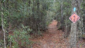
After visiting the Land Bridge, walk back to the kiosk at the crosswalk. An FT sign and blue blaze adjoin the footpath for the return route.
Amid the dense vegetation, the trail forks. Bear right at the HIKING ONLY sign. Longleaf pines tower overhead.
 Start of the return route
Head south, paralleling the interstate—not visible, but noisy. In the fall, bright dashes of yellow-orange draw attention to hickory trees among the oaks.
Beyond Equestrian Trail 2 at 1.6 miles, the understory closes in. Saw palmetto edges the corridor for a stretch.
 Reaching the palmetto corridor
The oaks forming the high canopy tip in a multitude of directions as the forest ages and trees weaken.
American holly, sweetgum, and silk bay round out the forest. A small pond is barely discernible through the riot of vegetation on the left.
 Under tangled limbs and vines
Pass a bench at 2.3 miles. Beyond, Spanish moss sways in the high branches of massive live oaks, their limbs furry with ferns.
Look up to spot delicate greenfly orchids blooming amid the resurrection ferns in summer.
 Oak limbs overhead
Cross Equestrian Trail 2 and several mountain bike trails. Enter a longleaf pine forest planted over two decades ago, reclaiming what was once a pasture.
The wizened trees with crazy crooked limbs are Chickasaw plums, native fruit trees that burst into beautiful white blooms by February.
Blackberry brambles reach out to snag pants. Hike this trail in late spring to sample the juicy berries.
 Chickasaw plum branches
Pass through two clusters of sand live oaks among the pines before reaching a fork in the blue-blazed trail at 3 miles.
To the right, it heads to the first trailhead built along the Cross Florida Greenway for the Florida Trail.
Walk a short way down it to inspect the remains of an old homestead. Return to the intersection and continue the loop.
 Part of the limestone foundation at the homestead
Former plow lines make for rugged footing amid deep shade cast by laurel oaks.
Emerge at a crosswalk over the multiuse trail and enter a final stretch of planted longleaf pines.
Crossing the equestrian access trail for the Land Bridge trailhead, turn to follow blue blazes along the fence.
Where it ends, make a right to complete the 3.5 mile loop at its junction with the Florida Trail. Turn right to exit to the trailhead.
 End of the loop
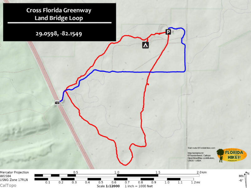
Trail Map
Explore More!
Learn more about the Cross Florida Greenway
 Cross Florida Greenway Spanning 110 miles between the St. Johns River near Palatka and the Gulf of Mexico, the Marjorie Harris Carr Cross Florida Greenway is a mile-wide recreational corridor.
 Florida Trail, Cross Florida Greenway 43.8 miles. A prime destination for backpacking and day hiking south of Ocala, the Florida Trail follows the Cross Florida Greenway between the Withlacoochee and Ocklawaha Rivers.
Slideshow
See our photos from the Land Bridge Loop over the years
Nearby Adventures
 Florida Trail, SW 49th to Land Bridge Trailhead 3.6 miles. Bookended by soft sand pines and ancient oaks, this particularly fascinating hike along the Cross Florida Greenway includes a massive dune-like slope and the Land Bridge over Interstate 75.
 Florida Trail, Land Bridge Trailhead to Santos 6.7 miles. Between the Land Bridge Trailhead and Santos, the Florida Trail winds its way around horse farms to meander through stands of oaks and pines.
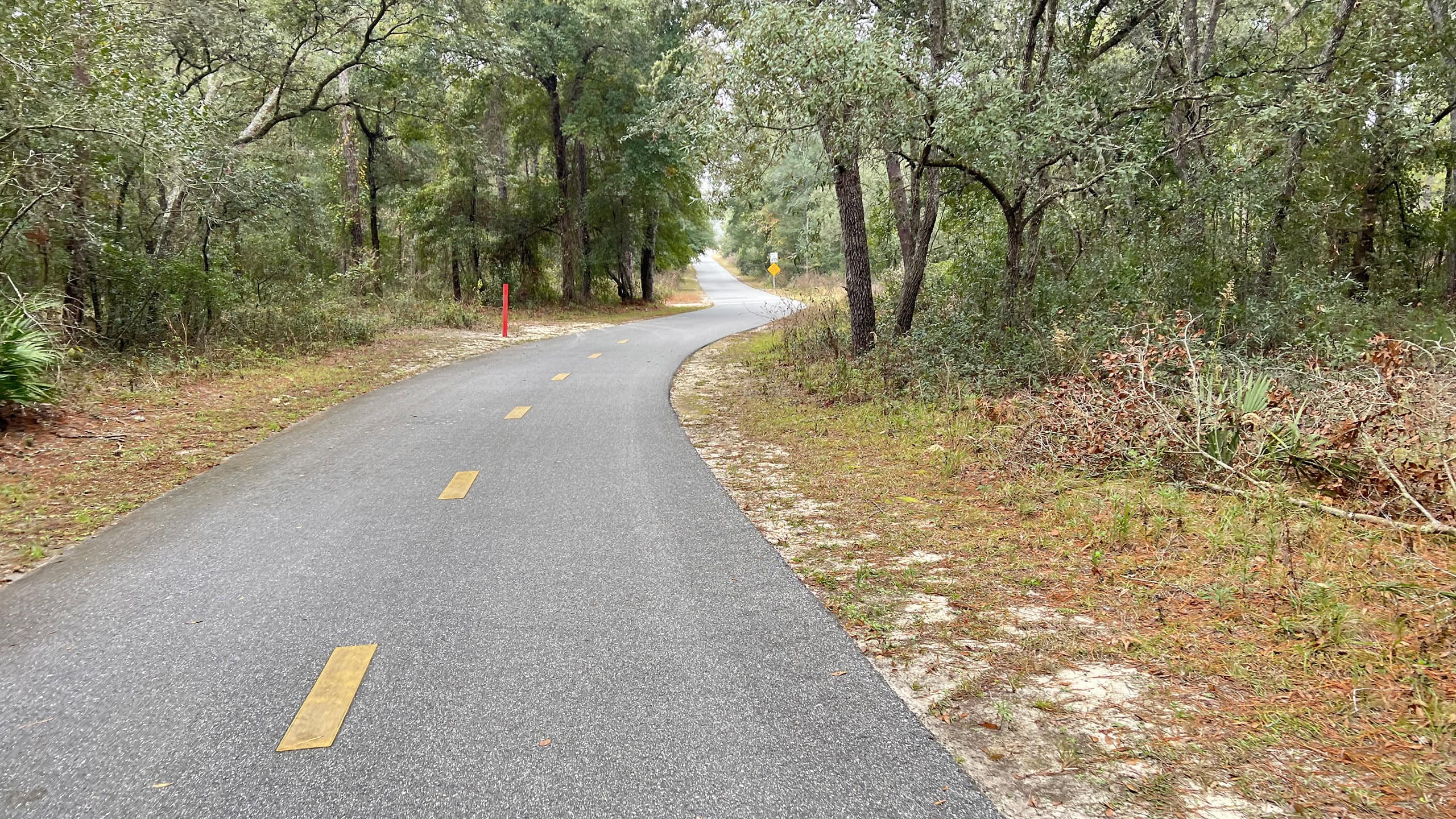 Cross Florida Greenway Multiuse Path Over fifteen miles long, this linear paved path along the Cross Florida Greenway connects Santos to Ross Prairie with direct access from several trailheads.
 Historic Ship Canal Trail The shortest trail on the Cross Florida Greenway interprets nearly a century's worth of efforts to dig a canal across the Florida peninsula and split it in two.
Official Map (PDF) Interactive App Official Website

- Hal Scott Red Trail - November 13, 2026
- Baseline Trails - November 7, 2026
- Hal Scott Yellow Trail - November 3, 2026