
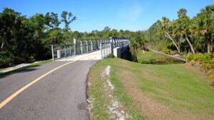
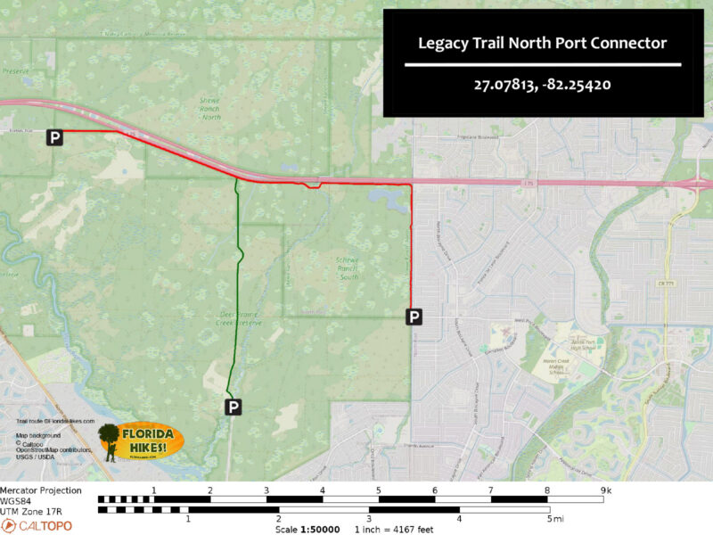
Physically separate from but connected by road to the Legacy Trail, this linear asphalt path traverses natural habitats.
It follows the north and west rims of Deer Prairie Creek Preserve and its Shewe Ranch Tract, ending at a bridge to a small trailhead in North Port.
 Along the central portion by the interstate
Cyclists can take on a 11.6 mile round-trip ride from either end, or make this one leg of a 23.3 mile loop.
Despite its central 3.4 miles paralleling traffic on Interstate 75, round-trips of up to 2 miles from either end are blissful immersions in nature.
 Winding through the pines in North Port
When the trail isn’t next to Interstate 75, birdsong and the rustle of the wind in the pines set the soundscape.
Wildflower-dotted prairies, ponds, and wetlands among the pines make for a serene setting.
The path connects to many numbered trails within Deer Creek Prairie Preserve, allowing visitors to try their own creative routefinding.
 Sandhill crane family alongside the path
Resources



Disclosure: As authors and affiliates, we receive earnings when you buy through our links. This helps us provide public information on this website.
Overview
Location: Venice to North Port
Length: 5.6 miles
Trailheads: 27.10680, -82.31883 (Venice), 27.07813, -82.25420 (North Port)
Address: 7001 Forbes Trl, Venice
Fees: Free
Restroom: At Forbes Rd trailhead
Land manager: Sarasota County
Phone: 941-861-5000
Open 6 AM to sunset. Leashed dogs welcome; pick up after your pet. Mileage posts count off quarter mile increments.
At mild curves in the path, a yellow line encourages riders to stay to their side where views are obscured.
Directions
Cyclists should start at the large Forbes Trail Trailhead. In Venice, take Interstate 75 exit 193, Jacaranda Blvd, and drive north 0.7 miles to Border Rd. Turn right. Continue 2.6 miles to its junction with Mabry Carlton Pkwy / Moon Dr. Turn right. Follow Moon Dr south under Interstate 75, after which it curves left becoming Forbes Trl. After 2.3 miles, the road ends at the trailhead at the northwest corner of Deer Creek Prairie Preserve.
Hiking is more pleasant from the small Price Blvd Trailhead. Use Interstate 75 exit 182, heading south on Sumter Blvd for 2.1 miles. Turn right on Price Blvd and continue 3 miles. Make a right on N Calera St and the trailhead is on the left.
Trail Details
From the large Forbes Trail Trailhead, shared with equestrians riding into Deer Creek Prairie Preserve, proceed out the entrance road back to Forbes Trail.
Turn right and slip around the gate. A kiosk displays a map of the route.
 Forbes Trail gate
The straightaway starts out broad and wide like a major road leading into a subdivision, which it was likely intended to be before the ranch was purchased and preserved.
The buffer of pine forest to the north ends at a slight curve by 0.8 miles as the path draws parallel to Interstate 75.
 Straightaway
The path behind Marker 35 leads a short distance to a large wet prairie good for birding.
At 1.1 miles, pass Marker 33 at a junction with a broad grassy road headed south into Deer Creek Prairie.
 Marker 33
A grassy strip parallels both sides of the pavement. Clumps of cabbage palms form a green buffer in front of the much taller pines.
At 2.2 miles, meet the Alphabet Trail junction. This marked forest road heads due south to the main trailhead for Deer Creek Prairie Preserve.
 Alphabet Trail
The road ends at a big clearing by this junction, the trail becoming a ribbon of asphalt as it enters Schewe Ranch South.
A tract managed by Southwest Florida Water Management District, it occupies the northeast corner of Deer Creek Prairie Preserve.
In a corridor lined by pines, cross a bridge. As the pines thin between the trail and the interstate, traffic noise thrums.
 Bridge
The pines thin on the south side, too, thanks to a series of wet prairies, some visible from the trail.
By the Marker 32 junction, scrubby flatwoods dominate to the south. Turn away from the interstate.
 Junction in scrubby flatwoods
Rounding a bend past the Marker 31 junction, where a two-track curves into the scrubby flatwoods, cross a bridge at 3.1 miles.
Curve north around a patch of scrub to parallel the highway fence. The low scrub forest has several entry points into it for maintenance by prescribed burns.
 Deer Creek flows beneath the bridge
Xeric flatwoods dominate this last stretch of forest fronting the interstate, a noisy one, with some brief bends around stands of pines near the fence.
A perplexing flurry of signs among the pines warn not to leave the path due to protected wetlands.
 Wetlands signs among the pines
Curving away from Interstate 75 at 4.1 miles, head southbound along the eastern edge of Schewe Ranch South. Pass Marker 28.
A line of houses stands beyond the pines and a canal beyond the boundary fence. Expect more pedestrian traffic over the next mile.
 Marker 27
Pass Marker 27 in front of a two-track leading towards the shore of a large pond.
At 4.5 miles, it’s a good birding spot, as is the prairie to its south that surrounds a large shallow marsh.
 Final stretch in North Port
A trailhead kiosk with shaded benches and a bike repair station adjoin the path at 5.7 miles.
Come to a bridge across the canal. Southbound pavement ends here. Volunteers informed us plans are to extend it to US 41 eventually.
 On weekends, you may see volunteers here with an information booth
Cross the bridge. Price Blvd Trailhead is on the right. There are no facilities and it’s quite small.
Return the way you came for an 11.4 mile ride. If you’d rather tackle a 23.3 mile loop, see the Connections section below on how to do so.
 Bridge to trailhead
Mileage
0.0 Forbes Trail Trailhead (Venice)
0.8 Marker 35 junction
1.1 Marker 33 junction
2.2 Alphabet Trail junction
2.4 bridge
2.7 Marker 32 junction
3.0 bridge
4.1 curve at property corner
4.5 Marker 27 junction
4.8 trailside marsh
5.3 Marker 26 junction
5.6 bicycle repair station
5.6 Price Blvd Trailhead (North Port)
Recommended Hike
From the North Port trailhead, cross the bridge over the canal and turn right. The broad asphalt path parallels the canal northbound.
An expanse of palmetto prairie stretches to the western horizon. Pass the trailhead kiosk with shaded benches at a tenth of a mile.
 Trailhead kiosk
Towering longleaf pines with a thick understory of saw palmetto and grapevines blot out views of the canal beyond the barbed wire fence.
Breaks in the scrim of forest reveal glimpses of backyards in the neighborhood beyond. Pass the first of a series of mileage posts at quarter mile increments.
 Milepost
To the west, the understory becomes scrubby, the pines more infrequent and oaks joining the mix.
At a break in the understory, a broad view opens up of a dry grassy prairie bounded by forest. Continue beneath the dappled shade of towering pines.
 Dry prairie
The grassy strip adjoining to the left broadens on the approach to a white-tipped post for Marker 26 a half mile into this walk.
It flags the first entry point for exploring the Schewe Ranch Tract within Deer Creek Prairie Preserve on forest roads. Consult the official map to plan routes.
 Marker 26
Skinny pines poke out of a vast understory of saw palmetto. Clusters of pawpaw with ivory blossoms rise from the grassy openings between them.
Jog through another curve with a yellow line down the middle of the path. Cabbage palms sprout amid the pines.
 Gentle curves
A ribbon of light appears along a treeline horizon, resolving into a large wet prairie. Seasonal shallows attract herons, egrets, and ibis.
Signs warn against entering the prairie. Its scenic north shore makes a good turnaround point for a 1.7 mile walk.
 North shore of the prairie
A shift to scrub habitat is evident by a thicket of scrub oaks. Jog through another slight curve in the pine flatwoods.
Within a quarter mile, Marker 26 signals access to a forest road quickly leading to another great birding spot along a large pond.
By 1.5 miles, the path straightens off its curve to parallel Interstate 75. Turn around here for a 3 mile round-trip.
 Reaching I-75
Connections
Legacy Trail
A road ride is necessary to connect to the Legacy Trail. From the Forbes Trail trailhead, head west on Forbes Trail 1.2 miles to Moon Dr. Turn right.
Follow it north 1.2 miles to Border Rd and turn left. Ride Border Rd westbound. Passing under Interstate 75, it changes its name to Edmondson Rd after 3.6 miles.
Continue westbound. The road name changes to Florence St when you cross Albee Farms Rd. Florence Street ends into the parking area at Nokomis Riverview Park.
Meet the Legacy Trail at a T at the end of a connector to it from the park, a ride of 8.7 miles from the Forbes Trail Trailhead.
 The Legacy Trail Connecting Venice and Sarasota, one of Florida's finest paved trails provides a corridor for biking and hiking along a historic railroad line.
Deer Creek Prairie Preserve
Requiring offroad tires, the trails of Deer Creek Prairie Preserve vary in quality from grassy to deep soft sand.
The Alphabet Trail forms a backbone to the trail system and is largely a well graded two-track. It extends 2.7 miles south from this trail to the preserve’s primary trailhead.
 Florida scrub-jays near Marker G on the Alphabet Trail
If you diverge from the Alphabet Trail, consulting their map (which labels trail junction markers) is a must before exploring.
The extensive trail system has many junctions and extends more than 60 miles. It is mainly used by equestrians.
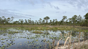 Deer Creek Prairie Preserve Part of a complex of public lands protecting the Myakka River and its tributaries, Deer Creek Prairie Preserve blankets over 7,300 acres between Venice and North Port.
Powerline Road Loop
Short road rides connect this bike path to the graded Powerline Trail crossing Big Slough Preserve and Carlton Reserve.
From the Price Blvd Trailhead, ride east along Price Blvd for a half mile. Turn left on Biscayne Drive, making a right on Ponce De Leon Blvd after 0.2 miles.
Follow Ponce De Leon Blvd for 2.3 miles, crossing over Interstate 75. Turn right on Tropicaire Blvd. Continue 1.6 miles east to Reistertown Rd. Make a left.
In another mile, turn into the entrance for Myakkahatchee Creek Environmental Park, which has a vault toilet and shaded picnic tables.
 Myakkahatchee Creek Environmental Park Along a 2.1 mile loop largely under a lush canopy of live oaks and cabbage palms, circle a deeply eroded basin holding sinuous Myakkahatchee Creek, also known as Big Slough.
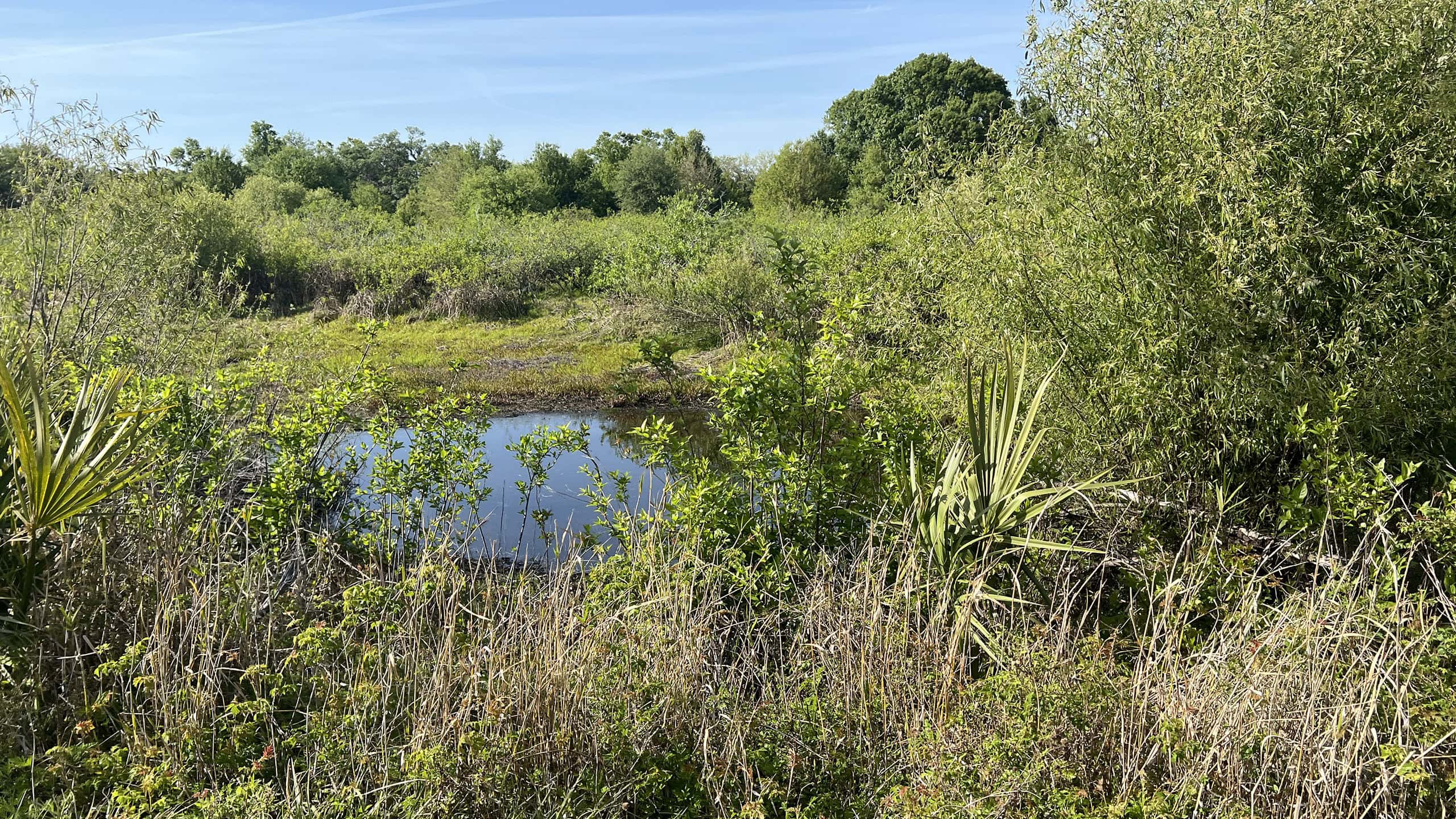 Big Slough Preserve Adjoining Carlton Reserve, Myakka River State Park, and Walton Reserve, Big Slough Preserve provides a vast space for wildlife to roam north of North Port.
Head through the parking areas to reach the gate at the northwesternmost corner. Follow the two track to a bridge over a canal into Big Slough Preserve.
 Myakkahatchee Trailhead in Big Slough Preserve
North of the bridge, meet Powerline Rd at a kiosk. Turn left. Enter Carlton Reserve within a mile. Continue along Powerline Rd for 8 miles to Marker 10.
 Swamp halfway to Marker 10 along Powerline Rd
Turn left and follow the graded road south, joining the Red Trail south to Carlton Reserve’s picnic area. Exit to the trailhead.
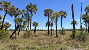 Carlton Reserve Less than a dozen miles from downtown Venice, the vast expanse of T. Mabry Carlton Reserve provides regional drinking water and a massive refuge for wildlife.
Exit the park southbound, crossing Border Rd and the overpass above Interstate 75. Turn left on Forbes Trail to return to the trailhead where you started the loop.
 Forbes Trail trailhead
Trail Map
Explore More!
Slideshow
See our photos from the Legacy Trail North Port Connector
Nearby Adventures
 Carlton Reserve Hiking Trails Explore open prairies, wetlands, and pine flatwoods on a series of nested loop trails within the vast expanse of Carlton Reserve north of Venice.
 Sleeping Turtles Preserve North Named for a feature on old navigational maps, Sleeping Turtles Preserve North provides great views of the Myakka River from its bluffs.
 Sleeping Turtles Preserve South Where subdivisions now occupy a formerly sleepy rural corner of Venice, Sleeping Turtles Preserve South provides a haven for wildlife along the Myakka River floodplain.
 Curry Creek Preserve East Amid expanding suburbia in Venice, this 71-acre island of botanical delights circled by a 1.6 mile loop buffers wildflower-rich longleaf pine flatwoods along a mangrove-lined stream.

- Hal Scott Red Trail - November 13, 2026
- Baseline Trails - November 7, 2026
- Hal Scott Yellow Trail - November 3, 2026