• Skip to main content
  • Skip to header right navigation
  • Skip to after header navigation
  • Skip to site footer
Florida Hikes logo

Florida Hikes

Hike Bike Paddle Camp Florida with authors Sandra Friend and John Keatley as your guides

  • Trails
  • Maps
  • Guidebooks
  • Hike
    • Scenic Hikes
    • Loop Trails
    • Dog-friendly Hikes
    • Hikes for Kids
    • National Parks in Florida
    • Florida State Parks
  • Bike
    • Major Bike Trails
    • Paved Bike Trails
    • Off Road Biking
    • Biking Articles
  • Paddle
    • Canoe & Kayak Rentals
    • Paddling Destinations
    • Paddling Articles
  • Camp
    • Cabin Rentals
    • Car Camping
    • Primitive Camping
  • Florida Trail
    • Plan your Hike
    • Best Scenic Hikes
    • Best Backpacking
    • Section Hiking
    • Thru-Hiking
    • Trail Updates
  • Travel
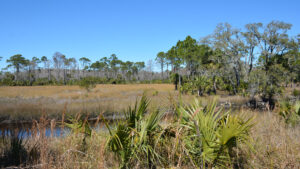
Marshes edged by pines

St. Marks NWR Deep Creek Trail

Savor coastal pine flatwoods and outstanding scenic panoramas of the Big Bend from a remote corner of St. Marks National Wildlife Refuge on this 12 mile circuit.

Newport (30.140917, -84.138847)   12.0 miles   St. Marks NWR

On this 12 mile day hike loop within St. Marks Unit of St. Marks National Wildlife Refuge, emerge from the pine flatwoods to a coastline like no other.

A little past the halfway point of the hike, stand within marshes west of the Pinhook River and take in the sweep of the Big Bend.

Horizon line view of salt marshes The Big Bend


Largely following forest roads and levees, this is an easy, flat walk that can also be tackled by bike.

Along an arc of coastal levees partly shared with the statewide Florida Trail, expect minimal shade paired with a delightful number of wildlife sightings.

Alligator crawling out of a ditch Even in the woods, alligators appear from roadside ditches


Resources

Resources for exploring the area
Florida Trail Hikes book cover The Florida Trail Guide book cover North Florida Panhandle Explorers Guide book cover Hikers Guide to the Sunshine State book cover Paddlers Guide Florida The Hiking Trails of Floridas National Forests Parks Preserves book cover
 
Disclosure: As authors and affiliates, we receive earnings when you buy through our links. This helps us provide public information on this website.

Overview

Location: St. Marks National Wildlife Refuge
Length: 12 miles
Trailhead: 30.140917, -84.138847
Address: Lighthouse Rd, St. Marks
Fees: $5 vehicle, $1 bicycle or pedestrian
Restroom: None
Land manager: U.S. Fish & Wildlife Service
Phone: 850-925-6121

Open sunrise to sunset. No pets. The gate on Lighthouse Rd opens at 6 AM and closes after dark. Keep alert for alligators as they are a common sight.

National Park Passes and Federal Duck Stamps are honored for admission. An annual pass for the refuge can be purchased for $25.


Directions


From Tallahassee, take SR 363 south to Wakulla. Turn left on SR 267. At the T with US 98, turn left. A prominent entrance sign points to Lighthouse Rd just after you cross the St. Marks River in Newport. Continue 3.7 miles to the Visitor Center. Stop at the fee station. Continue south another mile along Lighthouse Rd to the small pulloff at the St. Marks Unit Primitive Walking Trails gate on the left.

Hike

From the small parking pulloff adjoining the St. Marks Unit Primitive Walking Trails sign, cross the bridge and circle the gate for FR 105.

The Deep Creek Trail shares its start with the Stoney Bayou Trail, which covers half as much distance as an inner loop.

Large sign for Primitive Walking Trails Starting point


A set of stanchions allows a chain to bar the road a little further along where a side road leads to a maintenance yard under the pines.

Enjoy dappled shade cast by live oaks on the approach to FR 106 at a half mile, a forest road to the right that’s the return route for this loop.

Long straight two track bordered by forest Typical stretch of FR 105 to start


Stay with FR 105 heading east. Where FR 109 branches off, a broad grassy needlerush marsh fills an open expanse amid the pine flatwoods.

Beyond the 1.1 mile sign, the two-track stops being a straightaway and curves around a bend. Pass FR 110 at a marshy junction.

A succession of forest roads continue to branch off into habitats shifting to wet flatwoods dotted with forested swamps.

Deer along grassy road A deer watches from a side road


At the 1.9 mile sign, the Stoney Bayou Trail peels off to the right at an odd angle. Stay left to remain on the Deep Creek Trail.

Gaining a little elevation, pine flatwoods transition into mixed hardwood forest, offering the shade of live oaks over the trail.

A smattering of cedars and an increasing number of cabbage palms adjoin the trail.

Trail junction sign amid pines Stoney Bayou junction


Edged with sawgrass, dark pools of water are home to alligators, one of the most common wildlife sightings to expect along this trail. Don’t approach them.

White-tailed deer startle the unwary when they burst across the forest road.

Around 2.6 miles, cross a concrete bridge over Deep Creek, a broad blackwater stream outlined by floodplain forest, and continue through a curve.

Daypack on a concrete bridge The bridge at Deep Creek


As the habitat shifts to drier terrain, redbud sports showy blossoms in spring near a clearing under the pines shaded by live oaks.

Passing more forest road junctions, continue to follow the distinct two-track under the pines and oaks.

A ditch adjoining it broadens, particularly when the view opens up to a sawgrass prairie.

Prairie outlined by pines Sawgrass prairie


A signposted junction at 4.5 miles marks an important right turn where the Deep Creek Trail turns right on Main Levee, headed towards the coastline.

Raised up enough for nice views of the surrounding forests and marshes, Main Levee parallels a deep ditch where alligators sun along its sides.

Deep creek sign and broad grassy junction Junction at Main Levee


Six miles into this loop, a sign that says “Half Way” means just that. Not far past it is a junction with the Swamp Hammock Trail at a footbridge

It emerges from a coastal palm hammock. A bench in the shade is worth savoring, as the remainder of this hike is largely in full sun.

It has varied over the years, but the orange blazes of the Florida Trail join in on Main Levee here if they didn’t back at the earlier signposted junction.

Half Way sign on levee in forest Half Way point


Within a half mile, a grated bridge over an outflow from the marshes signals the start of a parade of coastal panoramas.

First framed by stunted cabbage palms and then simply laid out at the foot of Main Levee is a sweep of salt marshes extending to the far horizon.

Waterway through marsh with islands topped in palms Emerging into the salt marsh


They define the shallowest coastline of the Gulf of Mexico, where the Pinhook and Aucilla and Econfina Rivers empty dark waters into the curve of Florida.

The peninsula and Panhandle meet on the horizon. Since Main Levee is offshore, the salt marsh views on its inner curve are beautiful as well.

Watch for splashes of pink in the marsh. While likely to be roseate spoonbills sifting through soft mud, flamingos have been seasonally spotted, too.

Curving levee in vast marsh Curve of Main Levee west


Cross several large spillways within a half mile. When Main Levee reaches a cabbage palm hammock at 7.8 miles, a path left leads to Ring Dike Campsite.

It’s available for overnight stays for backpackers crossing the entire refuge on the Florida Trail and for paddlers following the Florida Saltwater Circumnavigation Trail.

Sign for Ring Dike campsite Blue blazed path to campsite


Stop for a rest break, as it’s worth a visit for its beauty and its bench overlooking the sparkle of Apalachee Bay.

Beyond the campsite, the open water on both sides of the levee make it easy to watch mergansers and ducks.

Open water and skinny palms in salt marsh Waterfront at Ring Dike


At a trail junction in the levee with a white “Trail” sign at 8.5 miles, meet the eastern edge of Stoney Bayou Pool #2.

The Florida Trail turns north here to meet the Stoney Bayou Trail along the north end of this large, shallow impoundment.

Continue straight ahead to stay on the Deep Creek Trail in full sun. The pool on the right bustles with the activity of wading birds.

Trail junction on levee Junction


Alligators lounge amid water lilies and tufts of needlerush on muddy islands. Flotillas of coots startle easily into skipping across the surface in semi-flight.

A channel parallels the base of the levee. Beyond it, the expanse of needlerush marsh continues.

It is broken in several places by intentional ditching around deeper waters in the marsh.

Alligators half submerged Alligators in the shallows


Reach the next trail junction at 9.7 miles and an important right turn at the open expanse of Stoney Bayou Pool #1.

Built by an all-Black workforce under the Civilian Conservation Corps in the early 1940s, these impoundments assisted in mosquito control.

Coots in a row in marsh Coots in a row in the marsh


They also provided migratory birds a variety of depths of waters to encourage their stopoff before winging across the Gulf to their next destination.

This impoundment tends to far more open water than the others. When sandbars are exposed, they draw the interest of flocks of skimmers and seagulls.

Sandbar and paddler on different sides of levee Sandbar along the levee


Within 0.7 mile, Deep Creek Trail turns right off this levee and meets a four-way junction with a 10.4 mile sign.

A trailhead at Lighthouse Road is visible to the left; the Florida Trail crosses here and proceeds towards it.

Marked with brown signs, the Stoney Bayou Trail turns off to join the Deep Creek Trail in its final stretch back to the Primitive Trails trailhead.

Signs for two trails amid a large marsh Where trails merge


A low, broad causeway leads through the expanse of grassy marshes for 0.2 miles to a slight rise into the pines.

With views out into the marsh, enjoy a straightforward walk through the pine flatwoods for the next mile.

At the junction with FR 105, turn left for the final half mile along the two-track road to the Primitive Trails trailhead, wrapping up this scenic 12 mile adventure.

106 sign at trail junction FR 105/106 junction


Trail Map

St. Marks NWR Primitive Trails Map
Red dashes: Deep Creek Trail. Dots: Stoney Bayou Trail. Orange: Florida Trail

Explore More!

Learn more about St. Marks National Wildlife Refuge

Lighthouse with palm trees and white sand beach on marsh St. Marks National Wildlife Refuge Stretching across 86,000 acres in Florida's Big Bend, St. Marks National Wildlife Refuge protects one of Florida's longest wild shorelines, more than 43 miles in three counties.

Learn more about the Florida Trail in the Big Bend

Words Florida Trail Big Bend over a lush marsh lined with palms and cypress on horizon Florida Trail, Big Bend Crossing rural farms and forests, this 116 mile segment of the Florida Trail reveals the secrets of the Aucilla River before tracing the Gulf coastline at St. Marks National Wildlife Refuge.


Slideshow

See our photos from this hike


Nearby Adventures

Expansive view of needlerush marsh on Gulf of Mexico Florida Trail, Apalachee Bay 14.3 miles. Hugging the Big Bend coastline, this hike through Aucilla WMA and St. Marks NWR offers some of the most breathtaking panoramas you'll find along the Florida Trail, and a profusion of wildlife.
Rounded spring surrounded by forest Florida Trail, Shepherd Spring Visit a pair of natural treasures along the Forgotten Coast on this 6 mile hike along the Florida Trail within St. Marks National Wildlife Refuge.
Wakulla Springs Trail Wakulla Springs Trail Immersed in dense forests along the Wakulla River floodplain, the Wakulla Springs Trail wraps together several named trails through picturesque landscapes near the big spring.
Aucilla Sinks Florida Trail, Aucilla Sinks 4.4 miles. Winding through a geologically weird and archaeologically significant part of Florida, the most fascinating segment of the Florida Trail is the Aucilla Sinks

Trail Map (PDF) Official Website

  • Author
  • Recent Posts
Sandra Friend
Sandra Friend
Author of 45 books, Sandra Friend established FloridaHikes.com in 2006 to expand on the field research she'd completed for her first six hiking guides. She has been honored with lifetime achievement awards from the Florida Trail Association and the Florida Outdoor Writers Association.
Sandra Friend
Latest posts by Sandra Friend (see all)
  • Michael Crotty Bicentennial Park - November 3, 2026
  • A.J. Henry Park - November 1, 2026
  • Okeeheelee Nature Center Trails - October 22, 2026
Category: Biking, Day Hikes, Hikes, Loop Hikes, Northwest Florida, Off Road Biking, TrailsTag: Alligators, Best Birding, Big Bend, Big Bend Scenic Byway, Birding, Newport, Scenic Hikes, St. Marks, St. Marks National Wildlife Refuge, Wildlife Viewing

Sidebar

FarOut Guides

Our comprehensive trail logistics presented on offline maps:

Florida National Scenic Trail (1,500 miles)
Florida Keys Overseas Heritage Trail (108 miles)
Eastern Continental Trail in Florida (92 miles)


We earn a small commission on sales through these links. Thanks for your support!


Our Guidebooks

We’ve written Florida guidebooks for over 25 years. These include Northwest Florida destinations.

Book cover with woman hiking through palms with baby carrier
Book cover of Florida Trail Hikes
The Florida Trail Guide fifth edition
Explorer's Guide North Florida & The Panhandle guidebook

Explore More

Newest Articles for Northwest Florida

Footpath in lush river hammock Florida Trail, Wakulla River
Expanse of lake Jackson View Park
Large pond with a boardwalk on its far shore Pedrick Pond Park
Sweep of bay beyond dunes and path through them Okaloosa Area

  • Facebook
  • Flickr
  • Instagram
  • Pinterest
  • Substack
  • Vimeo

FIND A TRAIL OR PARK

METROS: Bradenton. Clearwater. Crestview. Daytona Beach. Destin. Fort Lauderdale. Fort Myers. Fort Walton Beach. Gainesville. Jacksonville. Kissimmee. Lakeland. Melbourne. Miami. Naples. Ocala. Orlando. Panama City Beach. Pensacola. Port St. Lucie. Punta Gorda. St. Petersburg. Sanford. Sarasota. Sebring. Stuart. Tallahassee. Tampa. Vero Beach. West Palm Beach.

MULTI-REGION: Atlantic Coastal Ridge. Atlantic Coast. Bartram Trail. Big Bend. East Coast Greenway. Everglades National Park. Florida National Scenic Trail. Gulf Coast. Lake Wales Ridge. WATERWAYS: Indian River Lagoon. Intracoastal Waterway. Kissimmee River. St. Johns River. Withlacoochee River.

NORTHWEST FLORIDA: Altha. Apalachicola. Apalachicola National Forest. Big Bend Scenic Byway. Blackwater River State Forest. Blountstown. Bonifay. Bristol. Bruce. Cantonment. Cape San Blas. Carrabelle. Chattahoochee. Chipley. Crawfordville. DeFuniak Springs. Eastpoint. Ebro. Eglin Air Force Base. Freeport. Fountain. Gulf Breeze. Gulf Islands National Seashore. Holt. Madison. Marianna. Milton. Monticello. Mossy Head. Munson. Navarre. Navarre Beach. Newport. Niceville. Panacea. Panama City . Perdido Key. Ponce De Leon. Port St. Joe. Quincy. Santa Rosa Beach. Sopchoppy. South Walton. St. George Island. St. Marks. St. Marks NWR. Sumatra. Vernon. Wakulla. Wewahitchka. Woodville. WATERWAYS: Apalachicola River. Blackwater Bay. Blackwater River. Chipola River. Choctawhatchee Bay. Choctawhatchee River. Coastal Dune Lakes. Ochlockonee Bay. Perdido River. St. Marks River. Wacissa River. Wakulla River. Yellow River.

NORTH FLORIDA: Alachua. Amelia Island. Archer. Baldwin. Branford. Bronson. Bunnell. Callahan. Cedar Key. Chiefland. Crescent City. Cross City. Cross Creek. Dowling Park. Ellaville. Fanning Springs. Fernandina Beach. Flagler Beach. Fort White. Glen St. Mary. Green Cove Springs. Hawthorne. High Springs. Inglis. Jacksonville Beaches. Jacksonville Northshore. Jasper. Jennings. Keystone Heights. Lake Butler. Lake City. Live Oak.Macclenny. Mandarin. Mayo. Mayport. Micanopy. Middleburg. Old Town. Olustee. Orange Park. Osceola National Forest. Palatka. Palatka-Lake Butler Trail. Palm Coast. Palm Valley. Perry. Ponte Vedra. Rodman. Salt Springs. St. Augustine. Starke. Steinhatchee. Suwannee. Suwannee River Wilderness Trail. Suwannee Springs. Talbot Islands. Timucuan Preserve. Trenton. Waldo. Welaka. White Springs. Williston. Worthington Springs. Yankeetown. WATERWAYS: Santa Fe River. St. Marys River. Suwannee River. Tolomato River. Upper Withlacoochee River.

CENTRAL FLORIDA: Altamonte Springs. Apollo Beach. Apopka. Astatula. Astor. Auburndale. Bartow. Babson Park. Bayport. Belleview. Bithlo. Brandon. Brooksville. Bushnell. Canaveral National Seashore. Cassadaga. Christmas. Chuluota. Citrus Springs. Clearwater Beach. Clermont. Coast to Coast Trail. Cocoa. Cocoa Beach. Cross Florida Greenway. Crystal River. Dade City. De Leon Springs. DeBary. Deland. Deltona. Dunedin. Dunnellon. Edgewater. Enterprise. Eustis. Ferndale. Fort Meade. Frostproof. Geneva. Gibsonton. Haines City. Hernando. Hernando Beach. Holopaw. Homosassa. Inverness. Kenansville. Kissimmee. Lake Mary. Lake Wales. Largo. Leesburg. Lithia. Longwood. Lutz. Maitland. Malabar. McIntosh. Melbourne Beach. Merritt Island. Merritt Island NWR. Mims. Mount Dora. Narcoossee/Lake Nona. New Port Richey. New Smyrna Beach. Nobleton. Oak Hill. Oakland. Ocala National Forest. Ocklawaha. Ocoee. Oldsmar. Orange City. Ormond Beach. Osteen. Oviedo. Paisley. Palm Bay. Plant City. Poinciana. Polk City. Ponce Inlet. Port Orange. Ridge Manor. Riverview. Ruskin. Safety Harbor. Silver Springs. Sorrento. Spring Hill. St. Cloud. Tarpon Springs. Thonotosassa. Titusville . Umatilla. Viera. Walt Disney World. Weeki Wachee. Weirsdale. Wimauma. Windermere. Winter Garden. Winter Haven. Winter Park. Winter Springs. Withlacoochee State Forest. Withlacoochee State Trail. Yeehaw Junction. Zephyrhills. WATERWAYS: Alafia River. Halifax River. Hillsborough River. Lake Apopka. Little Manatee River. Ochlawaha River. Rainbow River. Tampa Bay. Wekiva River. Wekiva River Basin.

SOUTHWEST FLORIDA: Alva. Boca Grande. Cape Coral. Charlotte Harbor. Ding Darling NWR. Ellenton. Englewood. Estero. Immokalee. Marco Island. North Port. Osprey. Palma Sola. Palmetto. Pine Island. Port Charlotte. Sanibel Island. Venice. WATERWAYS: Caloosahatchee River. Manatee River. Myakka River. Pine Island Sound.

SOUTH FLORIDA: Arcadia. Basinger. Big Cypress National Preserve. Big Cypress Seminole Reservation. Big Cypress Swamp. Bowling Green. Clewiston. Everglades City. Indiantown. LaBelle. Lake Okeechobee Scenic Trail. Lake Placid. Lakeport. Moore Haven. Okeechobee. Ortona. Pahokee. Palmdale. Port Mayaca. South Bay. Wauchula. Zolfo Springs. WATERWAYS: Fisheating Creek. Lake Okeechobee. Peace River.

SOUTHEAST FLORIDA: Biscayne Bay. Biscayne National Park. Boca Raton. Boynton Beach. Coconut Creek. Coral Gables. Coral Springs. Davie. Delray Beach. Fellsmere. Flamingo. Fort Pierce. Hobe Sound. Hollywood. Homestead. Indrio. Jensen Beach. Juno Beach. Jupiter. Jupiter Farms. Key Biscayne. North Hutchison Island. Ocean to Lake Greenway. Palm Beach. Palm Beach Gardens. Pompano Beach. Redland. Sebastian. South Hutchinson Island. WATERWAYS: Florida Bay. St. Lucie River.

FLORIDA KEYS: Big Pine Key. Islamorada. Key Largo. Key West. Marathon. Overseas Heritage Trail.


©2006-2026, Sandra Friend & John Keatley | Disclosure | Site Index | Work with Us | Advertise with Us | Terms of Service and Privacy Policy

Florida Hikes PO Box 93 Mims FL 32754 | Contact
